| Introduction | Requirements | Lectures | Labs | Midterm | Final |
|
| |||||||
GIS FOR THE ENVIRONMENT: Introduction to Geographic Information Systems (GIS) Technology for Visualization and Analysis of Environmental Data (E.E.E./C.E. E1001x)
Prof.
Yuri Gorokhovich
 |
This course will introduce students to the general concepts of data entry, visualization and analysis, using the ARCVIEW and ARCINFO GIS software. Most of the course will examine the principles and application of GIS to specific examples and case studies in the area of the Earth and environmental sciences and engineering. This subject of multi-disciplinary interest will be taught by an expert in GIS Dr. Yuri Gorokhovich (also, Head of the GIS Unit for the New York City Department of Environmental Protection, Division of Water Quality Control). A team of scientists associated with Columbia's Earth Engineering Center will present specific environmental applications of GIS technology. The facilities of the Gateway computer laboratory of the Fu Foundation School of Engineering and Applied Sciences (SEAS) will be used.
Prerequisites - Desire to learn and basic skills in geography (coordinates systems, scales), computers (operating system, file management), mathematics (algebra), geometry (topology, geometric forms) and statistics (minimum, maximum, median, range, standard deviation)
Grading Policy:
Labs - 30%; Midterm - 35%; Final - 35%;
Labs have to be submitted by 12 p.m. on 7th day. Each day after that time will result in 5% reduction from the grade.
Letter grades will be based on the average grades and correspond to the following intervals:
90 - 100% (A)
80 - 90 % (B)
70 - 80% (C)
60 - 70% (D)
< 60% (F)
"+" will be given in addition to the letter grade for extra efforts, punctuality in lab performance and attendance.
Students requiring special assistance to complete assignments must identify themselves to the instructor by the end of the second week of classes. These include accommodations for physical handicaps or learning disabilities.
Required Assignments
Labs (after each class) - Midterm - Final
Exam Schedule:
TBA
Textbook:
Clarke, Keith. 1998. Getting Started with Geographic Information
Systems.
Introduction to GIS, computer hardware and software for GIS and peripheral devices
Geographical principles in GIS
Lecture 2-4.
Vector and raster types of GIS
Data structure and applications
Lecture 5-6.
Data input in GIS. Scale issues. Data resolution vs. spatial resolution
Topology of spatial objects. Data editing
Lecture 7-8.
GIS databases and attribute tables. Relational databases
Database query and analysis. Map algebra
Lecture 9-10.
Visualization in GIS. Maps as informational tool.
Basic cartographic principles. Techniques of spatial data visualization
Lecture 11-12.
Data interpolation. Statistical methods of interpolation
Interpolation technique with raster and vector GIS data
Lecture 13-14.
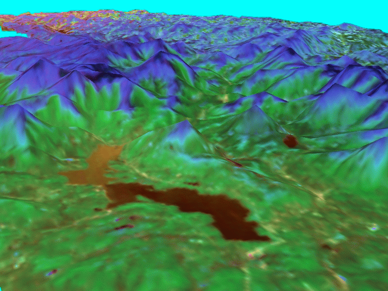
Topographic data
Digital Elevation Models (DEM)
Lecture 15-16.
Global Positioning System (GPS). Use of the GPS data in GIS.
Terrain and bathymetrical modeling using GPS data
Lecture 17-18.
GIS and hydrological modeling
Engineering design and use of GIS data.
Lecture 19-20.
Guest Lecturer (TBA). Remote Sensing and GIS applications
Lecture 21-22.
Ross Bagtzoglou. Groundwater modeling and GIS applications.
Lecture 23-24.
Roeloff Versteeg/Theresa Kennedy. Geophysical data in GIS applications. The New York Virtual Harbor.
Lecture 25-26.
Roberta Miller (CIESIN). Demographic and socioeconomic studies
Lecture 27.
Final Exam
Lab 1. Scales, Coordinates. Arcview Interface. Questions on GIS to discuss.
Lab 2. GIS Formats. Arcinfo and Arcview file structure.
Lab 3. Digitizing. Creating GIS file from
hardcopy map/text file/image.
Software commands.
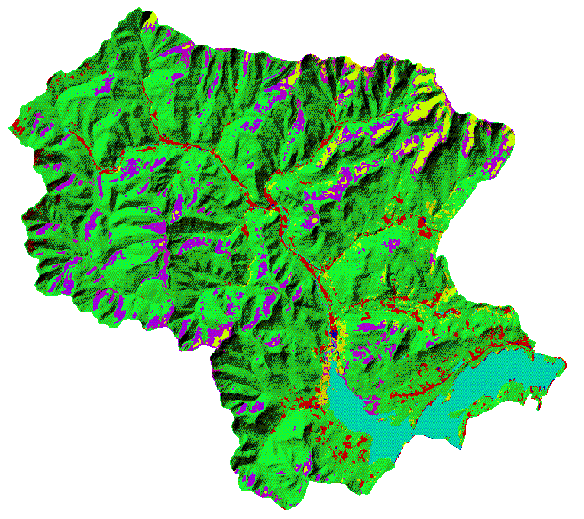
Lab 4. Working with GIS databases.
Define mileage of roads and wetland areas within watershed basins.
Define the ratio between reservoir areas and watershed basin areas.
Lab 5. Data Interpolation. Global and local interpolation methods.
Lab 6. Creation of the Digital Elevation Model
(DEM) from contour lines and random
points.
Lab 7. Creation of the Digital Terrain Model (DTM).
Hillshades, aspect and slope.
Simple analysis with DTM elements.
Lab 8. Working with bathymetric data. Modeling
level changes in lakes/reservoirs.
Calculating volumes.
Lab 9. Hydrological modeling of the small watershed. Drainage outlet design.
Lab 10. Remote Sensing Imagery. Review of NASA space projects.
Lab 11. Hydrogeological modeling with DRASTIC.
Lab 12. TBA
Lab 13. Demographic and socio-economic data in GIS.
Lab 14. GIS course review.
Final Exam
Books
Articles
Web Resources
Readings
Miscellaneous
... Please send all suggestions regarding this site to
Prof. Yuri Gorokhovich at:
[email protected]
!