
Fifth Avenue; glances at the vicissitudes and romance of a world-renowned thoroughfare
(New York : Printed for the Fifth Avenue Bank of New York, 1915.)
|
||

 Click here and hold to drag menu around
|


|
|
|
|
| Page 7 |
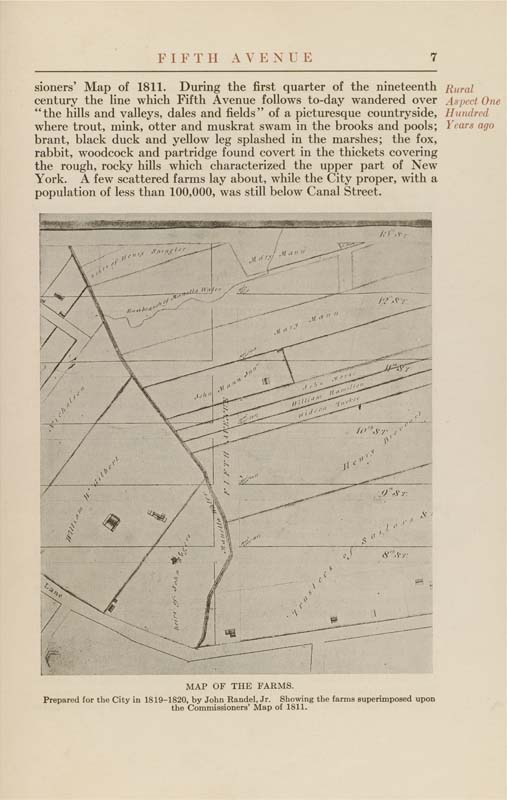
FIFTH AVENUE sioners' Map of 1811. During the first quarter of the nineteenth Rural century the line which Fifth Avenue follows to-day wandered over Aspect One "the hills and valleys, dales and fields" of a picturesque countryside. Hundred where trout, mink, otter and muskrat swam in the brooks and pools; Years ago brant, black duck and yellow leg splashed in the marshes; the fox, rabbit, woodcock and partridge found covert in the thickets covering the rough, rocky hills which characterized the upper part of New York. A few scattered farms lay about, while the City proper, with a population of less than 100,000, was still below Canal Street. MAP OF THE FARMS. Prepared for the City in 1819-1820, by John Randel, Jr. Showing the farms superimposed upon the Commissioners' Map of 1811. |
| Page 7 |