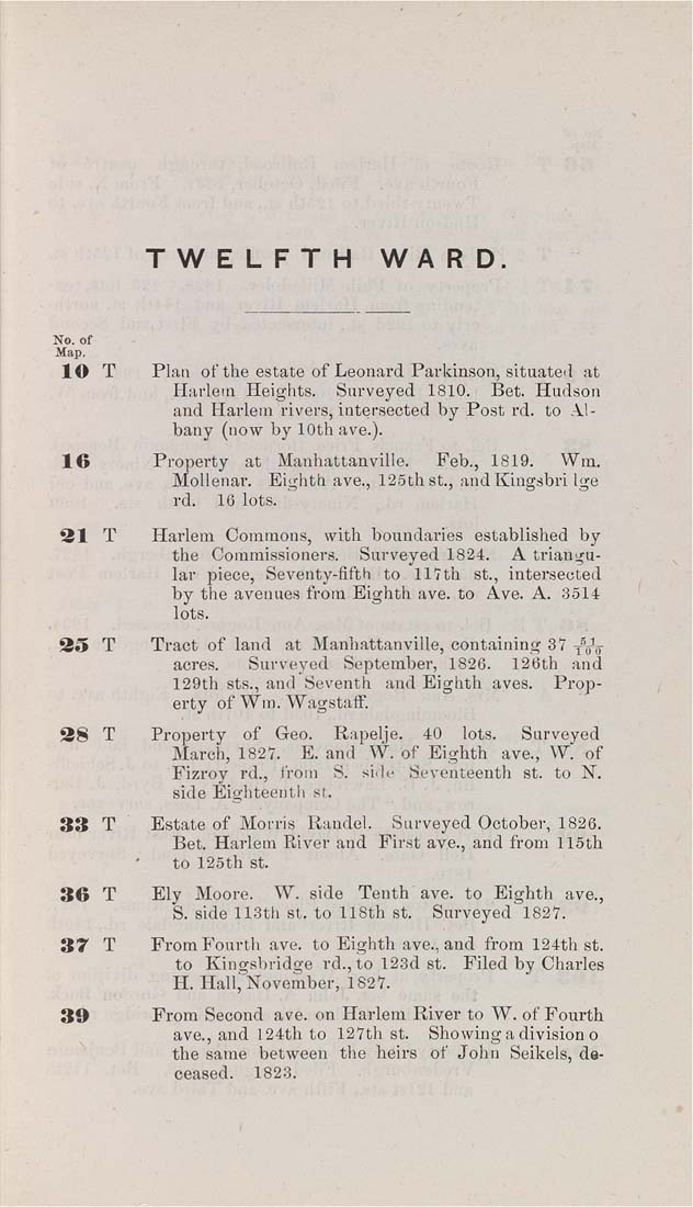
TWELFTH    WA R D.


No. of
Map.

lO T Plan of the estate of Leonard Parkinson, situated at
Harlem Heights. Surveyed 1810. Bet. Hudson
and Harlem rivers, intersected by Post rd. to Al¬
bany (now by 10th ave.).

16            Property   at   Manhattanville.     Feb.,  1819.     Wm.

Mollenar. Eighth ave., 125th St., aud Kiugsbri Ige
rd.    18 lots.

31 T Harlem Commons, with boundaries established by
the Commissioners. Surveyed 1824. A triangu¬
lar piece, Seventy-fifth to 117th St., intersected
by the avenues from Eighth ave. to Ave. A. 3514
lots.

35   T       Tract of land   at Manhattanville, containing 37 ^W

acres. Surveyed September, 1826. 126th and
129th sts., and Seventh and Eighth aves. Prop¬
erty of Wm. Wagstaff.

38   T       Property   of   Geo.    Rapelje.    40    lots.     Surveyed

March, 1827. E. and W. of Eighth ave., W. of
Fizroy rd., from S. si.le Seventeenth st. to N.
side Eighteenth st.

33 T Estate of Morris Randel. Surveyed October, 1826.
Bet. Harlem River and First ave., and from liSth
to 125th St.

36   T       Ely  Moore.    W. side   Tenth ave. to Eighth ave.,

S. side 113th st. to 118th st.    Surveyed' 1827.

37   T       From Fourth ave. to Eighth ave., and from 124th st.

to Kingsbridge rd., to 123d st. Filed by Charles
H. Hali; November, 1827.

39              From Second ave. on Harlem River to W. of Fourth

ave., and 124th to 127th st. Showing a division o
the same between the heirs of John Seikels, de-
1823.
|


