
Columbia Library columns (v.32(1982Nov-1983May))
(New York : Friends of the Columbia Libraries. )
|
||

 Click here and hold to drag menu around
|


|
|
|
|
| v.32,no.2(1983:Feb): Page 30 |
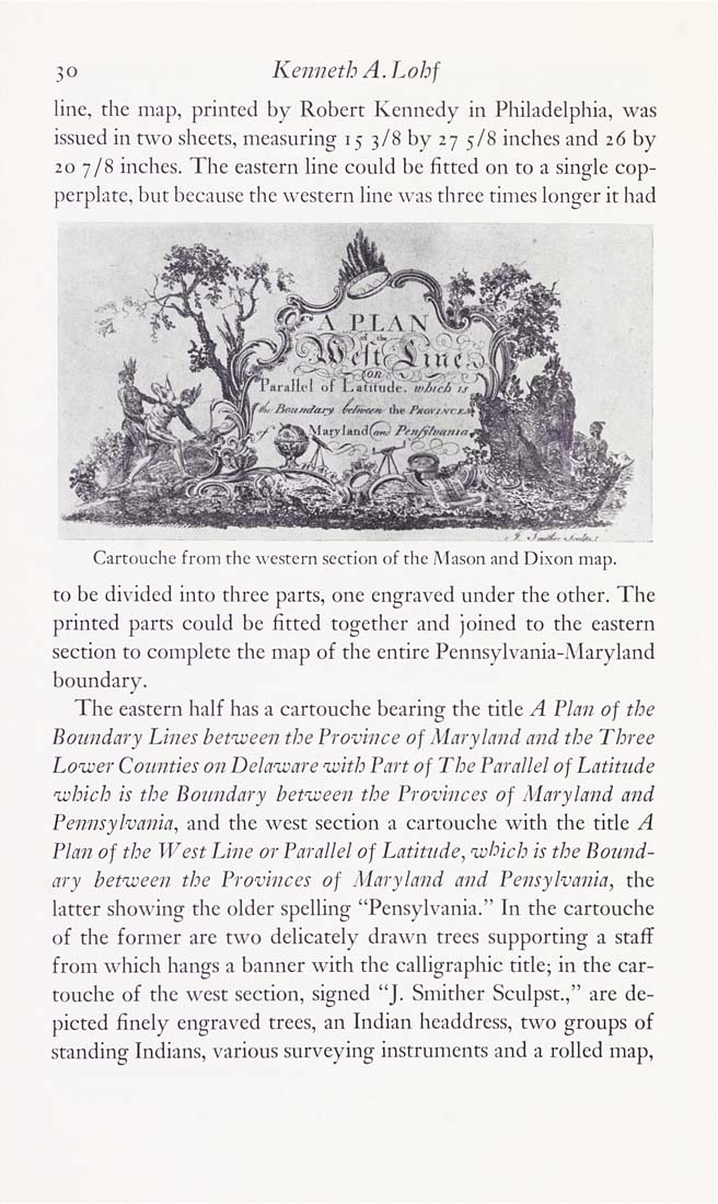
30 Kenneth A. Lohf line, the map, printed by Robert Kennedy in Philadelphia, was issued in t^vo sheets, measuring 15 3/8 by 27 5/8 inches and 26 by 20 7/8 inches. The eastern line could be fitted on to a single cop¬ perplate, but because tlie western line was three times longer it had Cartouche from the western section of the Mason and Dixon map. to be divided into three parts, one engraved under the other. The printed parts could be fitted together and joined to the eastern section to complete the map of the entire Pennsylvania-Maryland boundary. The eastern half has a cartouche bearing the title A Plan of the Boundary Lines between the Province of Maryland and the Three Lower Counties on Delaware with Part of The Parallel of Latitude which is the Boundary between the Provinces of Maryland and Pennsylvania, and the west section a cartouche with the title A Plan of the West Line or Parallel of Latitude, which is the Bound¬ ary between the Provinces of Maryland and Pensylvania, the latter showing the older spelling "Pensylvania." In the cartouche of the former are two delicately drawn trees supporting a staff from which hangs a banner with the calligraphic title; in the car¬ touche of the west section, signed "J. Smither Sculpst.," are de¬ picted finely engraved trees, an Indian headdress, two groups of standing Indians, various surveying instruments and a rolled map, |
| v.32,no.2(1983:Feb): Page 30 |