Image Set 4c
Capture Method: Original->4x5 Transparency->Digital File
Input Device:Kontron Digital Camera
Maximum Resolution:2984x2312
-
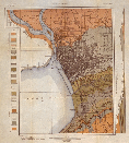
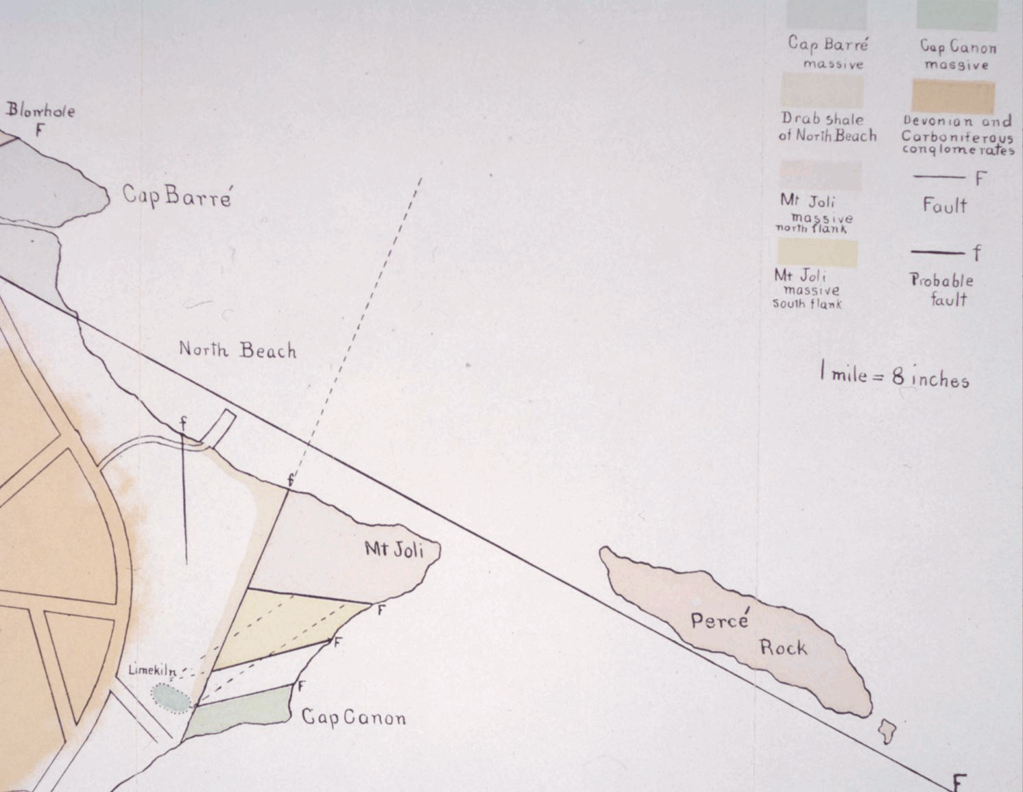
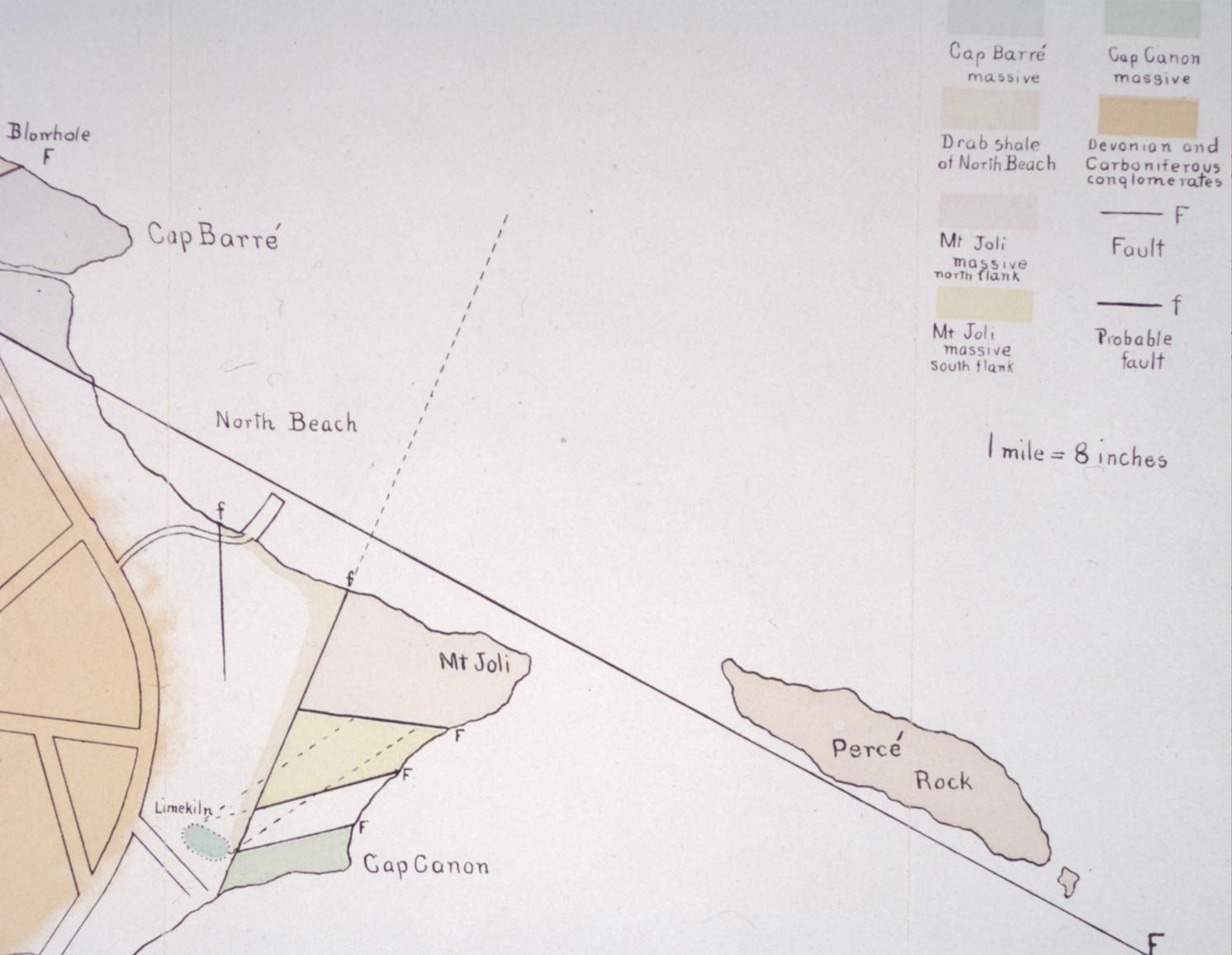
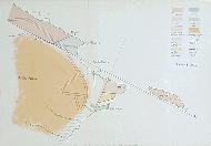 Geological Map of Perce and Vicinity
NYS Museum Bulletin 80 (1905), plate, 8.75"h x 12"w
Fold-out cross section with watercolor-like pigmentation.
-
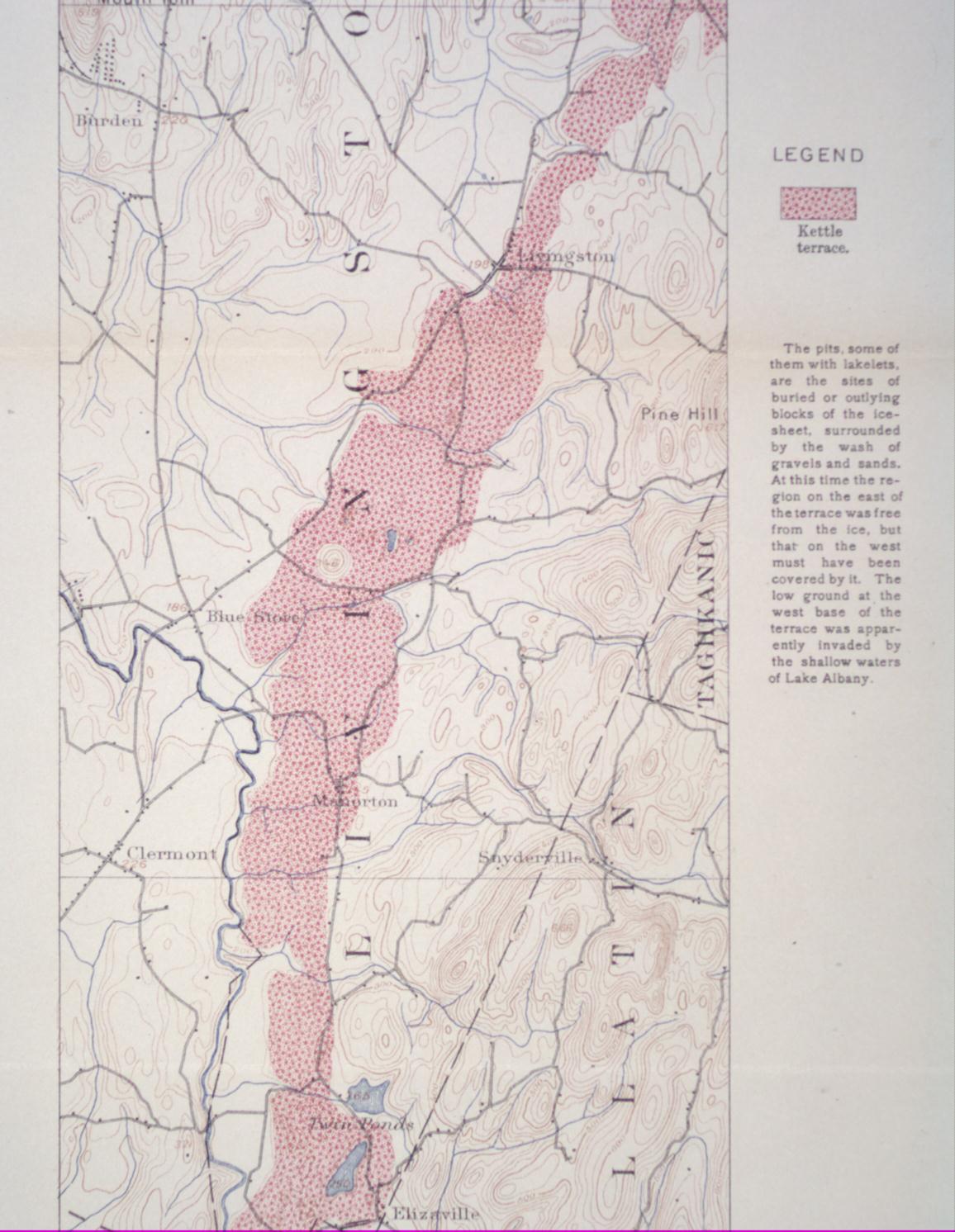
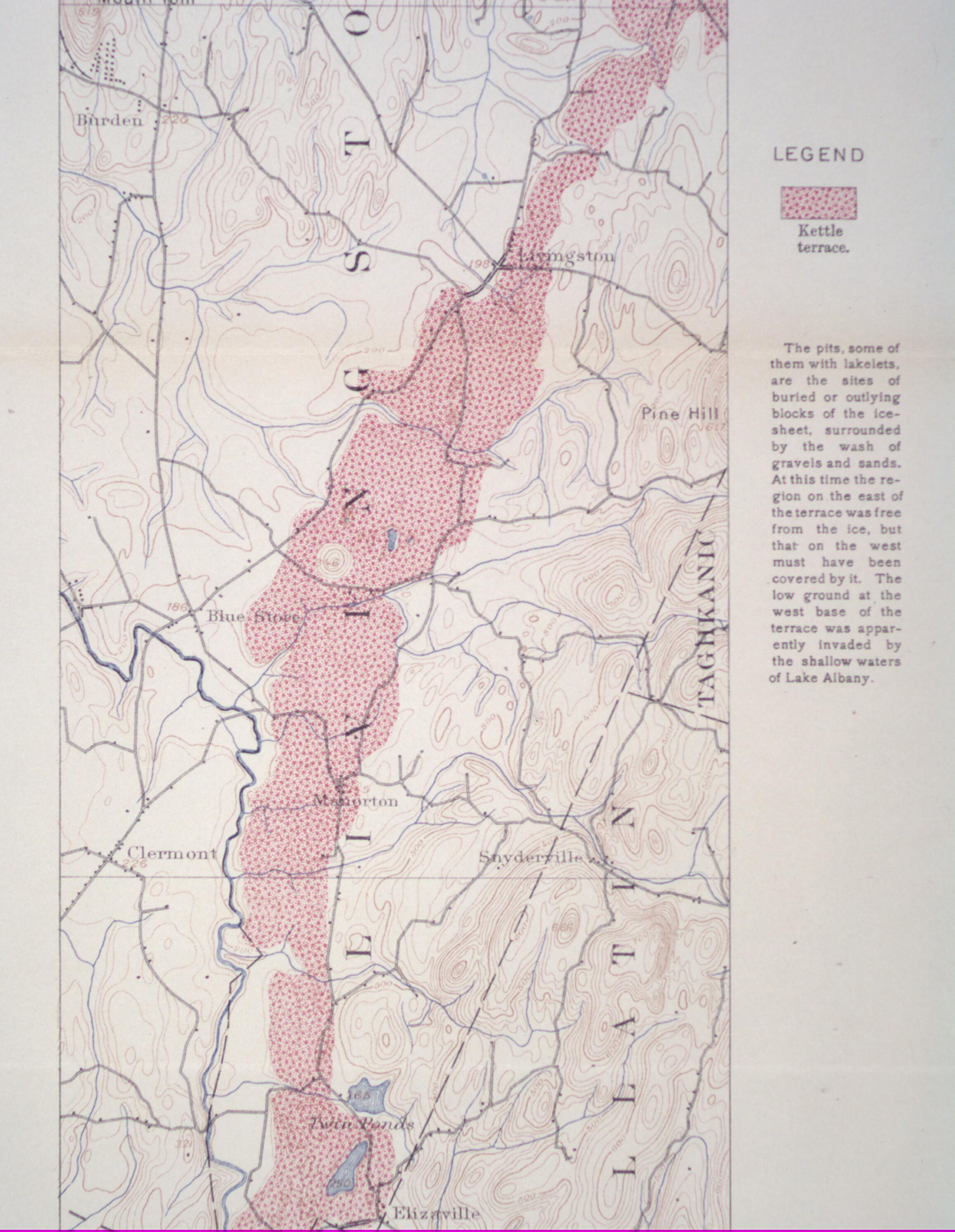
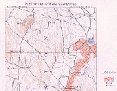 Part of the Catskill Quadrangle
NYS Museum Bulletin 84 (1905), plate 7, 9"h x 14"w
Geologic map with contour details in light brown and water in light blue.
-
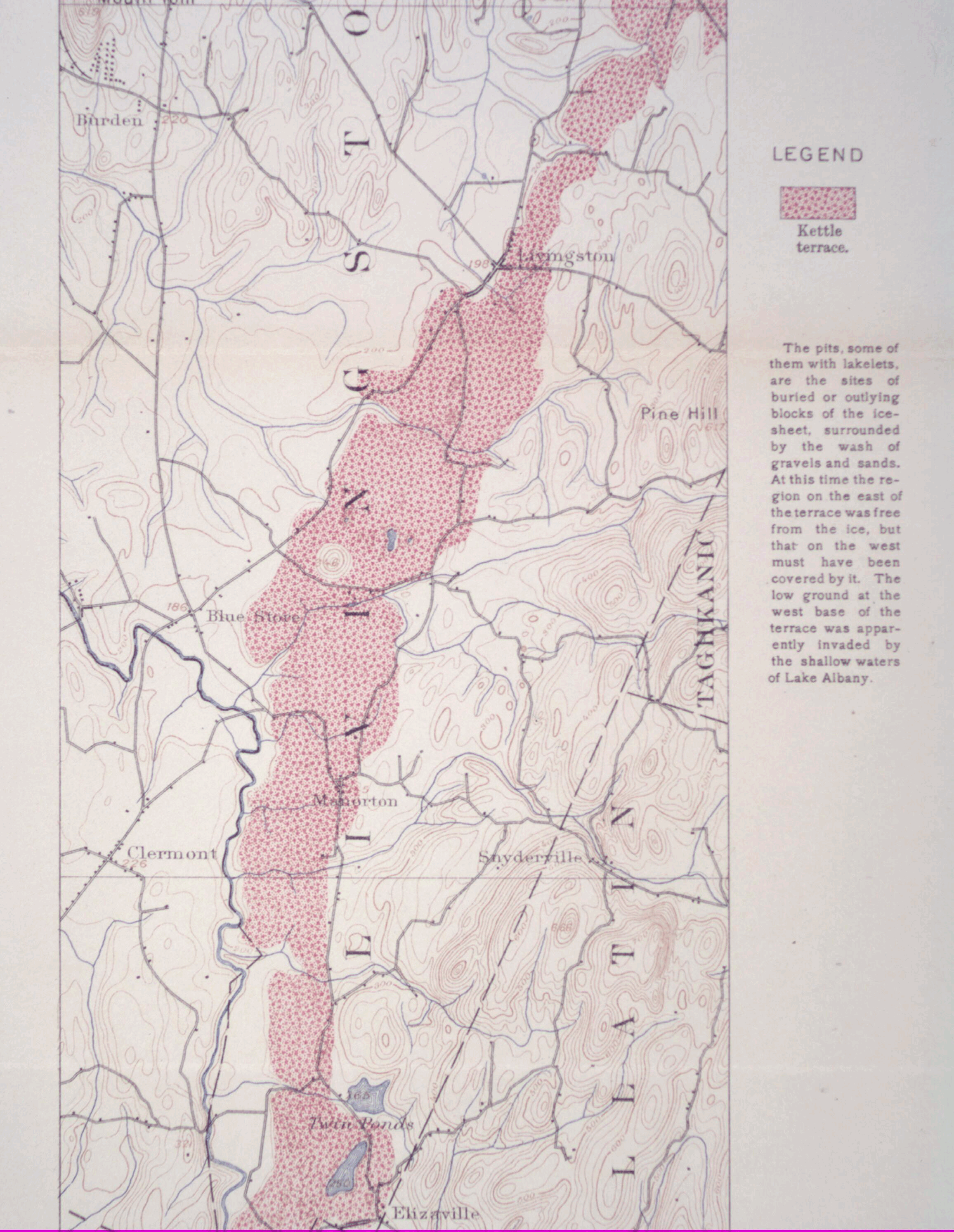
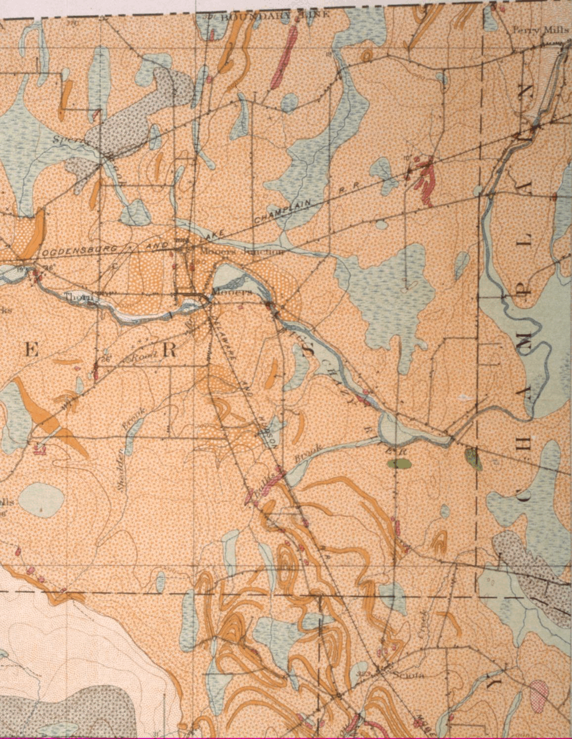
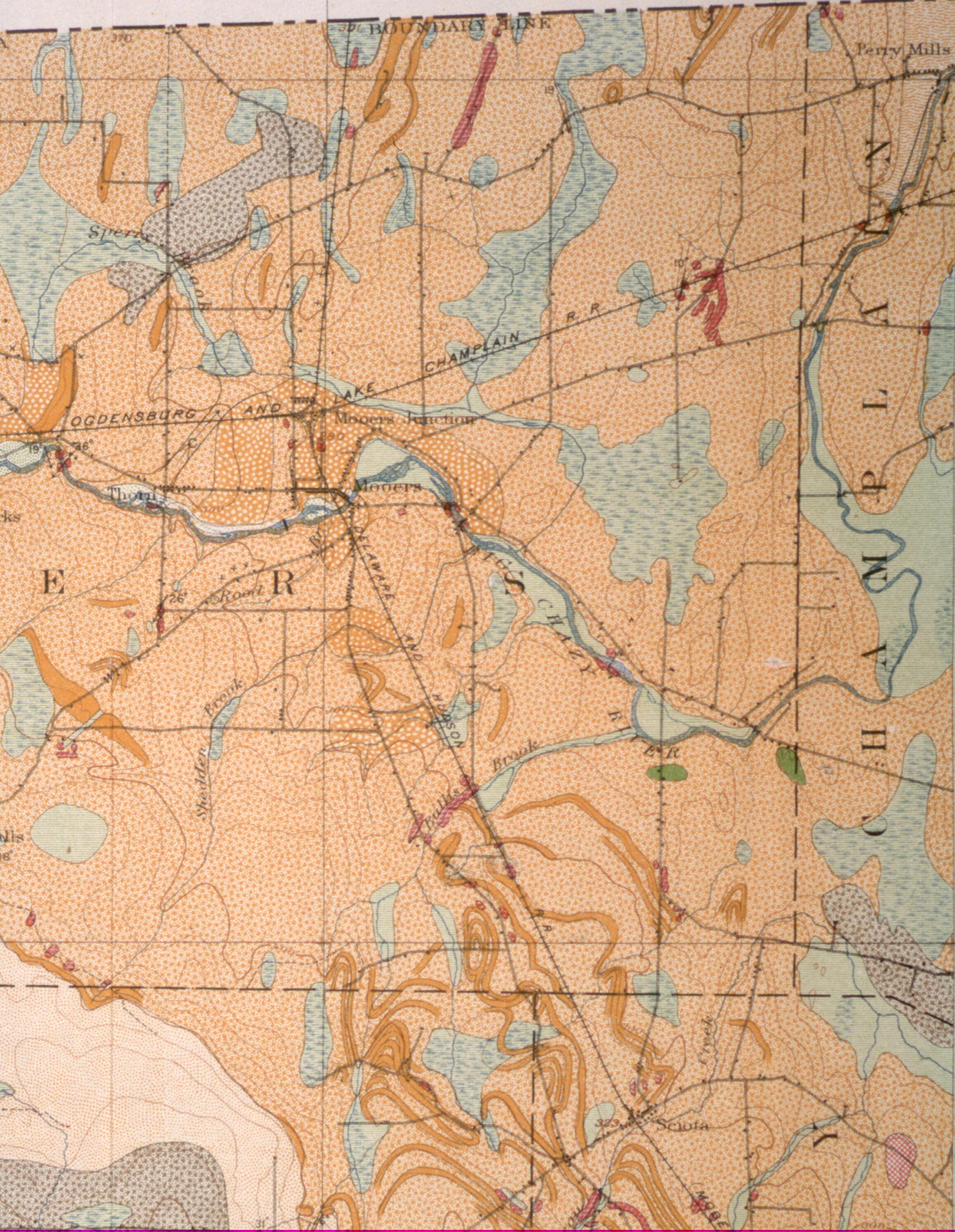
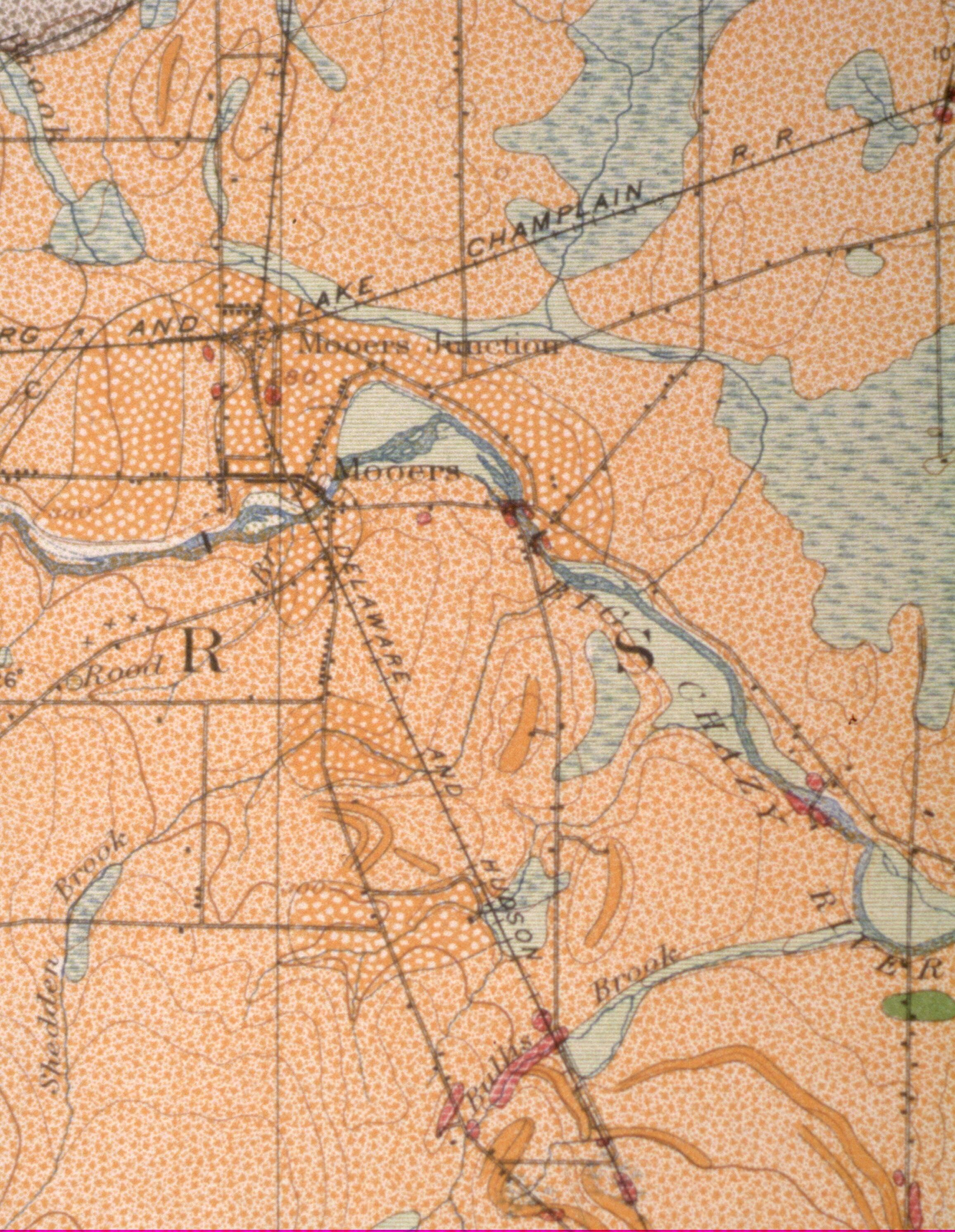
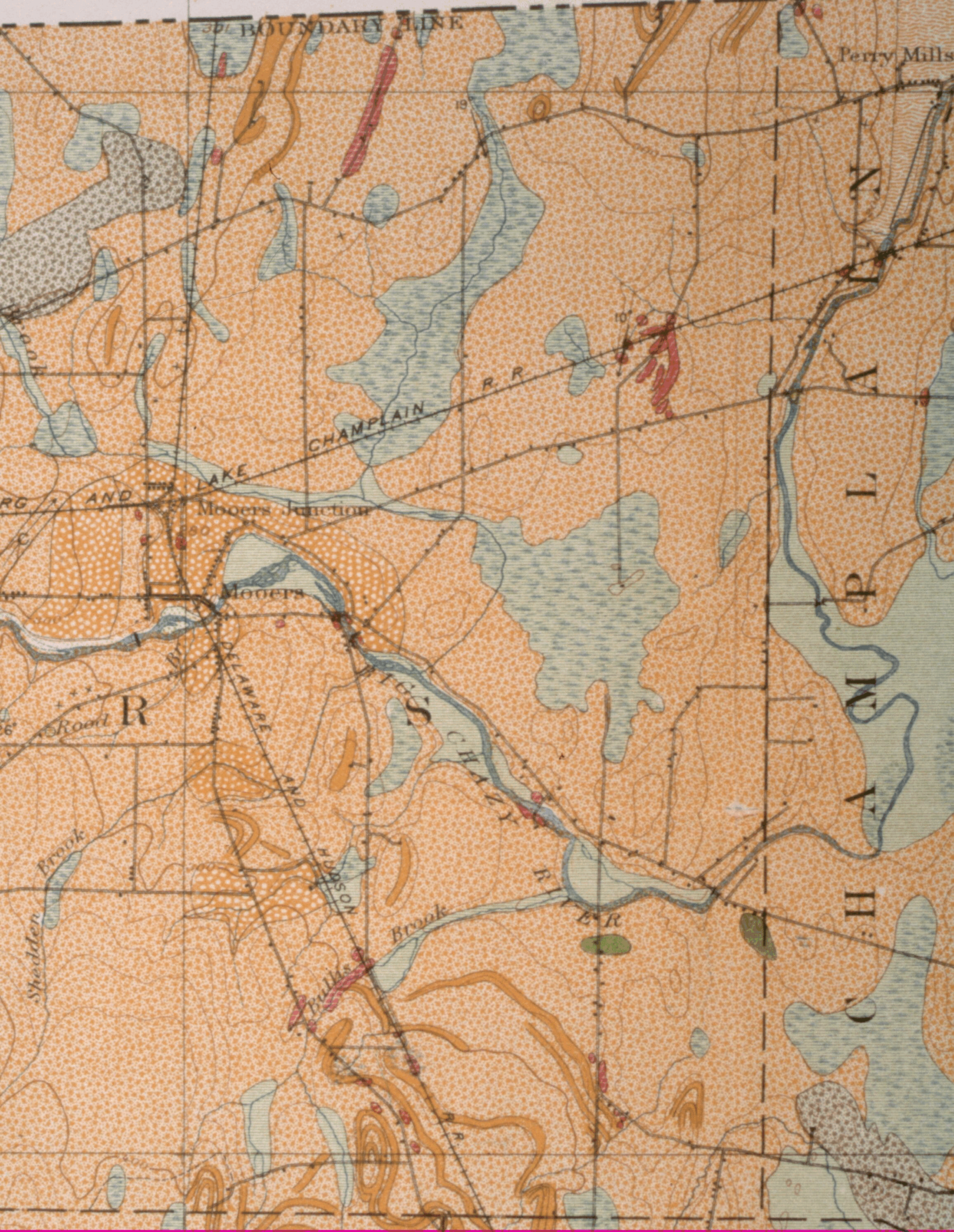
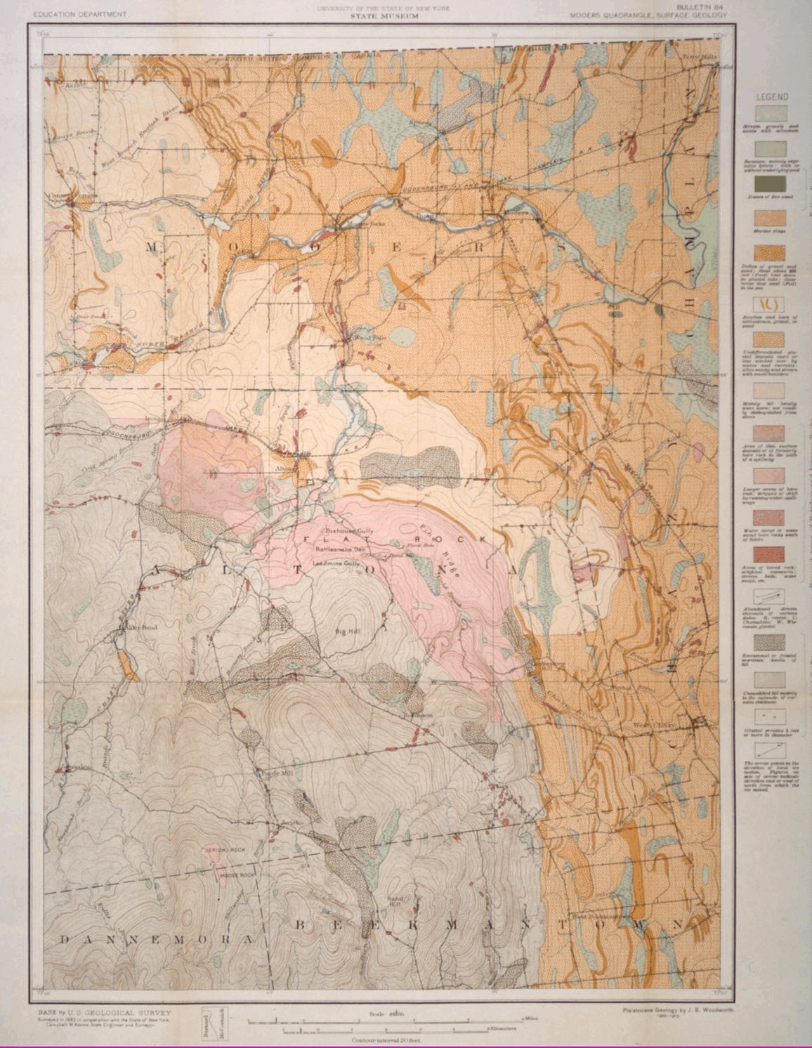
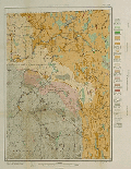 Surface Geology of Mooers Quadrangle
NYS Museum Bulletin 84 (1905), loose map, 17.5"h x 24"w
Typical geologic map with fine detail and subtle color coding.-
Complete Map
- 1492x1156, GIF, @1MB
- 2984x2312, GIF, @5MB
- 1492x1156, JPEG, 344KB
- 2984x2312, JPEG, 1.1MB
Detail 1 - 1492x1156, GIF, @1MB
- 2984x2312, GIF, @5MB
- 1492x1156, JPEG, 319KB
- 2984x2312, JPEG, 1MB
Detail 2 - 1492x1156, GIF, @1MB
- 2984x2312, GIF, @5MB
- 1492x1156, JPEG, 340KB
- 2984x2312, JPEG, 1.1MB
Complete Map - 1492x1156, GIF, @1MB
- 2984x2312, GIF, @5MB
- 1492x1156, JPEG, 284KB
- 2984x2312, JPEG, 1MB
-
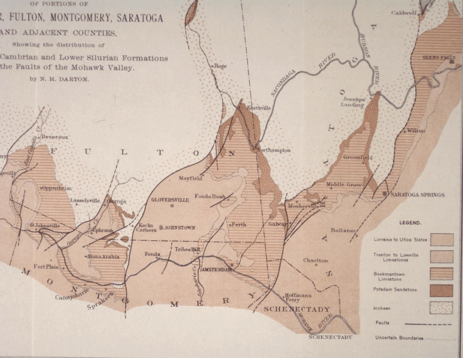
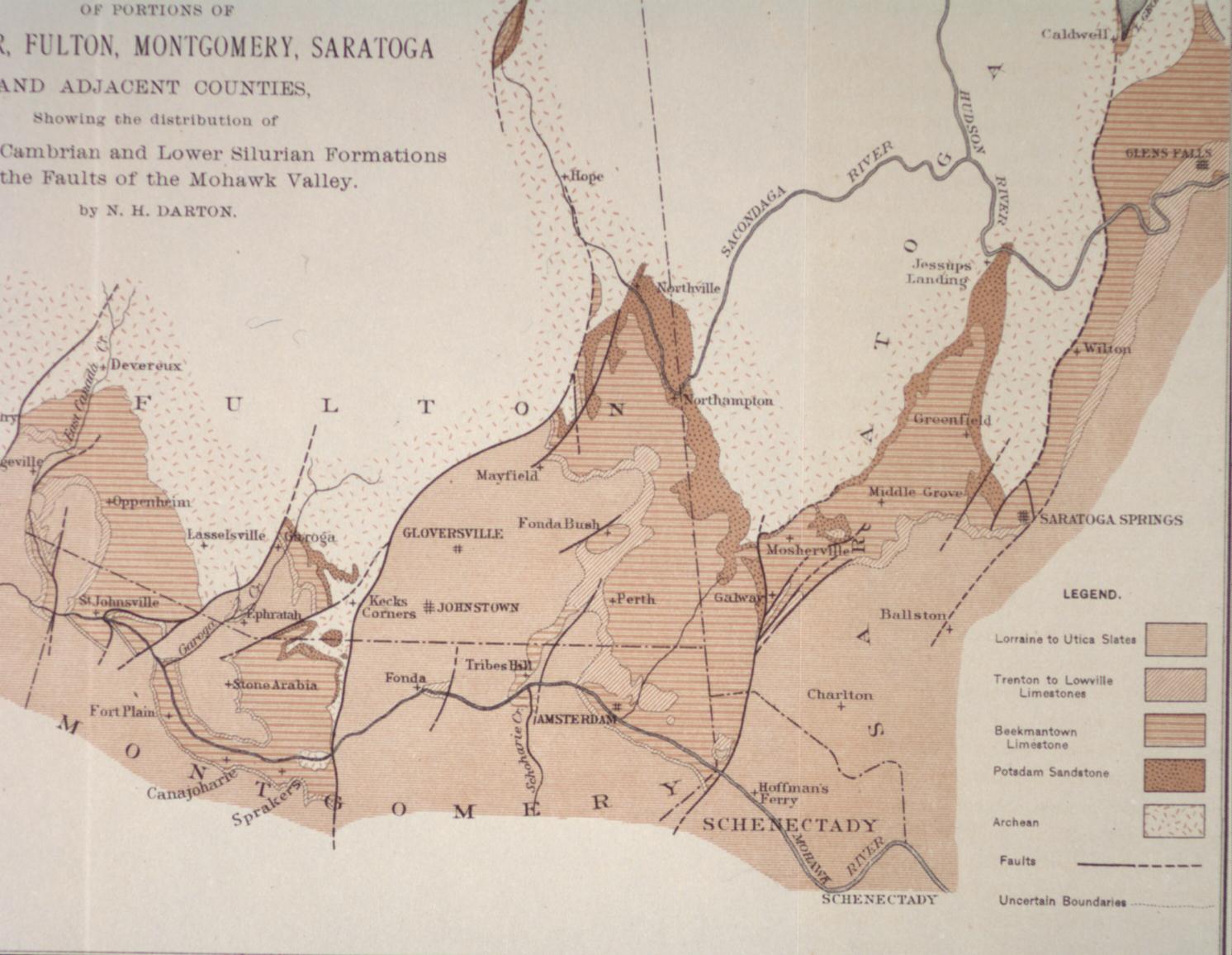
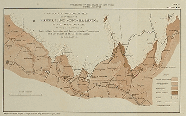 Preliminary Geological Map of Portions of Herkimer...
and Adjacent Counties
Preliminary Geological Map of Portions of Herkimer...
and Adjacent Counties
NYS Museum Bulletin 95 (1905), plate 14, 8.75"h x 13"w
Geologic map with coding in one color (light brown) in a variety of similar patterns.
-
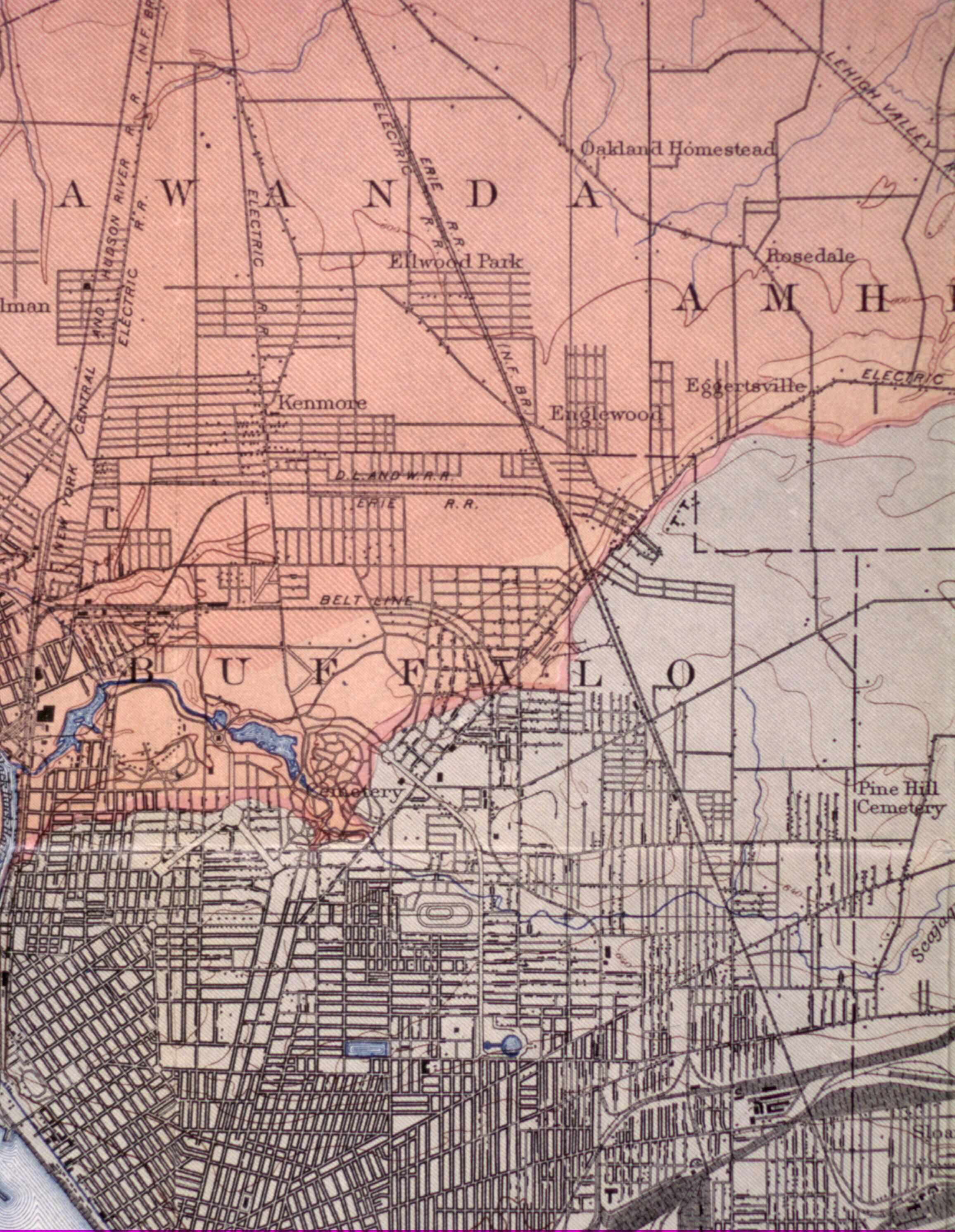
 Geological Map of Buffalo Quadrangle
NYS Museum Bulletin 99 (1906), loose map, 21.5"h x 19"w
Typical geologic map with fine detail including details of Buffalo city proper and cross section printed perpendicular to map along edge.