
|
Instructors Edith Hsu-Chen, 212-720-3437 |
Meetings Mondays, 3-5pm and |
|
| photo: Associated Press | photo: Joel Sternfeld, CCA |
|
INTRODUCTION
|
|
BACKGROUND
and HISTORY
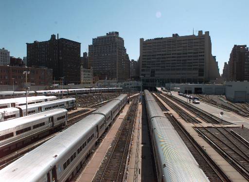
The eastern bank of the Hudson originally ran along what is now 10th Avenue. The land along the riverbank was worked as farmland for two hundred years when the area was known as Bloomingdale. With the adoption of the Commissioners' Plan of 1811, which created Manhattan's characteristic grid of parcels, the area began to be developed as an industrial center. The Hudson River Rail Road company, a forerunner to the present-day Hudson Line, opened a large freight yard in 1851 at 11th Avenue between 30th and 34th streets. In 1871, New York's first elevated railroad was opened along 9th Avenue, and the nearby piers took cargo on barges from New Jersey and passenger ferries, emphasizing the area's character as a transportation hub and distribution point. The nearby Herald Square retail center and the garment, fur, meatpacking and flower districts all expanded to take advantage of these transportation facilities. Although only one of many waterfront areas in the port of New York, the area was larger than the seaports of some smaller cities, and like many seaport areas it developed a certain infamy. It was described in 1939 as having "one of the most lurid reputations in America," and featured prominently in Herbert Asbury's seminal study in urban anthropology, The Gangs of New York, as an incubator for crime and a haven for gangsters. In 1937, work was begun on the Lincoln Tunnel, and completed two decades later. The Port Authority Bus Terminal was originally built in 1950, and underwent major expansion with the construction of the North Annex in 1979. Prior to 1961, the area was zoned for "unrestricted uses," the usual designation for manufacturing areas. The adoption of the 1961 Zoning Resolution brought zoning for low and medium density manufacturing districts in recognition of the area's predominantly industrial character. Since 1961, portions of the area have been selectively rezoned to facilitate specific projects, including the West Yard Distribution Center over a portion of the MTA rail yards and the Jacob Javits Convention Center (1986), for which a special zoning district was created. While the adjoining Midtown area enjoyed a boom in commercial development, West Midtown suffered from comparative neglect, being considered too far from mass transit and generally lacking in amenities to support either significant residential or commercial use. With most of the last of the large sites in Midtown being developed, however, the area is now poised for major development and is being studied intensively by local community groups, the Manhattan Borough President's Office, the 2012 Olympics, Madison Square Garden, the Jets, the Department of City Planning and the Municipal Arts Society. It was also the subject of a recent design competition sponsored by the Canadian Centre for Architecture in Montreal (won by the team led by Peter Eisenman and Skidmore, Owings and Merrill). |
|
THE 34TH
STREET CORRIDOR
The 34th Street corridor is a critical sub-area in the development of West Midtown. Now under study for major projects for the 2012 Olympics and a new NFL stadium, in addition to the expansion of the Javits Center and a connection to the Hudson River Park, the project site presents numerous, sometimes mutually exclusive, opportunities for development. The task of the studio will be to assemble base data on existing conditions, investigate projects for development currently in the planning stages and make recommendations for a coherent approach to development along the corridor. |
|
IN THE STUDIO |
| Back to top |