Japan Workbook | Japan's Geography (1)
A country's geography influences the development of its society and culture in many ways. Its location in relation to other nations has an effect on intercultural influences; its size affects demography, the development of social structures, and its position in the international community. Its topography dictates to a large extent where and how its people earn their livings, and its climate influences its agriculture and styles of living. The following maps will demonstrate these and other aspects of the influence of geography on national development.
Composition, Position, and Relative Size
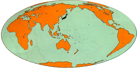
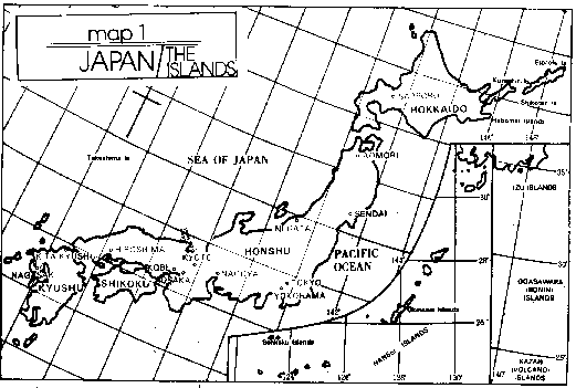
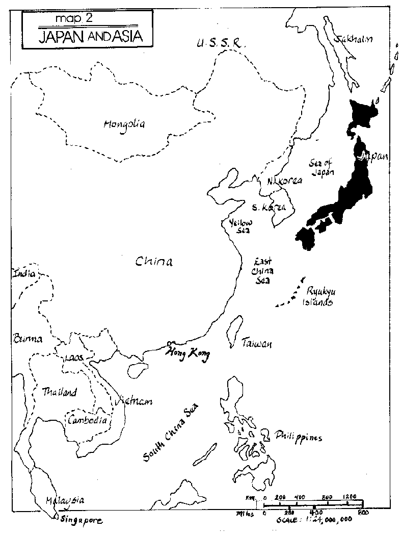
Japan is a shimaguni (island country): The Japanese archipelago (island chain) consists of four main islands – Honshu, Shikoku, Kyushu and Hokkaido – and thousands of smaller surrounding ones (see map 1). It lies off the Pacific coast of the Asian mainland; at the closest point, the main Japanese islands are 120 miles away from the mainland. (See map 2). Compare this with another shimaguni, Great Britain, which is, at the narrowest point of the English Channel, only 21 miles from Europe.
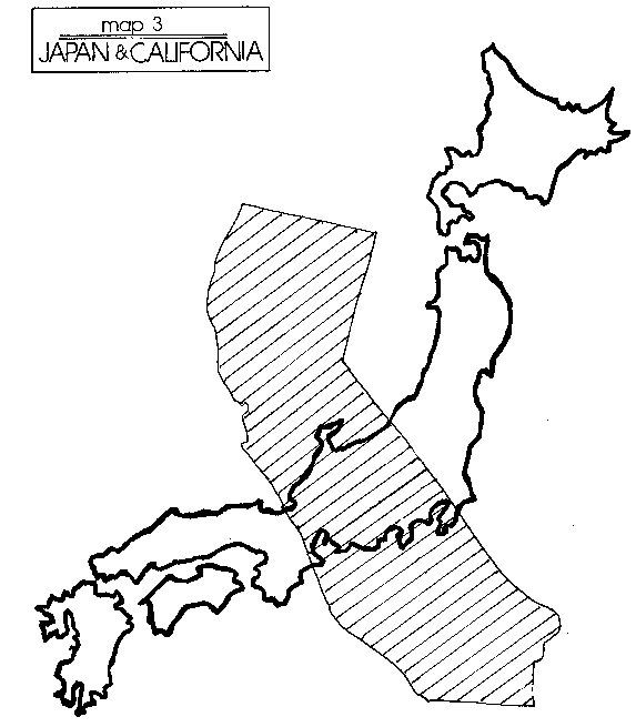
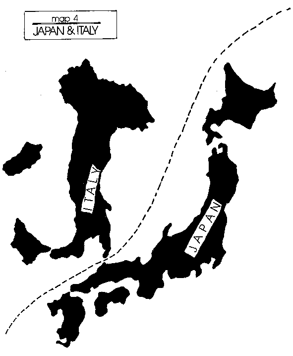
The total land space of the Japanese islands is about 142,000 square miles. As you can see from map 2 and map 3, it is a very small country when compared with the vast Asian mainland, or with the United States, where it is smaller than the single, although large, state of California. It seems even smaller when you realize how little of its land is useful for agriculture or housing, as we will discuss below. China, the United States, and a few other giants of the world are the unusual ones, however. Japan does not seem so small when compared with some of the nations of Western Europe. It is, for example, larger than Italy. (See map 4).
Topography
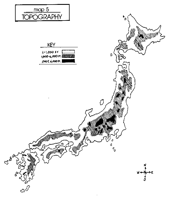
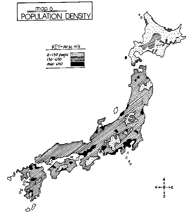
The Japanese islands are covered by mountains, most of them heavily forested, and crisscrossed by short, swift rivers. Only a few of the rivers are navigable. Relatively little of Japan's land mass is suitable for agriculture – only about 15 percent, the same land that is also most suitable for living (see map 5). The population and areas of agriculture are therefore concentrated together, as you will see if you superimpose map 5 on map 6.
Japan's islands are very beautiful and varied, but they can be treacherous. Earthquakes are common and result from a fault that circles the Pacific Ocean, causing earthquakes on the west coast of North and South America as well. They are frequent in Japan, occurring more often than they are felt. Even so, one big enough to be noticed by scientists occurs every three days in Tokyo. Occasionally they do serious damage. The mountains of Japan contain 10 per-cent of the world's most active volcanoes. Mt. Fuji, Japan's most famous mountain and one of its most beautiful and revered, is a dormant volcano, which last erupted in 1707. Tidal waves occasionally result from undersea earthquakes, and typhoons sometimes hit Japan as they move north from the South Pacific.
The Japanese are more impressed, however, by the beauty and richness of their land than by its dangers. Although its topography creates difficulties, its climate is more benevolent.
Climate
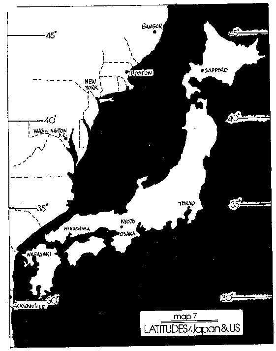
The Japanese islands are for the most part in the temperate zone; as you can see from map 7, they stretch from north to south in latitudes similar to those of the eastern United States, from about 45 degrees in the north to about 20 in the south. The capital, Tokyo, is in a similar position to Los Angeles or Washington in the United States (see map 7).
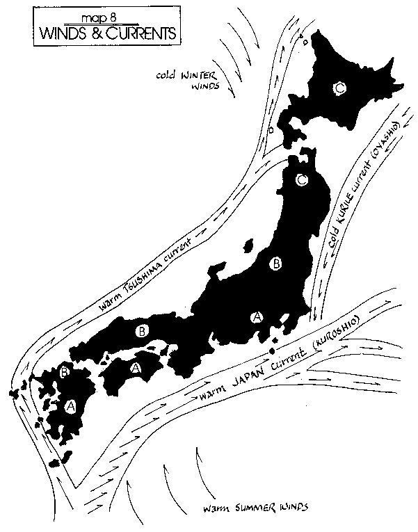
But latitude and longitude are not the only things that influence climate. Ocean currents, such as the Kuroshio and Tsushima currents from the south, warm the Pacific side of the islands and those near the Korean straits, especially toward the south, while the cold Kurile current, coming southward toward Hokkaido, brings plentiful nourishment to the coastal waters and improves the fishing (see map 8).
On the other hand, cold winds from the northern Asian continent blow east over the Sea of Japan, dumping deep, heavy snow on the northwestern coasts of Japan. There is a marked contrast between winters on the coast facing the Sea of Japan, called Japan's "snow country," where people often have to tunnel under the snow to move from house to house, and the clear, crisp winters on the eastern shore, with little snow at all, leaving dry winters on the more heavily populated side of the main islands.
Even on the eastern shores, however, Japan has abundant rainfall, since seasonal winds carry moisture into the country from its surrounding waters. In fact, in addition to the four seasons similar to those of our U.S. temperate zone climate, there is a rainy season, lasting about a month in June, followed by a hot summer. This is important for the cultivation of rice, Japan's traditional staple food.
Area: 377,708 square kilometers
(145,834 square miles)
Coastline: 33,986 kilometers
(18,487 miles)
From Japan Today, Ministry of Foreign Affairs,
Japan 1983
(1) Essay written by Dr. Amy Vladeck Heinrich, director, C.V. Starr East Asian Library, Columbia University.
Map Exercises
1. Japan: The Islands
Note for map 1: Ownership of the islands Kunashiri, Etorofu, Habomai and Shikotan (islands northeast of Hokkaido) is disputed. The USSR occupied then in 1945 and Russia continues to assert sovereignty over them. Japan claims these Northern Territories as original Japanese territory not affected by the San Francisco Peace Treaty of 1952. The issue is a continuing problem in Russo-Japanese relations.3. Japan and California (comparison)
4. Japan and Italy (comparison)
5. Topography
1) Look at map 2. Given the relative nearness of Japan to China and Korea, what can you imagine about Japan's traditional relations with these two countries?
2) In premodern times, when travel and communications were difficult because of Japan's mountainous terrain, the Japanese did not think of their country as small. Look again at map 2, map 3, and map 4. What modern developments and requirements make it seem small today?
3) Examine and compare map 7 and map 8. From what you can see of relative latitudes in Japan and the eastern United States, and from what you have read about the warm and cold sea and wind currents affecting Japan, discuss the climates you would expect to find in the areas marked A, B, and C.
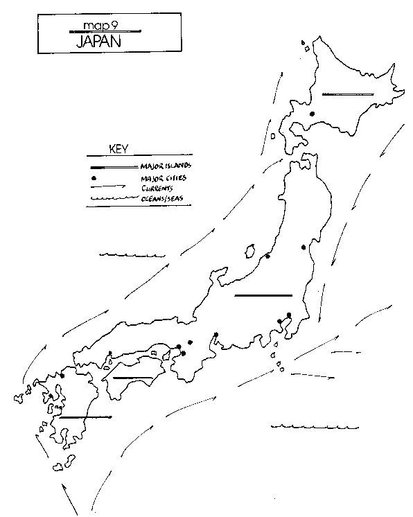
4) On map 9, insert the names of:
a) the four major islands (indicated by ====)
b) the six major cities (marked by ·);
c) the major ocean and wind currents (shown by-----) and
d) the surrounding oceans and seas (shown by ^^^^^).
Try to do this exercise without consulting the other maps.
5) Imagine that you are a tourist in Japan: It is January. First you travel to Tokyo and Kyoto to spend a week. Then you go to the northwest coast of the island of Honshu for a week.
Write one postcard to your family at home describing the weather during your week in Tokyo and Kyoto.
Write another postcard during your second week, describing the weather on the northwest coast of Honshu .
6) In land area Japan is about the size of California, but in population it ranks sixth in the world (behind China, India, the United States, Indonesia and Brazil).
How would you describe Japan's size?
Why is it important to know both the land area and the population of a country?
7) Use the following information to compare Japan and the United States:
| Japan | United States | |
| Total land area | 145,946 square miles | 3,615,054 square miles |
| Population | See Current Estimate for Japan | See Current Estimate for U.S. |
| Percent of land that can be cultivated for crops | 15 percent | 46 percent |
- How many times larger than Japan is the United States in land area?
- How many times larger is the U.S. population?
- How many people per square mile are there in Japan? (People divided by square miles) In the United States?
- How many people are there per land area that can be cultivated in Japan? In the United States?
- What conclusions can you draw about population density (people per square mile) in Japan and the United States?
- What conclusions can you draw about agriculture in the two countries?
