Remote sensing of ocean colour from space began in
1978 with the successful launch of NASA's Coastal Zone Color Scanner (CZCS). Despite
the fact that CZCS was an experimental mission
intended to last only one year, the sensor continued to generate a valuable
time-series of data over selected test sites until early 1986.
Ten years passed before othere sources of ocean-colour
data became available with the launch of MOS, OCTS and POLDER in 1996, and SeaWiFS in 1997.
Several new ocean-colour sensors have recently been launched and still more are
planned for the near future by various space agencies.
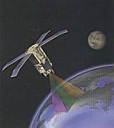
There are two
types of orbits for Earth observation satellites, polar
orbiting and geostationary. Polar-orbiting
satellites typically operate at an altitude of around 800 km, with a revisit
time of 2-3 days, whereas geostationary satellites operate in time scales
of hours, which could theoretically provide data on the diurnal variation in
phytoplankton abundance and productivity.

SeaWiFS
Sea-viewing
Wide Field-of-view Sensor