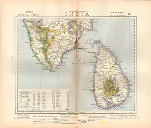
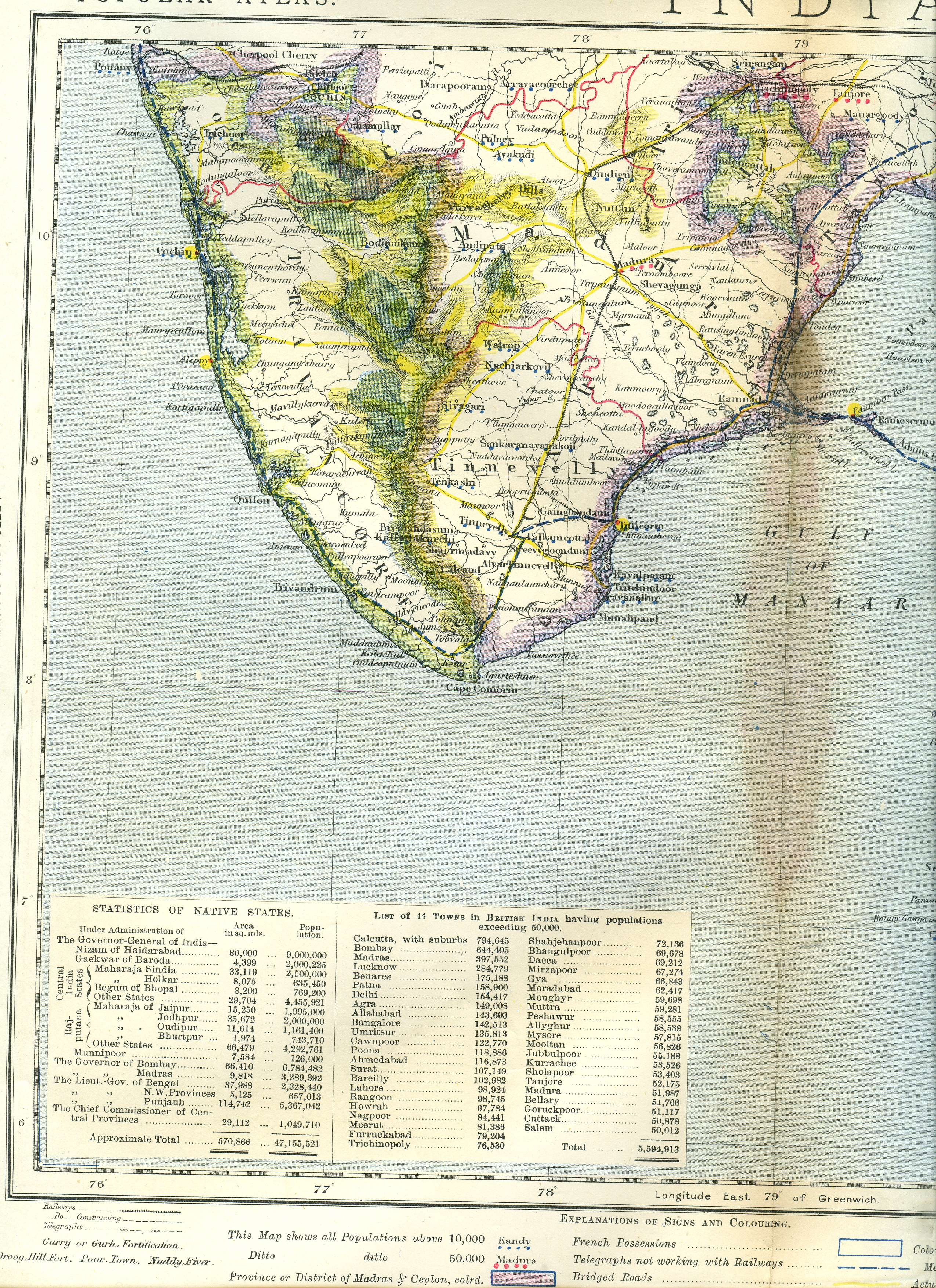
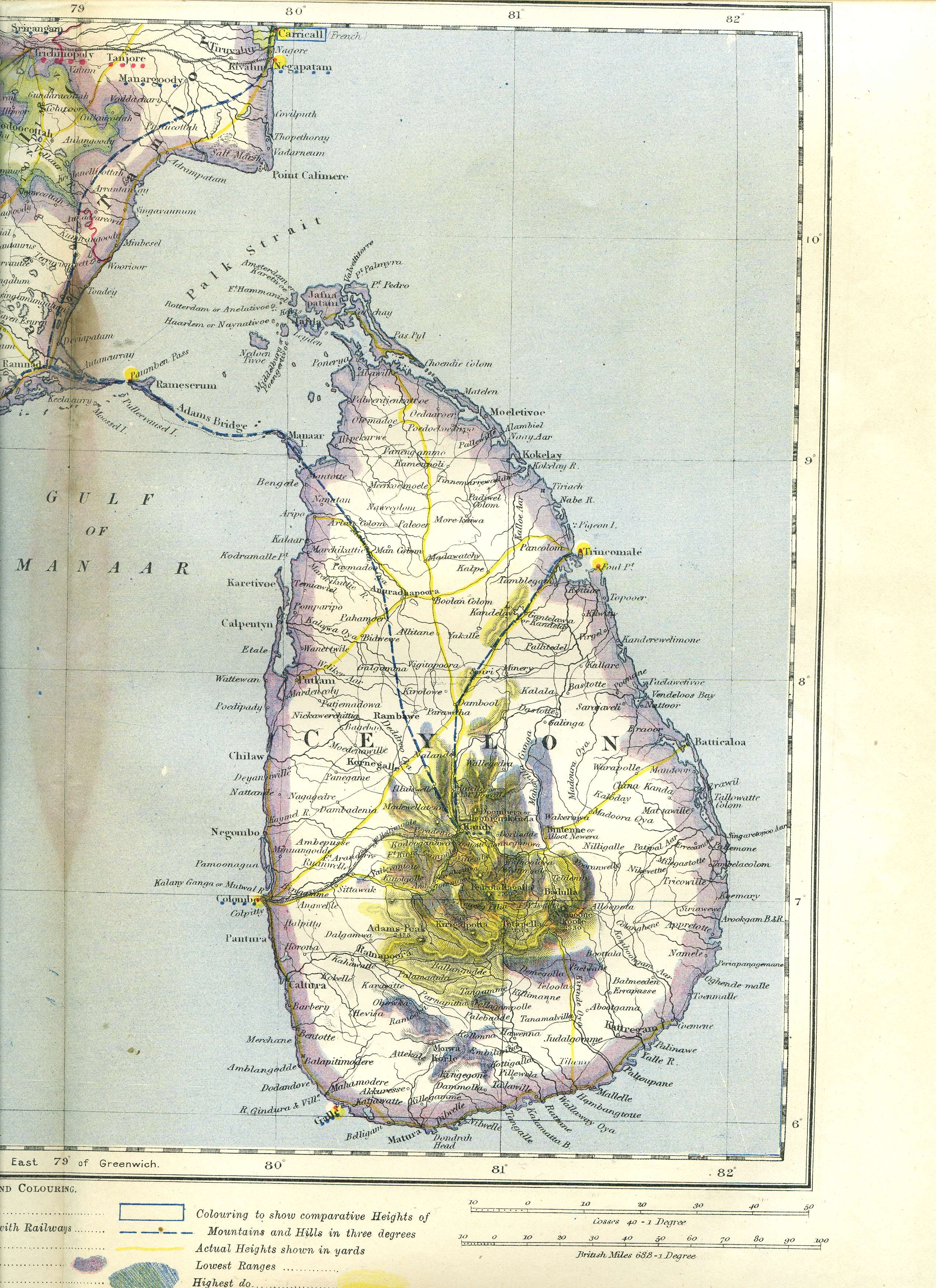
SDUK Map I -- Southern India and Ceylon, 1883
MAP I: "Southern India and Ceylon," by SDUK, from "Statistical
and General Map of India (in twelve sheets); Scale: 35 Miles to
the Inch" from 'Letts's Popular Atlas', 1883 (Letts & Co.,
London), with original hand coloring; with very large scans of
the *left half* and the *right half* of the map
Note: This map was a late and lucky acquisition, since it had been missing from the original Letts set that I was able to buy. For a fuller view of the key at the bottom, see *Map II* or any other map from the set.
== SDUK maps index == Colonial index == Main map index == Glossary == FWP's main page ==