 |
 |
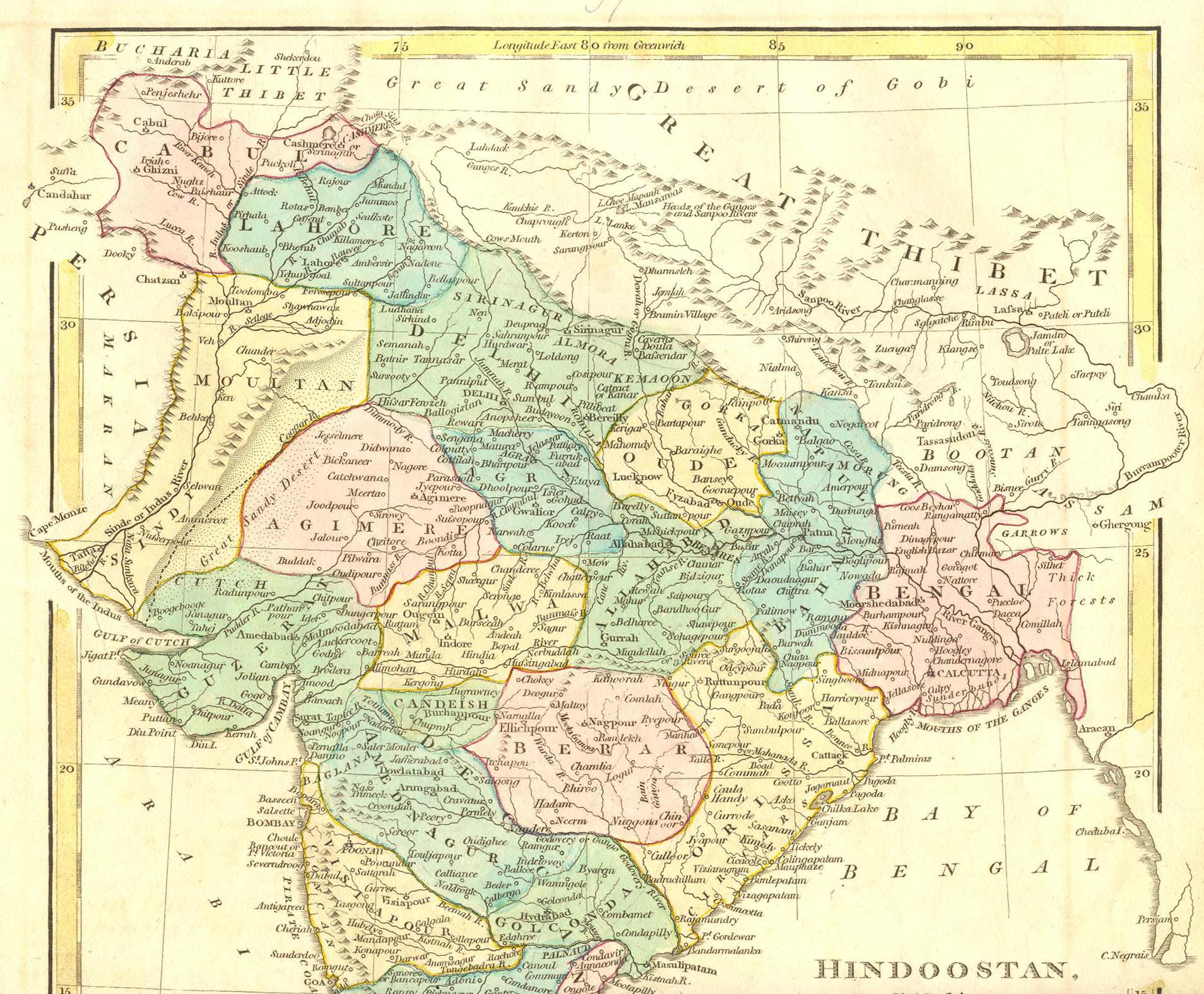
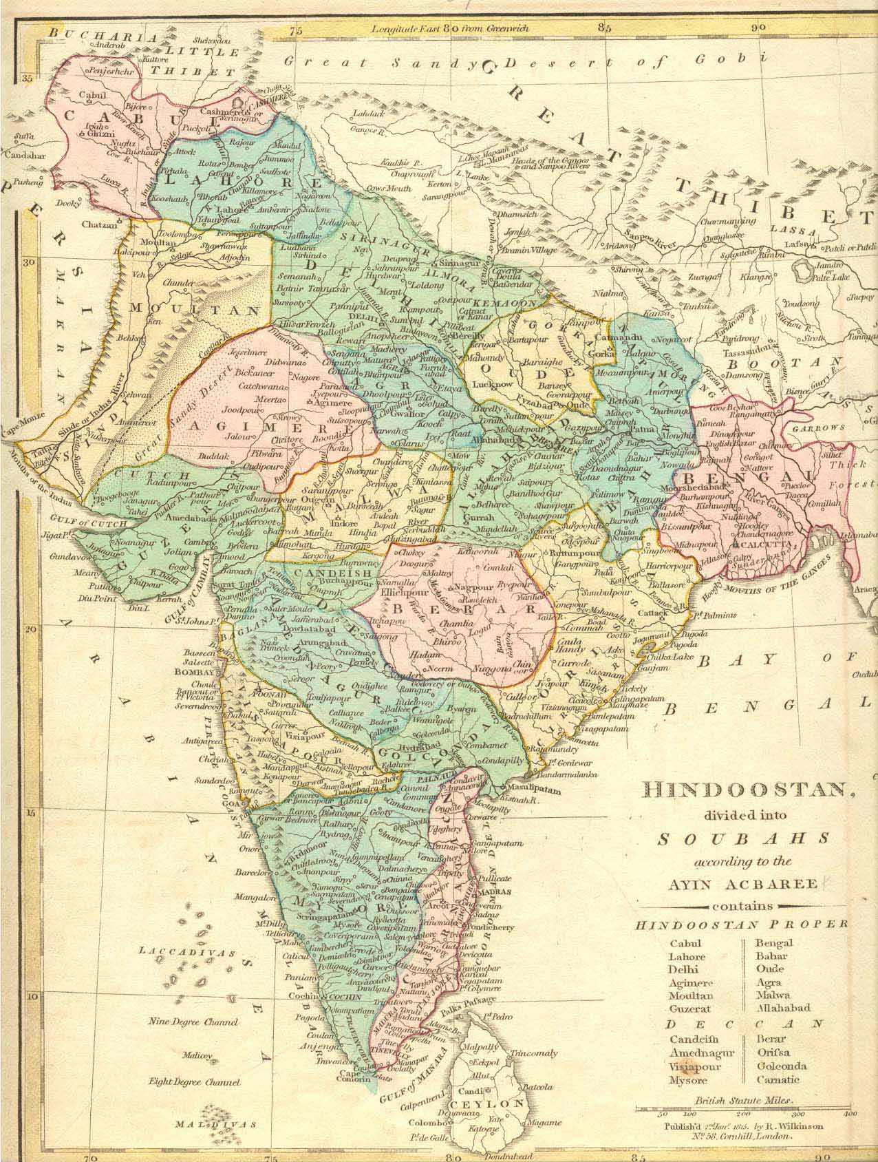
AKBAR'S INDIA (1815)
|
|
"Hindoostan, divided into Soubahs according to the Ayin Acbaree," a historical map of Akbar's India from Wilkinson's Atlas, 1815; CLICK ON EITHER HALF FOR A VERY LARGE SCAN
*A moderate-sized scan of the map*
== Wilkinson index == Colonial index == Main map index == Glossary == FWP's main page ==