 |
 |
|
|
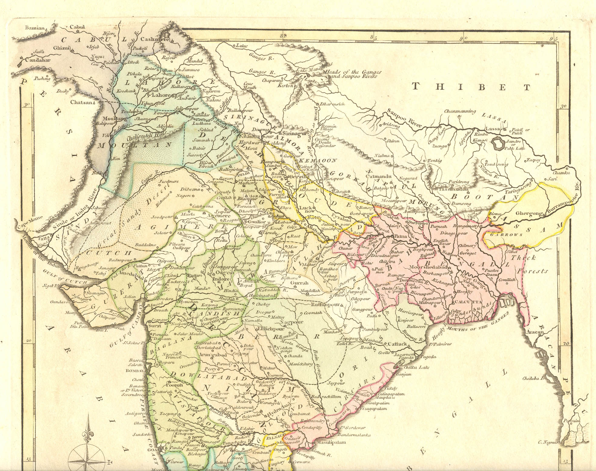
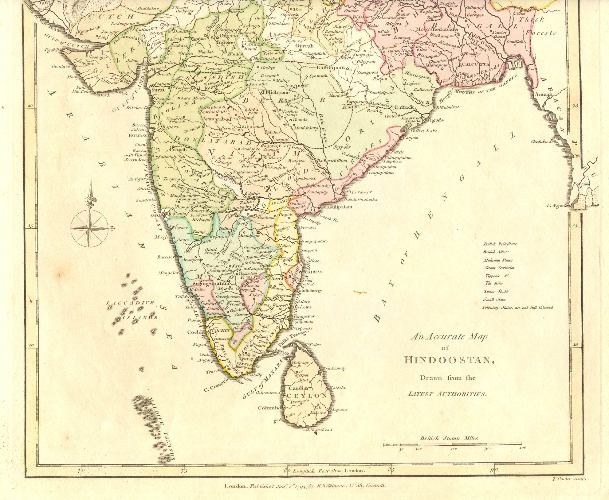
"Hindoostan," 1794, by Robert Wilkinson, London, from 'A General Atlas being A Collection of Maps of the World and Quarters, the Principal Empires, Kingdoms &c. with their several Provinces & others Subdivisions, Correcly Delineated'; CLICK ON THE MAP FOR A VERY LARGE SCAN
Note: It looks as though the territorial names listed in the lower right should have been keyed to the colors, but then that this wasn't done. Still, I think the colors on the map are original.
== Wilkinson index == Colonial index == Main map index == Glossary == FWP's main page ==