MERCATOR PTOLEMAIC MAPS, 1578 ON
MERCATOR PTOLEMAIC MAPS, 1578 ON
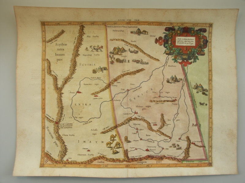
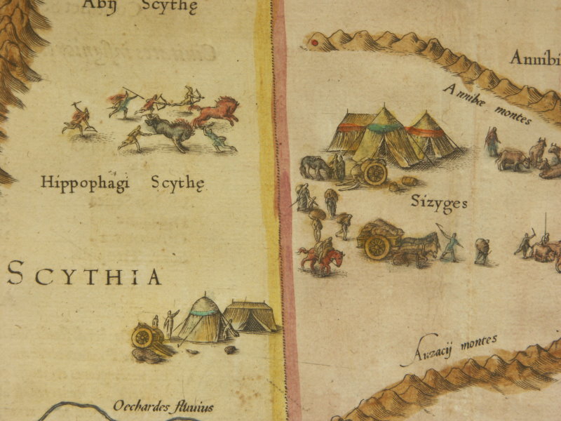
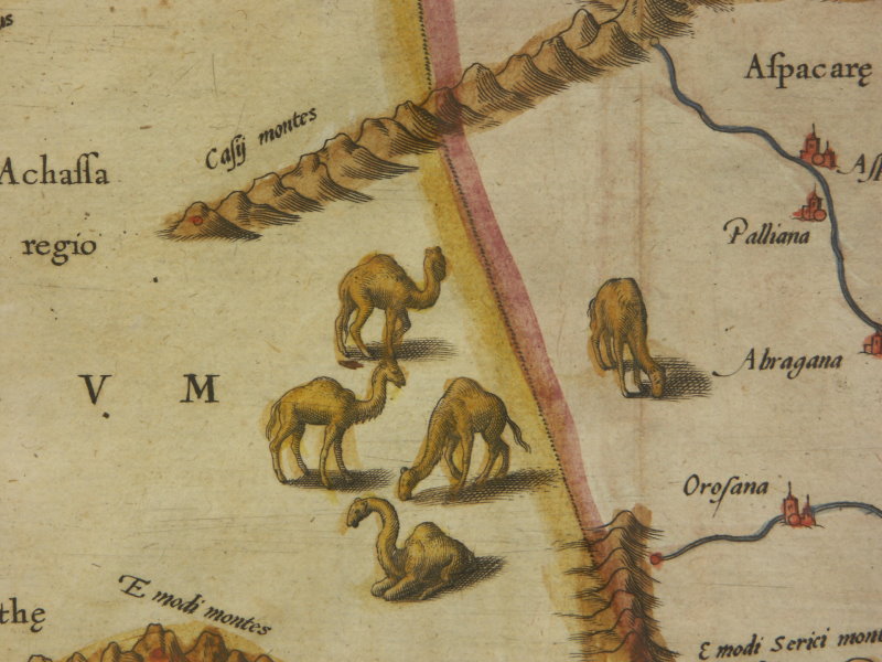
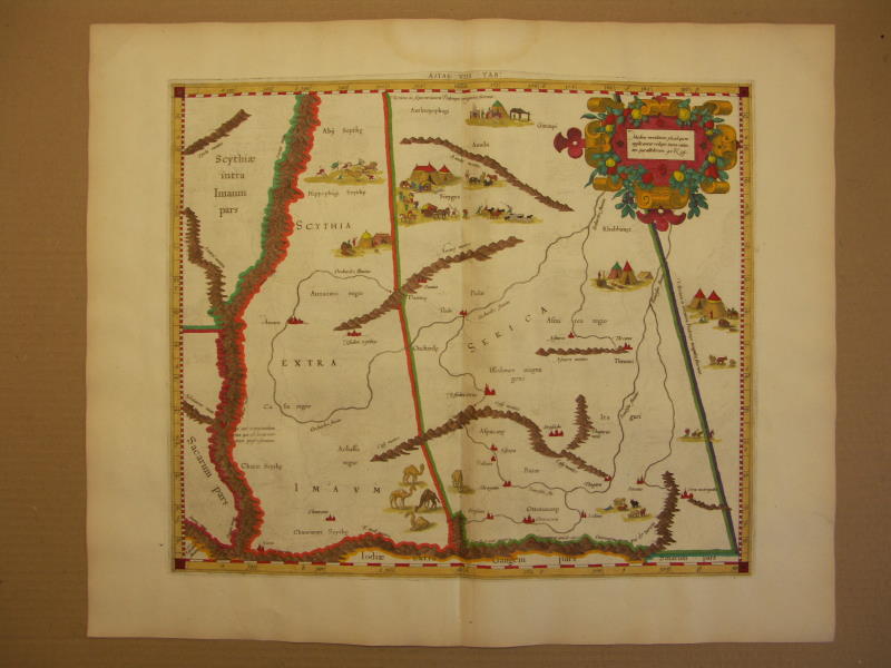
MAP VIII: From Mercator's first-edition 1578
"Ptolemaic" map of western Asia; closeups of this map: *Scythian
horsemen*; *camels*
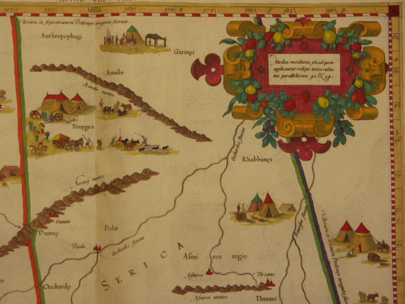
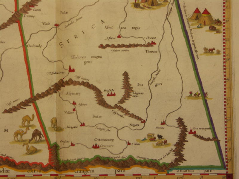
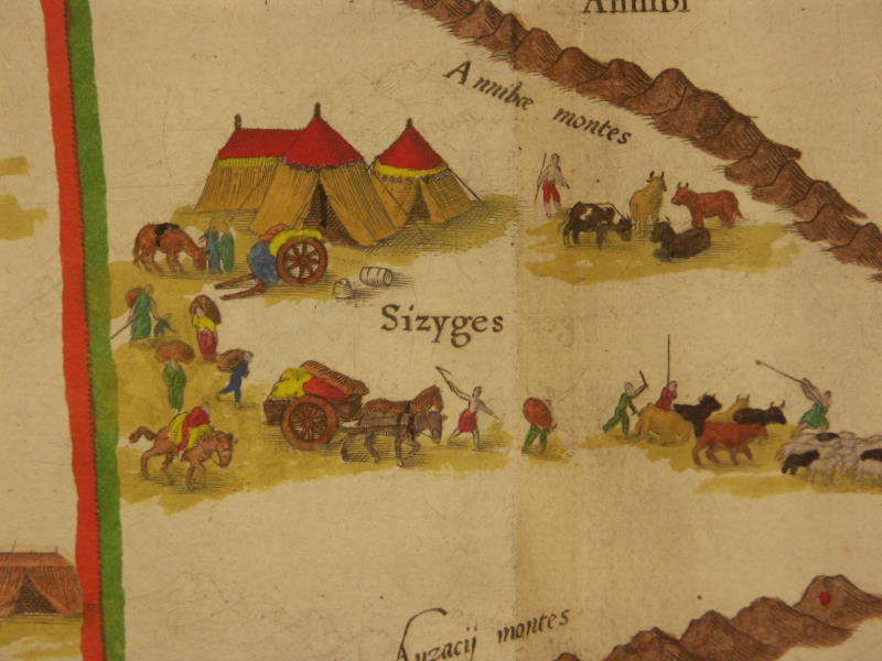
From the 1618 reprint: *the whole map*:
*northwest*; *northeast*;
*southwest*; *southeast*;
*the Sizyges*; *camels*
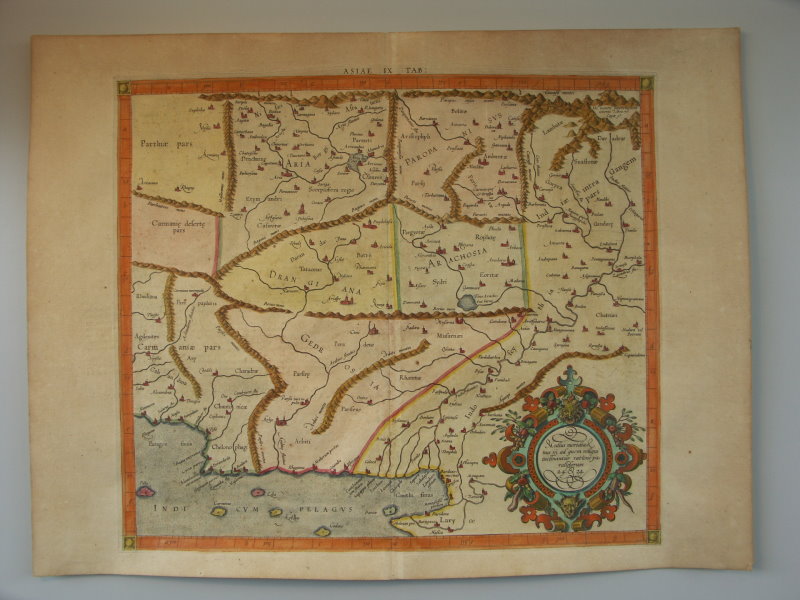
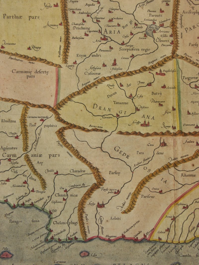
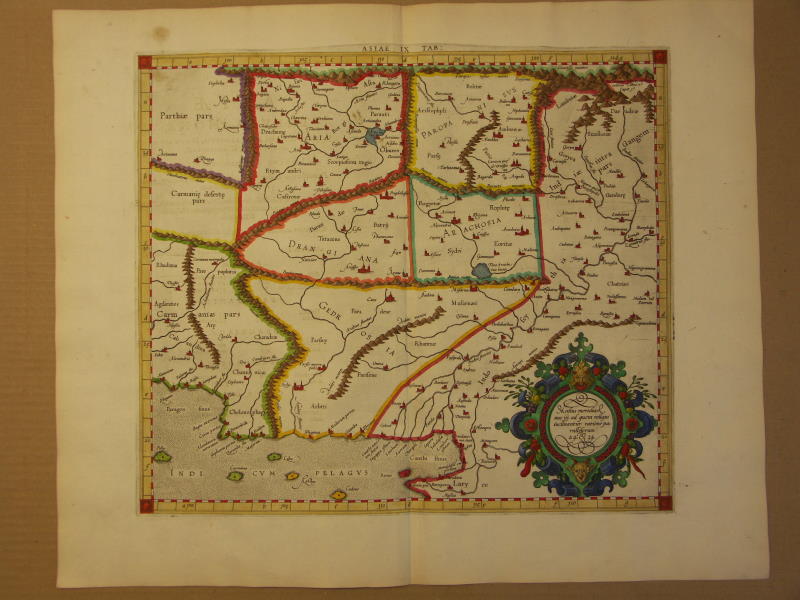
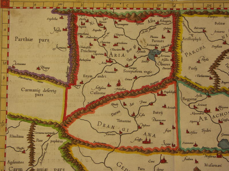
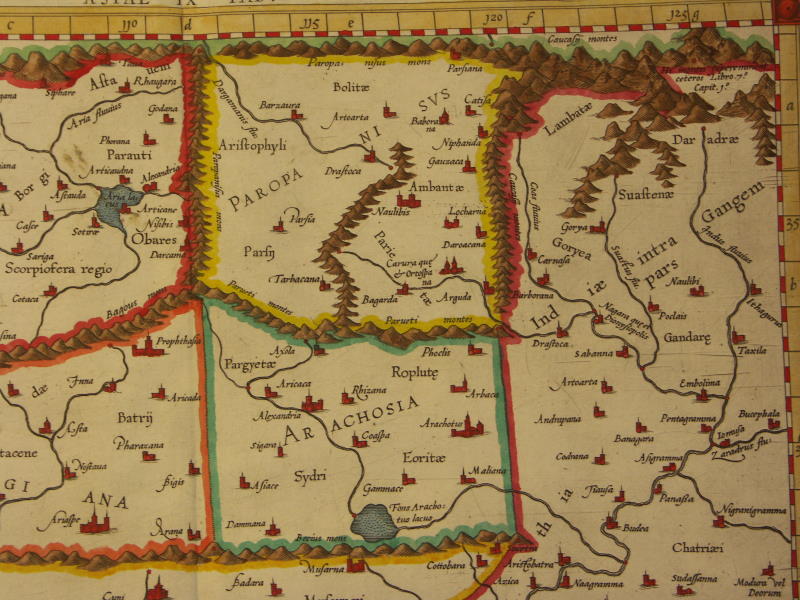
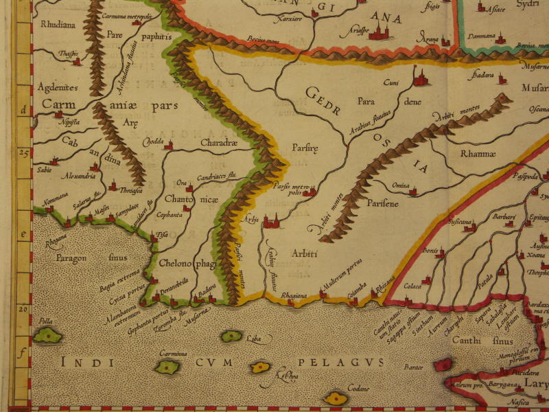
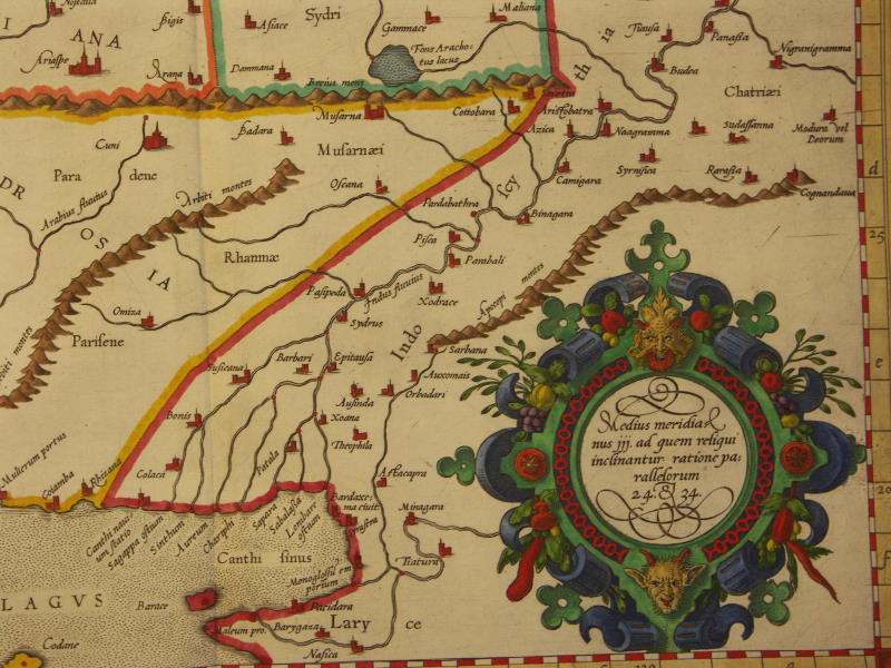
MAP IX: Mercator's first-edition 1578 "Ptolemaic"
map of Asia west of the Indus; closeups of this map: *western*;
*eastern*
From the 1618 reprint: *the whole map*:
*northwest*; *northeast*;
*southwest*; *southeast*
*A later version of Map IX, from 1584*
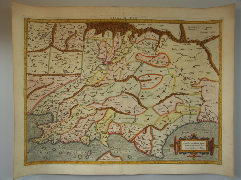
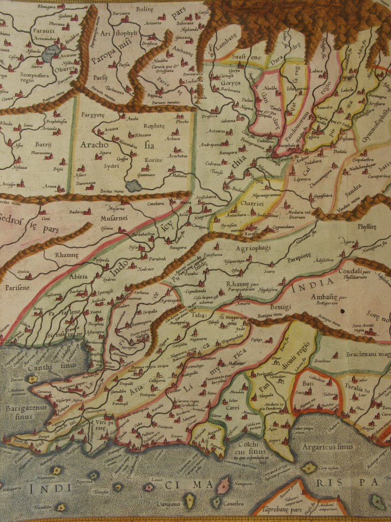
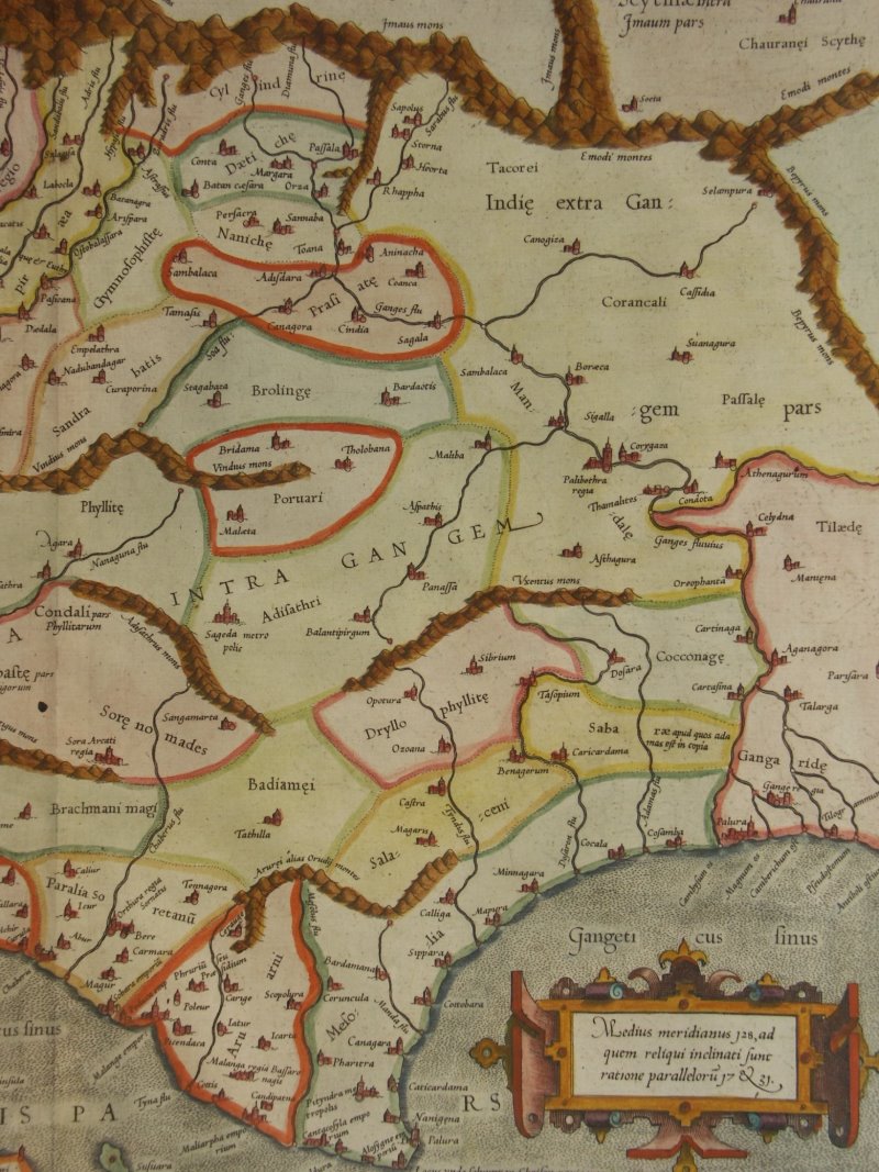
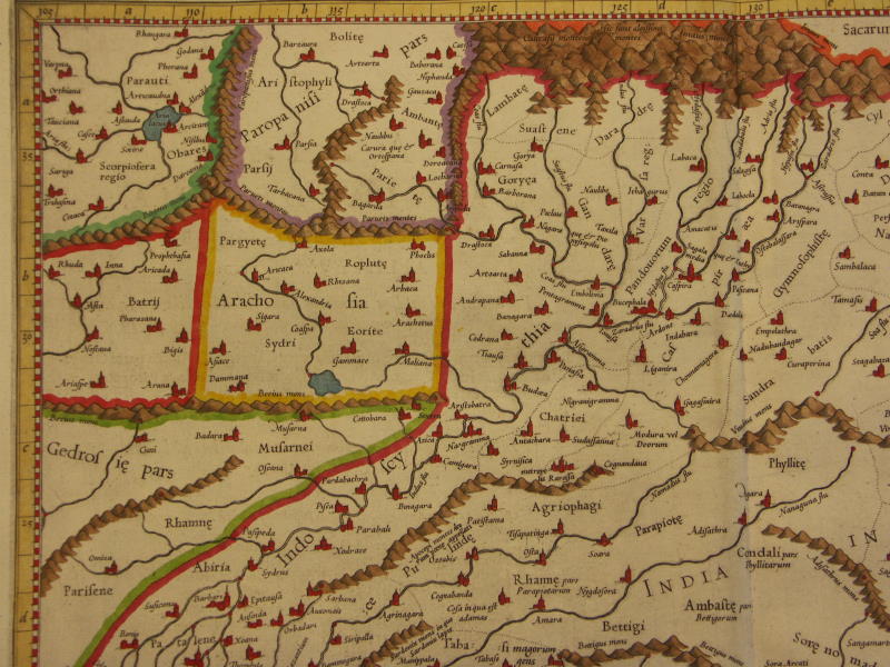
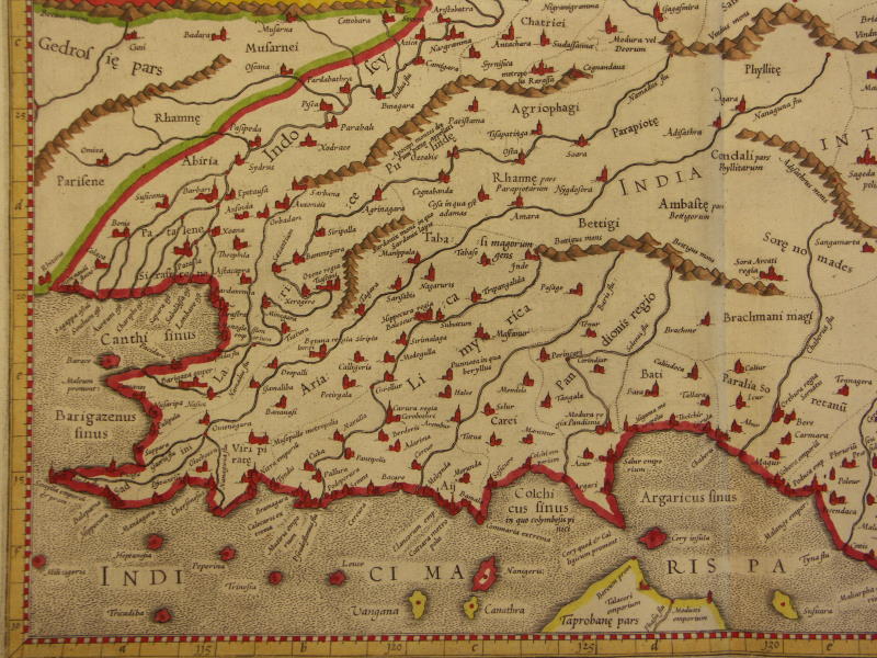
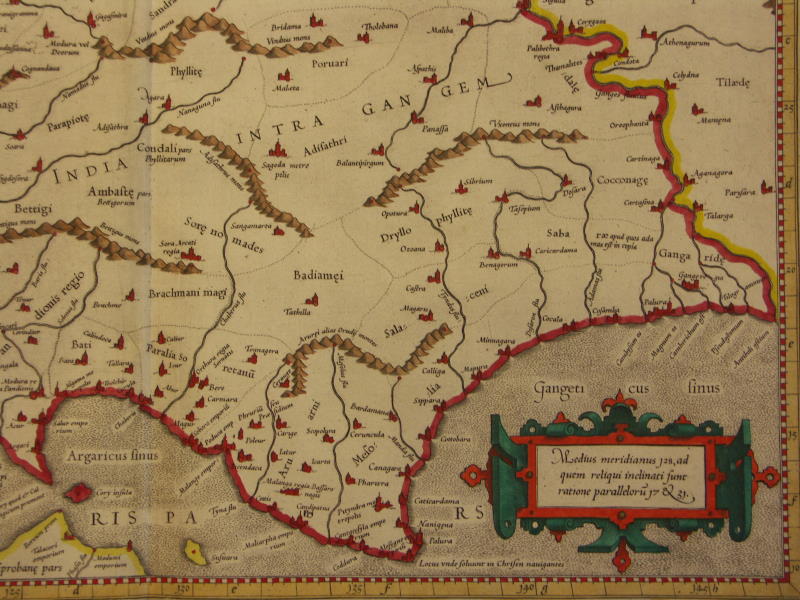
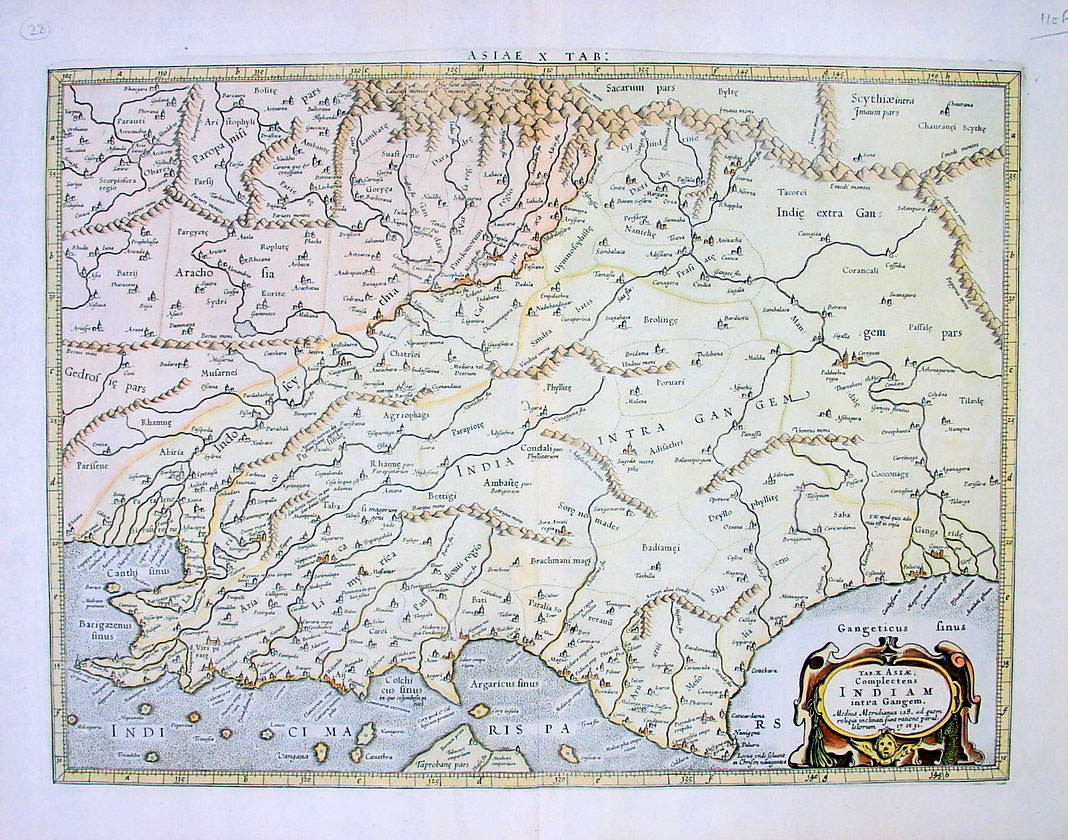
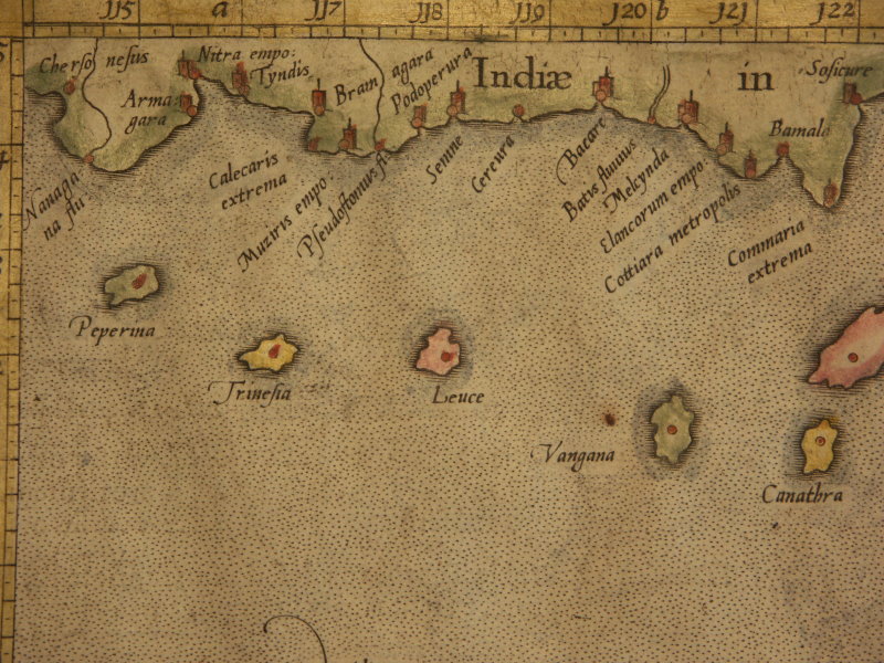
MAP X: From the same 1578 edition -- South Asia
proper; closeups: *western*; *eastern*
From the 1618 reprint: *the whole map*:
*northwest*; *northeast*;
*southwest*; *southeast*
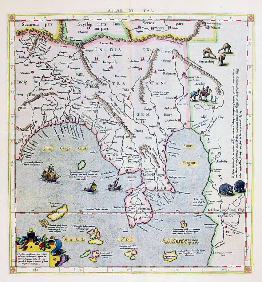
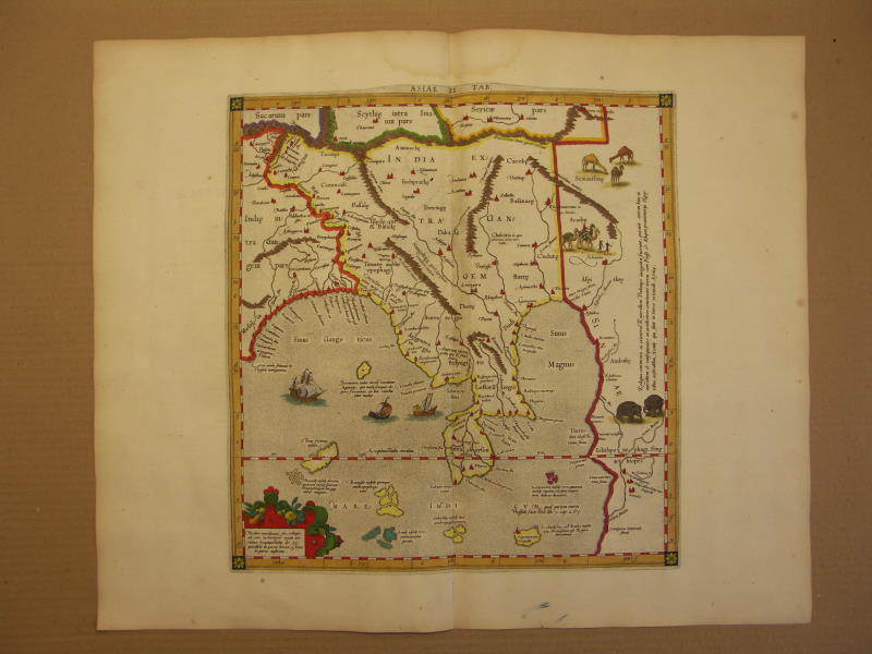
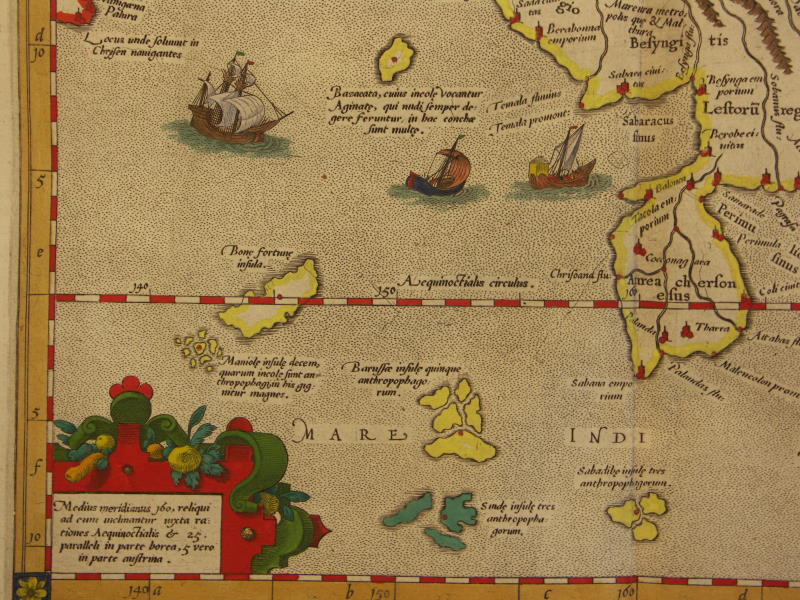
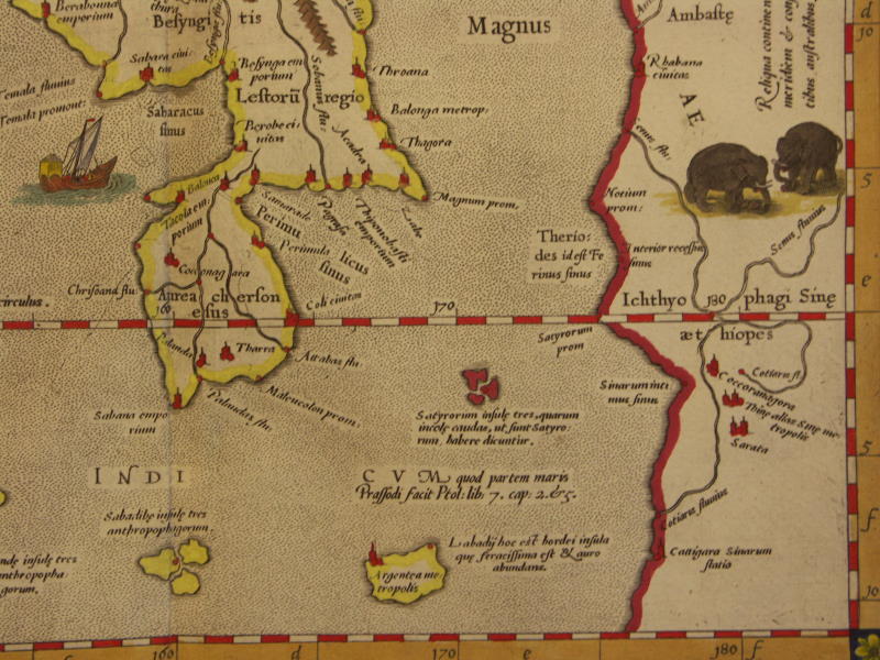
MAP XI: From the 1584 edition, not the 1578
one -- South and Southeast Asia
From the 1618 reprint: *the whole map*:
*northwest*; *northeast*;
*southwest*; *southeast*
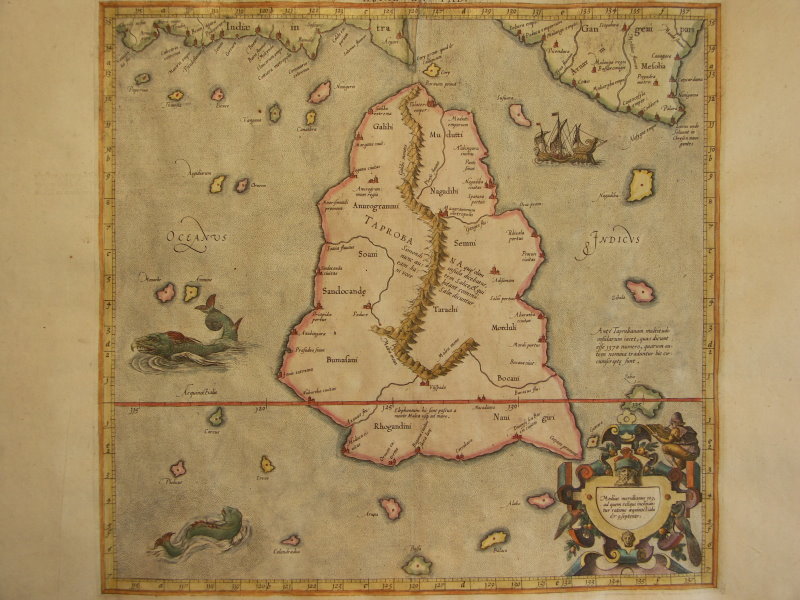
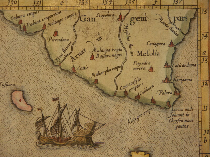
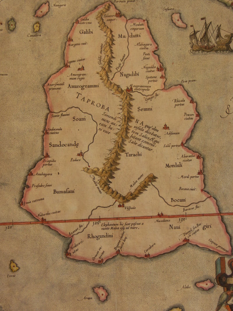
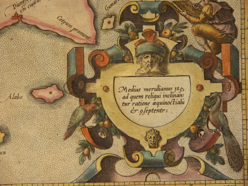
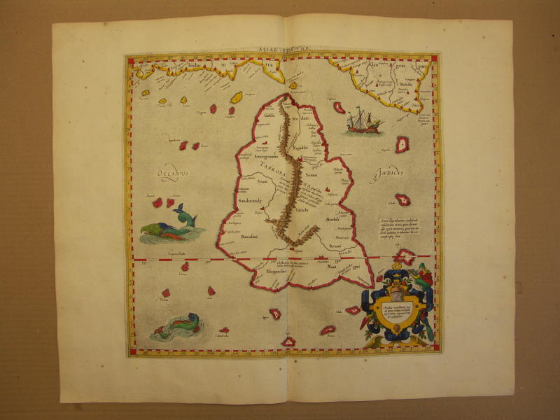
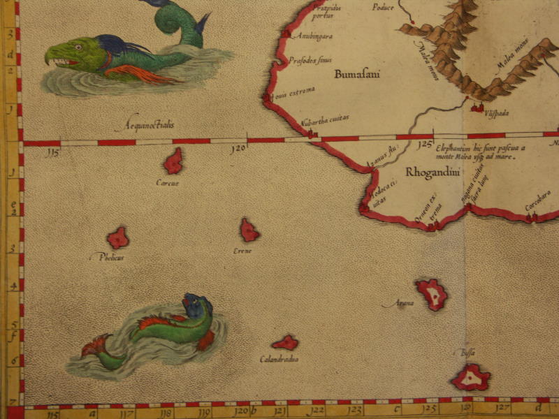
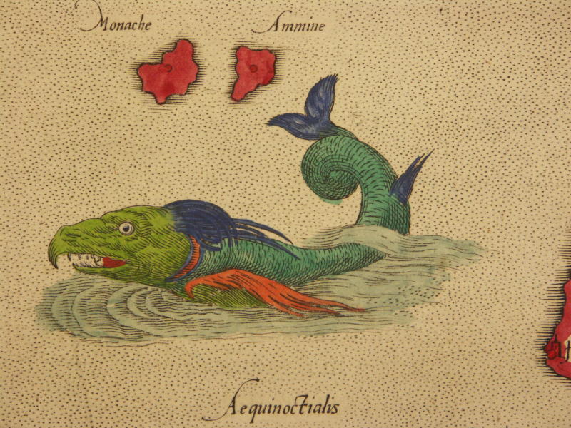
MAP XII: From the 1578 edition -- Taprobana
or Ceylon: closeups of *the upper left part of the
map*; *the upper right part of the map*; *Taprobana
itself*; *the cartouche*; *the
sea monster in the lower left*
From the 1618 reprint: *the whole map*:
*northwest*; *northeast*;
*southwest*; *southeast*;
*the sea monster in the upper left*;
*the ship in the upper right*
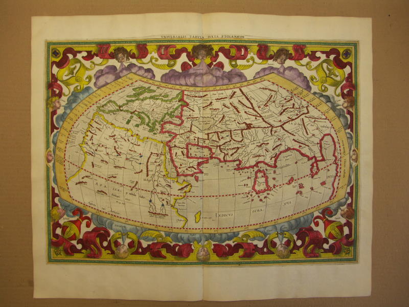
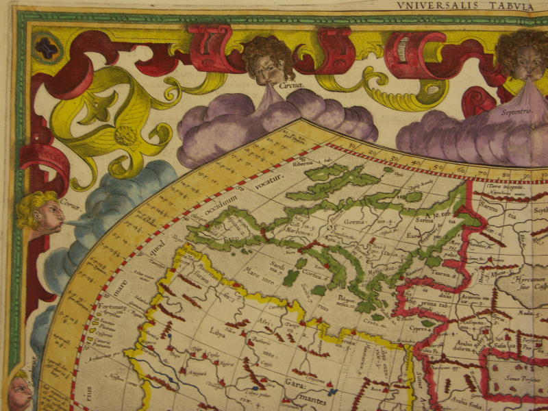
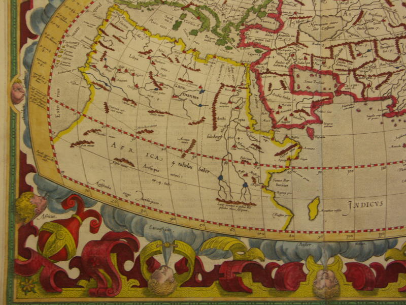
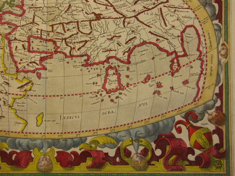
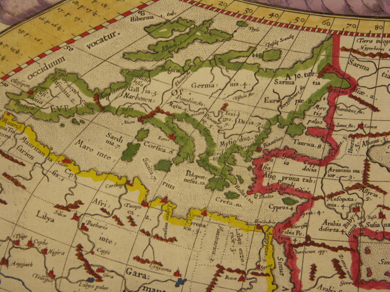
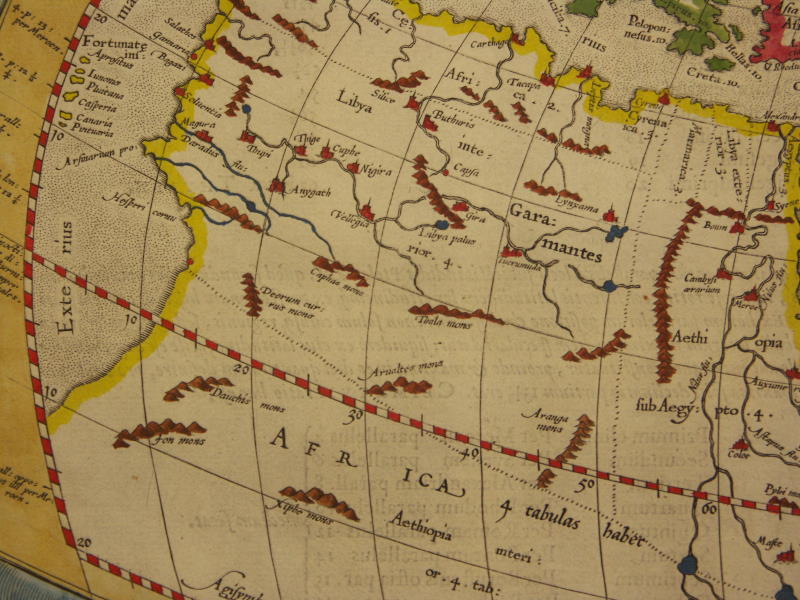
The Ptolemaic world: From the 1618 edition: *the whole map*: *northwest*; *northeast*; *southwest*; *southeast*; *Europe*; *northwestern Africa*; *central Asia*; *western Asia*
"These maps, based on the text of Ptolemy, were first published in the 1578 Gottfried von Kempen edition of Mercator's dedication to Ptolemy - Tabulae geographicae Cl: Ptolemei . Plate size: - 18 1/4in x 13 1/4in (463mm x 335mm)
Ptolemy (AD 87 - 150) was a Greek mathematician, astronomer and geographer who lived in Alexandria during the first century AD and assembled and codified his predecessors' cartographic theories including those of Marinus of Tyre (c. AD 120). In about AD 150 he published his Geographia, a work in 8 volumes, supposedly illustrated with a world map, 26 regional maps and a profusion of smaller maps. Although the text of the Geographia survived, no maps older than about the twelfth century have come down to us and, in consequence, we have no means of knowing whether the 'Ptolemy' maps on which we set so much store were, in fact, drawn by him or were the interpretations of later map makers using his text as a basis. Mercator's interpretation of the Ptolemaic text was possibly one of the truest undertaken up until that time. He had spent 13 years researching, drawing and engraving the maps at much commercial sacrifice to himself, having seen Ortelius's Theatrum and De Jodes Speculum published, to become both technical and commercial successes.
This map was published in the later 1695 Helma Strick edition of Tabulae geographicae Cl: Ptolemei . The plates were reworked from the earlier edition with a contemporary 17th century design with text relating to the meridian interpretation. Sea monsters, sailing ships and other decoration were also added. These additions were mainly superficial as the main topographical interpretation by Mercator remained true. The map impression is heavy on excellent stable paper with good margins. A wonderful map by the father of cartography. (Koeman pp. 491, 573)
For nearly sixty years, during the most important and exciting period in the story of modern map making, Gerard Mercator was the supreme cartographer, his name, second only to Ptolemy, synonymous with the form of map projection still in use today. Although not the inventor of this type of projection, he was the first to apply it to navigational charts in such a form that compass bearings could be plotted on charts in straight lines, thereby providing seamen with a solution to an age-old problem of navigation at sea. His influence transformed land surveying and his researches and calculations led him to break away from Ptolemy's conception of the size and outline of the Continents, drastically reducing the longitudinal length of Europe and Asia and altering the shape of the Old World as visualized in the early sixteenth century. Mercator was born in Rupelmonde in Flanders and studied in Louvain under Gemma Frisius, Dutch writer, astronomer and mathematician. He established himself there as a cartographer and instrument and globe maker, and when he was twenty-five drew and engraved his first map (of Palestine) and went on to produce a map of Flanders (1540) supervising the surveying and completing the drafting and engraving himself. The excellence of his work brought him the patronage of Charles V for whom he constructed a globe, but in spite of his favor with the Emperor he was caught up in the persecution of Lutheran Protestants and charged with heresy, fortunately without serious consequences. No doubt the fear of further persecution influenced his move in 1552 to Duisburg, where he continued the production of maps, globes and instruments culminating in large-scale maps of Europe (1554), the British Isles (1564) and the famous World Map on 18 sheets drawn to his new projection (1569). All these early maps are exceedingly rare, some being known by only one copy. In later life he devoted himself to his edition of the maps in Ptolemy's Geographia, reproduced in his own engraving as nearly as possible in their original form, and to the preparation of his 3-volume collection of maps to which, for the first time, the word 'Atlas' was applied. The word was chosen, he wrote, 'to honor the Titan, Atlas, King of Mauritania, a learned philosopher, mathematician, and astronomer' . The first two parts of the Atlas were published in 1585 and 1589 and the third, with the first two making a complete edition, in 1595 the year after Mercator's death.
Mercator's sons and grandsons, named above, were all cartographers and made their contributions in various ways to the great atlas. Rumold, in particular, was responsible for the complete edition in 1595. After a second complete edition in 1602, the map plates were bought in 1604 by Jodocus Hondius who, with his sons, Jodocus II and Henricus, published enlarged editions which dominated the map market for the following twenty to thirty years. (-- Attrib. to Koeman 1998)"
== Early index == Main map index == Glossary == FWP's main page