 |
 |
 |
 |
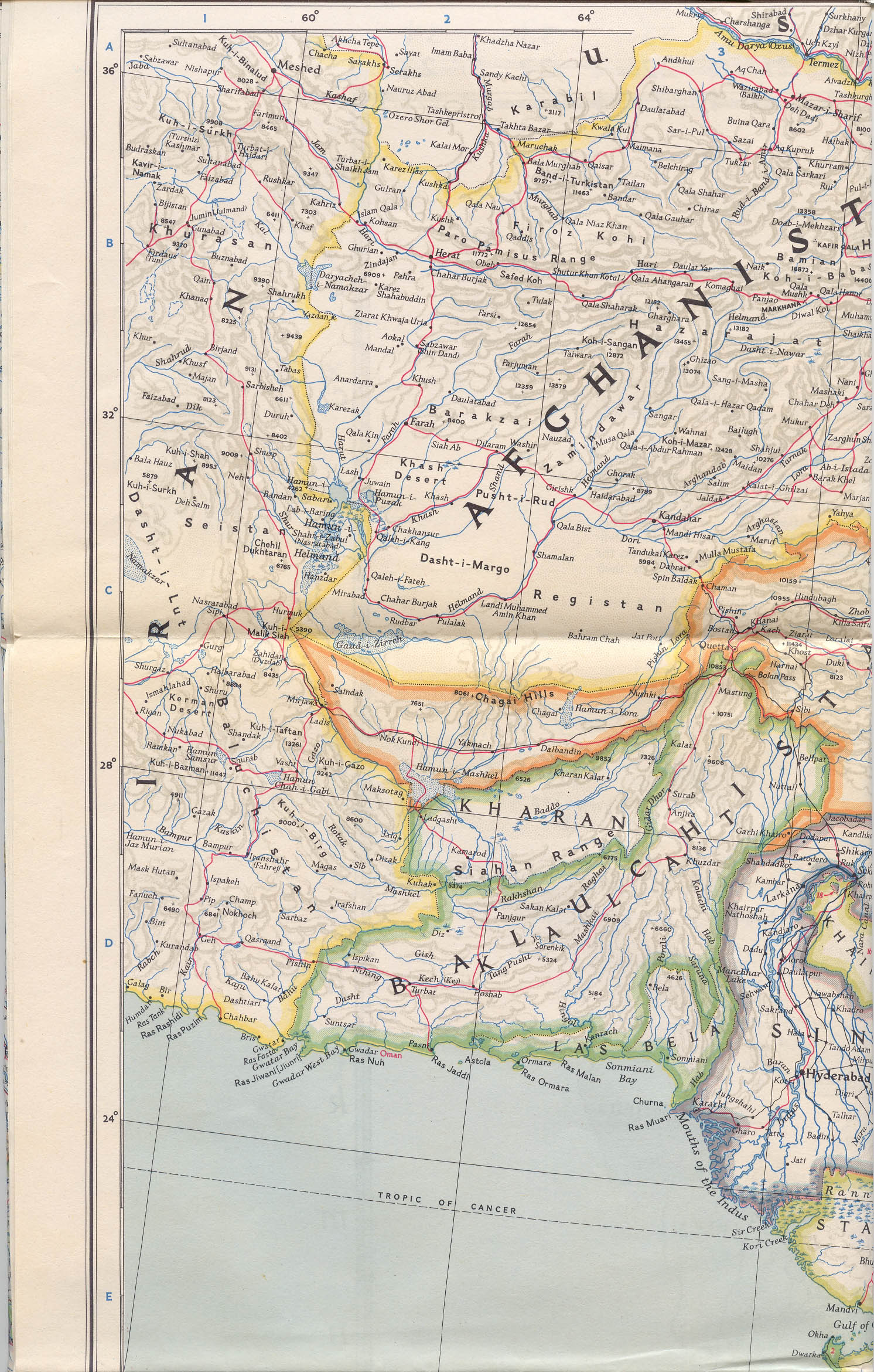
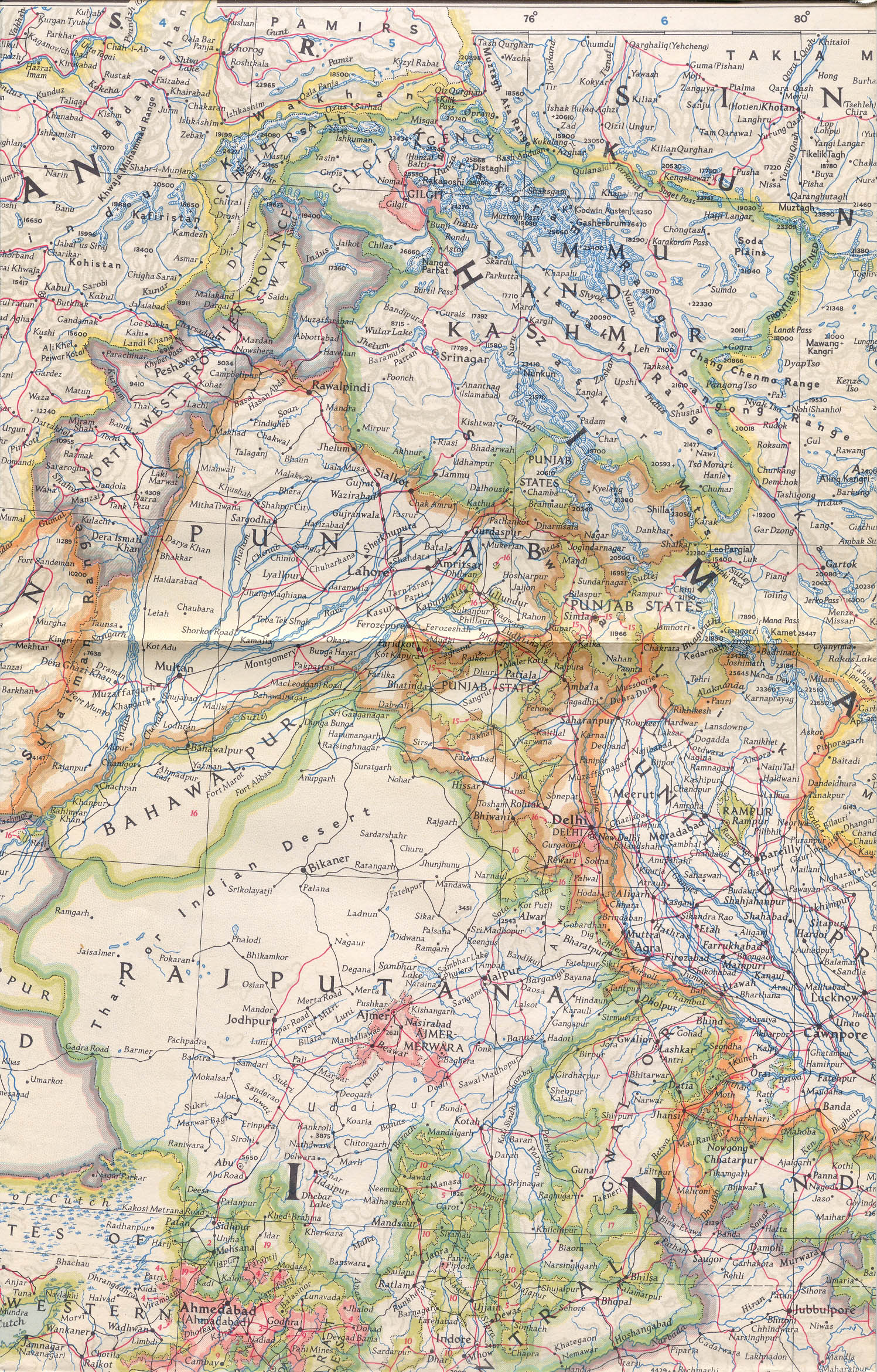
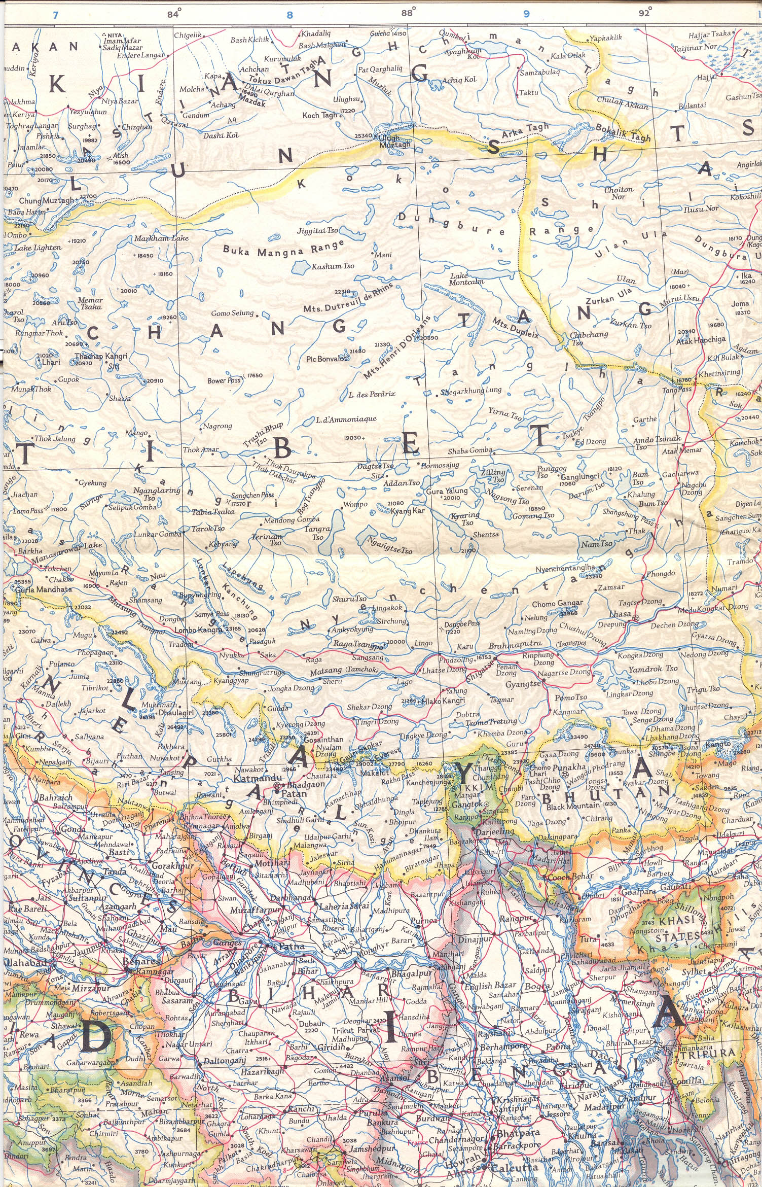
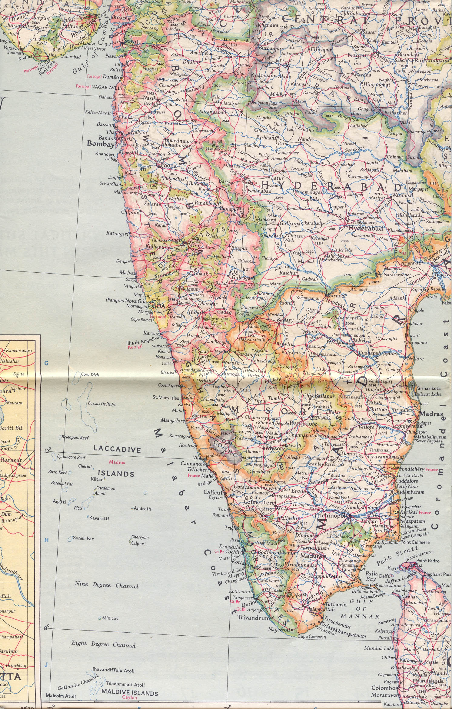
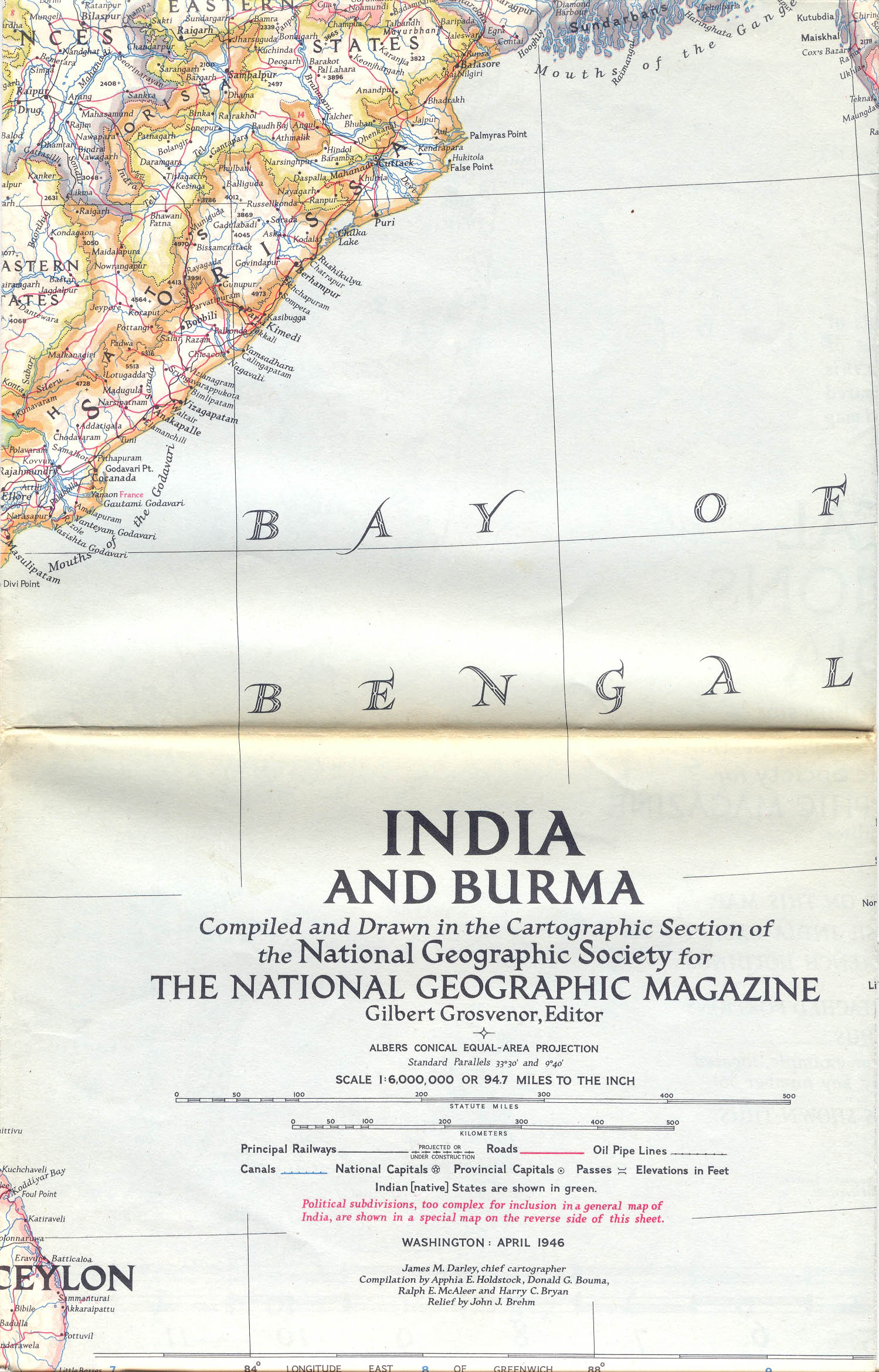
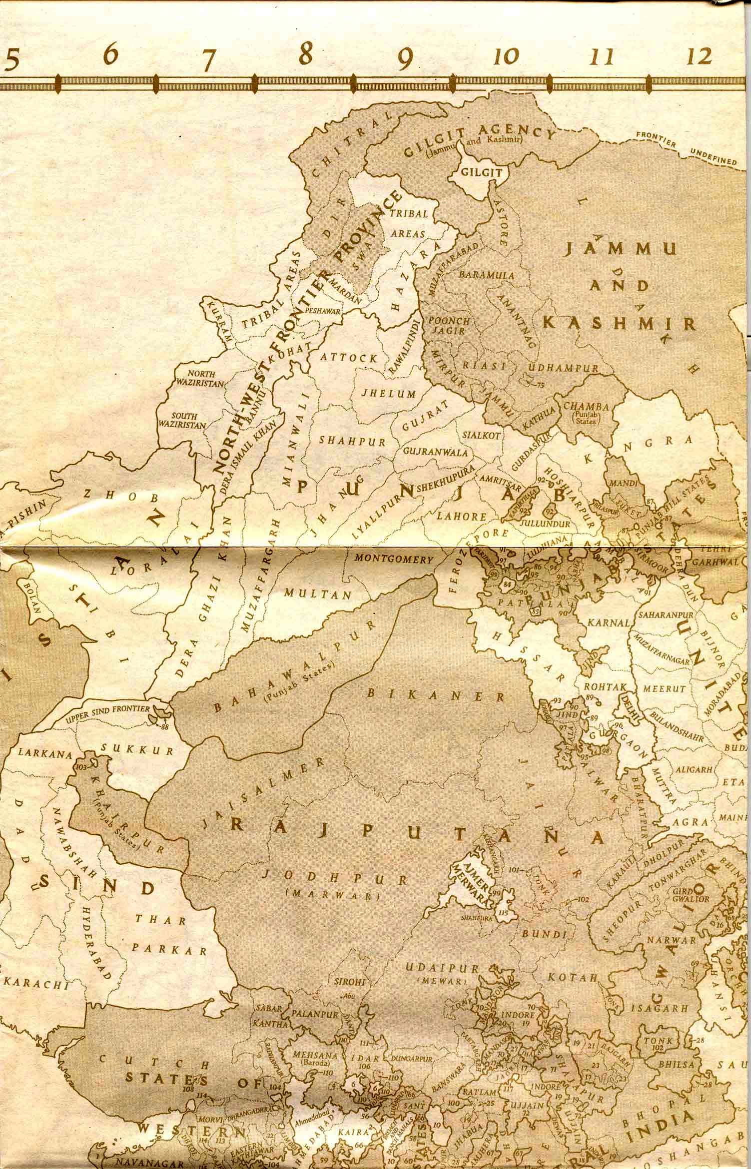
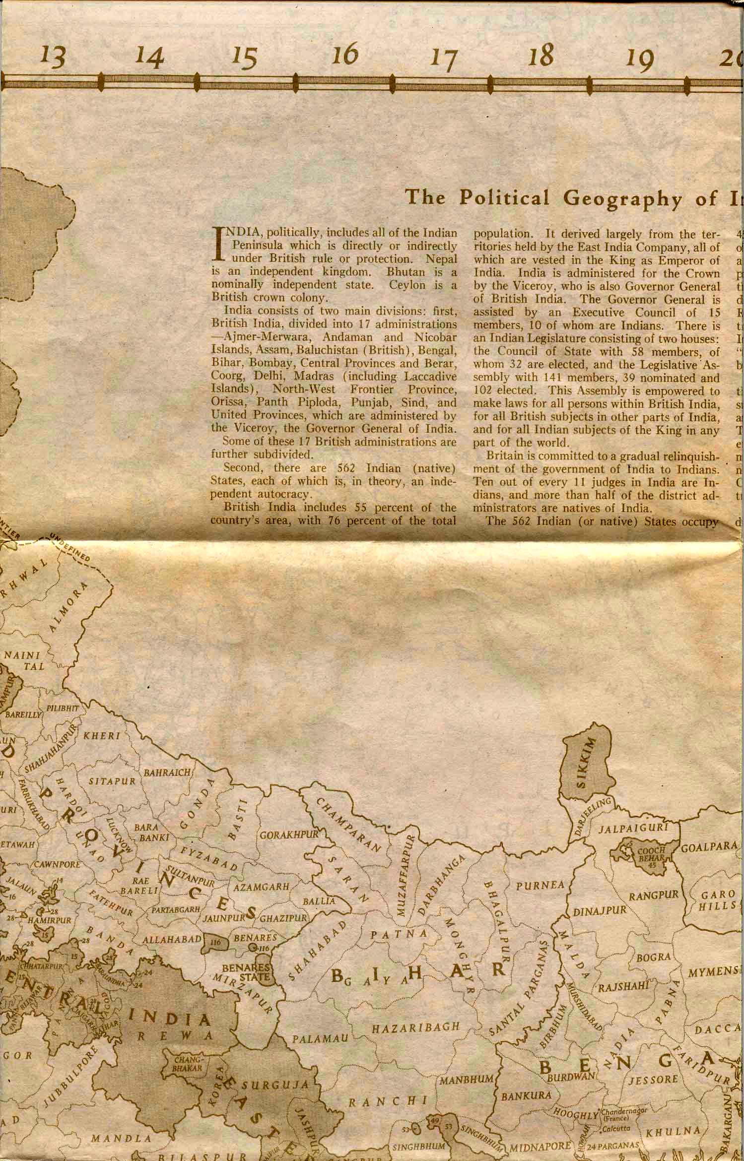
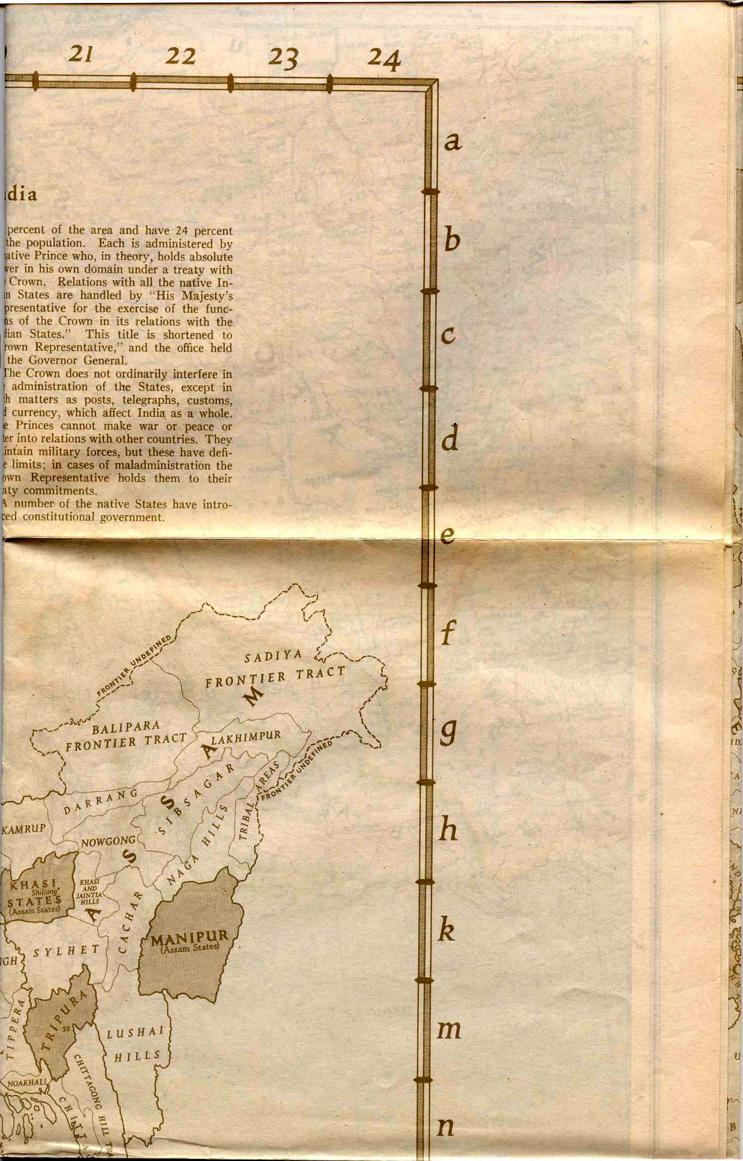
INDIA AND BURMA, 1946
|
|
|
|
 |
 |
 |
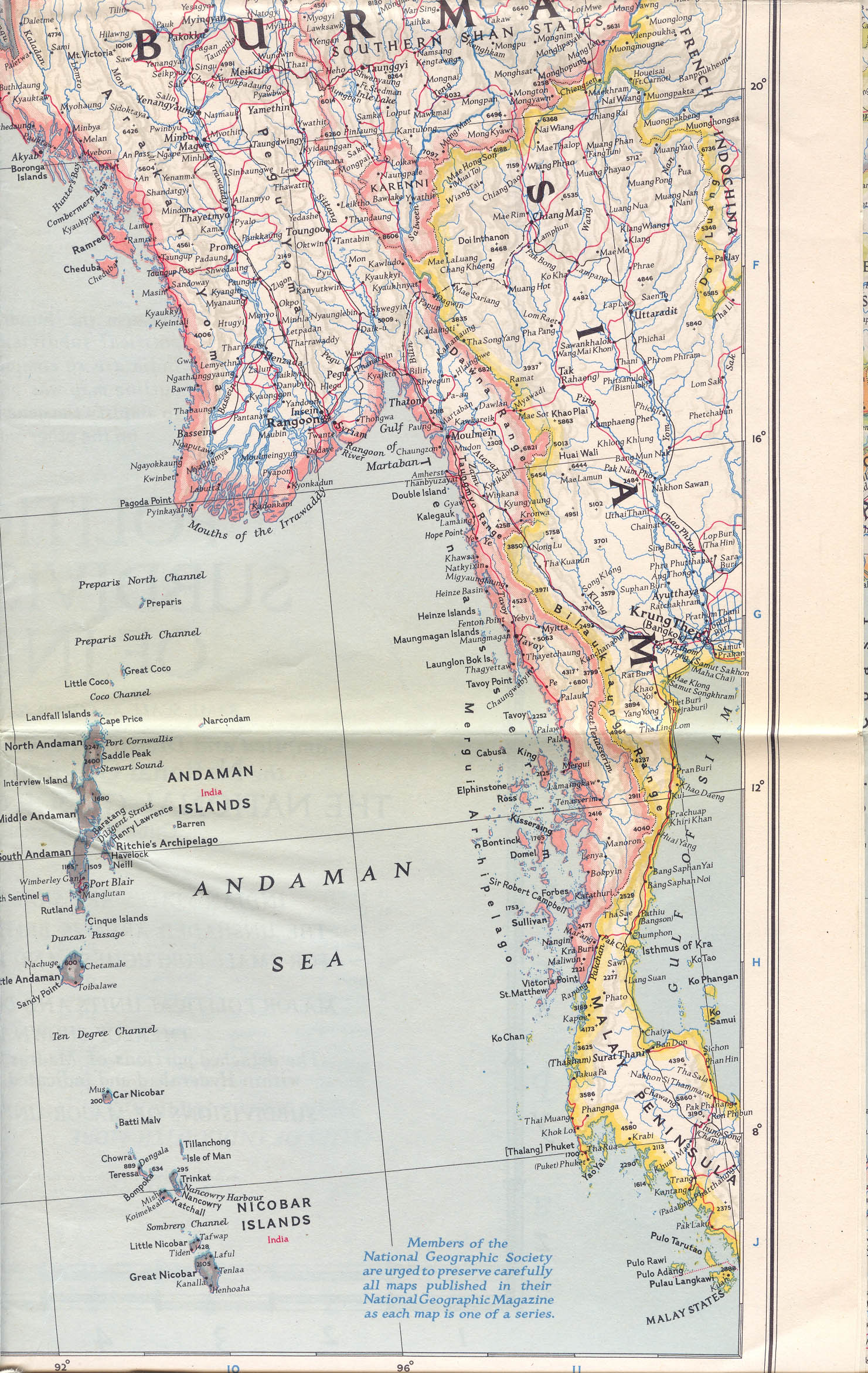 |
"India and Burma," a National Geographic map from 1946; CLICK
ON
ANY SECTION OF THE MAP FOR A VERY LARGE SCAN.
Also, here is *A COMPLETE INDEX
OF PLACE-NAMES* for the map.
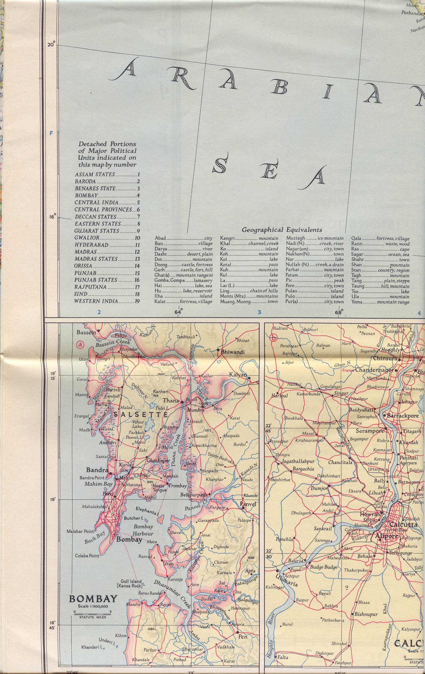
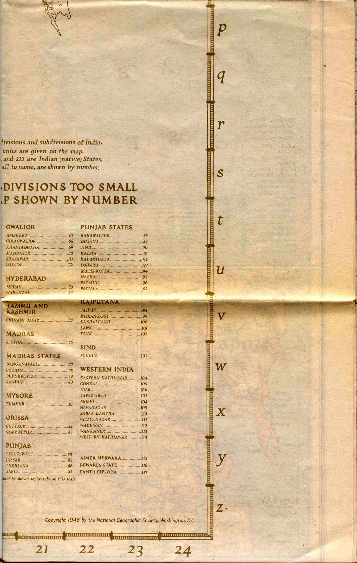
The back of the map provides further analysis of the princely
states.
It was originally printed in a very light beige, presumably so
that the
color wouldn't bleed through onto the main map; the contrast has
been
enhanced
for greater readability:
 |
 |
 |
 |
 |
 |
 |
 |
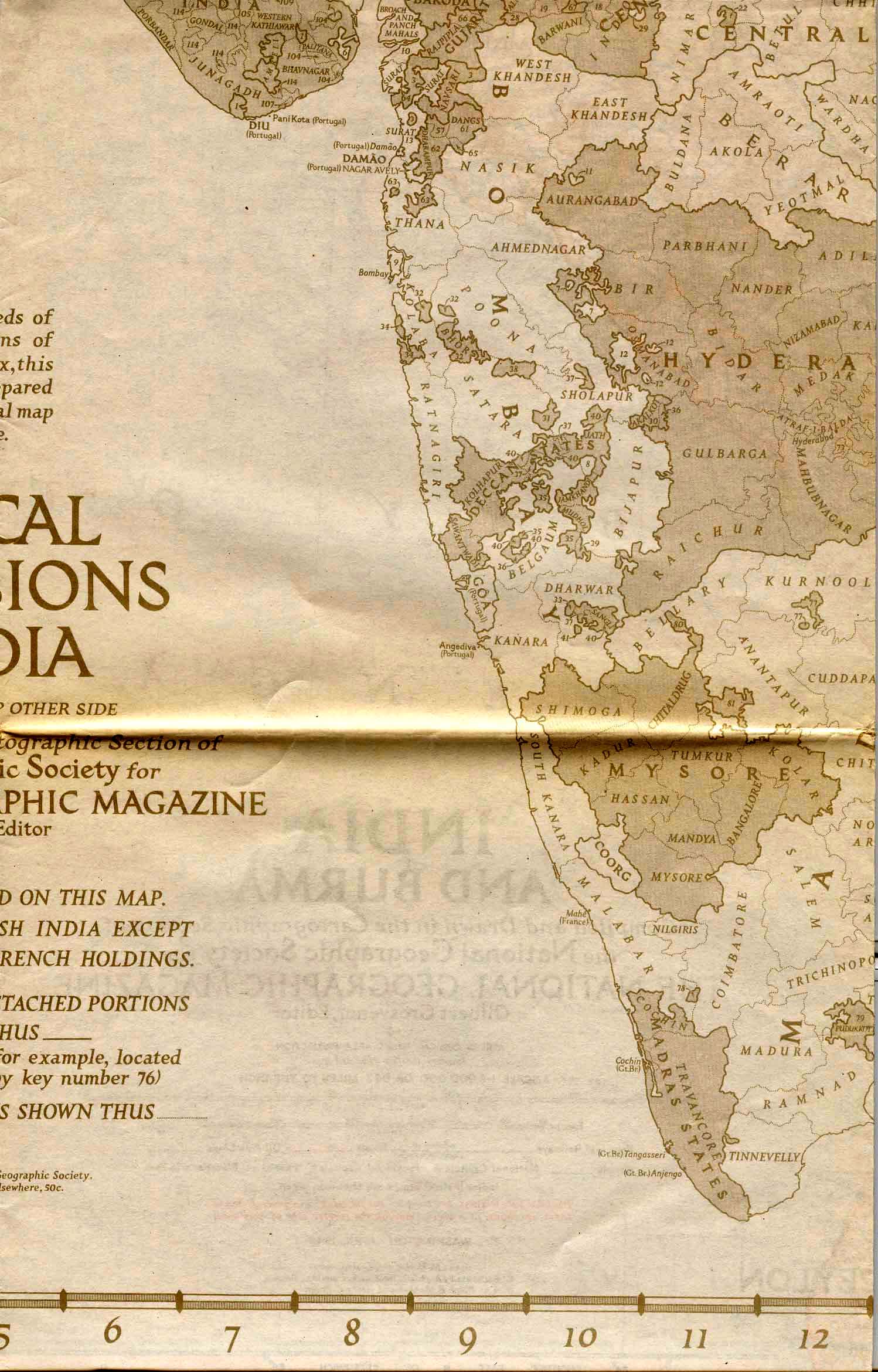
In case some of the tiny states in Gujarat and elsewhere might get lost in the creases, here are a few supplementary views:
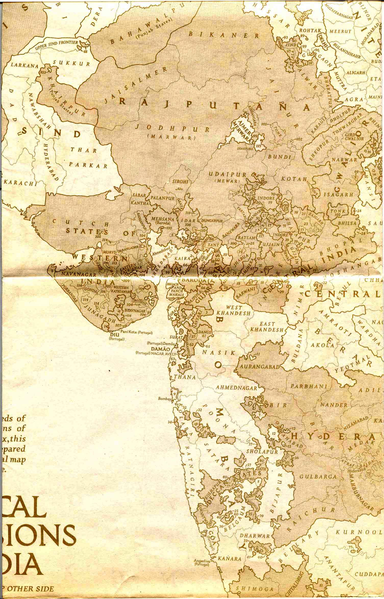
western |
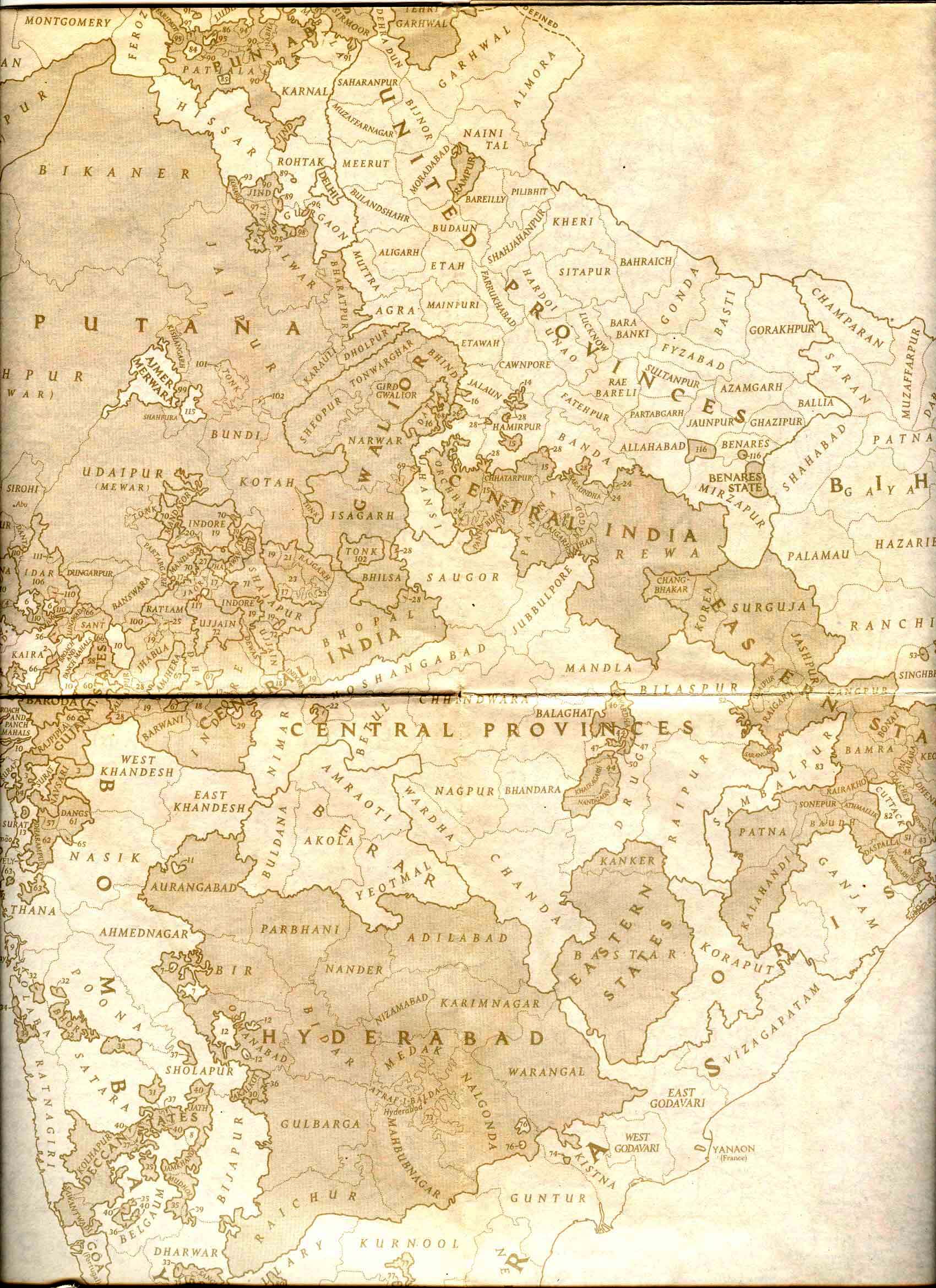
central |
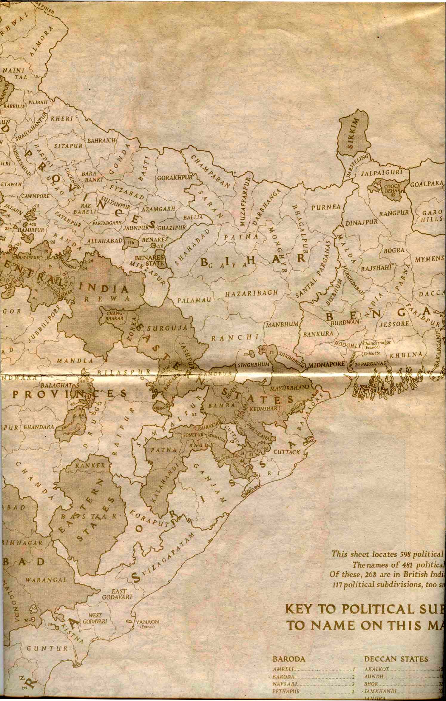
eastern |
== Modern index == Main map index == Glossary == FWP's main page