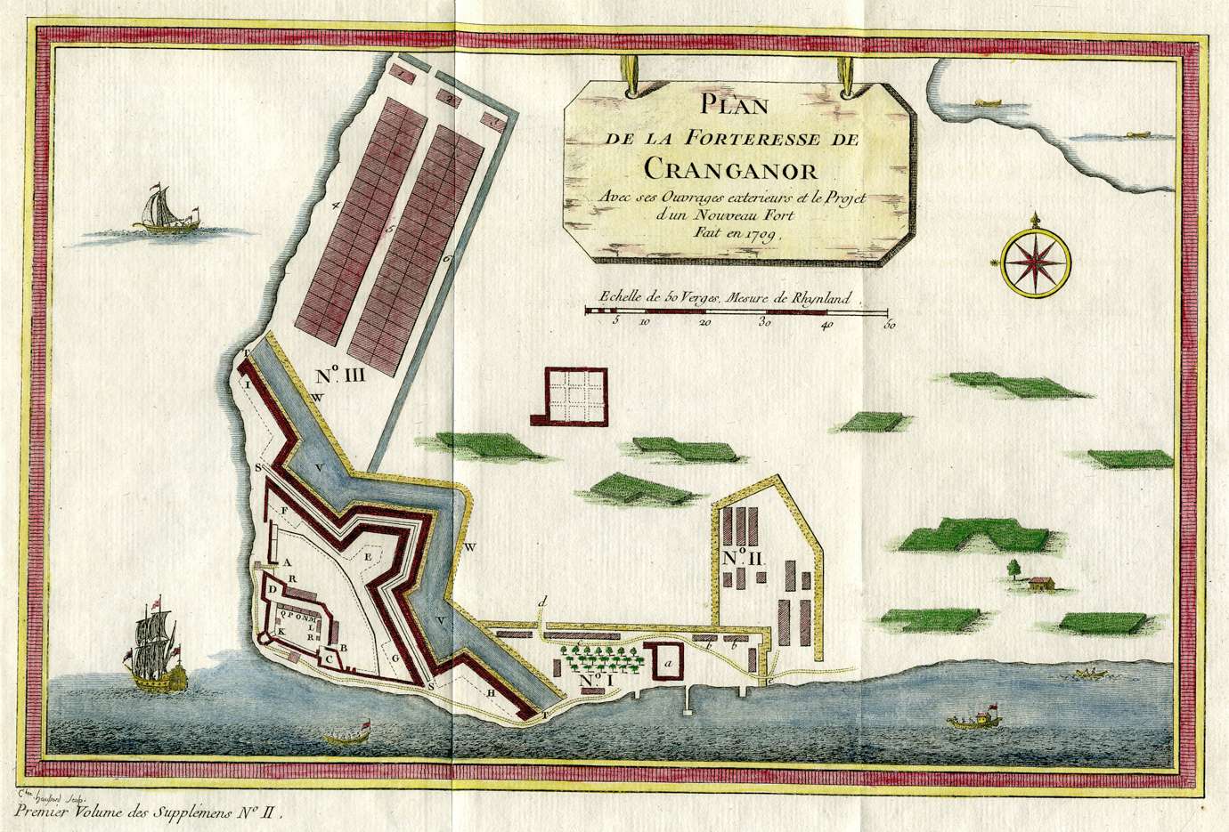
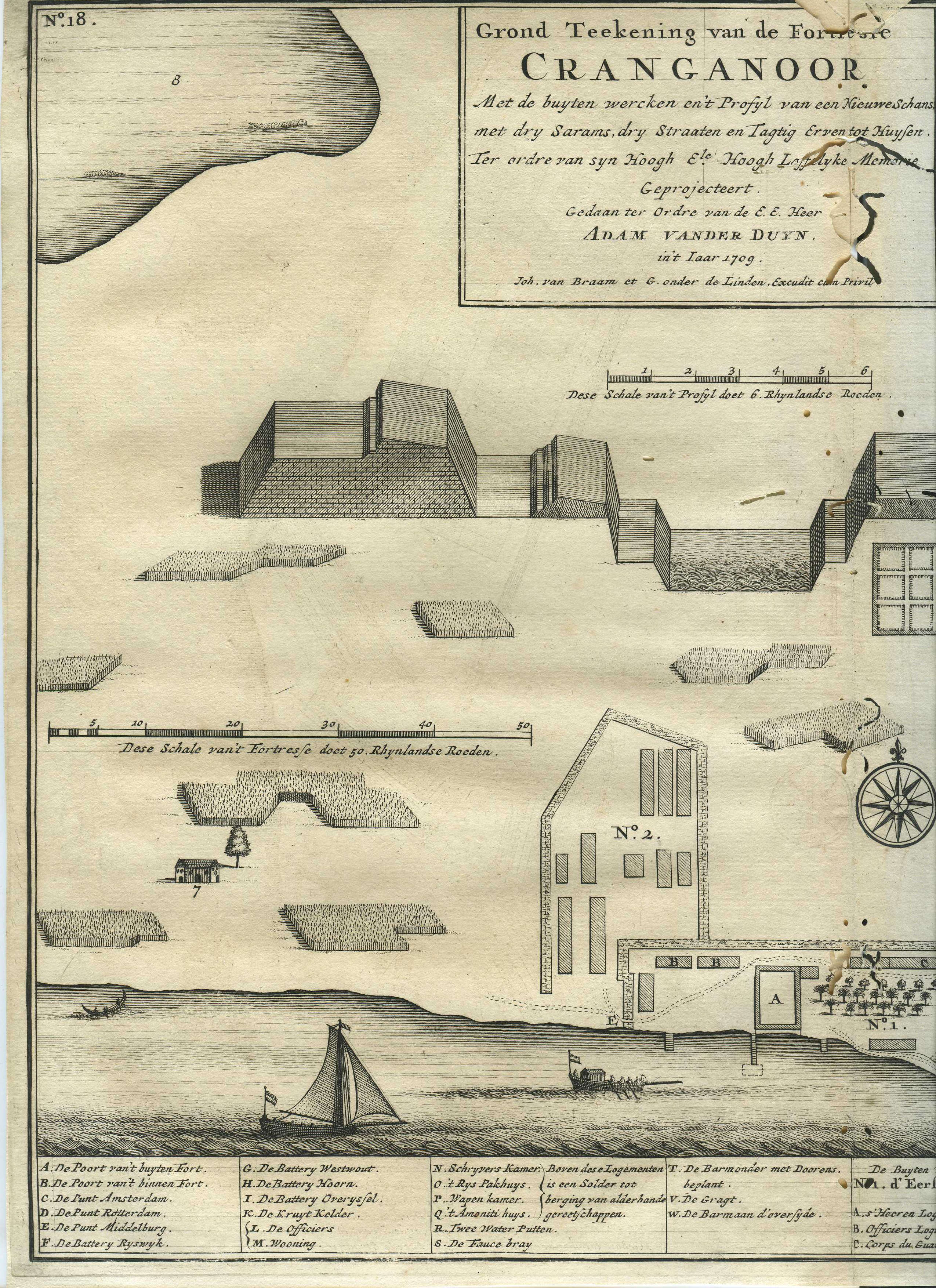
CRANGANORE, c.1750
Bellin's plan of Cranganore, with
modern hand coloring
The source of Bellin's plan:
From 'Oud en Nieuw Oost-Indien' by
Francois Valentijn, Amsterdam, 1724-26; the drawing is credited to
Adam van der Dyun, Commandant of the Malabar Coast, 1709; CLICK ON
EITHER HALF OF THE MAP FOR A VERY LARGE SCAN
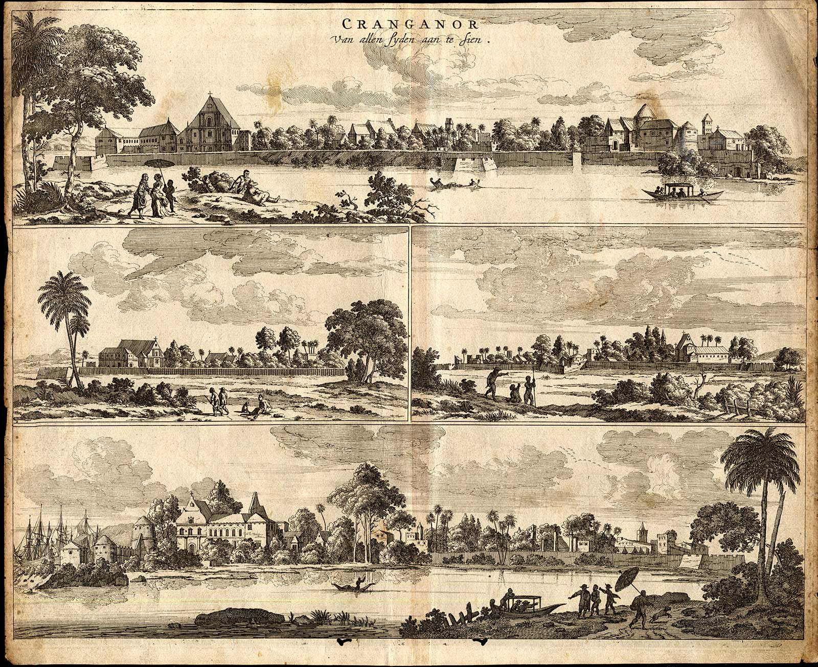
Compare: "Cranganor" by Philip Baldaeus, from 'Nauwkeurige
beschrijving Malabar en Choromandel, derz. aangrenzend rijken, en
het machtige eiland Ceylon', Amsterdam, 1672
== Bellin
index == Mughal
index == Main
map index == Glossary
== FWP's main page
==