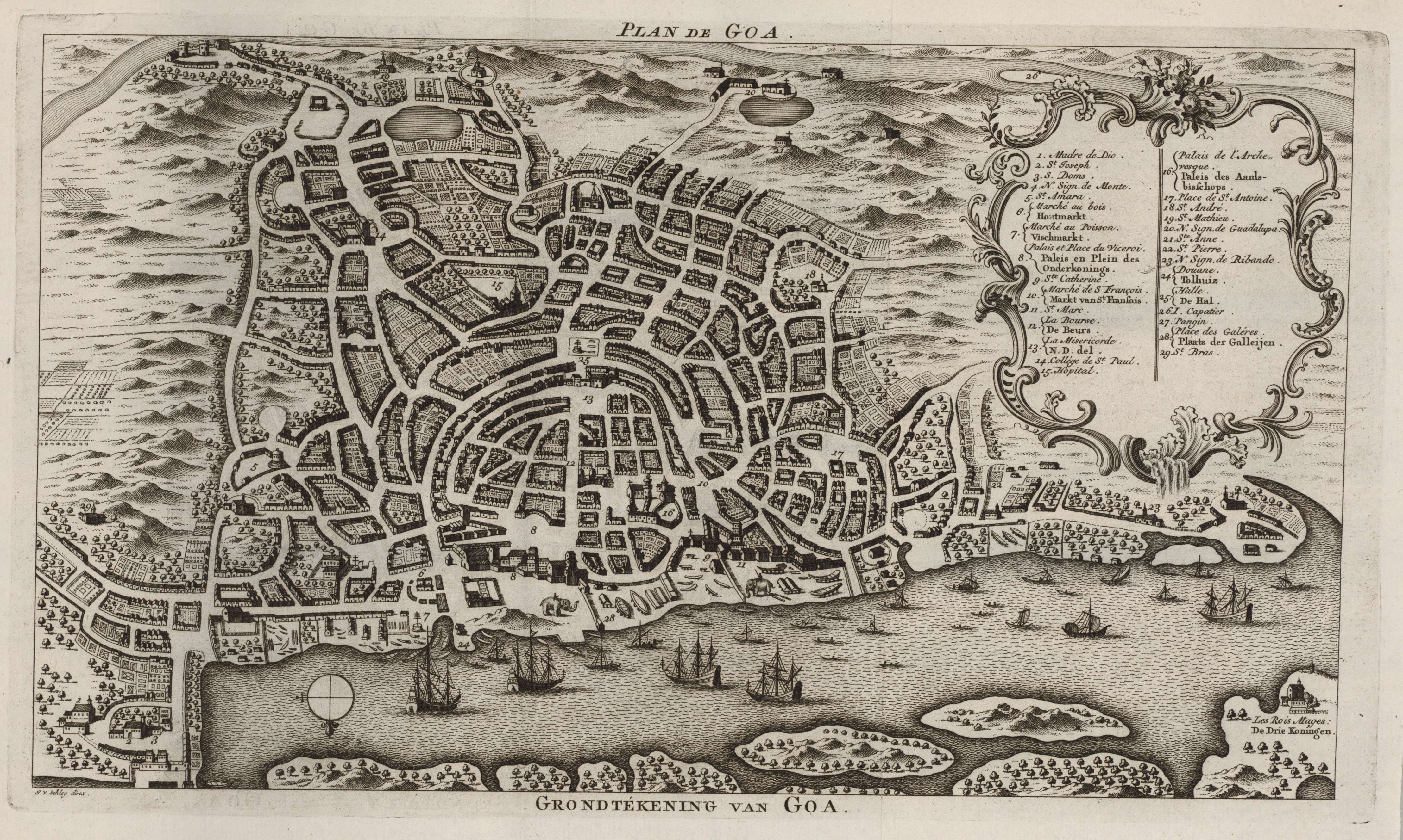
GOA, c.1750
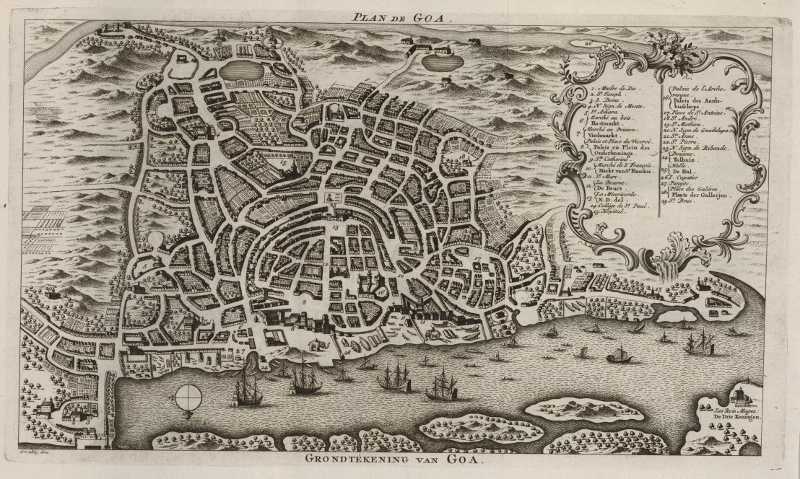
Bellin's plan of Goa, c.1750; CLICK ON THE MAP FOR A
VERY LARGE SCAN
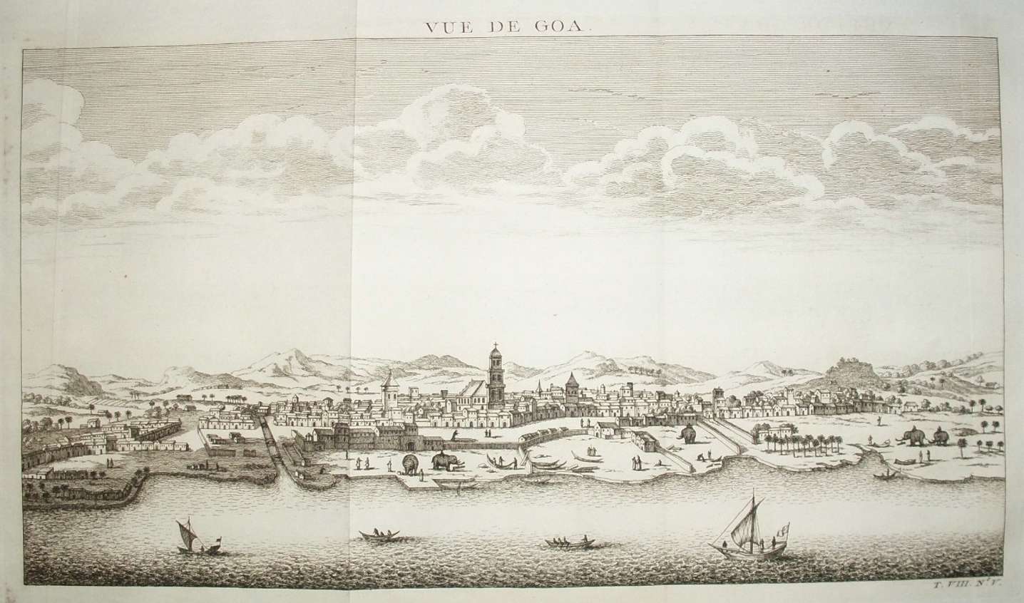
"Vue de Goa, by Bellin: with very
large scans of the *left part*
and the *right part* of the
engraving
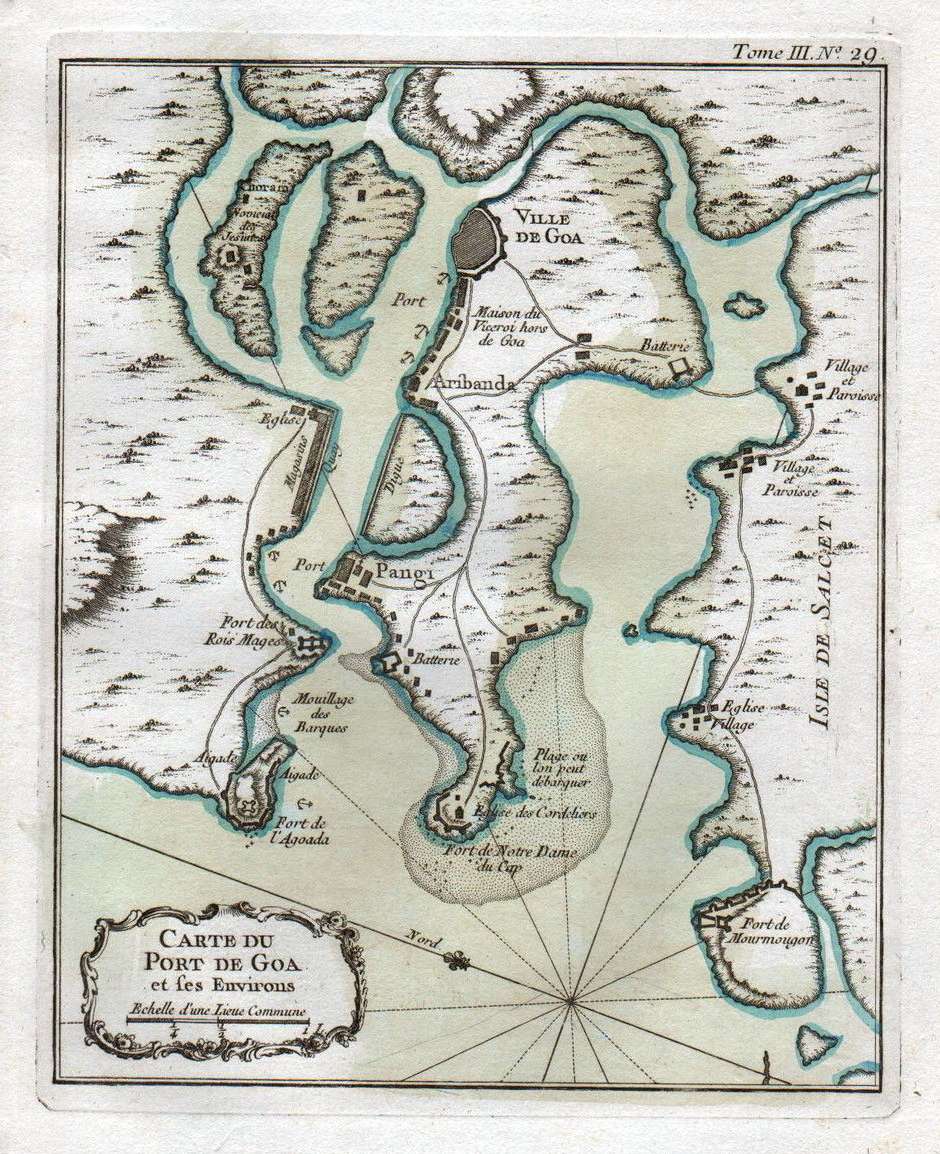
Bellin's "Map of the port of Goa and its surroundings," 1764;
with modern hand coloring
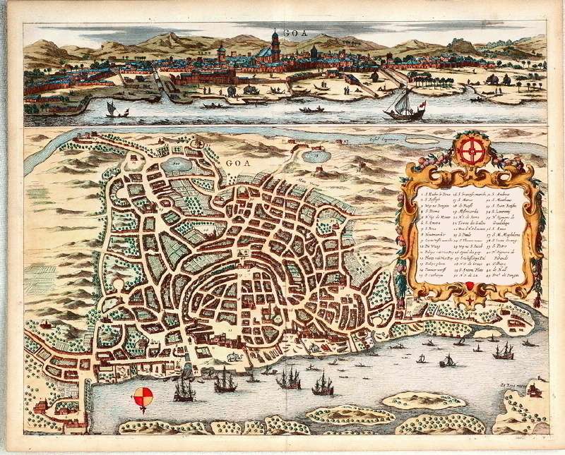
Bellin's apparent source: this map
(with modern hand coloring) from Philip Baldaeus's work 'A true and exact
description of the most celebrated East-India coasts of
Malabar and Coromandel and also of the Isle of Ceylon',
published in Amsterdam, 1672 by Jansssonius van Waasberge
en van Someren, with later reprint editions.
For comparison, to show the
pervasiveness of the kind of borrowing that Bellin often did:
*"Goa
Indiae
Orientalis
Metropolis,"
by
Pieter
Boudewyn
van der Aa, 1719* (BL). This
plan was reproduced from one by Jan Jansson, 1657: *overview*; *left half*; *right half*; *detail*; *key*. Another
reproduction was published *by M. Merian,
1646* (*a detail*; *key*). Both of these borrowed from an earlier
work, the "Itinerario" (Amsterdam,
1596) by *Jan
Huyghen
van Linschoten*, who had secretly copied it from Portuguese
maps.
== Bellin index
== Mughal index == Main map index == Glossary == FWP's main page
==