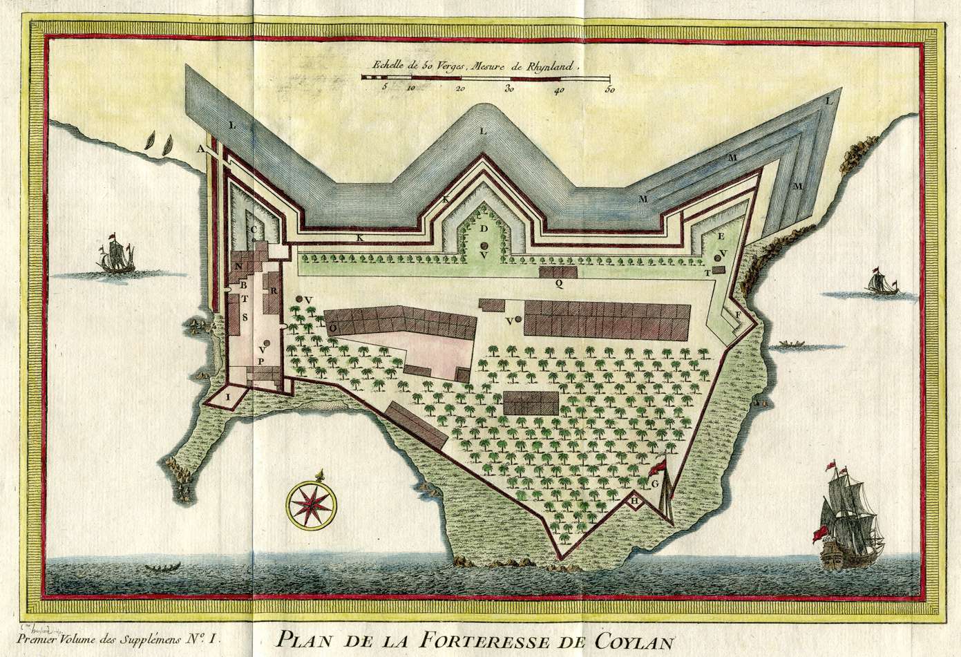
QUILON, c.1747
Bellin's plan of the fort of
Quilon, from Prevost, c.1747, with modern hand coloring; his *map of the
vicinity, c.1764*
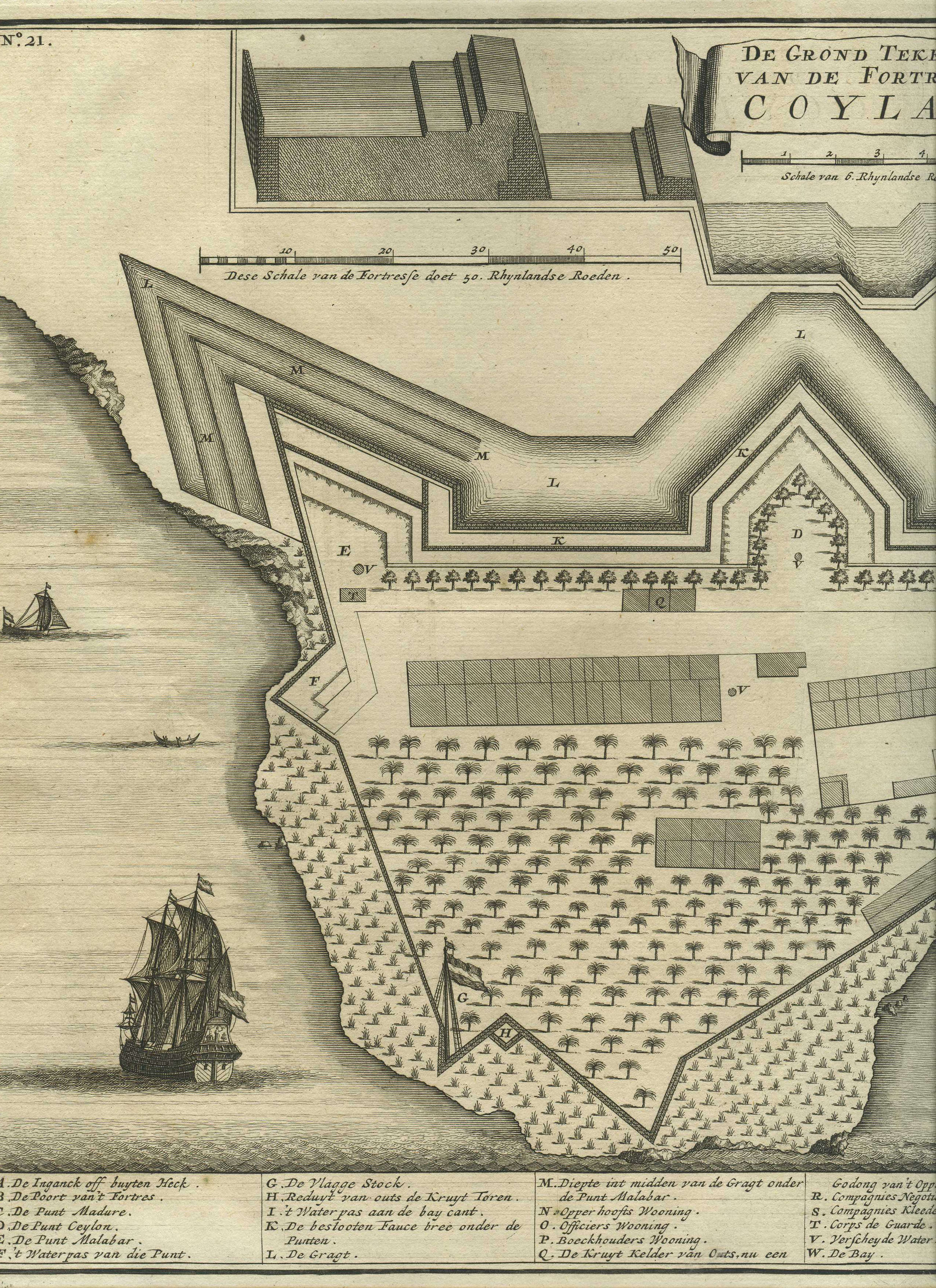
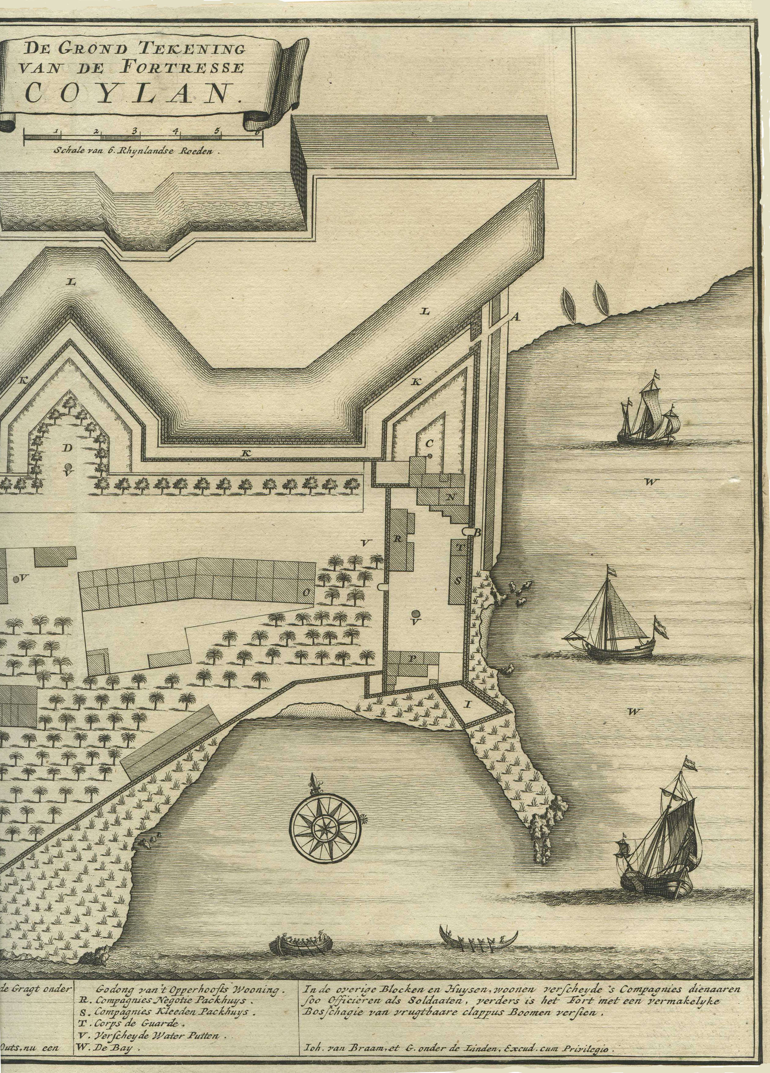
Bellin's source for this plan:
"De Grond Tekening van de
Forteresse Coylan," from Francois Valentijn's 'Oud en Nieuw Oost
Indien', a 5-volume encyclopedia on the Dutch East India Company's
empire, published in Amsterdam, 1724-1726; CLICK ON EITHER HALF OF
THE MAP FOR A VERY LARGE SCAN
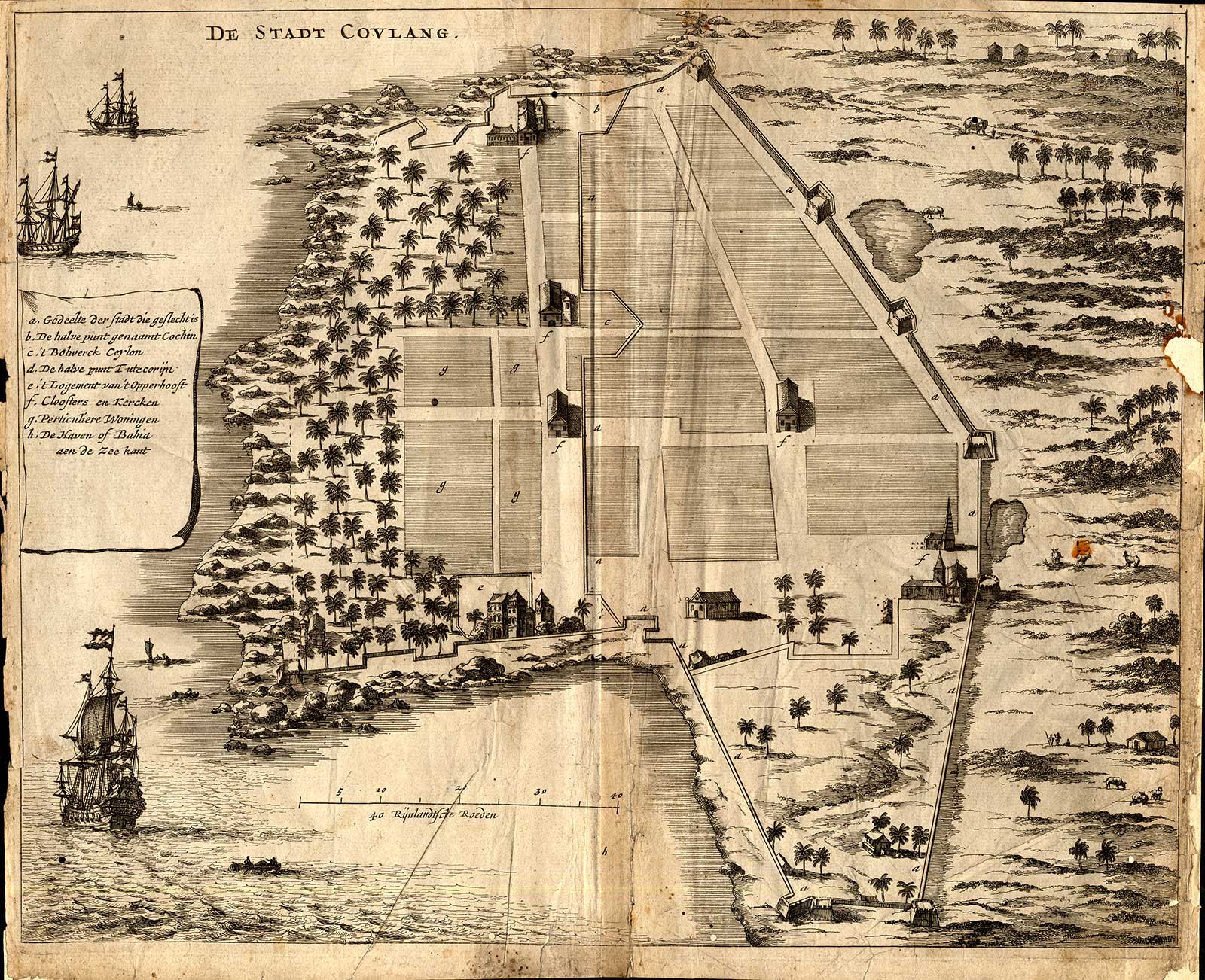
For comparison: "The City of Cowlang" by Philip Baldaeus, from 'A
True and Exact Description of the most Celebrated East-India
Coasts of Malabar and Coromandel; as also of the Isle of Ceylon',
London, 1672
== Bellin index
== Mughal index == Main map index == Glossary == FWP's main page
==