 |
 |
 |
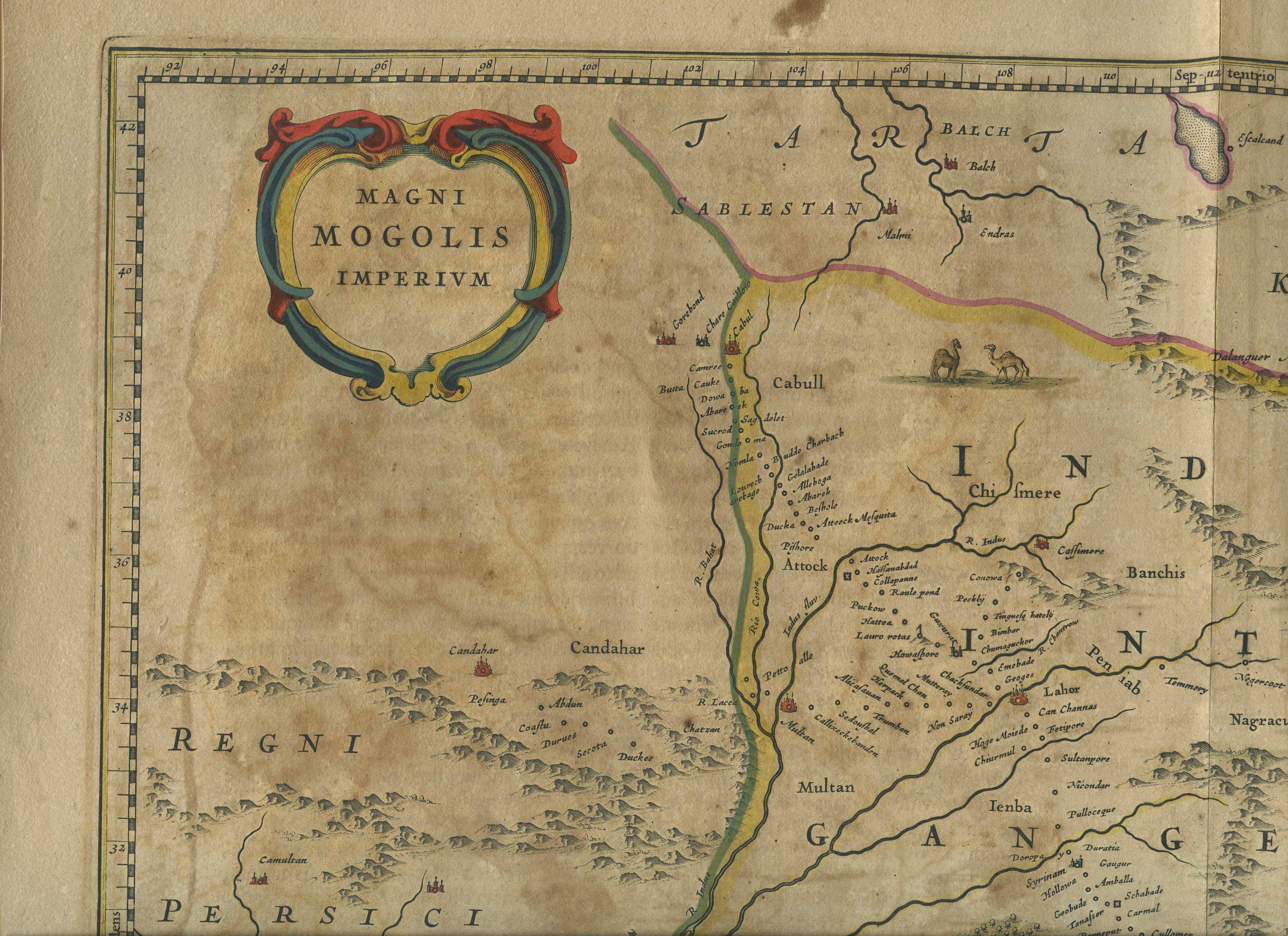
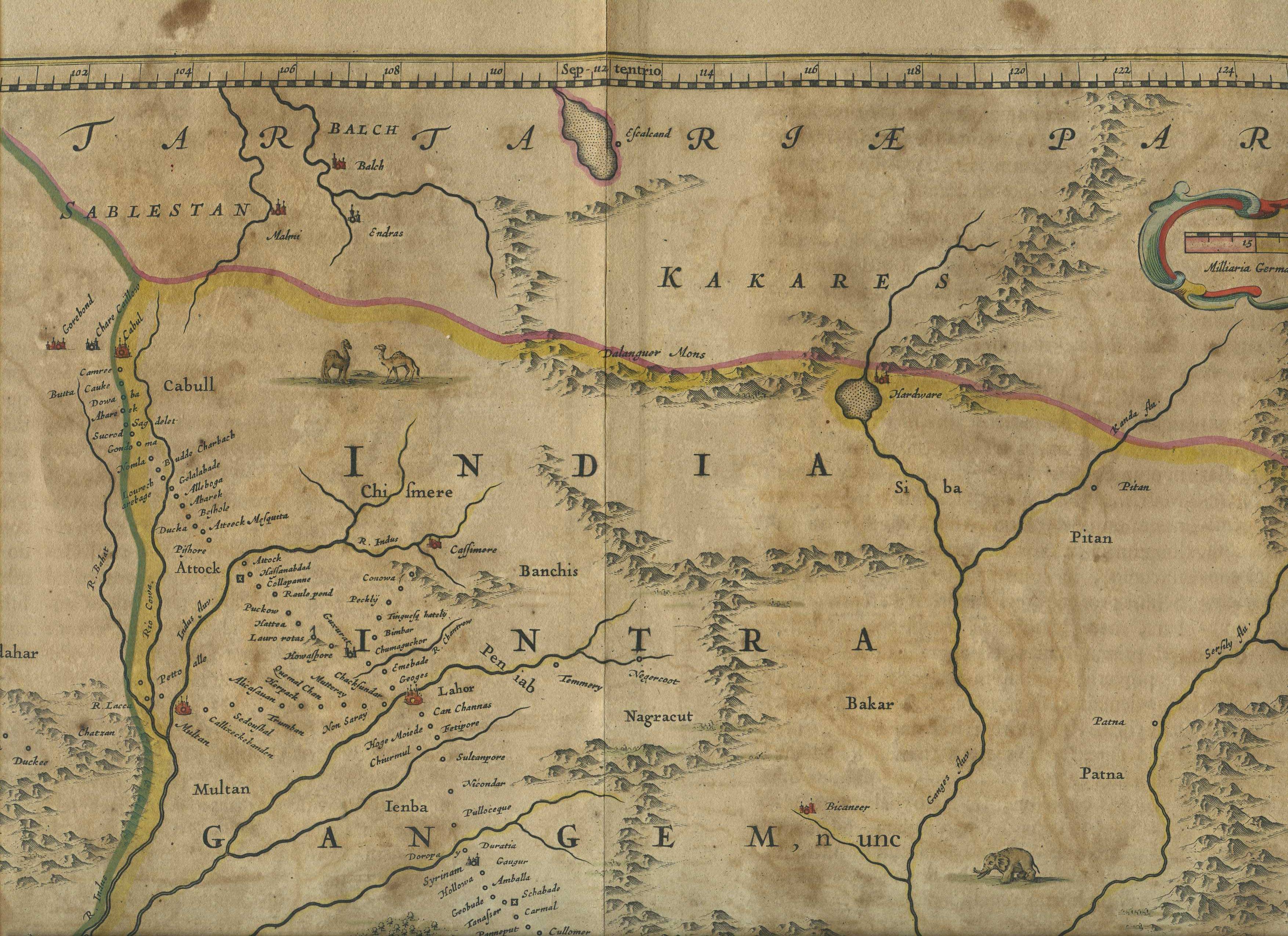
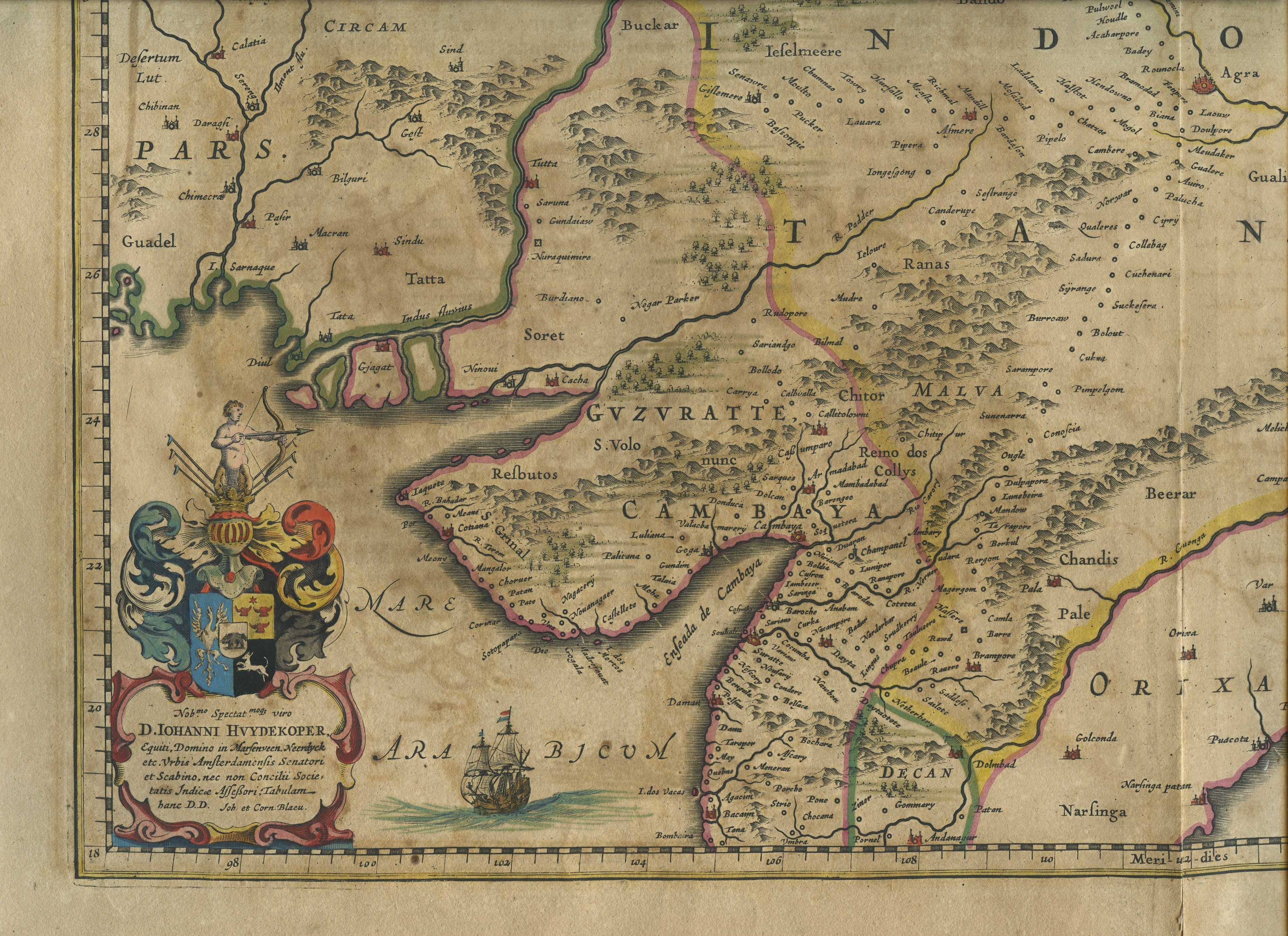
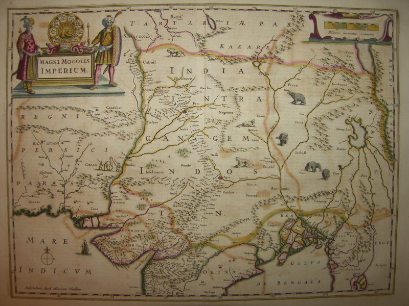
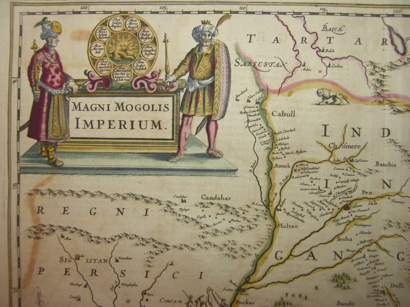
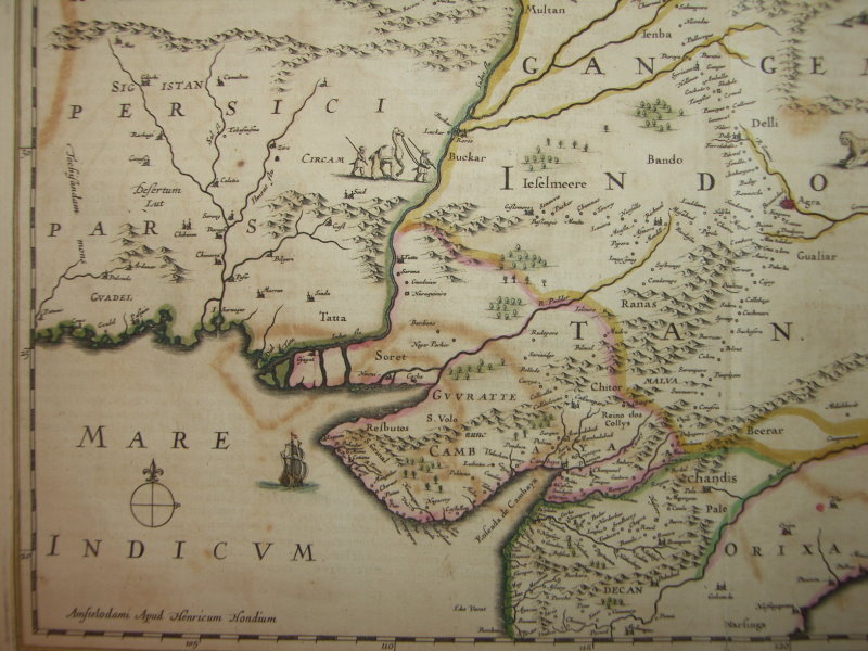
THE MUGHAL EMPIRE, 1638
|
|
|
 |
 |
 |
 |
 |
 |
"Magni Mogolis Imperium," from 'Novus Atlas' (Amsterdam, 1638) by *Willem Blaeu*, based ultimately on Sir Thomas Roe's journey; CLICK ON ANY PART OF THE MAP FOR A VERY LARGE SCAN
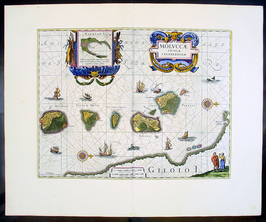
*Blaeu's map of the Moluccas, 1630*
Compare "Magni Mogolis Imperium" by Henricus Hondius, Amsterdam, c.1630: *the whole map*: *northwest*; *northeast*; *southwest*; *southeast*
== Mughal index == Main map index == Glossary == FWP's main page