INDIA, c.1685
INDIA, c.1685
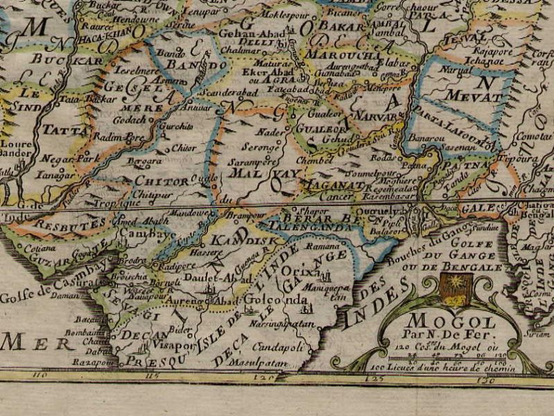
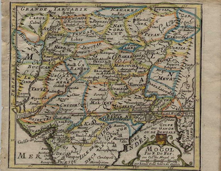
North India, from a miniature map by Nicolas de Fer, c.1685 onwards; *the whole map*
"Mogol; by Nicolas de Fer (1646-1720), Geographer to the King. Engraved
by Liebaux, from "Methode pour apprendre la Geographie" by M. Robbe, seventh
edition, 1721. Printed area: 5 1/4 x 6 1/4" (135 x 160 mm) plus margins."
South India and Southeast Asia, from the same atlas:
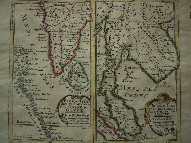
De Fer's corresponding miniature map of South India and Southeast Asia, c.1685
"PRESQU'ISLE DE L'INDE DECA (DELA) LE GOLFE DU GANGE by Nicolas de Fer, Geographer to the King. This map was part of Jacques Robbe's Methode pour apprendre facilement la Géographie Paris 1703 (fifth edition). The maps appeared in the second edition in 1685."
== 1600's index == Mughal index == Main map index == Glossary == FWP's main page ==