INDIA IN ASIA: PHYSICAL MAPS
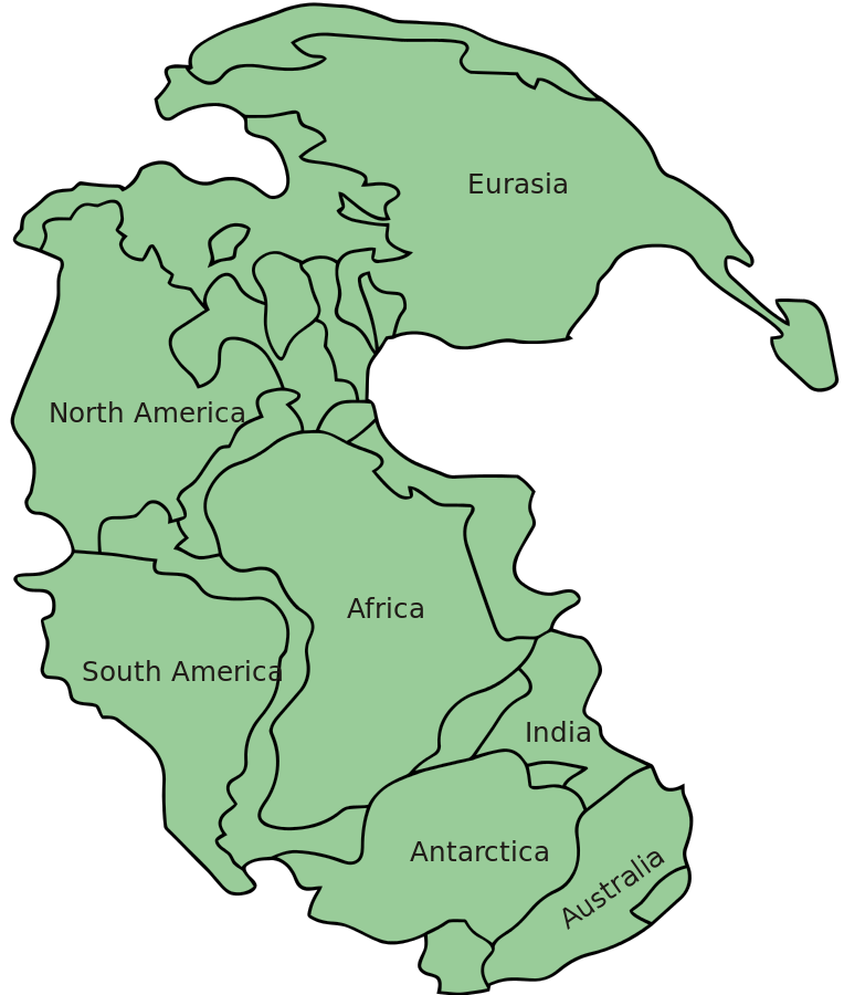
The early "world continent" of Pangea
Source:
http://en.wikipedia.org/wiki/File:Pangaea_continents.svg
(downloaded Dec. 2013
PLATE TECTONICS: *A
flexible time-lapse display (by a consortium of
universities)*
*Time-lapse displays from U.C. Berkeley**;
also *here*
and *here (in reverse)*
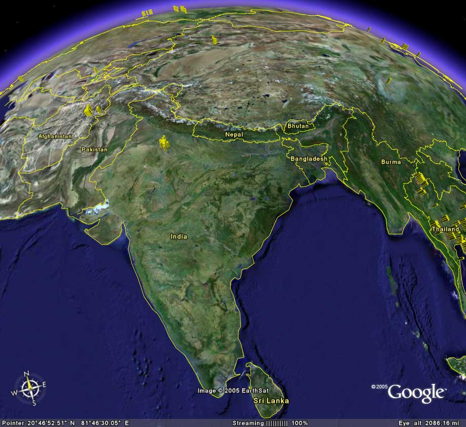
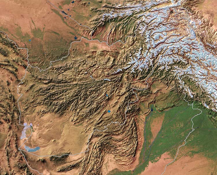
The South Asian tectonic plate, pushing into Asia
Source: http://earth.google.com/coverage/india_lg.jpg
(downloaded Feb. 2008)
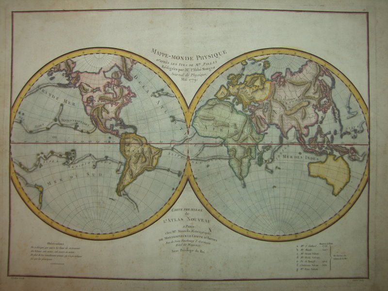
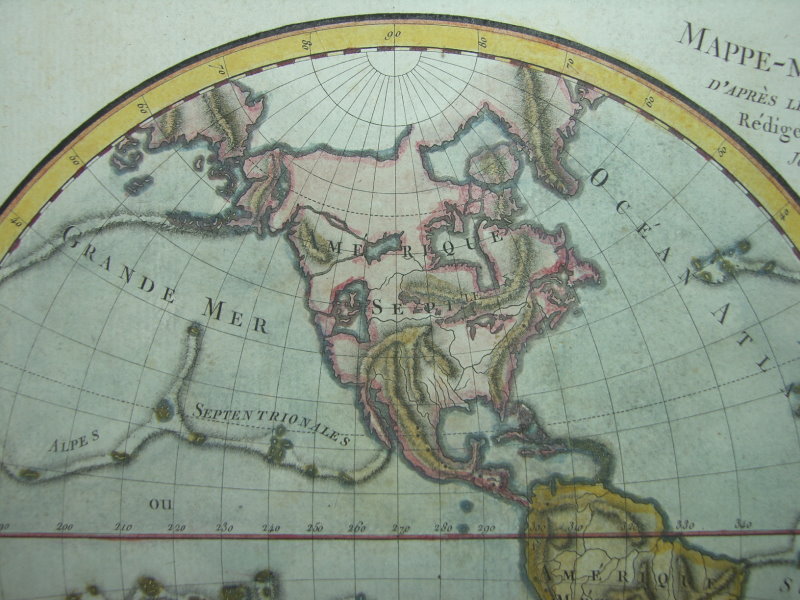
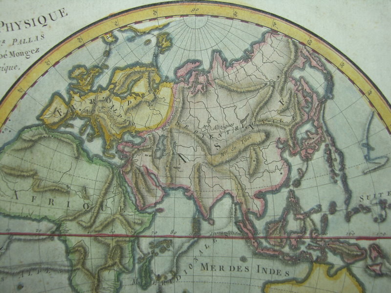
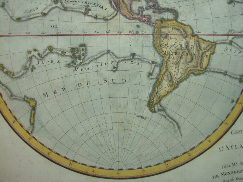
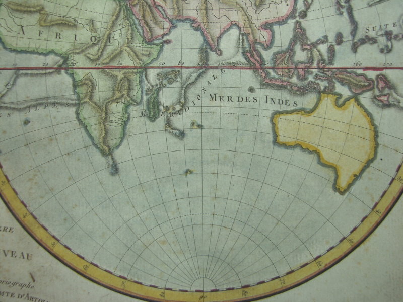
"Mappe-Monde Physique," by l'Abbé Mongez (Mentelle, Paris,
1779): *the whole map*: *northwest*; *northeast*; *southwest*; *southeast*
 |
 |
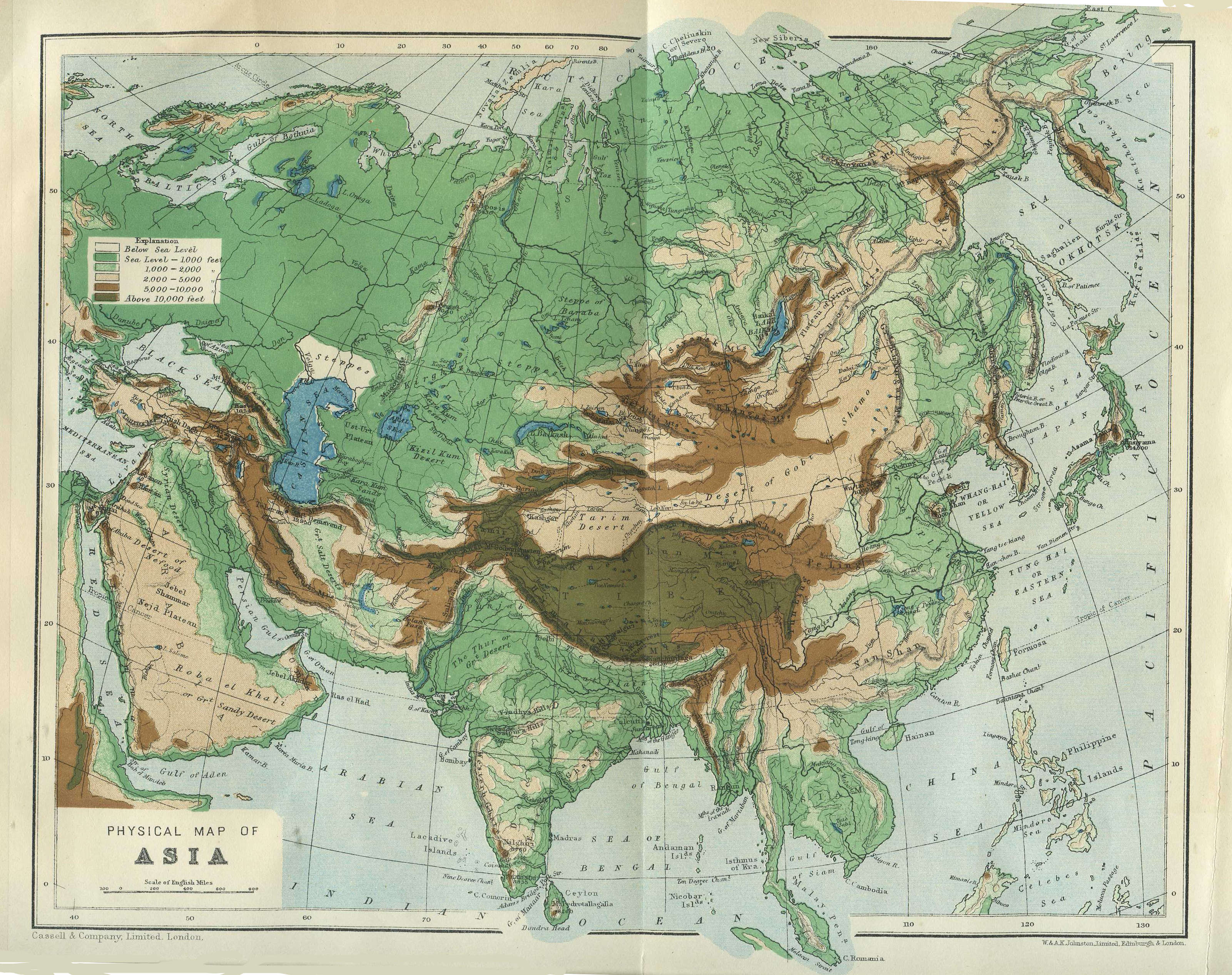
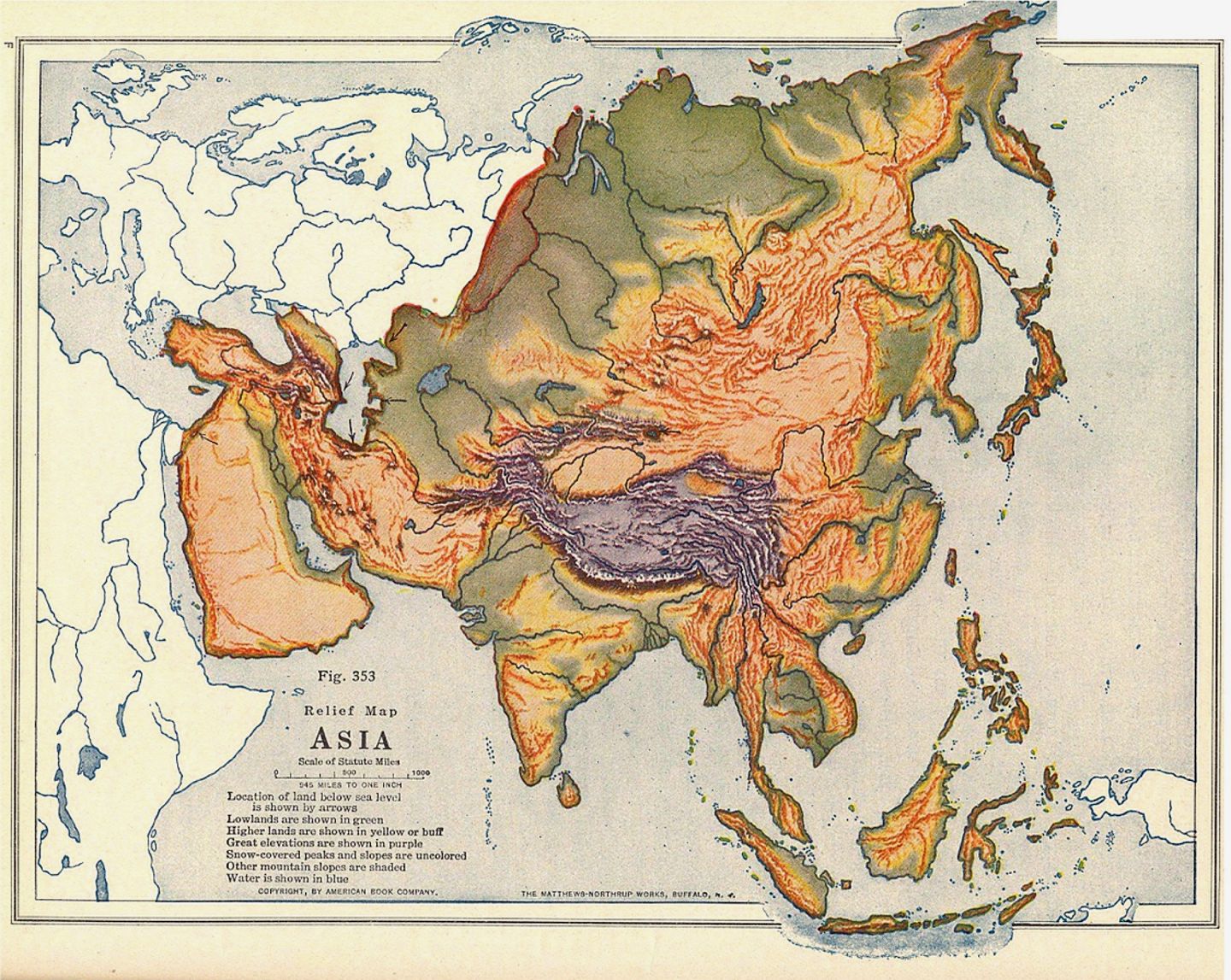
Two maps from Albert Perry Brigham and Charles T. McFarlane, Essentials of Geography: First Book (New York: American Book Company, 1920); CLICK ON EITHER MAP FOR A LARGE SCAN
Source:
http://www.mssu.edu/projectsouthasia/DigitalImagery/Maps/Asia-Physical/
(downloaded May 2006)
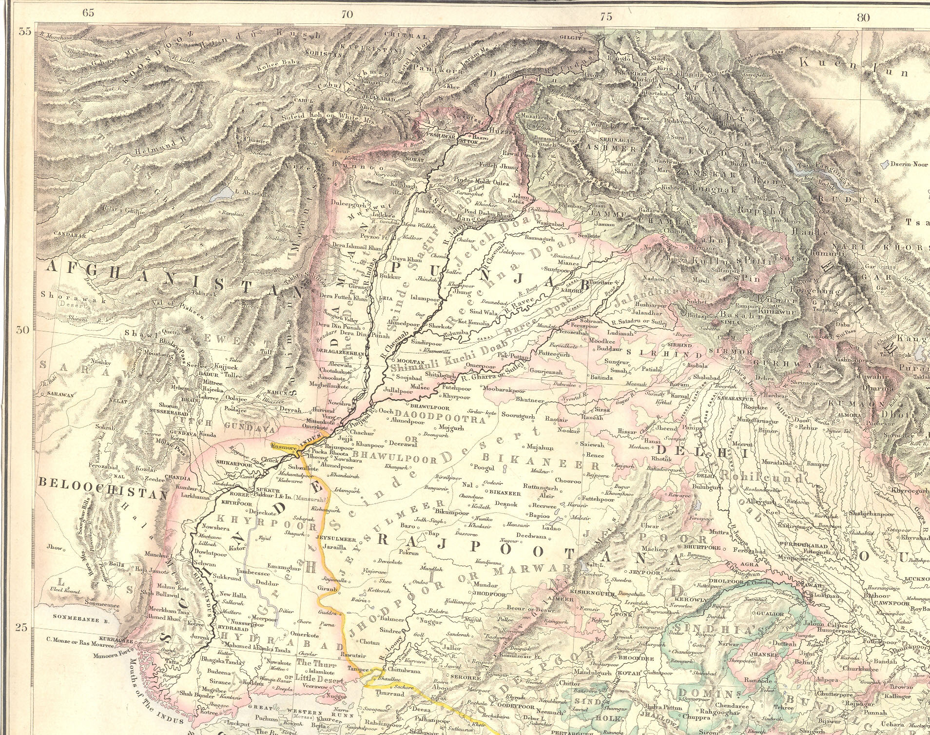
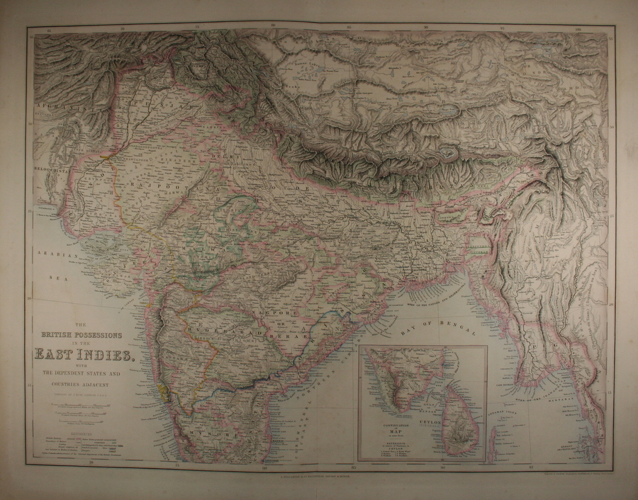
The special position of the Punjab and the Indus from "Companion Atlas to the Gazeteer of The World" by G. H. Swanston (A. Fullarton, Edinburgh, 1859); CLICK ON THE MAP FOR A VERY LARGE SCAN. *The whole map*; *CLICK HERE FOR A VERY LARGE SCAN OF THE WHOLE MAP*
Some small but convenient topographical and overview maps of various regions:
*the eastern Himalayas*
*the Steppes*
*the Tarim Basin and the Takla Makan desert*
*west Central Asia*
*Iraq*
*the Caucasus*
*Mongolia*
*northern China*
*Southeast Asia*
== Overview index == Main map index == Glossary == FWP's main page