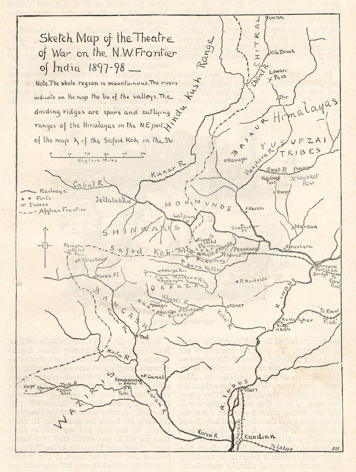


A map of Pathan tribal subgroups, undated but certainly pre-1947; CLICK ON THE MAP FOR A VERY LARGE SCAN
Source: http://www.khyber.org/images/maps/triballocations.jpg
(downloaded July 2006)
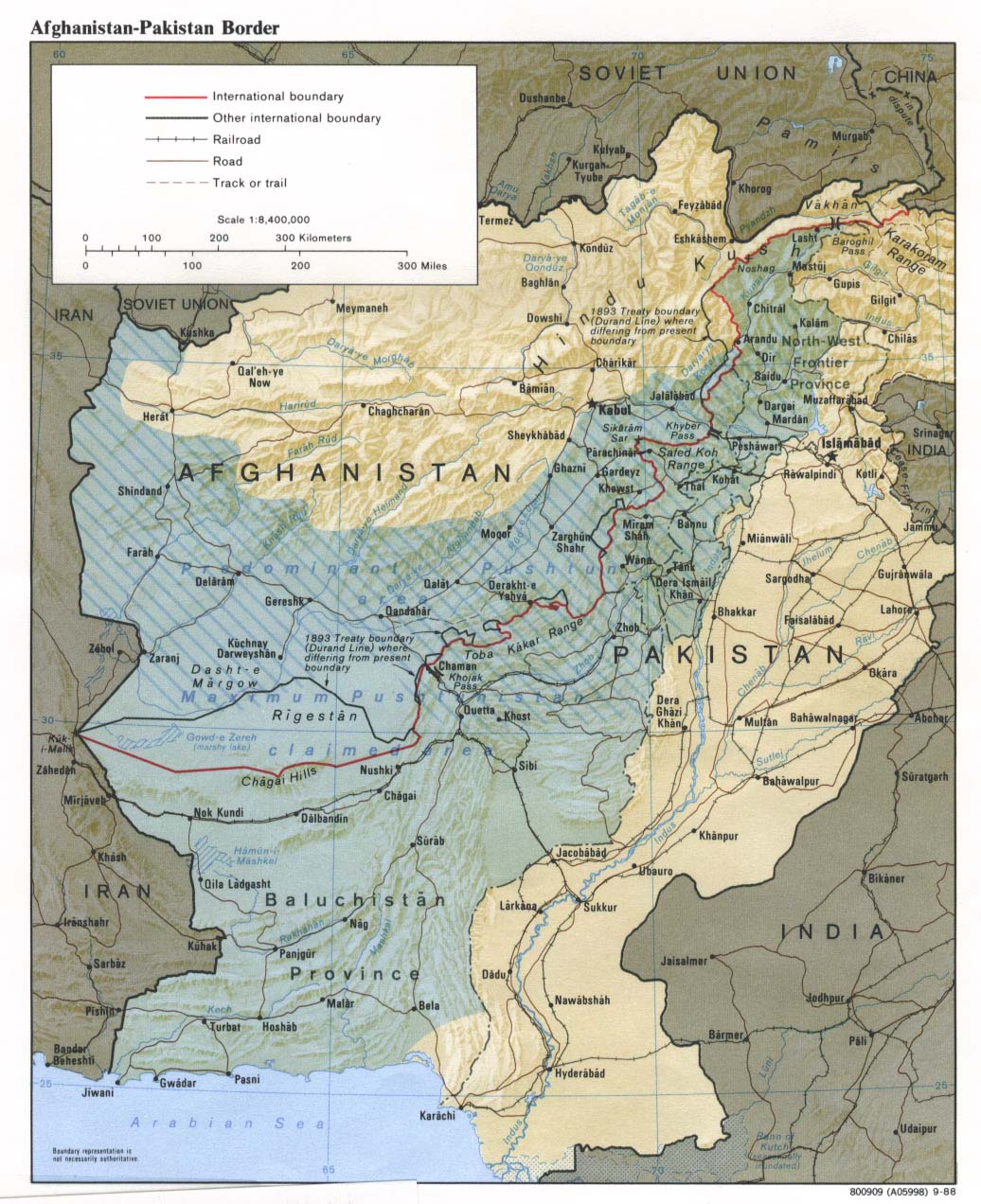
The region sometimes claimed as "Pakhtunistan"; CLICK ON THE MAP FOR A VERY LARGE SCAN
Source:
http://www.lib.utexas.edu/maps/middle_east_and_asia/afghan_paki_border_rel88.jpg
(downloaded Apr. 2008)
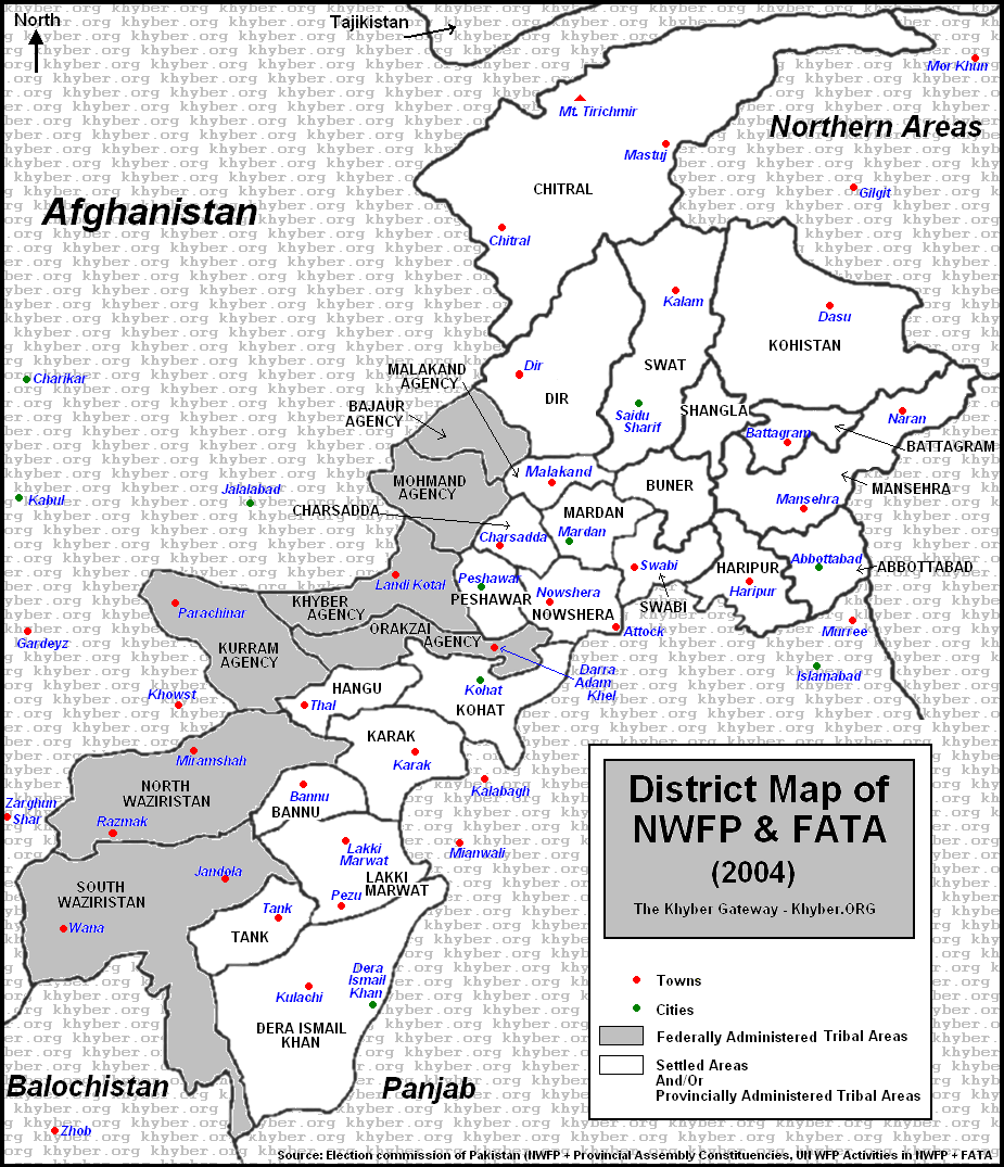
The NWFP in modern Pakistani administrative terms
Source: http://www.khyber.org/images/maps/nwfpmap01.gif
(downloaded June 2008)
== Overview index == Main map index == Glossary == FWP's main page