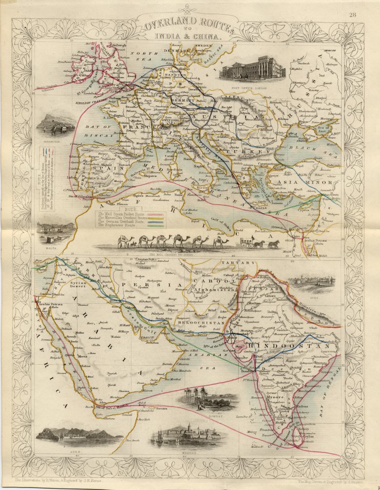
Outline of some of the main British routes, overland and sea, from Europe to India and China (1840's)
Source: ebay, Sept. 2001
"Overland Routes to India and China. Ex Atlas of the World by Tallis & Co. (1838-51). Published by London Printing and Publisheg Co. Engraved by J. Rapkin. 9 1/2 x 13 1/8. Condition: very good. Illustrations: Gibraltar, Post Office, London, Malta, Mail crossing the desert, Aden. Madras. Bombay amd Suez. Original outline color tracing railways opened on the line of Routes, projected railroad England to India, projected ship canal at the Isthmus of Suez and electric telegraph lines uniting England and America."
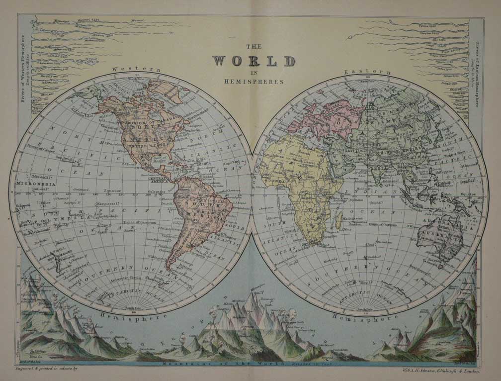
South Asia looks like a central shipping hub for the whole Eastern hemisphere (a map from 1895)
Source: ebay, May 2006
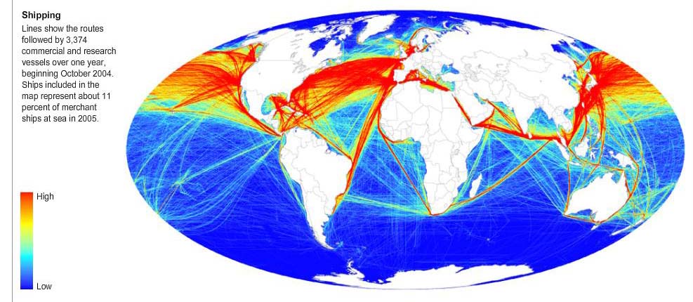
Even today, it has that kind of stopover role
Source: http://www.nytimes.com/interactive/2008/02/25/science/earth/20080225_COAST_GRAPHIC.html#second
(downloaded Feb. 2008)
== Indian Routes index == Indian Routes sitemap == Glossary == FWP's main page ==