| CALCUTTA -- THE city of Bengal | |
|
|
Section 8, on the coast-- you can't miss it; and here are some *city maps of Calcutta, 1756 onward* |
|
MAPS* |
REGIONAL MAPS of the area around the mouths of the Ganges, in the early modern period; *Gaur*, *Pandua*, *Rajmahal*, and *Dacca* were all former capitals of Bengal |
 |
Some coins of earlier Bengali rulers |
 |
And a look at some of the coins of the East India Company |
 |
The Dutch were in CHINSURA, only a mile from Hooghly (which had its own extremely complex colonial history); and the French were in *Chandernagore* (see also *S. C. Hill*) |
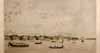 |
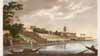
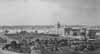
Early views of the city; see also the remarkable work of *Francois Balthasar Solvyns*, who created in the 1790's over 600 etchings depicting life in Calcutta |
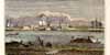 |
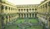
Views of Fort William, home of the
famous
Fort William College language training center for East India Company
officers (and alleged site of the *"Black Hole
of Calcutta"*) |
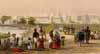 |
Views of Calcutta's famous Esplanade |
 |
As museums, Calcutta has both the Victoria Memorial and the monumental Indian Museum, a building first proposed in 1858 |
 |
Other post-1857 views |
 |
Calcutta had the right architecture for British imperial pomp and circumstance |
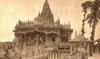 |
Some of Calcutta's religious architecture |
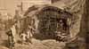 |
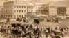
Some scenes of daily life around the city |
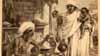 |
The terrible Bengal famine of 1874 |
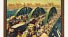 |
Calcutta-- tourist-poster views |
|
|
A search for "Calcutta" will yield hundreds more images; and here's *another BL set* of search results for Calcutta |