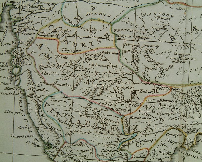
The "Pirate Coast," including Geriah, in a map from 1785
Source: ebay, Sept. 2005
"From AN ACCURATE MAP OF HINDOSTAN OR INDIA, engraved by Thomas Kitchin, published by C. Dilly & G. Robinson, London, 1785. The map is from 'The Atlas to Guthrie's System of Geography'."

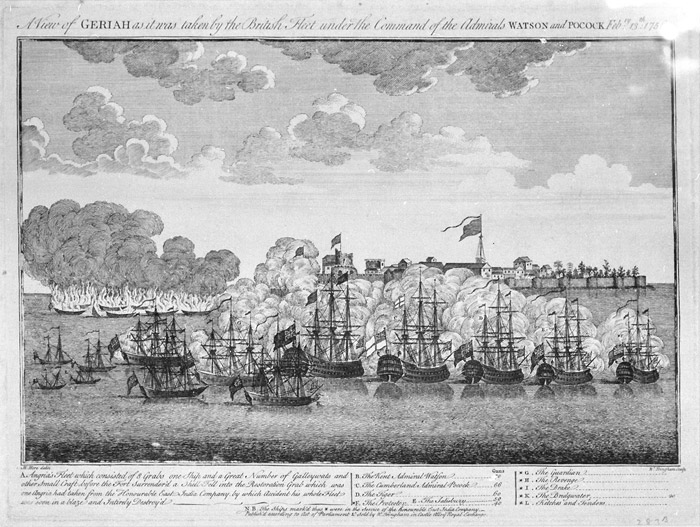
A British-Portuguese-Indian naval force attacks the fort of Geriah, 1756
Source: ebay, Jan. 2004
"Hand-colored engraving: Geriah Fort, India. Published circa 1760. The scene depicted is that of the British-commanded Indo-Portuguese naval force which attacked the base of the Maratha pirate Tulagee Angria on the 13th of February 1756. The British Admirals Pocock and Watson with their Indo-Portuguese manned naval force (the first time such a mixed force had been used in a military situation) were attempting to suppress Tulagee Angria who had been attacking Portuguese and English shipping."
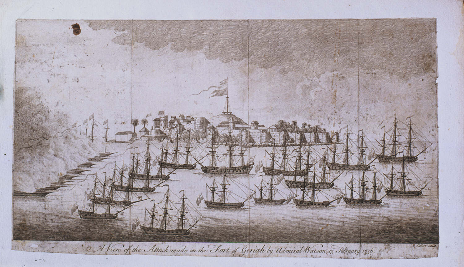
"A view of Geriah as it was taken by the British fleet under the command of the Admirals Watson and Pocock 13 February 1756," by M. Hore and W. Tringham
Source:
http://www.nmm.ac.uk/server/show/conMediaFile.3222/outputRegister/lowhtml
(downloaded June 2006)
A closer look at the attack in progress: "from the logbook of the H.M.S. Elizabeth, 1759"
Source: http://www.gtj.org.uk/en/item6/22048
(downloaded Oct. 2005)
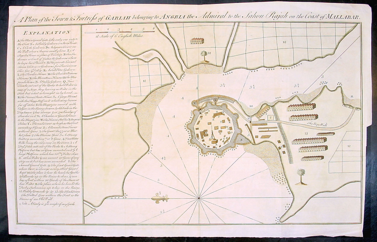
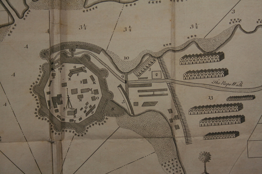
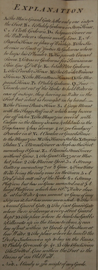
"A plan of the town and fortress of Gariah, belonging to Angria the Admiral to the Sahou Rajah on the Coast of Mallabar," from 'The Gentleman's Magazine: or, monthly intelligencer' by Sylvanus Urban, published by Edward Cave, London, 1756; *a closeup of the fort itself*; *a closeup of the key*
Source: ebay, Apr. 2007
== Indian Routes index == Indian Routes sitemap == Glossary == FWP's main page ==