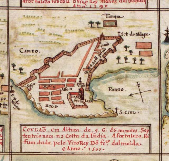
From a Portuguese atlas, 1630
Source: ebay, Mar. 2007
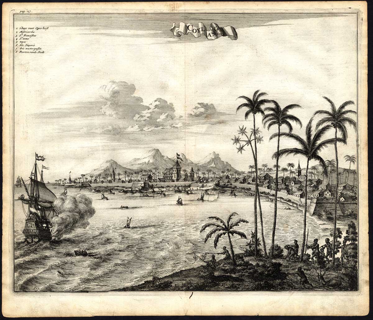
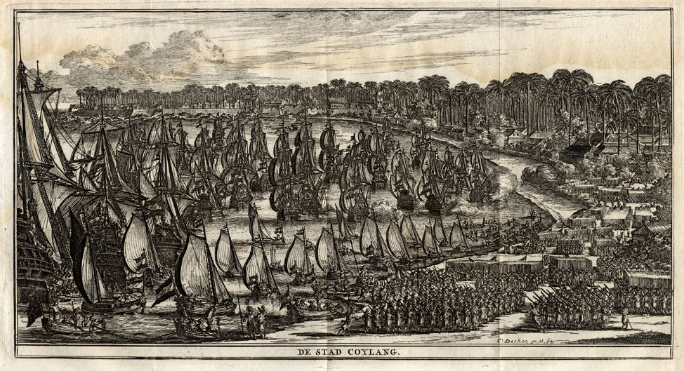
"Coylang," or Quilon, from 'Gedenkweerdige Brasiliaense Zee en Lantreize ...' by Johan Nieuhof, published by Jacob van Meurs, Amsterdam, 1682. First and only Dutch edition. Later amended English edition published by Churchill in 1744.
Source: ebay, Sept. 2005
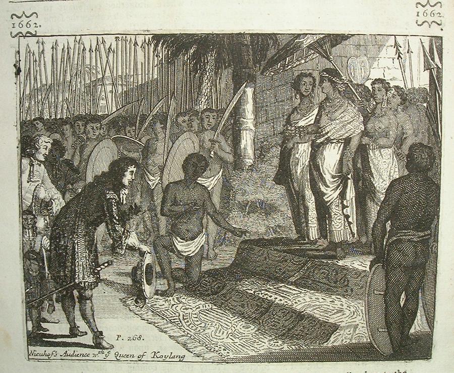
"Nieuhof's Audience with ye Queen of Koylang [Quilon]," from
"Mr John Nieuhoff's remarkable voyages & travels into ye
best provinces of ye West and East Indies", printed for Awnsham
and John Churchill at the Black Swan in Pater Noster Row,
London, 1703
Source: ebay, Sept. 2004
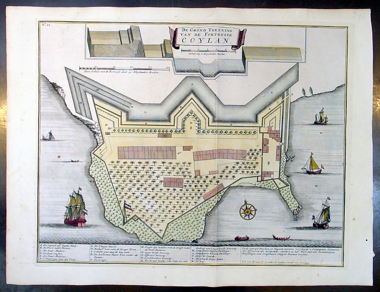
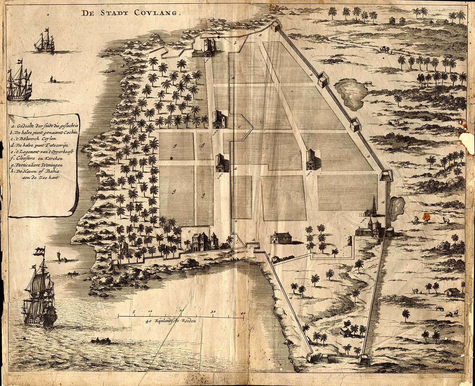
A plan published by the Van Keulen family in 'De Zee En Land-Caarten en Gizigeten van steeden en landvertooningen van oost-indien', 1752
Source: ebay, Oct. 2007
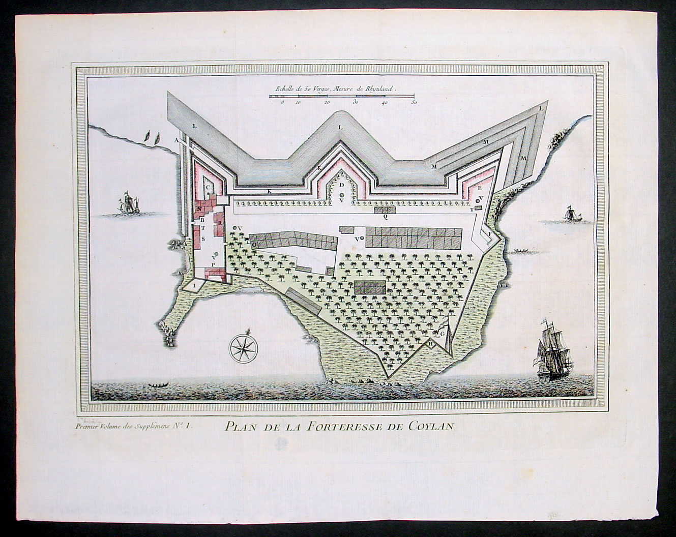
A plan of the Dutch fortress by Bellin, from *PREVOST*, c.1750's; *Bellin's map of its immediate vicinity*
Source: ebay, Nov. 2006

Source: ebay, Apr. 2008

Today, Tangasseri Fort (built by the Dutch in the 1500's) survives only as a few ruined walls
Source: http://www.flickr.com/photos/malayalam/39463151/
(downloaded Nov. 2006)
== Indian Routes index == Indian Routes sitemap == Glossary == FWP's main page ==