 |
|
|
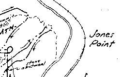
Not seen. The NY-NJ Trail Conference map shows a viewpoint at about where the Ramapo-Dunderberg Trail (shown by a dashed line) crosses the unbuilt hairpin turn. The topographic map suggests the turn would have been built up on high fill, creating an even better view north up the Hudson, with Bear Mountain and Anthony's Nose. There is probably also a view up the Hudson from the spiral, at the next level up.
The several short gaps in the grades should be examined. Is this erosion, or are there obstacles in the way at those points that were to be taken care of later?