Johnstown Incline
by Joseph Brennan
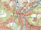
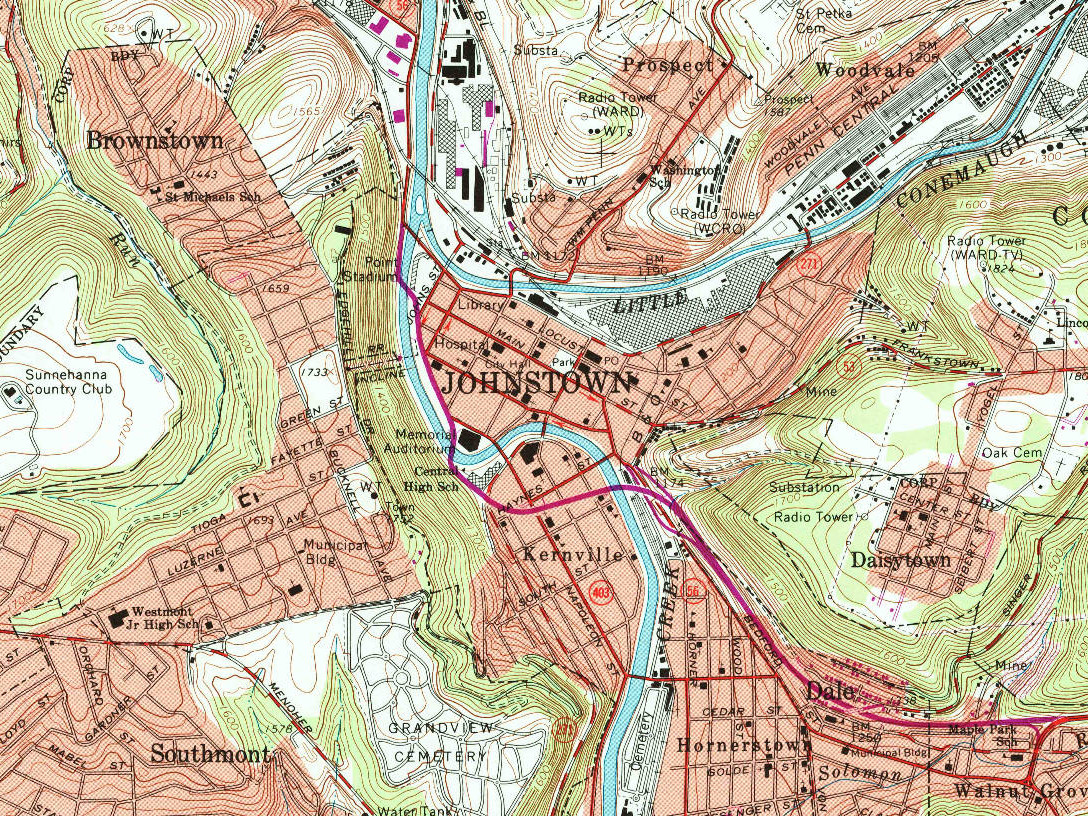
Topographic Map.
(click on images to enlarge)
Cambria works top left center. Prospect was worker's housing.
Brownstown and Daisytown were post-flood residential neighborhoods.
Westmont (center left) was the neighborhood developed in connection
with the Johnstown Incline.
The Pennsylvania Railroad main line (called Penn Central here)
followed the right bank of the Little Conemaugh (top right) and
crossed over to the left bank on the bridge that survived the flood.
The rectangle marked as Library is now the Johnstown Flood Museum.
The most well-known and most horrible event in the history of
Johnstown, Pennsylvania, was the flood of May 31, 1889. A badly
maintained earthen dam fourteen miles upstream on the Little Conemaugh
River failed after days of heavy rain. Twenty million tons of water
rushed down the valley, destroying property and human lives as it
went. The worst loss came when the flood hit Johnstown, a prosperous
steel mill and coal mining town. More than 2,200 people were killed
and most buildings in the town center were reduced to rubble.
At Johnstown, the flow of the Little Conemaugh takes a 90 degree turn
to the right as the Stony Creek River (sic) joins from the left, the
two forming the (big) Conemaugh River. The immense flood missed the
turn, instead washing over the town and then slamming into the steep
wall of Yoder Hill, 500 feet high. The impact pushed water to both
sides, breaking the flood's momentum. The stone multi-arch
Pennsylvania Railroad bridge over the Conemaugh, just two years old,
was the first one the flood did not knock out, and it still stands
today. But an enormous pile of debris formed against the upstream side
of the bridge, and in one more terrible twist, somehow the pile caught
fire, burning to death victims caught in it who had survived drowning.
If there is any good to be told, it is that Clara Barton, age 68,
arrived and took charge of the relief effort, earning for herself and
her Red Cross staff the praise of all concerned for her dedication and
organizational skills, forming the reputation that the Red Cross
maintains to this day.
It is sometimes said that the poor suffer the most in a disaster. In
the case of Johnstown it was not so. The working men's cottages were
up on the hills, not in the downtown flood plain, and while it meant
they had a weary walk up each night it also meant their homes escaped
destruction. The main employer in town was the Cambria Iron Works, on
the Conemaugh just downstream from the railroad bridge. The company's
name is little known today because it was absorbed into Bethlehem
Steel almost a hundred years ago. But from 1852 to 1992 the works in
Johnstown was one of America's top sources of iron and steel products.
The company proudly told people it was the only steel mill with a coal
mine on premises. The hills here are full of coal. Cambria Iron was
behind the creation of the Johnstown Incline.
Just two months after the flood, Cambria Iron announced a new town to
be built on Yoder Hill, to be reached by an incline similar to those
recently built on Coal Hill, now called Mount Washington, on the south
side of Pittsburgh. The incline was designed by Samuel Diescher, who
was responsible for several others including Pittsburgh's Duquesne
Incline (still in use) and Castle Shannon Incline. The Johnstown
Incline opened in 1891 and was operated until 1962. Later that same
year it was renovated and reopened and ran until 1983 when it was sold
to the Cambria County Transit Authority, now called Cam Tran. It was
then totally rebuilt adhering to Diescher's original plans, supplied
by one of his descendants. The exception was that his two-level cars
were not re-created, but instead the single-deck cars from 1921 were
renovated and put back on the line. The incline reopened in its
present form in September 1984. The footbridge over the highway was
built some time later, and the original 1890 bridge over the Stony
Creek was renovated in 2000-2001.
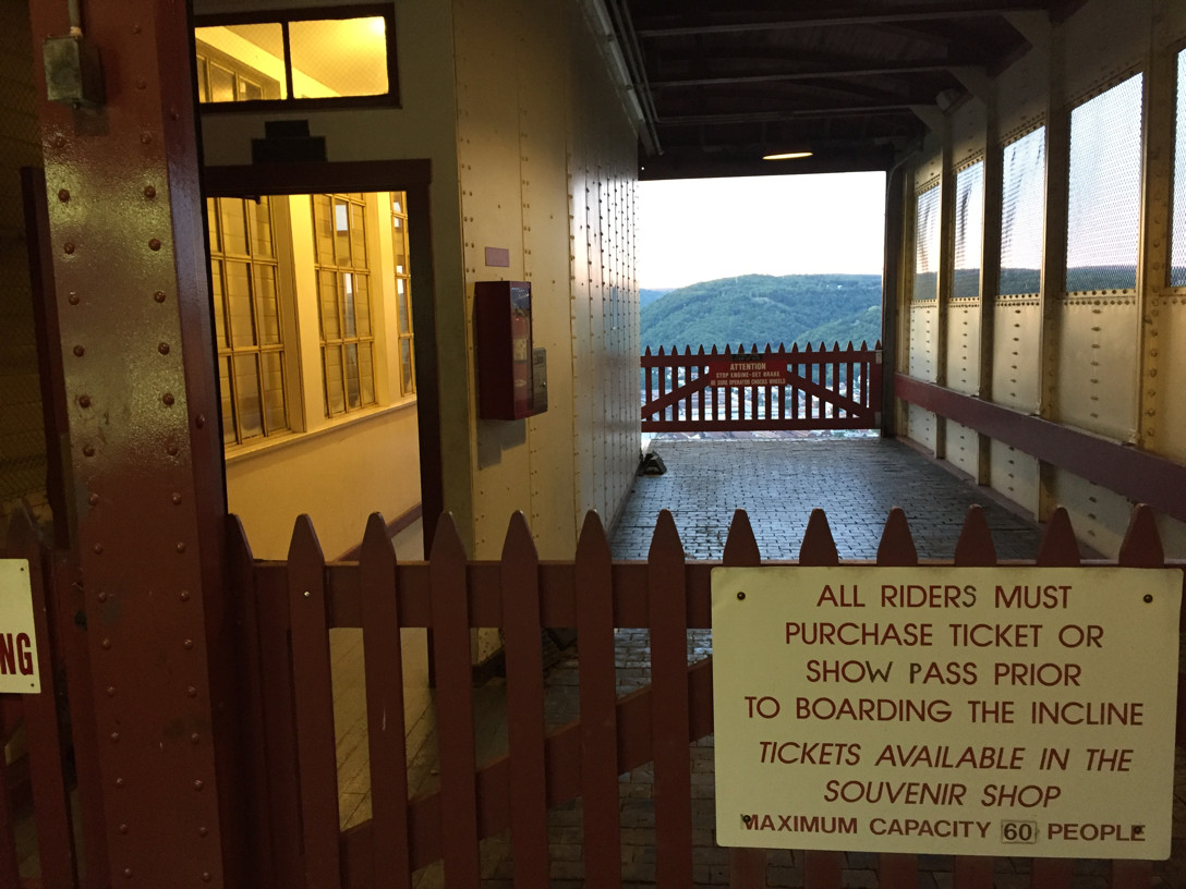
The Johnstown Incline rises 502 feet at a 72 per cent grade,
travelling 867 feet. The claim to fame is that it is the world's
steepest vehicular inclined plane. Note the qualification. When
we visited Johnstown in August 2016 I could not help asking the nice
young man at the lower station whether he could name a steeper one
that was not vehicular. He thought there might be one in Norway
or some place like that. I didn't realize till later that I had ridden
on a steeper one myself just a year earlier—the Monongahela
Incline is 75 per cent*, but certainly it does not carry vehicles, and
notably as well it travels only 365 feet. Yes, if the point is not
clear, you can have your automobile taken up or down on the Johnstown
Incline for six dollars one way.
(* The Monongahela's slope is given differently in various sources,
ranging from 35 to 38 degrees, or 70 to 78 per cent. What I would
consider an unbiased and professional report, that of the National
Park Service's Historic American Engineering Record dated 1993, makes
it 37 degrees, which is 75 per cent. The HAER report for Johnstown
says 35 degrees, therefore "only" 70 per cent, but still, remember it
is vehicular. And no wagering please.)

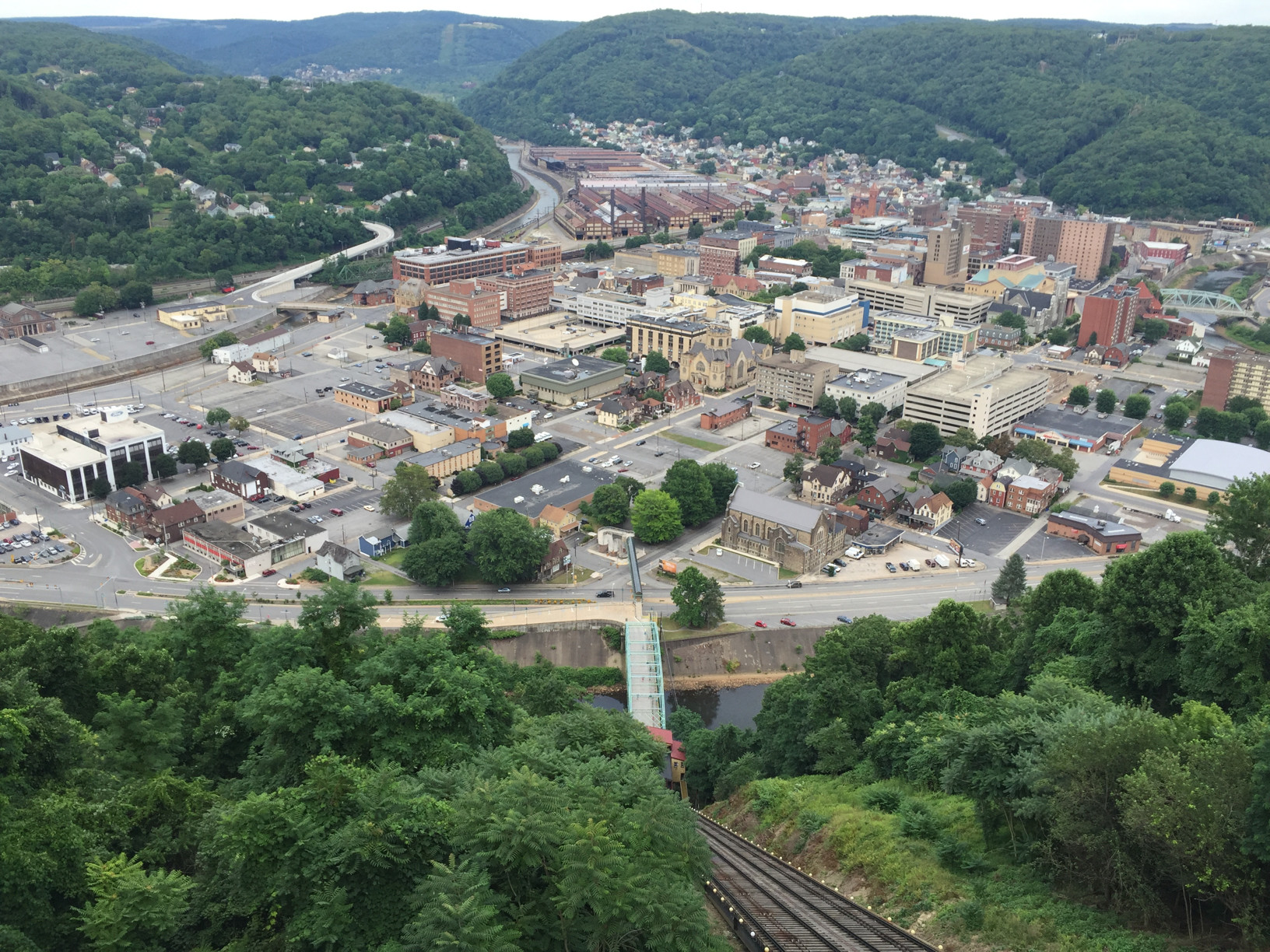
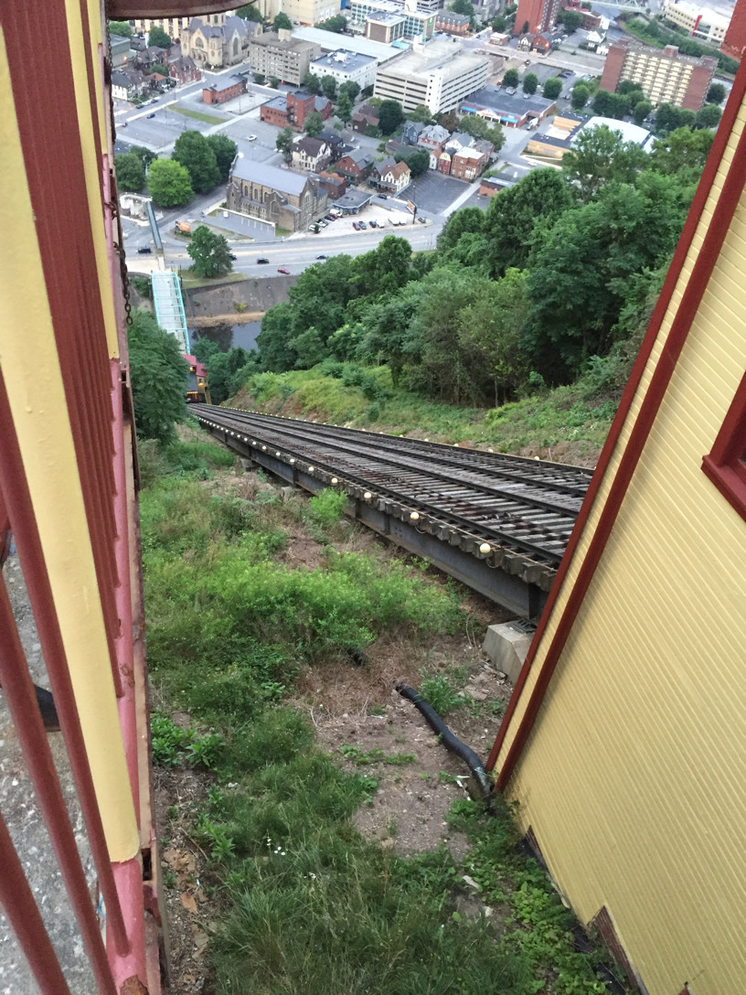
View from the deck.
The view from the observation deck is breathtaking.
We're looking east. The Little Conemaugh comes down the valley at the
top and runs off to the left, where it joins the Stony Creek, seen at
the bottom. The flood burst out of the Little Conemaugh and across the
city, stopped in its path by the mountainside at the bottom of this
image. Both rivers are now within concrete lined channels but they can
still flood after heavy spring rains.
Downtown Johnstown is contracting away from the incline, leaving in
its wake a scattering of old and new buildings and fields of private
parking lots. The Cambria works were a few blocks off frame to the
left. Since the works closed the largest employer in town is the
Conemaugh Health System, located in buildings right of center.
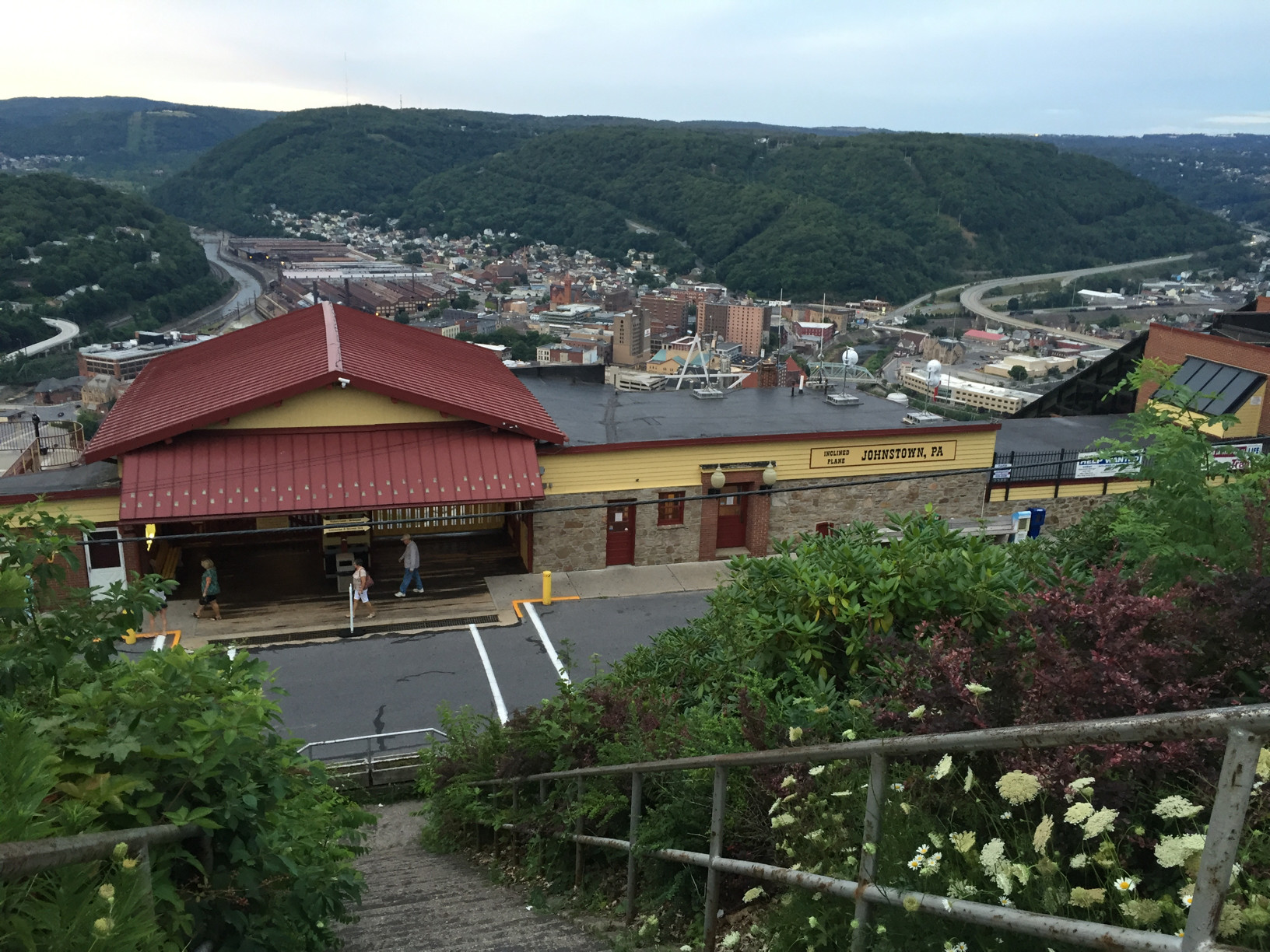
Pedestrians can reach the lower station, with its red roof, by using
the footbridge over the highway and then joining automobile traffic
(when there is any) on the original bridge over the Stony Creek River.
The other rail line in town is Amtrak, one train a day in each
direction at the former Penn Station, seen at the center left edge of
this image.

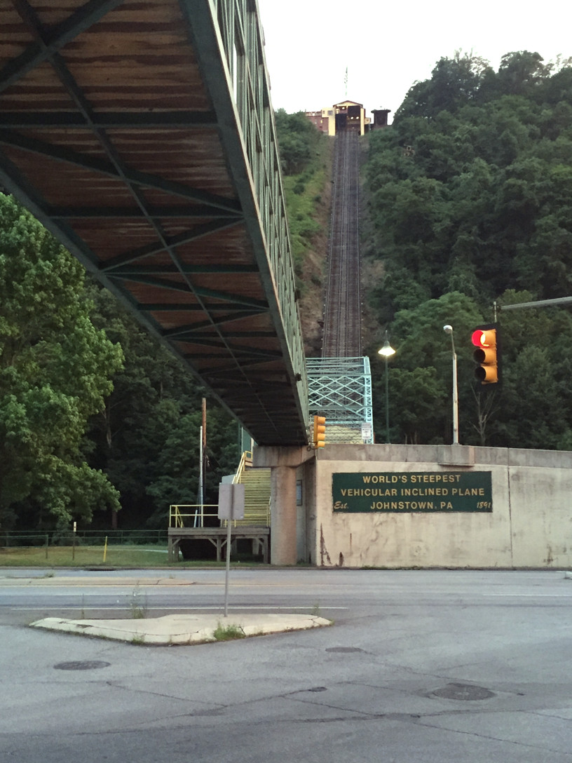
Approaching the lower station.
This is not foreshortened by a special camera lens. It really looks
like this. I was there. It's not as much as 45 degrees, and yet it
looks like it's straight up. You've used an elevator, haven't you?
It's almost the same technology. A funicular car is counterbalanced
by the other car; an elevator by a pile of weights you don't see
in the shaft.
Looking up from the back of
the lower station.
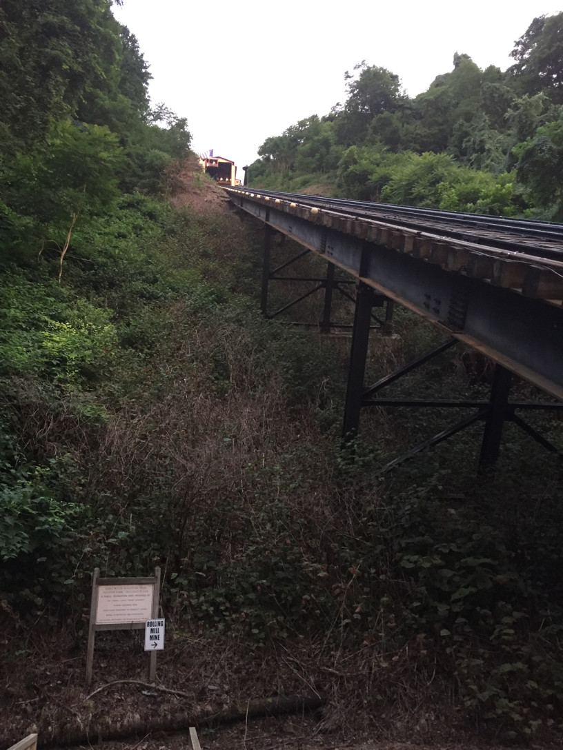
When you're at the lower station, instead of riding on the incline,
you can also choose to take a foot path to see the entrance to a coal
mine in Yoder Hill. The path entrance is on the left side of the lower
station building, and this is what you see when you come out of the
building before going down the steps. The steel work is from the
1983-1984 reconstruction, but it was built to the same plans
as the original.
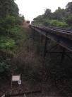
As you might have noticed in the previous picture, the path to the
mine takes you to the right, under the incline. Here we are. I don't
think you're allowed to go under the inclines in Pittsburgh so
this is a treat.
We walked out here on our way back to the hotel and daylight was
fading, so we did not follow the trail to the mine entrance and past
eight colorful James Wolfe
steel constructions along the way. It's almost a mile and a half one
way, and they say it's "perfect for a leisurely stroll," but time
was our enemy.
The Rolling Mill Mine was the scene of a terrible disaster in 1902
where 112 miners lost their lives in a gas and dust explosion. The
mine was closed in 1931.
From almost the same location as the previous views, here are closeups
of an incline car standing at the lower station. I hope the second one
makes you totally sure the car can't go any further down no
matter what happens.

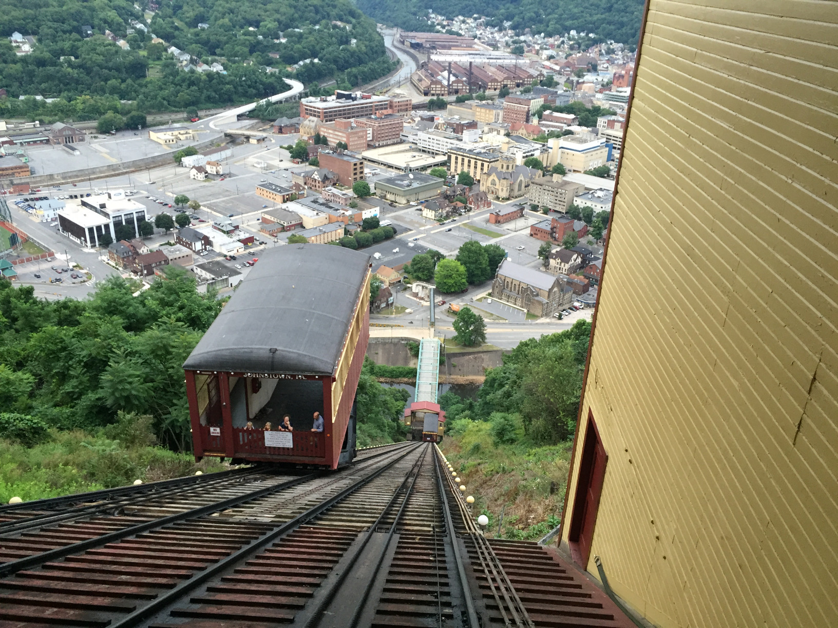
This view is from the upper station. The cars are nearing the end of
their trips.
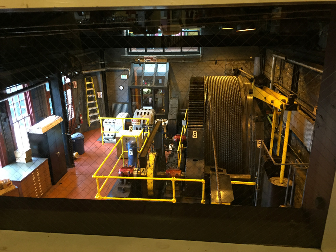
Like other inclines the Johnstown Incline is a funicular. The cars are
permanently attached to the ends of a wire rope, and they move
together, so that the car going down acts as a counterweight to the
car going up. The engine only has to lift the difference in
weight. They pass at the halfway mark. An elevator works on the same
principle, with hidden lead weights in the shaft as the counterweight
that passes at the halfway mark.
The four people in the car on the left are in the vehicular
compartment of the car. The narrower section is the passenger
compartment. Most people like to ride on the vehicular side, like we
did ourselves, because that wooden picket fence of a gate is all that
separates you from the uphill track or the open space below on the
downhill side

The incline does not go all the way to the top. If you are
determined to conquer the last 30 feet or so, you can walk up a
stairway in a park, from which you get this view.
Here is a good look at the inside of one of the cars. The wooden gates
are part of the car. If any automobiles were being carried they would be
in the larger righthand side and the chocks out there on the left would
be placed against the down-side wheels.
Opportunity missed: The next day as we left Johnstown our route went
up the same hill a little farther south, and I wonder now why I did
not think of spending six bucks to use the incline to take the car up.
What a picture that would have been. Should I go back just to
do it?
If you go to the Asiago restaurant at the top, you can get this view
along the down-side of the upper station buildings. The incline car
looks impossibly high above its track. Neither of the bottom images
shown previously really capture the height of the car over the
lowest wheel like this one does.
Does that look steep or what?
Indulge me. One more look down, between the observation deck (left)
and the upper station.
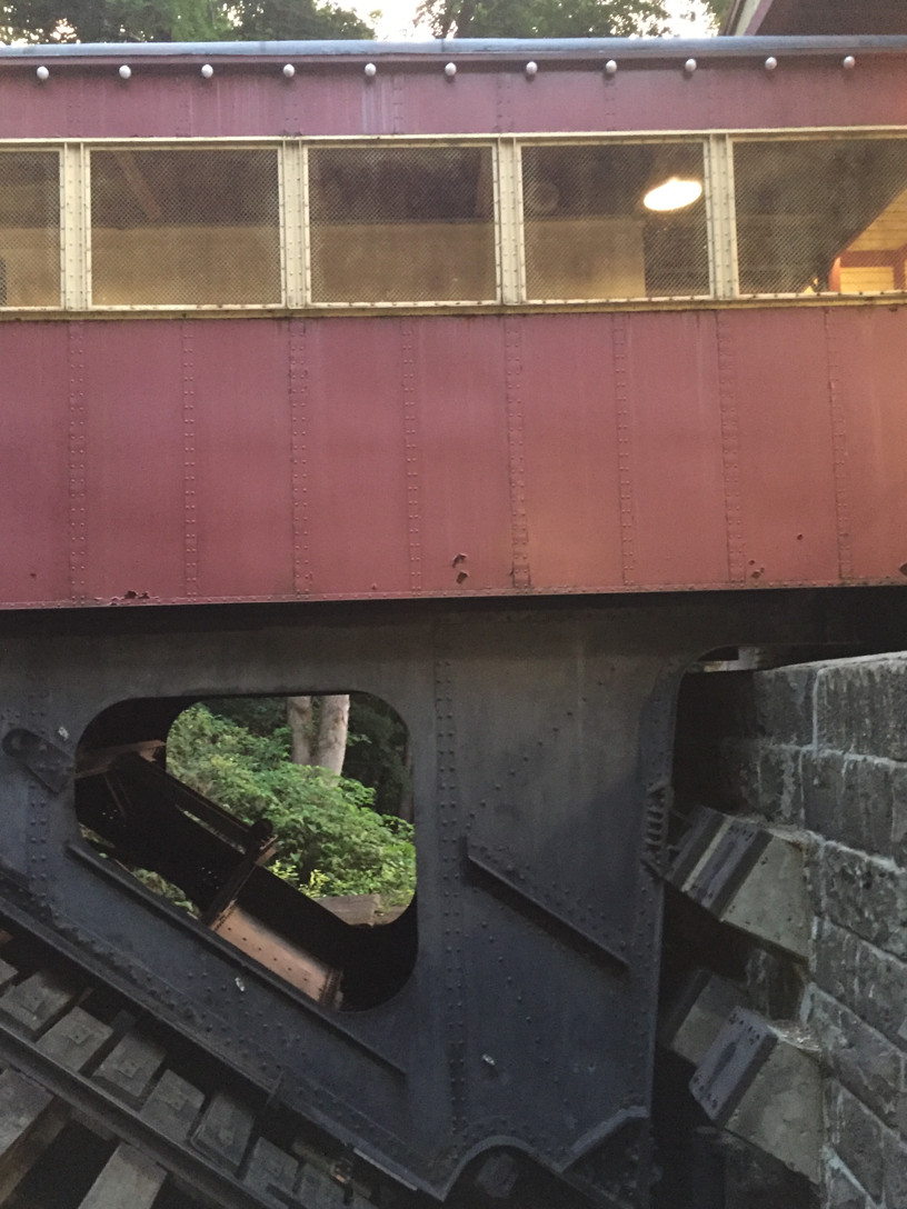
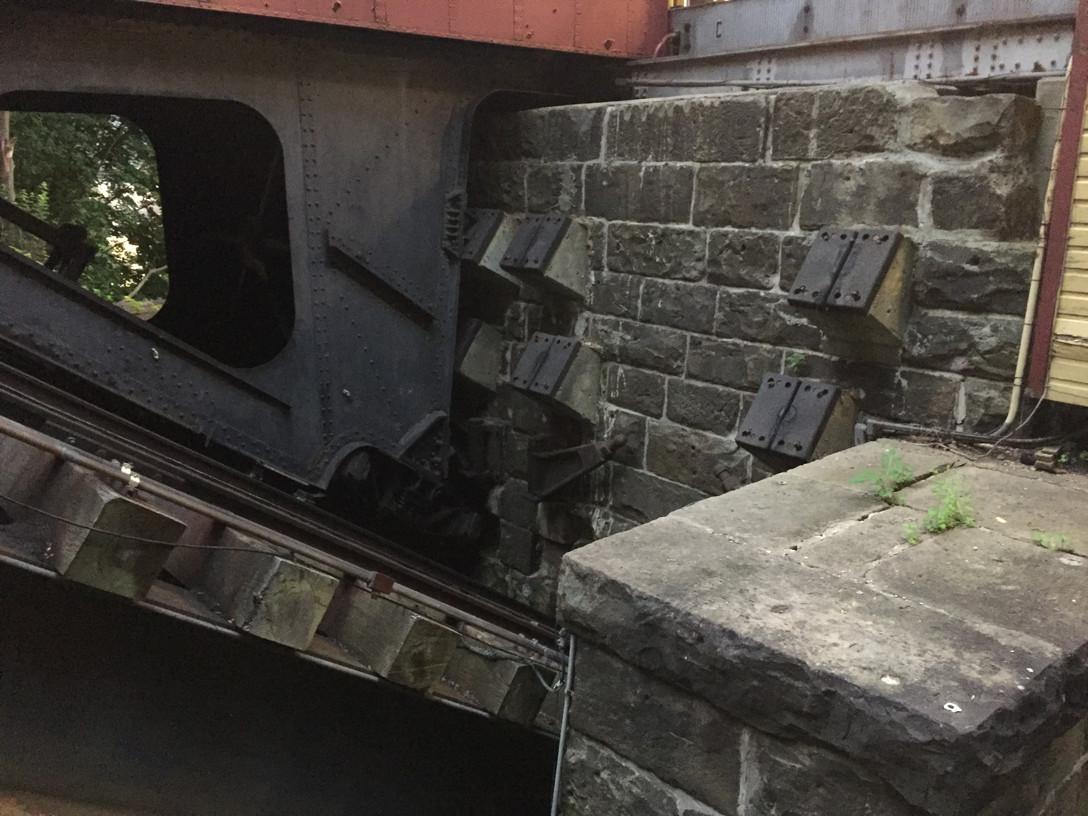
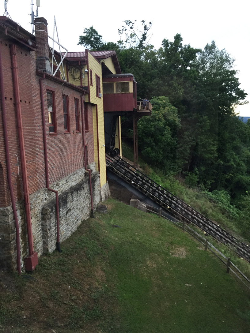
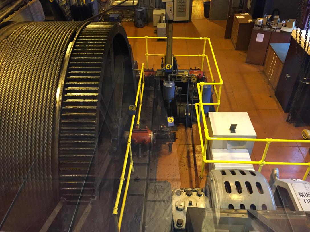
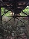
Two views of the powerhouse. The first is from the station side and
the other from the opposite side near the restaurant entrance. Most
inclines have the powerhouse straight ahead at the top end of the
rope, with the entrance to the car to one side. Probably because the
Johnstown Incline was always intended to load vehicles, the car loads
from the end, and the powerhouse is at a right angle to the incline.
The wire rope has to turn 90 degrees between the incline and the
winding wheel, adding wear every time it runs in and out.
If you go to Johnstown, read David McCullough's book The Johnstown
Flood before you go. We did. Travelling from New Jersey, we
reached Johnstown at about 2 in the afternoon. That gave us enough
time to see the Johnstown Flood Museum in town and the Johnstown Flood
National Memorial at the remains of the dam. We got back to town and
walked to the incline around 6, ate at the restaurant, and went back
down to stay overnight at the Downtown Holiday Inn.
As we drove out of town the next morning, we decided that after our
flood activities the previous day we would take a few minutes to pay
our respects at Grand View Cemetery, not far from the top of the
incline.
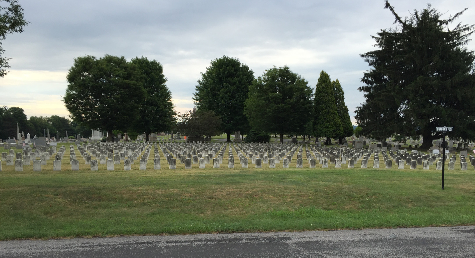
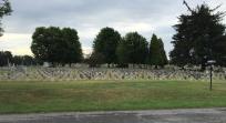
Here in the Unknown Plot are buried the remains of seven hundred flood
victims who could not be identified. I find it looks smaller in the
picture. Maybe you have to walk through it to appreciate the scale.
The little headstones have of course no names but they serve to show
what seven hundred graves look like—and these are just one-third
of those who died that day. It has quite an impact. In surrounding
sections of the cemetery we noticed other graves with names and the
repeated death year of 1889.
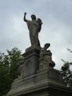
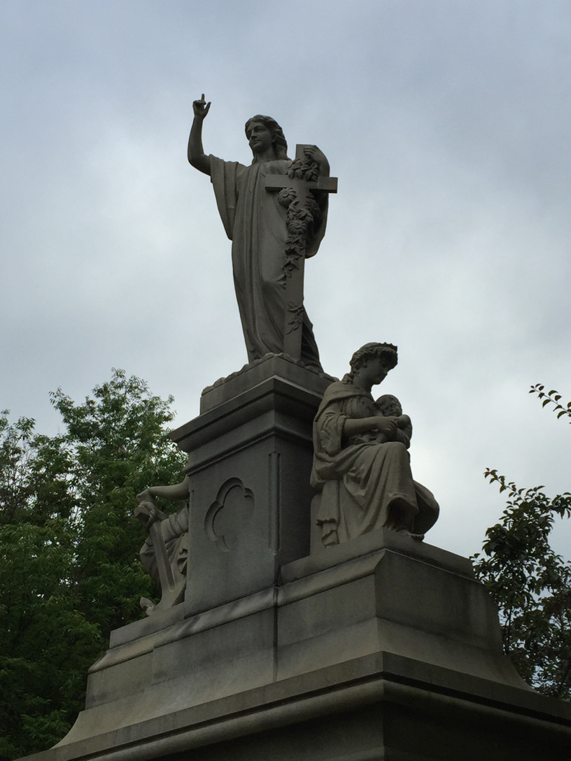
The monument in front of the Unknown Plot. On its base is the
inscription, In Memory of the Unidentified Dead from the Flood of
May 31, 1889. The scene of mother and child is particularly
touching—so many children were left orphans and so many parents
left childless. So many survivors lived with the memories.
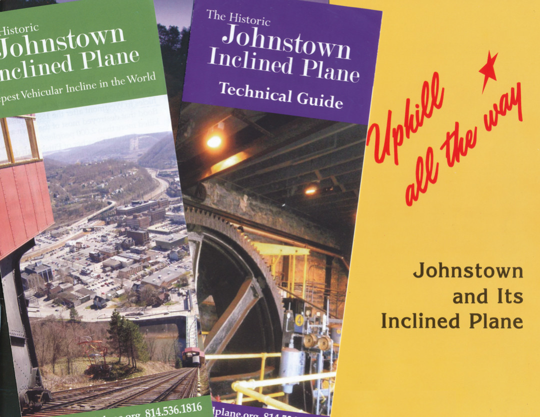
At the upper station you can get your Incline goodies which reportedly
make up a significant source of income for the property. The green
brochure has three panels of History inside, and the purple one has
the technical Fact Sheet. Uphill All the Way is a 32 page book
by Richard A. Burkert and Eileen Mountjoy Cooper published in 1985 by
the Cambria County Tourist Council that is still the best monograph
about the history of the incline. It was the main source for my
historical ramblings in the first section above. The crude printing in
brown ink almost put me off but I am glad I took a copy.
One piece of Incline swag to consider is this cool cap. You know you
want one. Adding cat hair is your own decision.
If you want to see more pictures Jon Bell captured some good images in
2003 that you can see at www.jtbell.net/transit/Johnstown/.
See also the Historic American Engineering Record reports on the Johnstown Incline
and the Stony Creek
bridge. I like old bridges almost as much as old railways and I
failed to appreciate this bridge when I was there.