Maps in PNG format. Click to enlarge map.
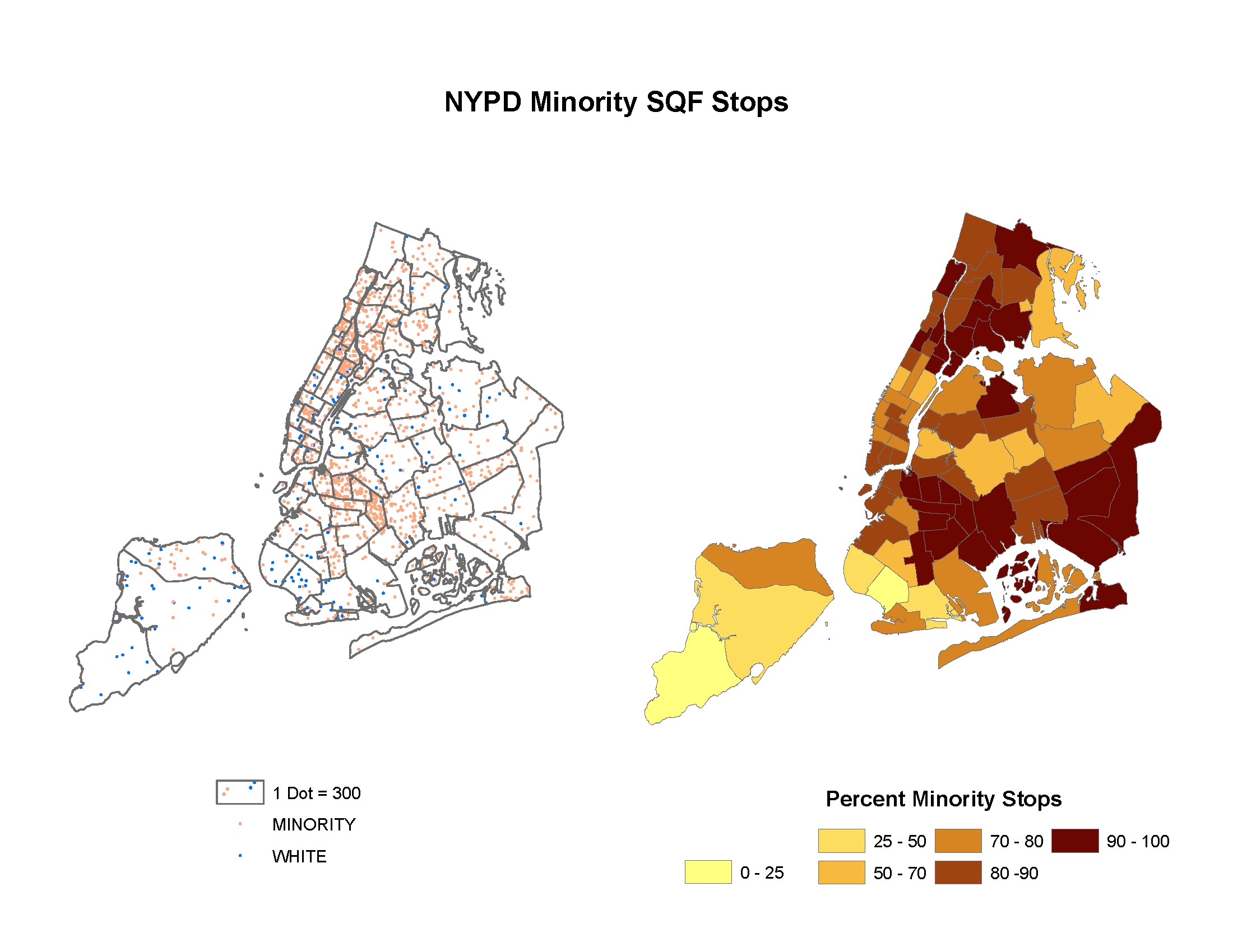
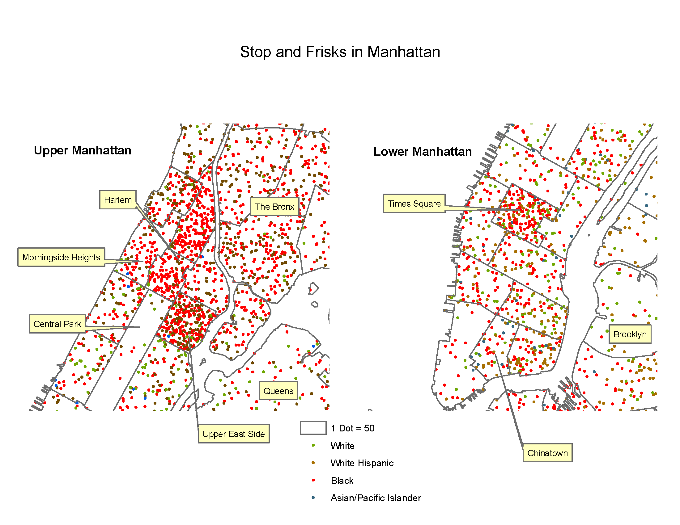
Data is from the NYPD. Each dataset was imported into SPSS, exported as a CSV file, and then imported into a PostgreSQL database. Maps were made in ArcGIS 9.3.
Note: Precincts vary in geographic extent and population. Take these with a grain of salt.
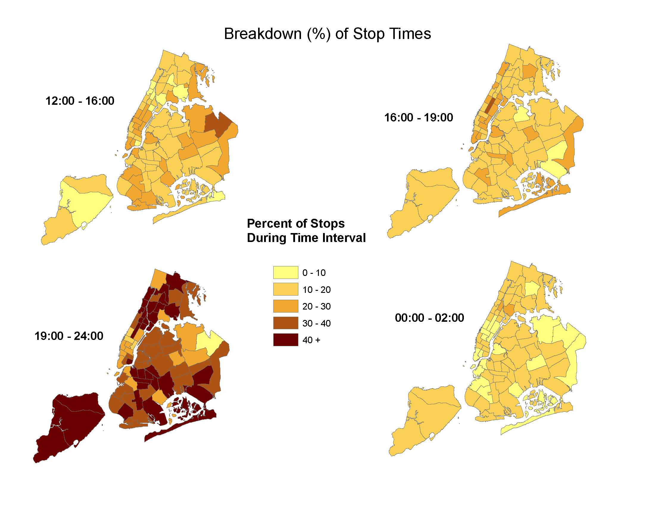
I divided these maps based on time periods of the day. 12.00-16.00 = afternoon; 16:.0-19.00 = evening rush hour/commute; 19.00-24.00 = evening; 00.00-02.00 = late night