[ Home | Biography | Schedule | Videos | Mountains | Lessons | Contact ]
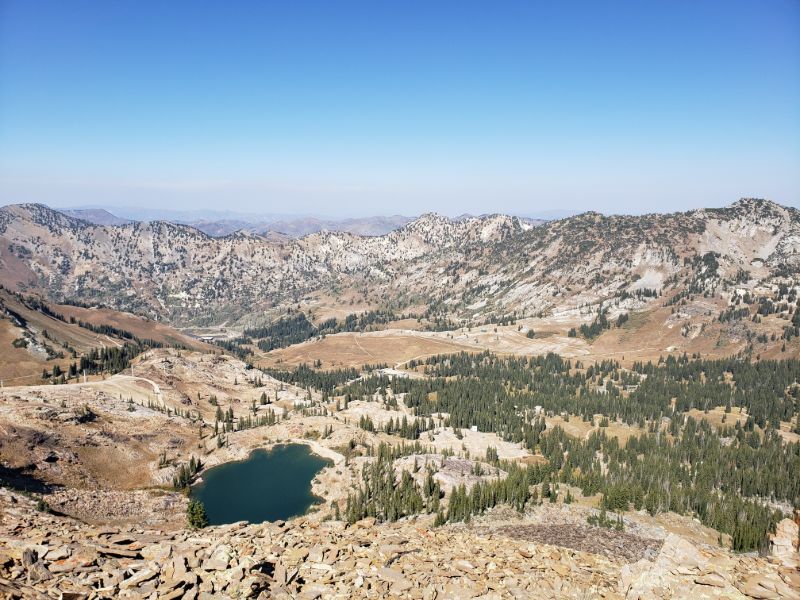
Cecret Lake, Devil's Castle, and Sugarloaf Peak border the southeast side of Little Cottonwood Canyon near Salt Lake City, just above the town of Alta. The trail is a four mile loop with around 2000' of elevation gain, peaking at 11,050' on Sugarloaf. This is my favorite hike of all time, so naturally I completed it six times by myself and with various friends while living in Utah.
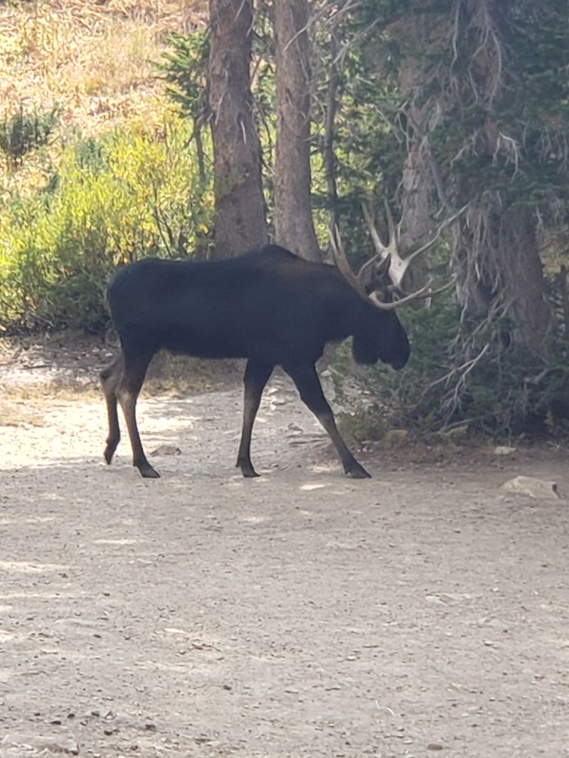
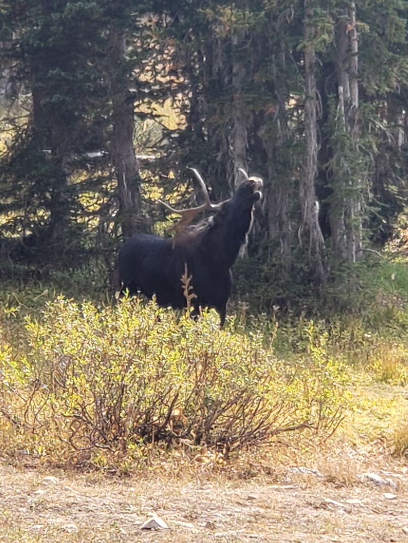
The first mile of this hike is family friendly, very straightforward, and leads to Cecret Lake (yes, spelled with a "C"). On my first attempt, my adventure nearly ended a half mile in when a bull moose, flanked by two females, stood in the middle of the trail and refused to move. After a lengthy staredown, the moose won, and I ended up bushwhacking a wide circle around him. After overcoming this obstacle, I was on my way.
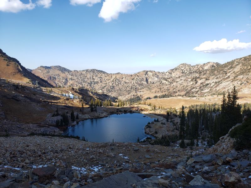
Cecret Lake, like many alpine lakes, is formed over time from snowmelt in an amphitheater-like space, where the surrounding wall is the face of a mountain, in this case Sugarloaf Peak. On a hot summer's day, it is tempting to dive right in, but, alas, swimming in this lake is forbidden since it is a protected watershed that provides drinking water for Salt Lake City.
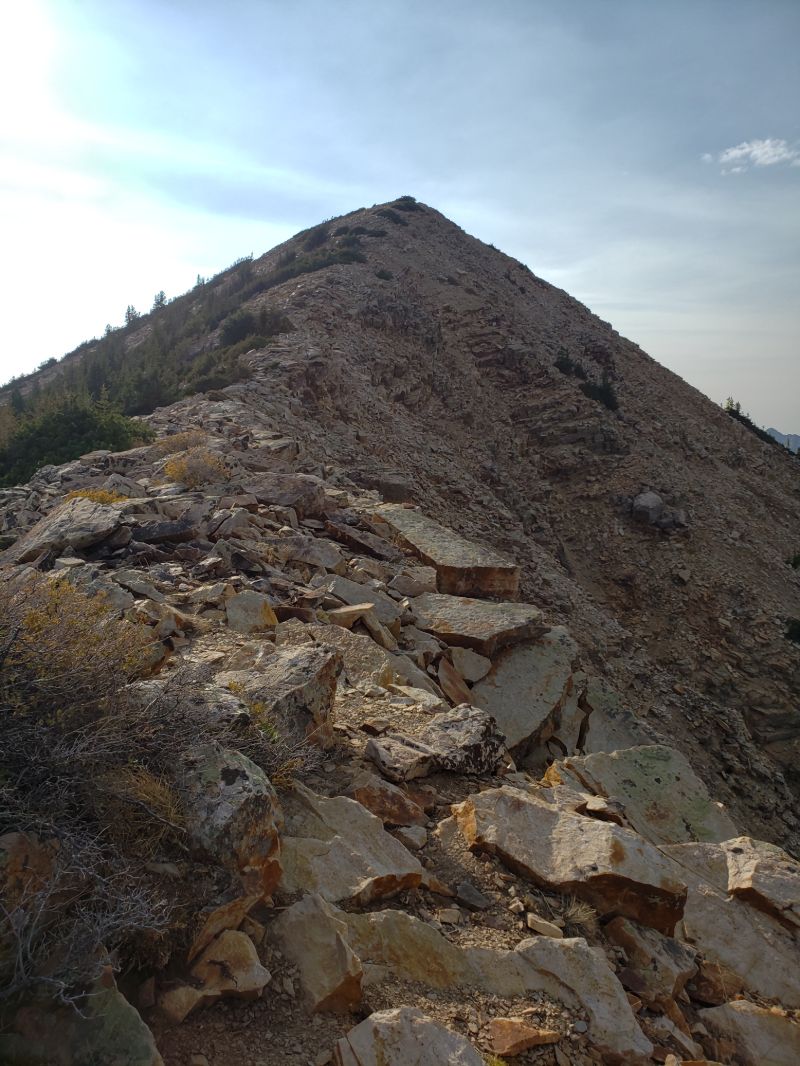
After Cecret Lake is the hardest non-technical section of the hike. The trail climbs practically straight up from the lake to the saddle between Devil's Castle and Sugarloaf Peak: 1000' in 0.7 miles, which is an average of 27% grade. Even after completing the hike six times, I still find this section difficult. Also, the trail leading away from the lake is not apparent. I think each time I've gone a different way. It is useful to bring a map on the first try.
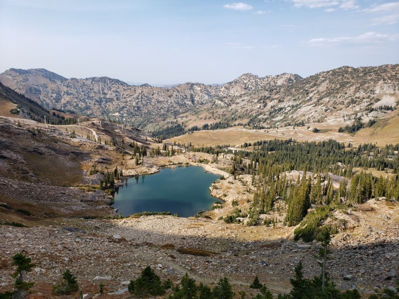
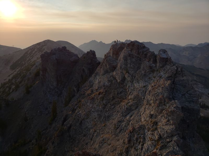
Once the trail reaches the saddle, it is a quick quarter mile boulder hop to the top of Sugarloaf Peak, on the right. From the top of Sugarloaf I was awarded with breathtaking views of Devil's Castle, Cecret Lake, and the surrounding Wasatch peaks. This is where the fun begins.
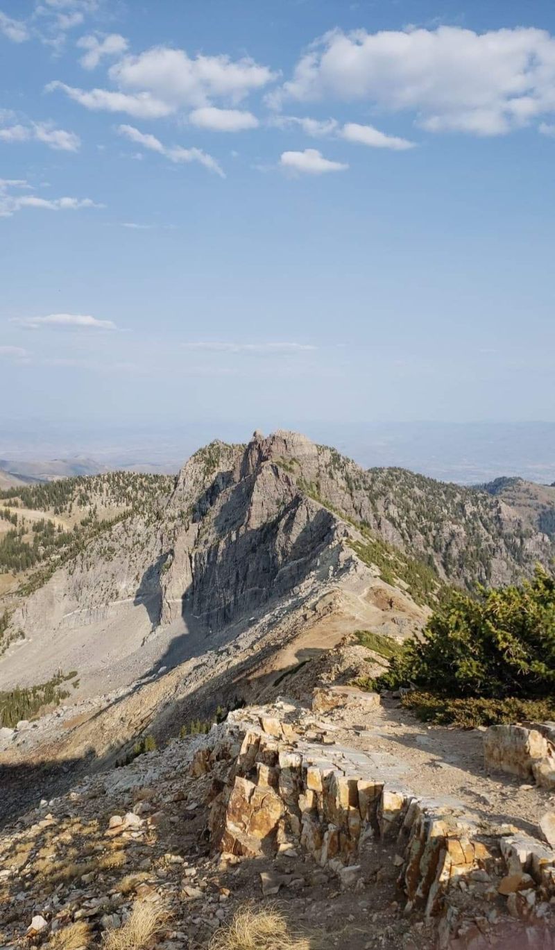
After scrambling back down to the saddle, I began the narrow ascent up to the base of Devil's Castle. There are many ways to go along the ridge. Staying just to the right follows a semblance of a trail, while traversing along the spine affords some fun scrambling (however, if not approached with care, this option can lead to becoming stuck on a 1000' cliff). On my first attempt, I was grateful for a map because I would have lost the trail otherwise.
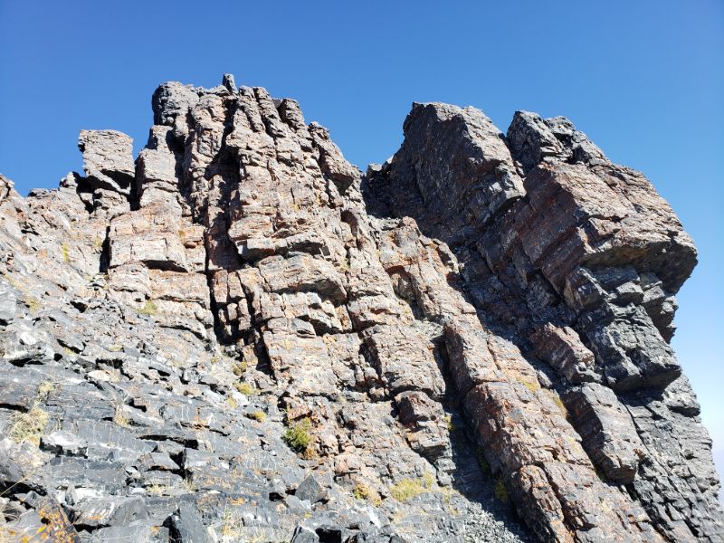
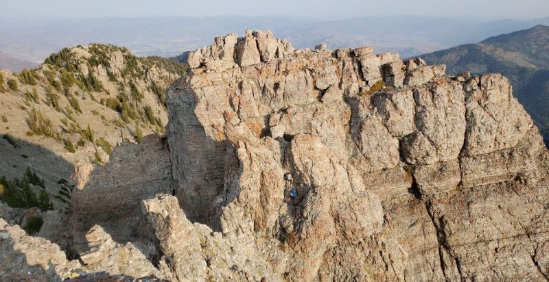
At the base of the first castle I reached the first of the three class 3/4 climbs on this hike. In hiking, the class rating, also known as the Yosemite Decimal System, is used to denote the technical difficulty of the trail. Class 1 is regular hiking, class 2 is scrambling on hands and knees, class 3 is scrambling with increased exposure, class 4 is scrambling and/or some very basic climbing with exposure, and class 5+ is climbing that requires equipment. The tower below is the first of the three climbs. To the right is the route I took. In my opinion, this tower is the most resemblant of a castle, but Devil's Castle proper is not until the second climb. Luckily, this climb (as well as the other two) did not prove to be too scary or technical thanks to ample handholds and footholds. Still, this is not for the faint of heart, so I would not recommend this trail for anyone without extensive hiking experience or with a fear of heights.
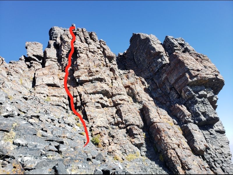
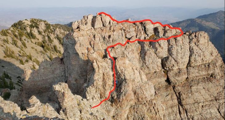
The "trail" past the first climb is the most treacherous, leading along a narrow ledge on a cliffside, which I outlined in the photo below. It's fairly straightforward as long as you don't look down or overthink. I think these photos speak for themselves. The views and landscape were epic.
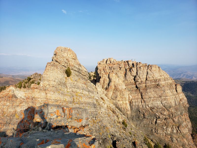
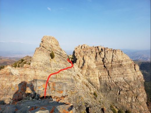
There are multiple options to summit Devil's Castle proper. One starts on the west side of the castle, closer to the first climb. I found this route to be harder than the second option because of a tricky maneuver near the top. The second option goes around the castle on the right and summits from the east. This climb is on more unstable terrain, but also is more straightforward. Upon summiting Devil's Castle, I was genuinely confused as to the route I would take for the third climb as there did not seem to be any clear path. Luckily, there were a few other people around who showed me the way, which I outlined below.
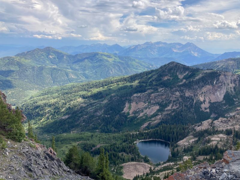
I really did not want to get stuck on the ridge after dark, so it was time to hurry down the mountain. The trail from the third castle, if it can be called a trail, was an extremely slippery, steep descent with little to break an inevitable fall, so I dirt-sled down 1000' back to a fire road. In the late summer and early fall, the wildflowers turn into incredibly sharp shrubs, so, after unknowingly grabbing onto one and subsequently picking thorns from my hands for a week, I noted to bring gloves in the future. After emerging, thankfully uninjured sans some thorns in my hand, back on the fire road, I ran down through the Albion Basin Campground and made it to the Cecret Lake trailhead right as the sun was setting.

[ Home | Biography | Schedule | Videos | Mountains | Lessons | Contact ]