
[ Home | Biography | Schedule | Videos | Mountains | Lessons | Contact ]
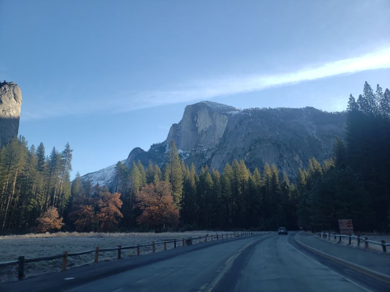
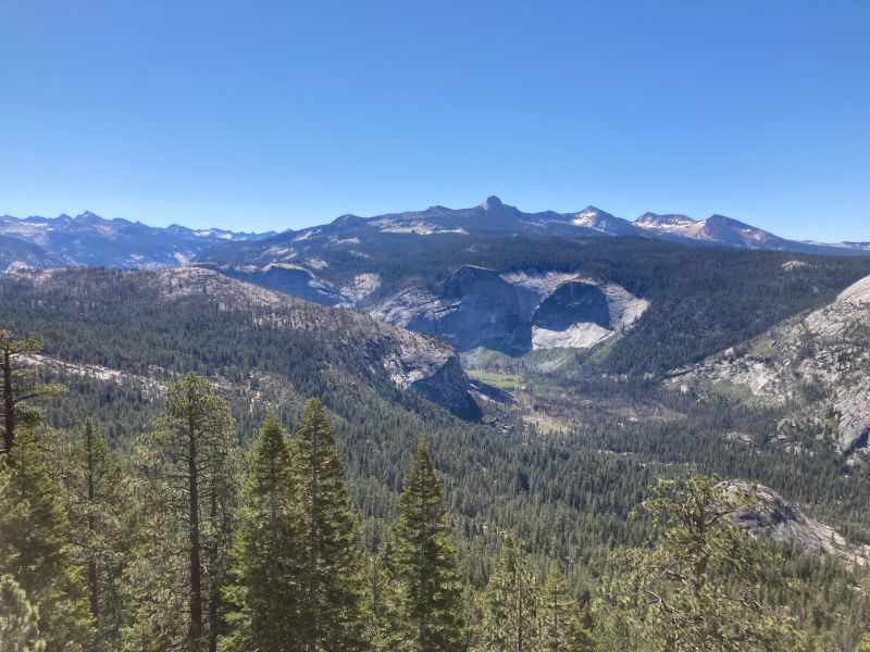
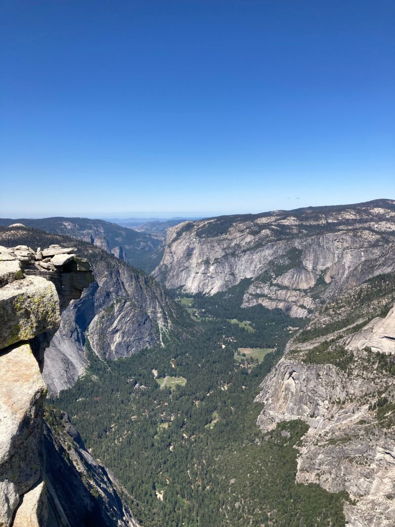
Easily the most recognizable mountain on this page, Half Dome, along with El Capitan, are the defining landmarks of Yosemite National Park in California. Standing at 8839', towering nearly 5000' above the valley floor, this formidable dome is on many hikers' bucket lists. Interestingly enough, I could not even conceive of climbing this mountain a year prior due to my fear of heights. Many things can change in a year. In order to climb Half Dome to the summit, one must enter a lottery in March for a permit (unless you are absolutely hard-core and want to climb Half Dome when the cables are down, typically from mid-October until Memorial Day in May). Since there is such a high volume of applicants, not everyone is awarded a permit, but I got lucky and received one. I decided to tackle this adventure with my best friend, Cyrus, who does not normally undertake such grand pursuits, but decided that this mountain would be worth the pain and suffering. We trained for months leading up to the big day, he on our local mountain in the Bay Area (Mount Diablo) and I in Utah.
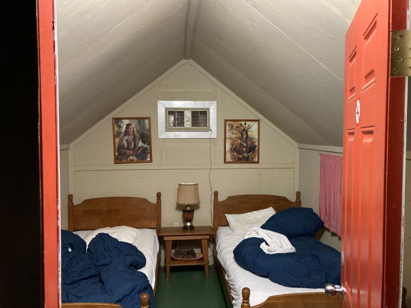
We emerged from our heated tent cabin at the Yosemite Bug Resort (highly recommend for those on a budget) at around 3:30am. After a quick breakfast, we were on our way. The perk of entering Yosemite at 5am during peak tourist season is avoiding the hour-long wait at the gate and the bumper-to-bumper traffic through the valley. Plus, the sunrise in Yosemite is always epic. We were parked and ready to roll from Upper Pines Campground at 6am.
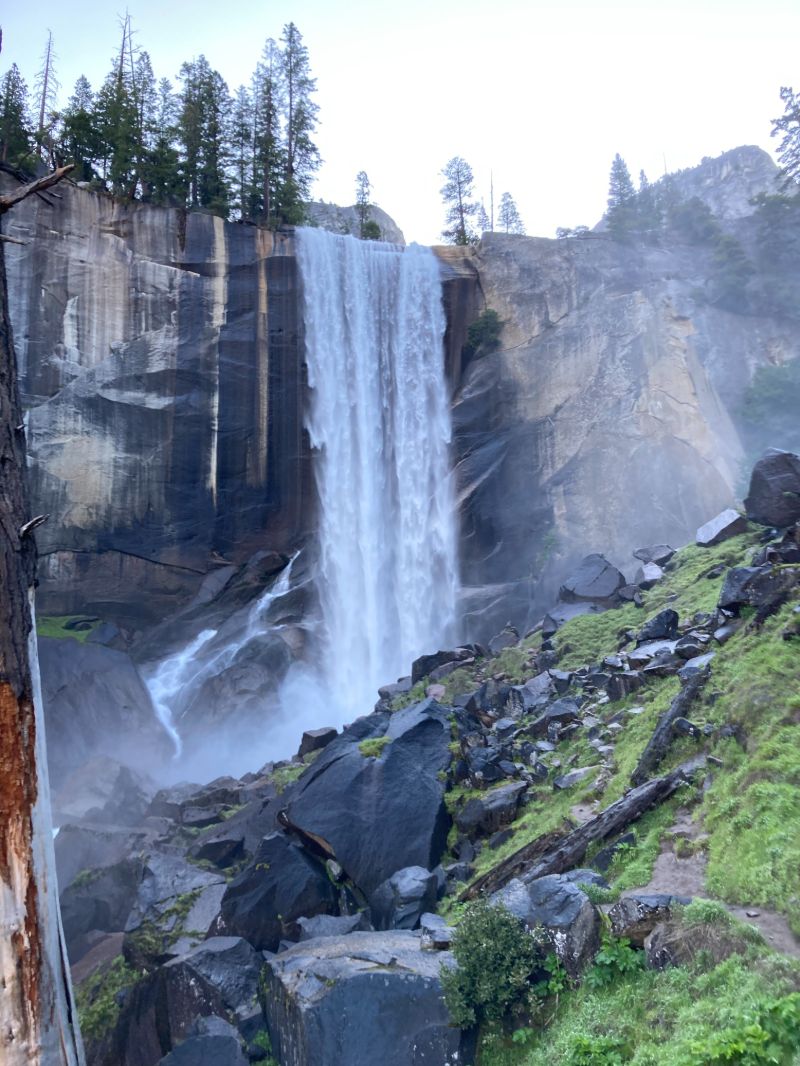
The Half Dome trailhead is located at Happy Isles, in easternmost Yosemite Valley, which, coincidentally, is also the John Muir Trail north trailhead. The first mile and a half are on a pleasant, paved trail through the woods (although mid-day in the summer here is always packed with tourists - the early morning or the off season are the times to go). After crossing the bridge over the coursing Merced River, the trail begins the infamous 600+ step climb to Vernal Falls. This section is called the Mist Trail because of the almost constant mist created by the power of Vernal Falls. With the exception of the end, this section is the hardest in the hike because of the steep, uneven steps that are often slippery from the mist.

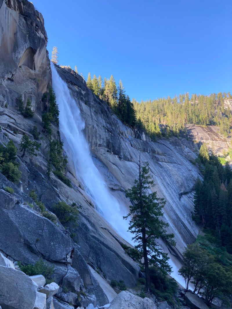
After passing Vernal Falls, the trail reaches Emerald Pools, which are quite a site in the winter when they are frozen. This time they were not frozen, so we continued on, without stopping to admire them, for a mile and a half or so to Nevada Falls. If attempting this in the winter, microspikes are a must because this section of the trail is covered in ice. It took us approximately a quarter of the time to reach Nevada Falls without the ice. Nevada Falls were just as spectacular and proved to be quite useful for our weary feet on the way back.

After passing Nevada Falls, the trail flattens out for a mile and passes the Little Yosemite Campground (for those who wish to break up the hike into two days and really enjoy the scenery instead of torturing themselves) before entering a forest and climbing for three miles to the base of the subdome. This is where a park ranger stands and checks for permits, so it is important to have it downloaded if you wish to continue. The subdome climb is not as difficult as it looks - there are stairs built into the rock, and there is only approximately 460' of elevation gain here (granted it's over 0.3 miles, so yes, it is steep, but compared to the actual dome it's a cake walk).
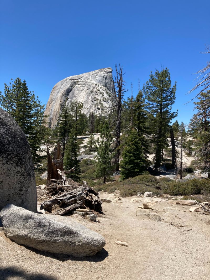
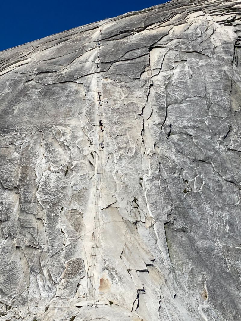
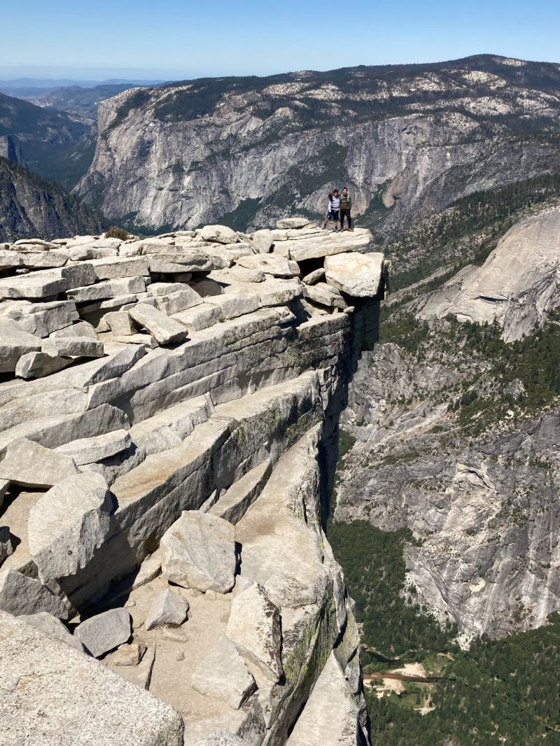
At the top of the subdome, we saw up close the formidable task ahead and the crux of this trail: the infamous Half Dome cables. We were in awe. People dotted the massive wall like ants. For a moment, I even reconsidered continuing, but immediately shrugged this thought off. We did not come all this way only to quit. (Disclaimer: if there is even a minimal chance of a storm brewing anywhere on the horizon, do not attempt this section, as becoming stuck in a storm on Half Dome will likely result in death). Luckily for us, there was not a cloud in the sky, so after a long lunch, delaying the inevitable, we began the climb. For this section of the hike, it is essential to have gloves and upper body strength. This is no longer hiking; this is pulling yourself up, while hanging onto the cables for dear life. The cables climb 400' in 0.1 miles, a staggering 75% grade. Grade is calculated by dividing vertical by horizontal distance (literally, the slope). So, in this case, 400/(0.1*5280)=75.8% grade. As you approach a vertical wall, the grade approaches infinity. I digress. The cables are wild. Steps are set up every 10' or so, and there is two-way traffic, so each person scrambles up one step at a time before letting someone pass in the opposite direction. The beginning is the steepest; a particularly scary moment was when we came to a ledge and had to step a bit past vertical in order to climb over it. This was even harder on the way down. Finally, breathing heavily, we reached the top. The views are unparalleled; standing 5000' above the valley, looking straight down, is quite a perspective.
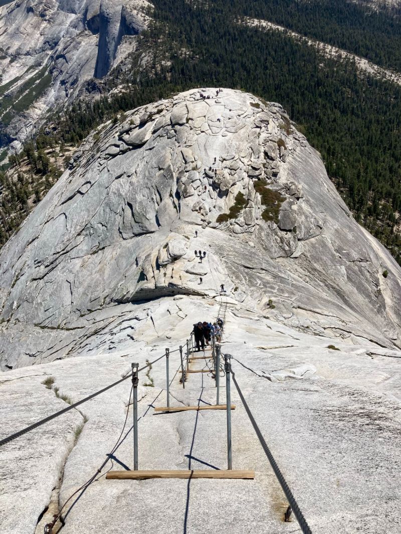
Coming down the cables was, for me, much scarier than going up. I nearly froze in place a few times, but was inspired to move by the fact that there were a few hundred people on the cables, and I did not want to hold everyone up. By the time we reached Nevada Falls, our feet were begging us for mercy. We decided to take a break and dipped our feet in the icy water. One of the best feelings ever. This whole adventure was roughly 18.5 miles with 5,684' of elevation gain. I cannot wait to attempt this beast sometime in the future.
[ Home | Biography | Schedule | Videos | Mountains | Lessons | Contact ]