[ Home | Biography | Schedule | Videos | Mountains | Lessons | Contact ]
One of my big goals before my knees turn to mush is to climb the highest point in each of the fifty states (yes, even Florida and Louisiana). This page is dedicated to the high points that I have completed.
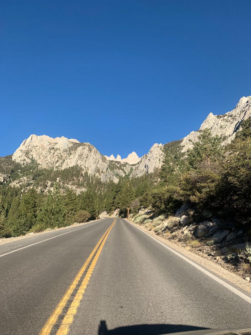
Mount Whitney is the second tallest state high point after Alaska's formidable Denali and the highest point in the contiguous United States. At 14,505', Whitney looms above the eastern California town of Lone Pine, a hot, dusty community famous for the many Westerns that used its otherworldly landscape as their backdrop. Just 84 miles away - and in the same county - lies North America's lowest point: Badwater Basin in Death Valley, at an elevation of -282' (-86m). The (oversimplified) reason for the proximity of these extremes is that Death Valley lies near the boundary of two tectonic plates. Hundreds of millions of years ago, as the plates were moving, the land in Badwater Basin "folded" inward as its surroundings were pushed up to form what is now known as the Sierra Nevada mountain range. To this day, Death Valley continues to sink along the fault that lies at the base of the Black Mountains. This is quite a fascinating corner of our large country, and I am keen on learning more about it.
I was a bit nervous heading into this undertaking as trip reports read anything from "hardest thing I have ever done" to "took 18 hours" to "never again." To compound my fears, I had spent most of the month leading up to my permit date at or near sea level in Hawaii and around California, rather than in my usual home base of Utah. As a necessary precaution, I booked the Whitney portal campground (8374' or 2552m) for two nights so that I would not have to make the nine hour drive back to Utah on the same day as the hike, and so that I could immediately crash upon my return (I expected to be out well into the evening). On Alltrails, the standard route up Whitney is listed as 21 miles with 6646' of vertical gain. I had done longer hikes and shorter hikes with more vert before, so I was hoping this prior experience would be helpful on the mountain. I had also read about frequent thunderstorms that formed almost daily in the afternoon, so I set my turnaround time for 11am if there was even a semblance of clouds. I also made sure to let my family know where I was and approximately when I would be down, so that if they did not hear from me they could contact Search and Rescue (SAR).
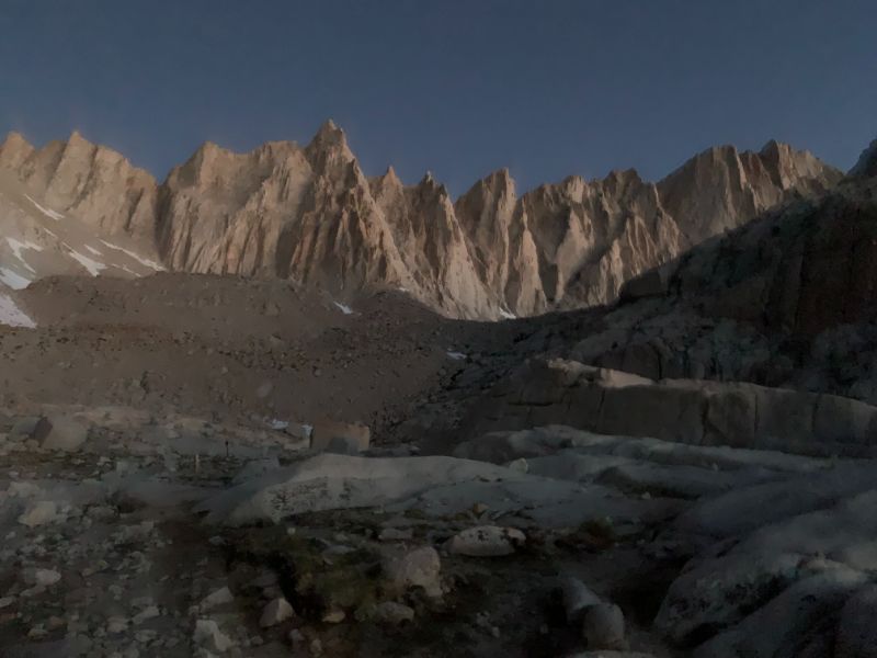
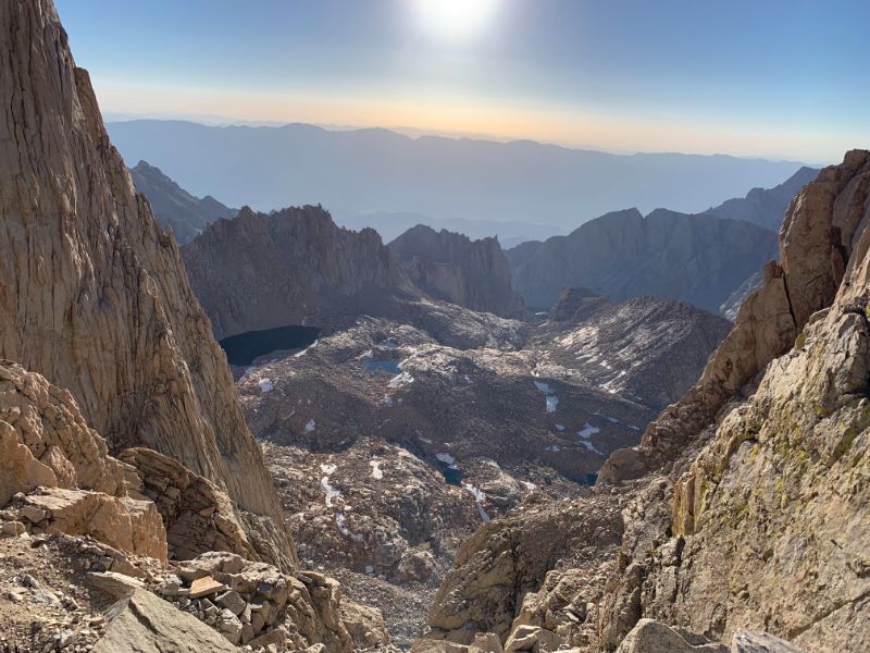
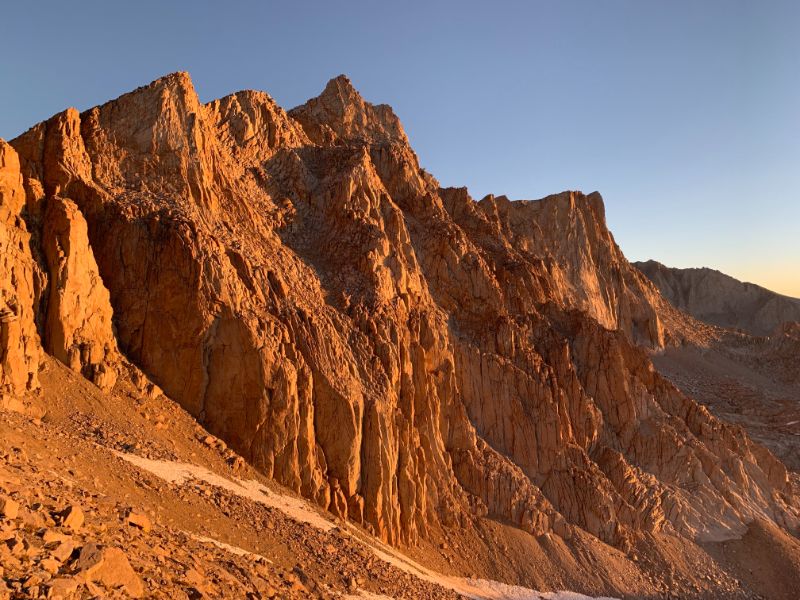
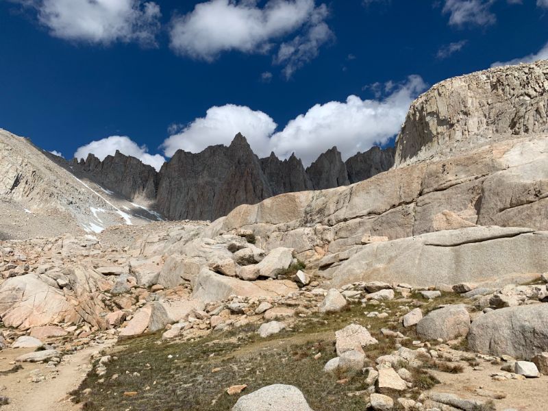
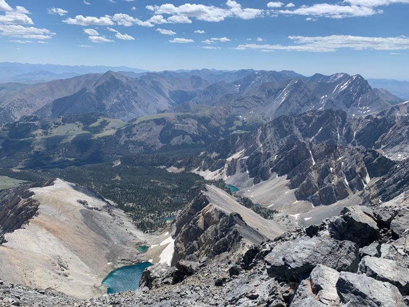
My day began early, at around 02:00. I set my alarm for 02:30, intending to start at 03:00, but realized that I would not be going back to sleep after midnight because of excitement, so I decided to get an early start. I set out at 02:45, and there was already a number of people on the trail. In the first few hours I made fairly good time and was above tree line at first light. My goal was to be on the infamous 99 switchbacks at sunrise since I heard the view is more spectacular than the human imagination can conceive. As I started going up the switchbacks, I began counting in my head - it was hard for me to imagine that there were actually 99 of them. Seeing the morning alpenglow on these majestic mountains was phenomenal. The sun peeked over the Inyo mountains to the east as I was approximately halfway up, around 12,600' (3850m). The sight absolutely took my breath away - or perhaps it was the altitude finally getting to me.
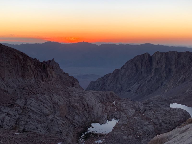
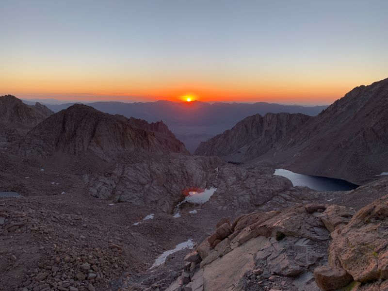
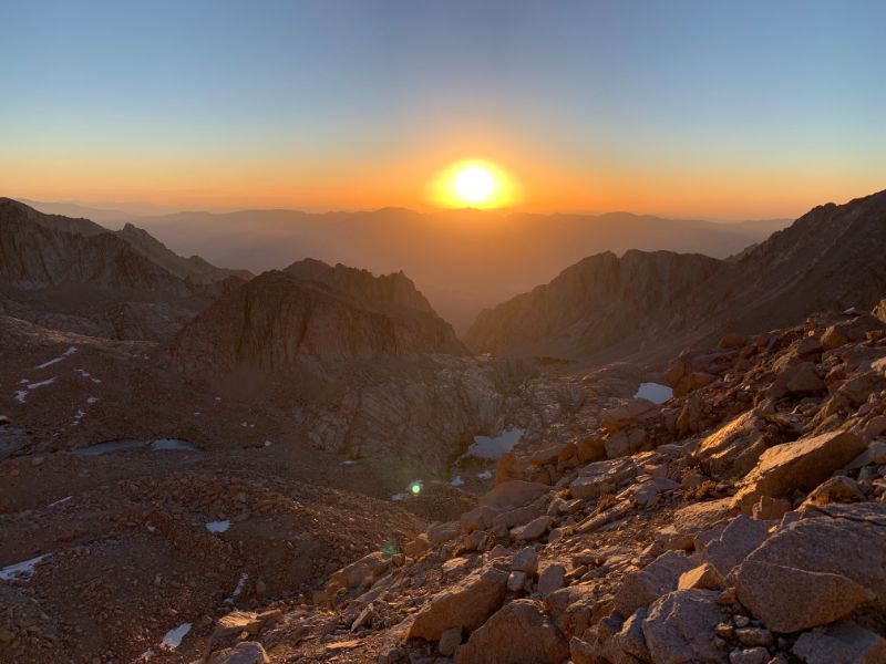
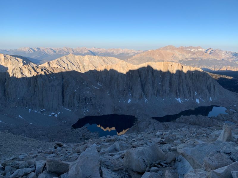
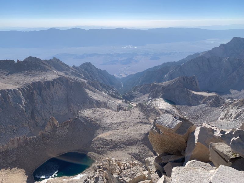
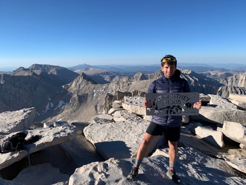
As I approached Trail Crest at 13,620' (4150m), I confirmed that there were indeed precisely 99 switchbacks. Most of them flew by and were not as difficult as I had expected, but the last seven felt almost as long and taxing as the first ninety-two. Trail Crest offers views both to the east and west, so it was the perfect place to stop for a few minutes to rest and take in the views before tackling the final two miles to the summit. I made it just past 07:00, had a mild headache, came to the realization that I would have all day to kill once I finished, but mostly was overwhelmed by the grandeur of being on the rooftop of the lower 48 states. I ate my breakfast, which consisted of trail mix, an energy bar, and an energy gel, spent approximately 40 minutes at the summit, and began the long slog down. The headache promptly disappeared.
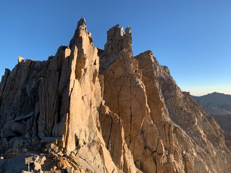
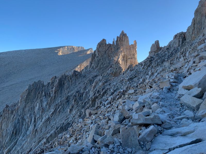
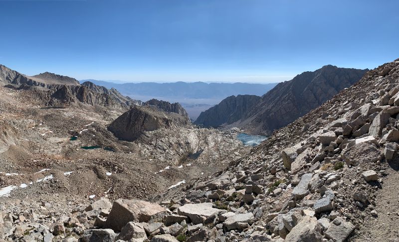
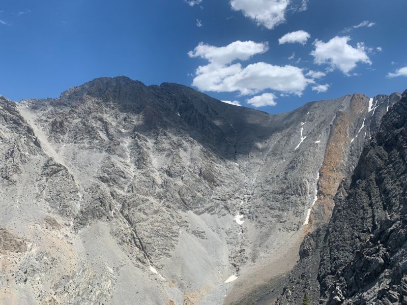
On the descent, I noticed that there was another 14-er (14000' mountain) just off the main trail - Mt. Muir. I attempted to climb it, but the terrain proved to be much too steep and loose for my comfort. I did not want to start a rockslide that could kill both me and whoever was below me, so I promptly backed out and continued down. By this time, there was a steady stream of people coming up the trail, and since uphill hikers have the right of way, this meant a lot of stopping for me, which I did not mind since the views were jaw-dropping in all directions. The descent was rather uneventful save a protective grouse who would not leave the center of the trail to protect its chicks. It's hard to run this trail on the downhill since it is quite rocky and uneven, so my descent was almost as slow as my ascent. I was back at Whitney Portal just before 11:00, having spent just over eight hours on the round trip (including my two meal breaks, many breaks for photos, and constant stopping to make way for those suffering on the uphill). My reward was a big, delicious burger and a heap of fries at the Portal store.
Conclusions: this is my new favorite mountain of all time. The views cannot be understated. The 11 mile grind each way is well worth the incredible sunrise on the 99 switchbacks, as well as the high of standing on the summit and looking down over 10,000' to Lone Pine on the valley floor. Anyone who is decently fit, has experience with altitude and long hikes, and most importantly has the willpower, will be successful on the Mount Whitney trail, barring unforeseen circumstances such as weather and cumbersome hiking partners. That being said, it is still a substantial and difficult hike, and is not for the average Joe. Had I not consumed gels every three miles, I do not think I would have had the energy to summit. In the winter, however, from approximately October until June, this is a completely different undertaking and requires mountaineering experience. By the time I went, all of the snow had melted from the trail, and it was a simple, non-technical hike with a relatively steady incline (no steep surprises) all the way from the trailhead to the summit. I will definitely be back to do this again, prehaps next time via the Mountaineer's Route.
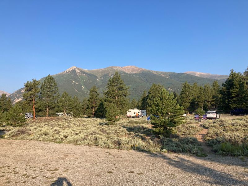
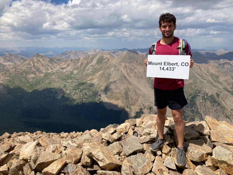
Mount Elbert, at 14,433', is the third highest state high point after California's Mount Whitney and Alaska's Denali. This mountain is located in the Sawatch range of the Rocky Mountains, above the town of Leadville. I completed the East Ridge Route, although there are also the North and South ridge options, with the South ridge being most direct and steepest. Mount Elbert is a good introduction to 14ers, as it is one of the more moderate ones in Colorado and elsewhere, with no special equipment required besides a certain level of fitness and acclimitization to the altitude. The East Ridge trail has around 5000' of elevation gain and a round trip of just over 15 miles.
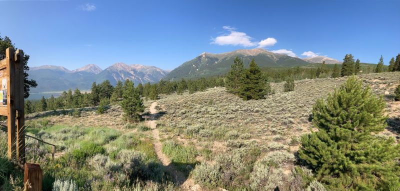
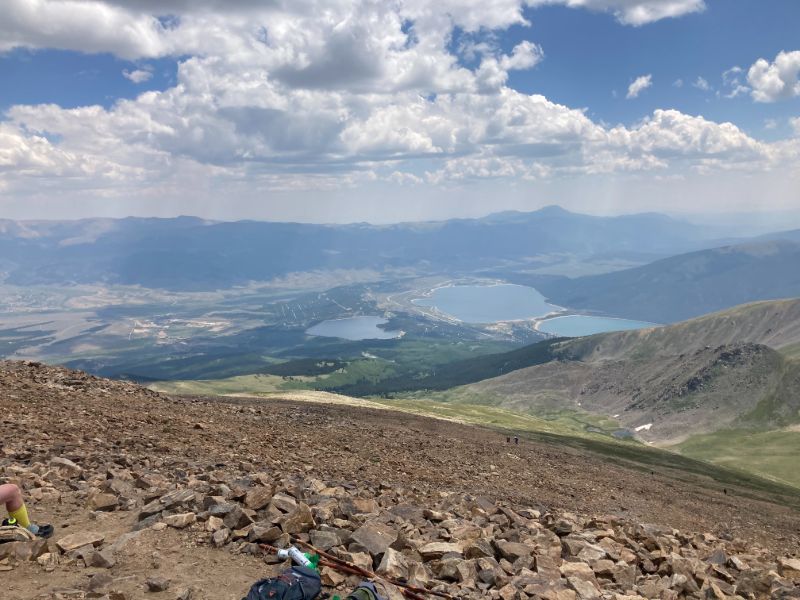
I arrived at the White Star Campground at nearly midnight after a very long day on King's Peak, Utah's tallest mountain. I cannot recommend this campground enough: sitting on the shore of Twin Lakes, with beautiful panoramic views of the surrounding mountains (including Mount Elbert), it makes for a fantastic camping experience. It is also extremely well maintained. I'm surprised that I was able to reserve a spot at all during peak season. Each campsite was widely spaced out, so I did not even notice my neighbors at night.
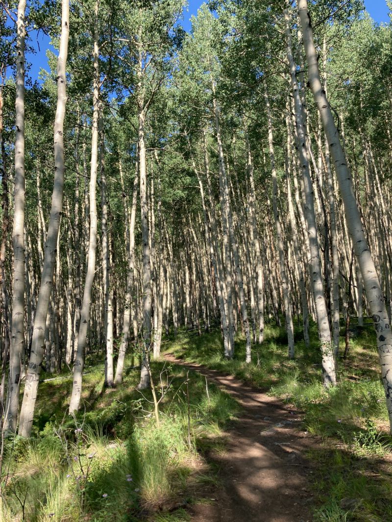
In order to maximize my chances of summitting, and after extensively researching various trip reports, I decided to prioritize my sleep, and started the hike at 9am. The first five miles are fairly easy, climbing consistently through a beautiful forest with occasional views of the valley and Twin Lakes below. 2.3 miles into the hike, there is a mountain spring from which I filtered water to drink. I don't think I have ever tasted water as refreshing, perhaps with the exception of glacial runoff at Glacier National Park.
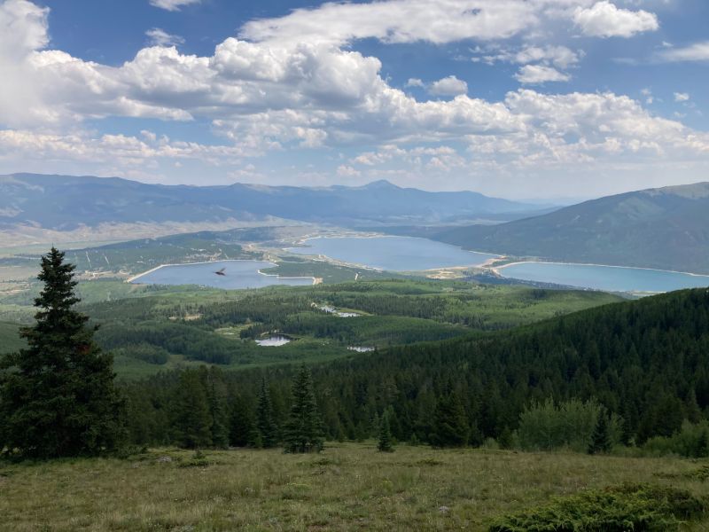

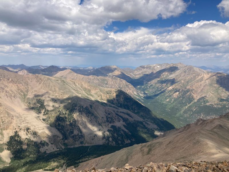
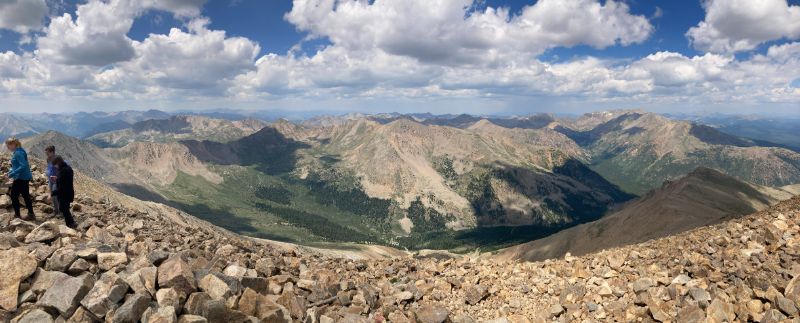
After surpassing tree line, the trail gains steepness, with the last two miles to the summit going straight up the ridge with very few switchbacks to ease the climb. The final mile to the summit climbs over 1000', so it is very important to be acclimated here in order to avoid altitude sickness. The views at the top were spectacular; I will let the photos speak for themselves.
On the way down, I made the mistake of diverging from the main trail onto the dirt road near the upper parking lot. It was slippery and dusty, and I had to share the narrow road with a few cars. If I climb Mount Elbert again, I will stay on the main trail, which is much more pleasant. Made it back to the trailhead at 2pm, just in time for a deluge of rain. I highly recommend this mountain to anyone who likes hiking and 14ers, and I hope to be back someday.
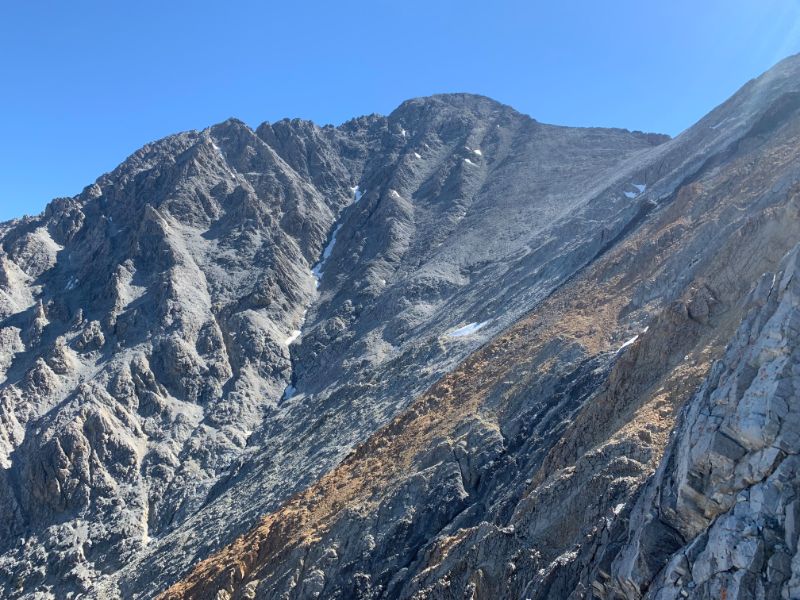
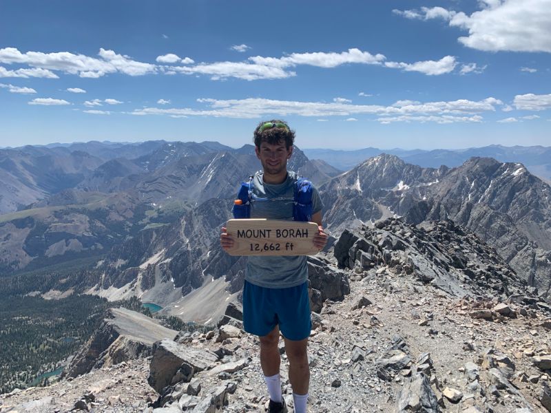
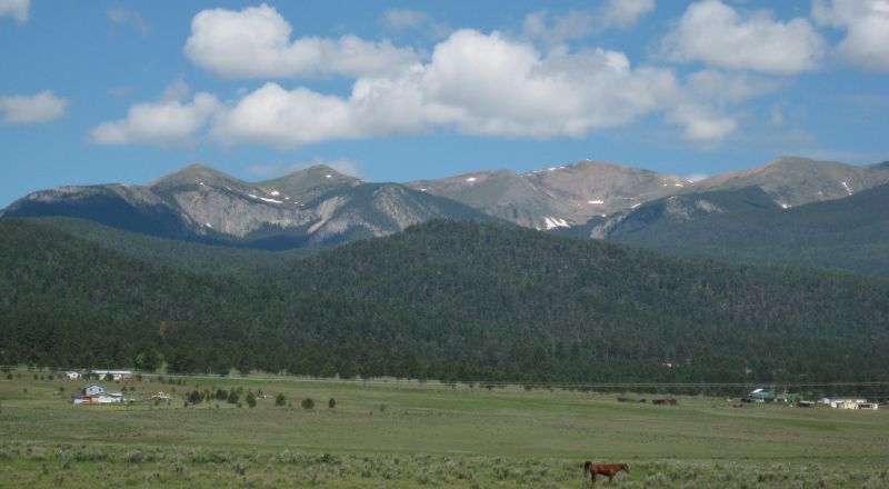
Back to topThe eleventh tallest state high point, Borah Peak stands at 12,662' (3859m). Located in the Lost River Range approximately 20 miles north of the town of Mackay (pronounced Mackie), Borah is Idaho's only active glacier, measuring at around 30 acres. According to the USGS, glaciers form when fallen snow sticks around for long enough to consolidate into ice and are generally accepted to be at least 25 acres in size. The Borah Glacier was formally recognized only in 2021, although it was initially discovered in 1974.
The Snake River Plain around the Lost River Range is interesting from a geological perspective because the region has been stretching for the past 30 million years. The force of the stretching crust causes the hot rocks below to melt on occasion and flow to the surface, causing eruptions. This explains the unique formation of the Craters of the Moon National Monument, 70 miles (112km) to the south of Borah. In 1983, the tensional forces resulted in a 6.9 magnitude earthquake centered at the base of the Lost River Range, which caused Borah Peak to rise one foot and the valley below it to sink by approximately eight feet. I'm sure the hike would have been much easier without those extra nine feet.
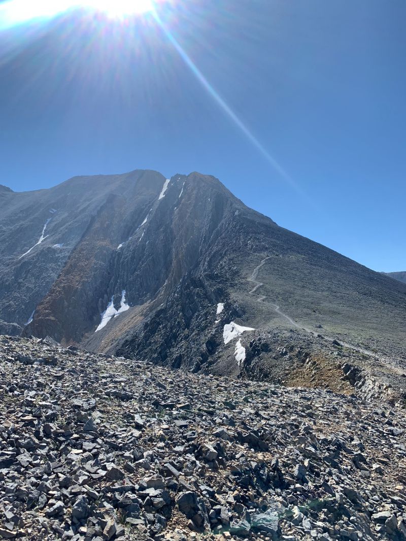
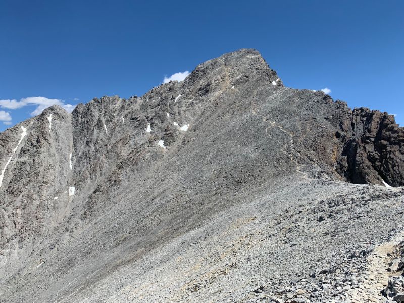
The Borah Peak trail can be broken into three parts: 2.5 miles of steep hiking, Chicken Out Ridge/snow bridge, and saddle to summit block. I was already exhausted coming into the hike from two days and 36 miles on my feet in the Tetons right before, with exceedingly poor sleep on top of that. Even without reading the reviews for Borah, just the stats on Alltrails were daunting enough: over 5400' (1600m) of elevation gain in 4 miles (6.4k). Luckily I was able to snag one of the campsites at the trailhead and managed a fairly good night's sleep prior to tackling this mountain. Even so, I decided to take it easy, so I would not burn myself out, and started around 9am.
The first mile gains around 950' (290m) while traveling through a high desert/pine forest landscape. The second mile is where it really gets fun, however, with approximately 1600' (488m) of elevation gain. This is the most brutal section of the hike, in my opinion, as it is difficult to feel secure in the footing, and there is not even a moment of respite from the steep grade. At the end of this section, the trail briefly flattens out, and you get the first view of the peak as well as the rest of the route: Chicken Out Ridge and the snow bridge. The view is overwhelming, both in its grandeur and in the realization of what is yet to come.
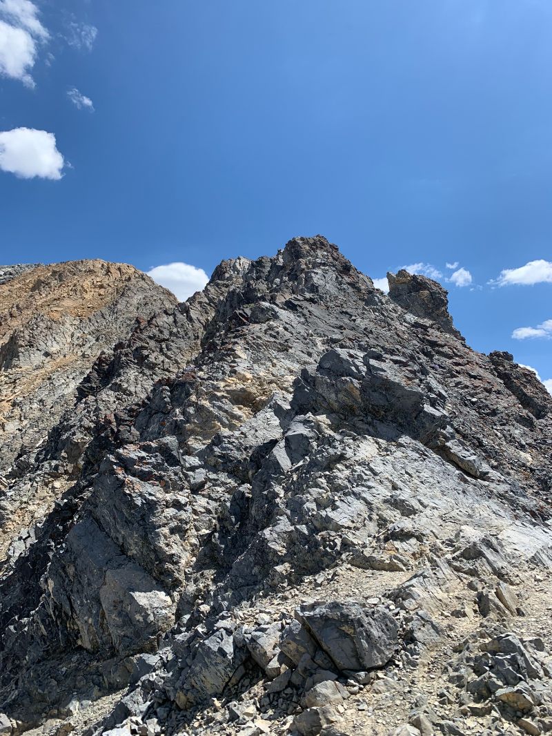
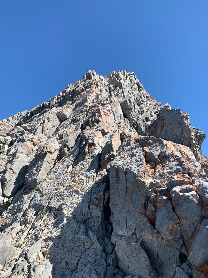
As I began the steep ascent towards Chicken Out Ridge, I was relieved to come across the first group of people I had seen all day. I stopped and chatted with them for a while before (incorrectly) continuing to the right along a cliff and scaling a class 4 rock face (with lots of comfortable handholds and footholds). Little did I know that I had found a sketchier and more exciting alternative to the beginning of Chicken Out Ridge. I should note that I felt 100% secure and comfortable the whole time, not like on some of my other scrambles, and had I not felt this way, I would have retraced my steps. After my slight detour, I briefly found myself on the correct path before once again unknowingly straying slightly off route. I ended up to the left of Chicken Out Ridge and had to jump over two icy sections before climbing straight up to the "nose": the outcropping of rock just before the snow bridge. After down climbing the nose, I proceeded to cross the snow bridge. Much ado about nothing, in my opinion, at least this late in the year. Earlier in the season I am sure the crossing would be quite a bit more treacherous.
After another quarter mile of fairly easy hiking, I was at the saddle below the summit block, which is a steep and demoralizing 1000' (305m) climb to the peak. There is a marked trail to the left, but I opted to stay on the ridge and scramble up to the top - much more fun. Finally, after 2.5 hours, at around 11:30, I was on the rooftop of Idaho. The steepness of the ascent had taken everything out of my legs, so I was not looking forward to the descent.
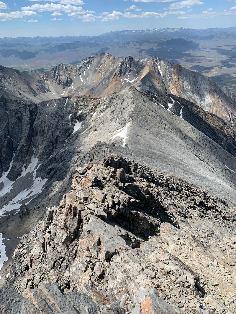
Summitting is only half the battle. Now it was time for the demoralizing downhill. I went the correct way across Chicken Out Ridge this time, and it was so much easier! Who knew that sticking to the trail would be a good idea! (In my defense, I did not realize I was off trail on the way up). I took quite a nice tumble while turning down a steep switchback and attempting to step off the trail to let some uphill hikers pass. Still feel that bruise, three days later while I am writing this. Other than that, the downhill was uneventful. Just the usual digging in for dear life with each step and attempting not to slip on the knee-pulverizing, soul-crushing 30% grade trail. I was back at the trailhead at 2pm and proceeded to make the four hour drive back home to Utah. Hot food has almost never tasted as good as when I got home that night. Conclusions: hardest high point I've done so far, Chicken Out Ridge is aptly named because you'd have to be a real chicken not to do it.
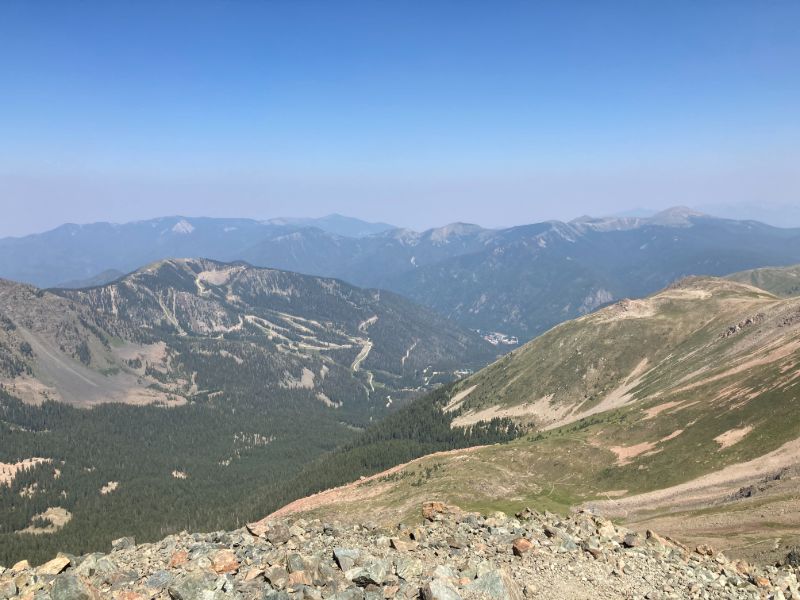
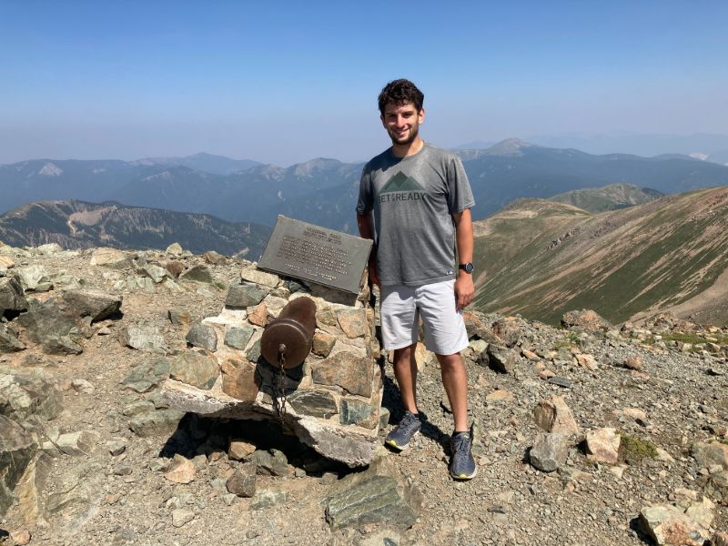
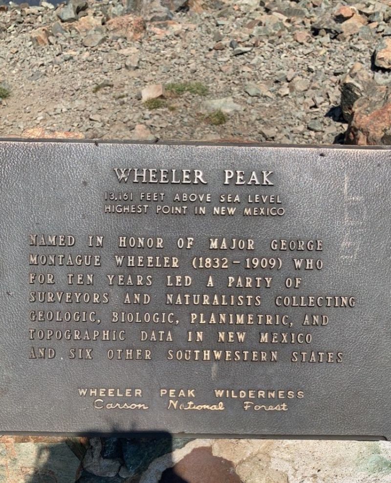
Wheeler Peak, at 13,161', lies in the Sangre de Cristo range of the southernmost Rocky Mountains, around 15 miles northeast of Taos, and just a few miles south of Taos Ski Valley. This mountain is named after George Montague Wheeler, a cartographer thanks to whom much of the western United States was mapped in the 1870s, first through the Wheeler Survey and later through the U.S. Geological Survey. I conveniently found myself here in the summer of 2021 when I was picking up a friend from the Taos Chamber Music Festival. How fortunate I am to have talented friends who lead me to my goals!
The Williams Lake Route is the quickest and most direct way to summit Wheeler. Built in 2011 over a period of two weeks, this trail is quite new compared to many of the others in the U.S. From looking at trip reports and elevation profiles, I thought this route would be mostly runnable or semi-runnable, so I set out to do it despite being on a time crunch. Again, I was wrong (surprise, surprise).
The first two miles are a pleasant jaunt, with around 1000' of elevation gain, to beautiful Williams Lake. The next mile and a half works its way up toward tree line and passes it at around 12000' of elevation. The final mile to the summit kicked my butt. This is where I completely underestimated the difficulty of the hike. Despite the many short switchbacks, the trail practically climbs straight up the face of the mountain on loose rocks (truly living up to the "Rocky Mountains" name). When I looked at recordings of people who have summitted Wheeler, there was at most 800' elevation gain in any mile, which is why I was misguided before starting the hike. I should have looked from mile 4-4.4, where the trail climbs 500', or from 3.5-4.5 where the trail climbs 1000'. On top of this, I was at 13000', which is not an easy altitude to handle. Perhaps if I was not in such a hurry I would have a different assessment of this route, but I was going as fast as I could and therefore was struggling.
The summit was well worth the struggle, though. I met a hiker at the top who had summitted 44 of the 50 state high points, which is epic. After taking in the views for a few minutes, I began slipping and sliding down, focusing all of my energy into maintaining my balance on this treacherous trail. If I or any of my friends are ever accepted into the Taos Chamber Music Festival, I will certainly climb this mountain again.
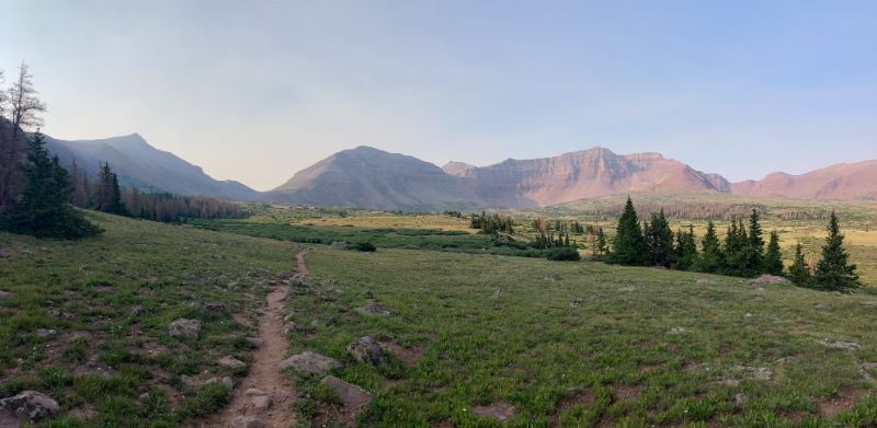
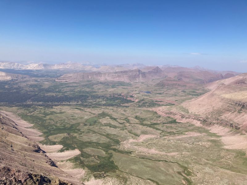
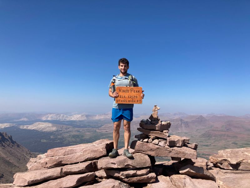
Utah's King's Peak (13,528') via the Henry's Fork Trail is the longest and one of the most beautiful hikes I have completed. The whole time I could not take my eyes off of the absolutely stunning scenery. The peak is quite remote, tucked away deep in the High Uintahs, so any approach is very long. With the trail being over 26 miles long, and with well over 4000' of elevation gain, most people complete it in two or even three days and make the most of the scenery. I, however, was on a mission, so I set out to tackle this beast on a one-day journey.
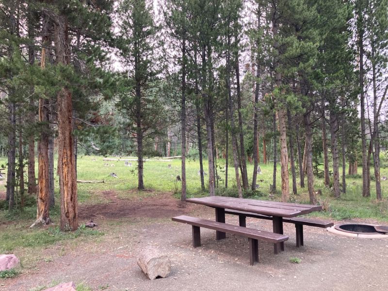
I arrived the night before at the Henry's Fork Campground (also the trailhead), where I intended to spend the night. Planning ahead, I saw some mixed reviews about the campsite; many were also saying that it was quite busy and difficult to find a spot. Luckily, I had no trouble finding a place to set up, likely because I came on a weekday. The campsite was also gorgeous and quite spacious, so my expectations were far exceeded. The road to the trailhead is bumpy and rocky, so it is recommended to have an AWD or 4WD vehicle. Also, there is no cellular service within a half hour drive of the campsite, so luckily I had downloaded all of the necessary information beforehand. I set up camp and settled in for a frigid sleepless night.
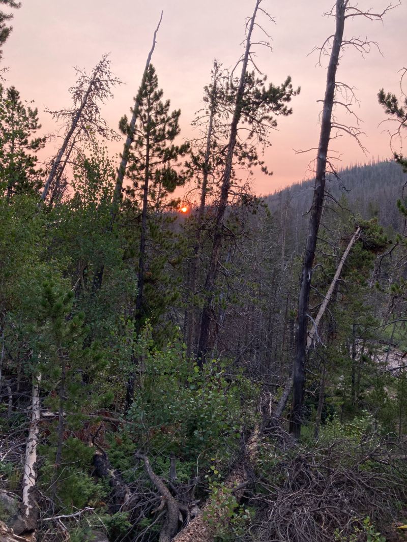
I intended to start at around 4:30am, but when I woke up and heard animal noises, I became too scared to head out alone in the pitch black, so I stayed in my tent until the first light and set off two hours later than my planned start time (this is why I arrived at the White Star Campground by Mount Elbert at nearly midnight that day). Overnight, some smoke had rolled in, so the sunrise was a fiery orange color. I was so enthralled with the scenery that already on my fifth mile I did not notice a concealed rock and took a fall on practically flat ground. Luckily it was not anything serious, and I was able to continue after walking it off (although I suspect the slight twinge in my knee that began in mile 18 was indirectly a result of this).
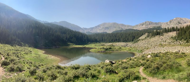
The first five and a half miles lead through a forest at an extremely mellow incline. In the sixth mile, the trail crosses a bridge across Henry's Fork, and, after another mile or so, I found myself in an otherworldly meadow surrounded by the High Uintahs, with Dollar Lake on my left. This is where most people camp in order to break the hike up into multiple days. I made great time in the first 10 miles - approximately two hours - with two stops, one after my fall and one to fertilize the woods. After the tenth mile, the trail decided to get to business.
There is an established "shortcut" on this trail that cuts some of the distance. I am a sucker for shortcuts, so I took it, which, in retrospect, I would not do again. My reasoning was that the main trail dipped back down into the valley after reaching Gunsight Pass, and I did not relish the idea of losing and regaining the elevation for which I had just worked so hard. The shortcut did not drop down; however, it also did not follow a clear trail, so it was not enjoyable. I had difficulty understanding how this was an established trail since I felt like I was trampling the delicate high alpine vegetation under my feet, which was not a good feeling.
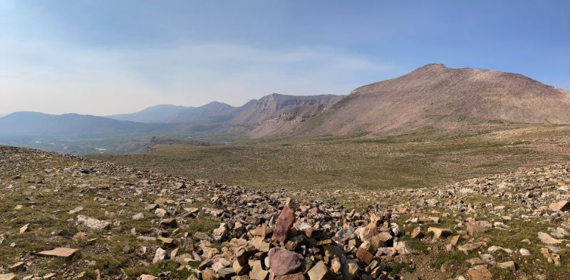
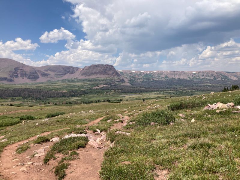
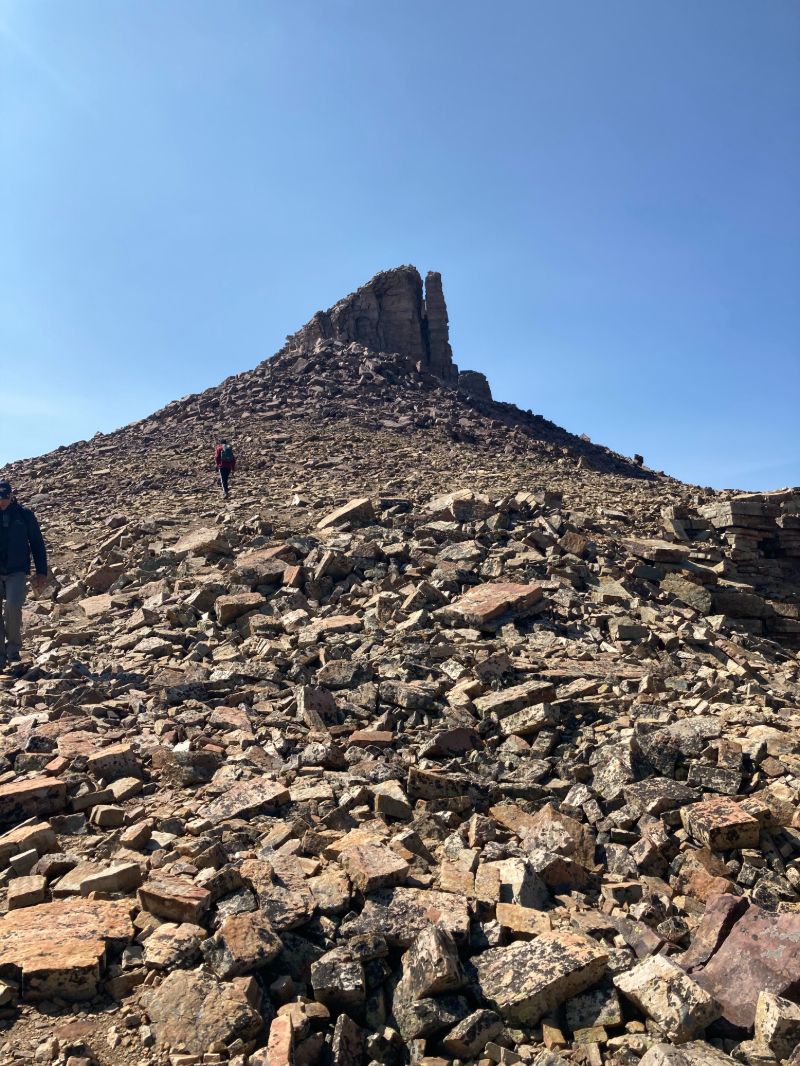
In the twelfth mile, the boulder hopping began and continued to the peak. This is also where I saw the peak in plain sight for the first time. Since this whole area is at a high altitude, and most of the peaks are a similar height, it was difficult to distinguish which one was King's without seeing it before. None of this was on my mind, however, as I was desperately trying not to twist my ankle on the unstable rocks. My pace slowed dramatically. It took me nearly the same amount of time to complete the final three miles as the first ten. Finally, after reaching Anderson Pass, only 0.7 miles and 800 vertical feet stood between me and the peak. I dragged my fatigued body up the loose boulders and summitted at 10:30am. The people at the top were shocked that it took me only four hours to summit and thought that this was some kind of record; I assured them that it was not (and later checked out of curiosity - someone indeed ran the entire round trip in the same amount of time it took me to go one way).
The peak offers one of the most impressive views I have ever seen: over 2000' straight down into the high plain below, which does not resemble a real landscape, but rather a painting. After enjoying the view with a well-deserved lunch for nearly an hour, it was time to head down.

On the return trip, the sky opened up around my 20th mile and released a frigid sleet that I was completely unprepared for: it was early August, and I was wearing shorts and a t-shirt. This, along with the kink in my knee, made for a less than ideal final five miles. However, no amount of rain, snow, or slush could dampen my elation of having summitted this incredible mountain. I was back at the trailhead at 3pm and consumed as much food as I could possibly lay my hands on.
Back to top[ Home | Biography | Schedule | Videos | Mountains | Lessons | Contact ]