[ Home | Biography | Schedule | Videos | Mountains | Lessons | Contact ]


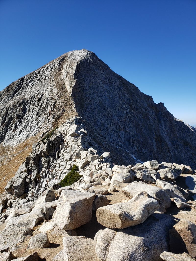
Pfeifferhorn from the
final ridge approach

Pfeifferhorn - October 22, 2020

Strava

Pfeifferhorn is located on the south ridge of the mountains surrounding Little Cottonwood Canyon near Salt Lake City. The Cottonwood canyons in Utah are a hiking and climbing heaven. This 11,332' peak is most often climbed from the Red Pine Lake trailhead, which is approximately three-quarters of the way up Little Cottonwood Canyon. The trail is around 11 miles round trip with 3800' of elevation gain.

Red Pine Lake
Pfeifferhorn is my favorite hike of all time barring Devil's Castle. Perhaps it's the sentimental value of being the first major hike I attempted in Utah, but something about this mountain gives me a sense of inner peace, clarity, and contentment. I especially recommend going in the fall before the first real snowfall to avoid crowds - I only saw two other hikers during my whole outing. I did not successfully summit Pfeifferhorn until my third try; the first time, in May 2020, my friend and I were thwarted by a still considerable snowpack. We did not have the proper snow hiking gear, so we decided to take some aesthetic graduation photos and turn back instead. The second time I was hoping to summit as part of a ridge that crossed from White Baldy, directly to the east. I severely underestimated the intensity of the ridge and the time it would take to traverse, so I was forced to descend straight down from White Baldy (more on this on the White Baldy page).

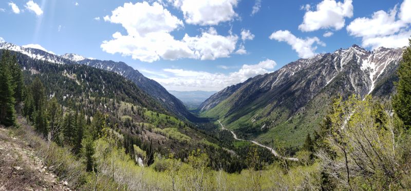
View of Little Cottonwood to the west
The Pfeifferhorn trail can be broken down into four parts. The first part is the trail to Red Pine Lake, which is approximately 3.5-4 miles. This section starts in a beautiful pine and aspen forest and is straightforward throughout. In the second mile, the trees part for a beautiful view of the Little Cottonwood Canyon and Sandy to the west. The trail then re-enters the forest - one of the most enjoyable parts of the hike for me since it is always completely silent - before gaining some steepness and becoming more rocky. After switchbacking for a while, the view opens up to the beautiful and serene Red Pine Lake. This section in itself would make a for a fun family outing, as long as you are acclimated to the altitude (the lake sits at 9600').

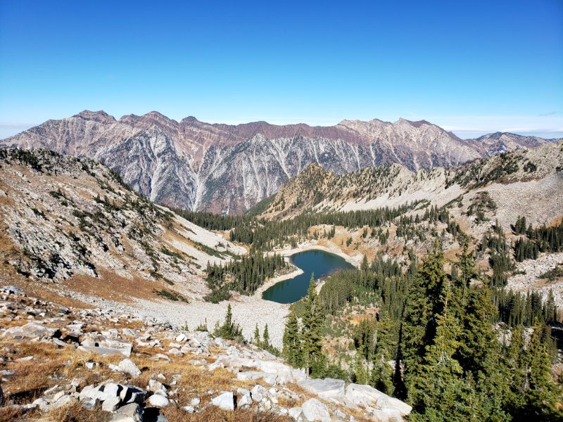
Looking back down at Red Pine Lake and
toward the ridge north of Little Cottonwood
The second part of the trail is the ascent from Red Pine Lake to the ridgeline connecting Pfeifferhorn to White Baldy. This section is non technical, but the trail can be difficult to follow in places, so a map came in handy (I have run into trouble when relying solely on my "instincts" before). It is also brutally steep, climbing 1115' in just over a mile from the lake to the ridge. Here, the trail passes tree line, so I was awarded with a sweeping view of my surroundings. The terrain is predominantly granite, with many slippery loose rocky sections, which, combined with the steepness and altitude, can be quite difficult for those who are not experienced. As I reached the ridge, I finally saw the peak for the first time and was quite intimidated.

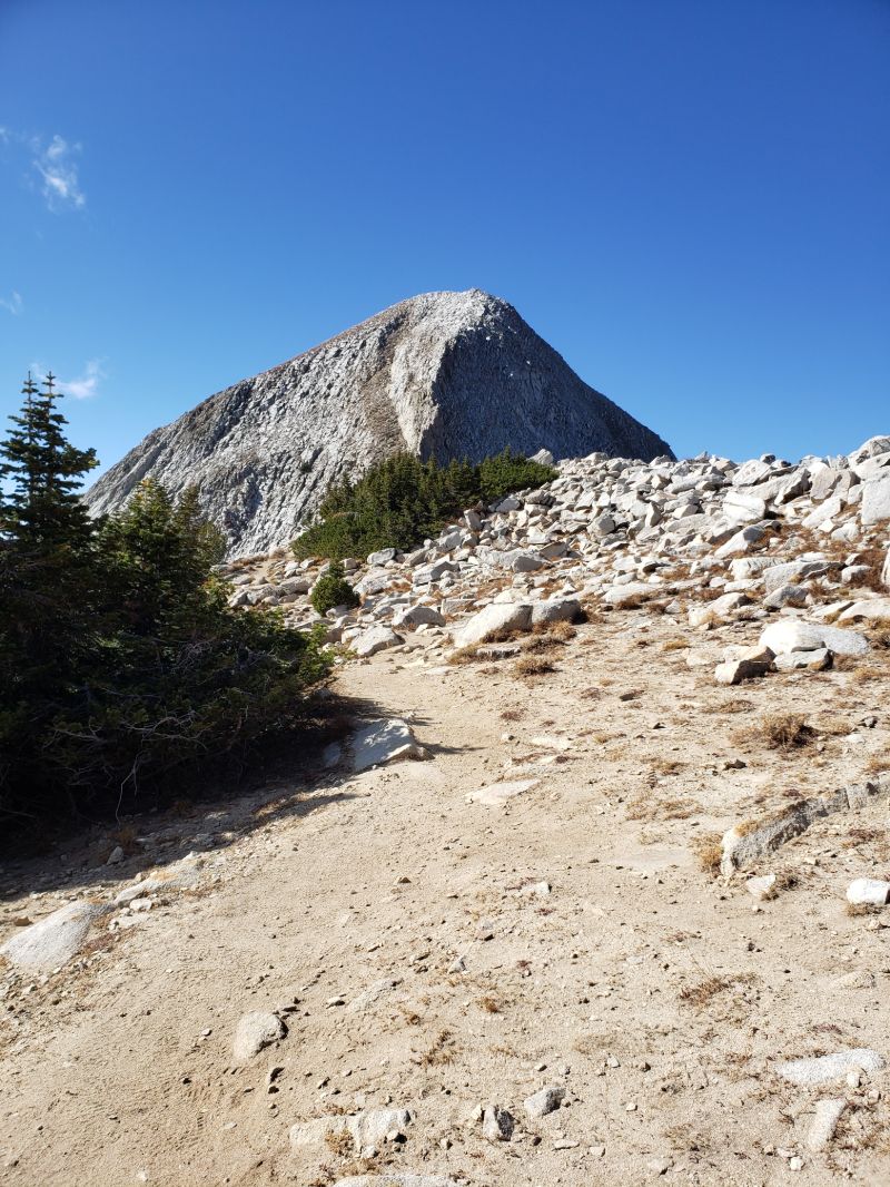
First view of the peak from the ridge
The third section of this trail is the ridge. The ridge itself was a welcome relief because there is a well maintained, relatively flat trail that leads to the base of the mountain, with the exception of one short technical section. The technical section is a few hundred yards and is similar in difficulty to the last section of Lone Peak. Route finding with some boulder maneuvering is required, and there are significant drop-offs on either side. As long as you are in decent shape and are cautious, this should not present a problem. The end of the ridge deposited me at the base of Pfeifferhorn.

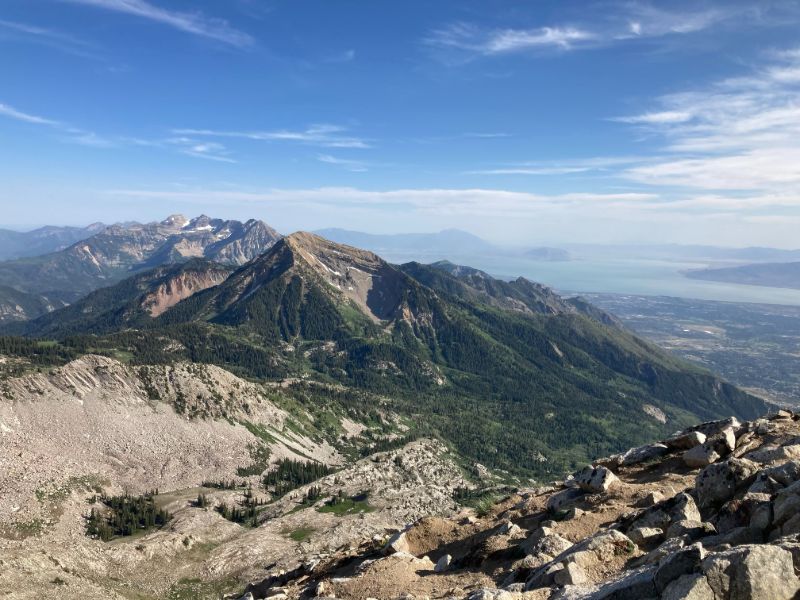
View of Box Elder and Timpanogos to the south
The fourth section of this hike, is the final climb of Pfeifferhorn. Once I reached the base of the mountain, it was a scramble on all fours to the summit, which was actually quite fun because it took my mind off the difficulty of what I had just done. This part was not as exposed, and the end was in sight, so I had a renewed burst of energy. As you might be able to see from the first photo on this page, the trail ascends up the mountain slightly to the left of center. The top boasts some of the most incredible panoramic views of the Wasatch mountains and the valley below, as well as the coldest wind I have experienced on any hike. I took off my gloves briefly to snap some photos and label the various peaks in the area, and my hands promptly started hurting. This is an incredible hike I would recommend to anyone who enjoys the mountains and would like to visit Salt Lake City.


[ Home | Biography | Schedule | Videos | Mountains | Lessons | Contact ]