[ Home | Biography | Schedule | Videos | Mountains | Lessons | Contact ]
Mount Timpanogos, at 11,749', is the second highest mountain in the Wasatch range, and the tallest peak in the Salt Lake City metro area. The Timpanogos massif towers over the cities of Orem and Pleasant Grove and includes the subpeaks of Bomber Peak, Roberts Horn, North Timp, and South Timp. There are many routes up Mount Timpanogos, of which the two most popular are Aspen Grove and Timpooneke Trail. I have not done the Aspen Grove route, so this post will be about the Timpooneke trail.
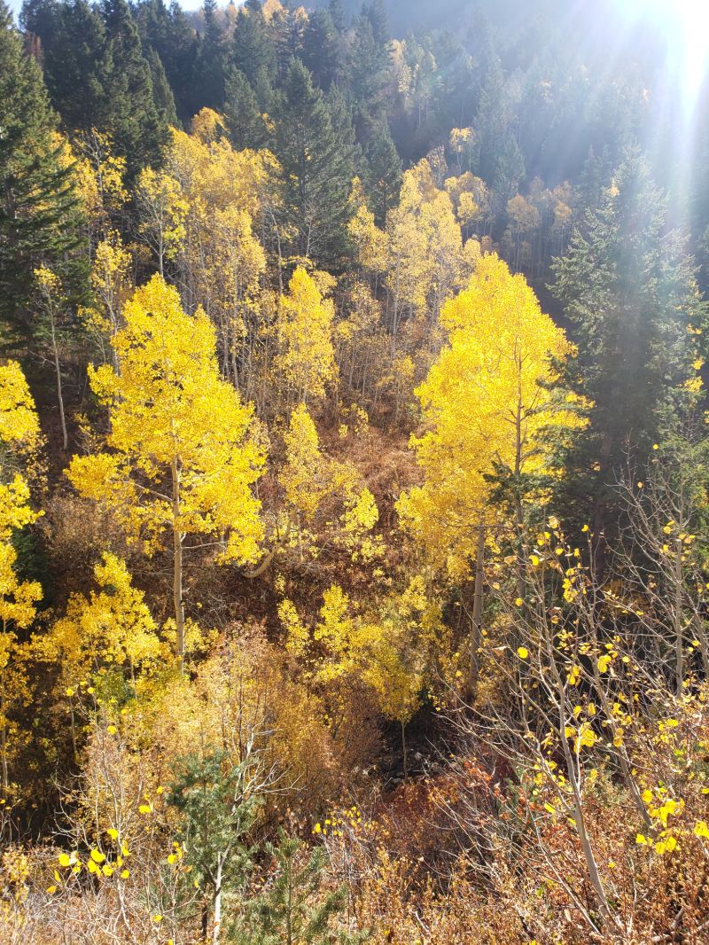
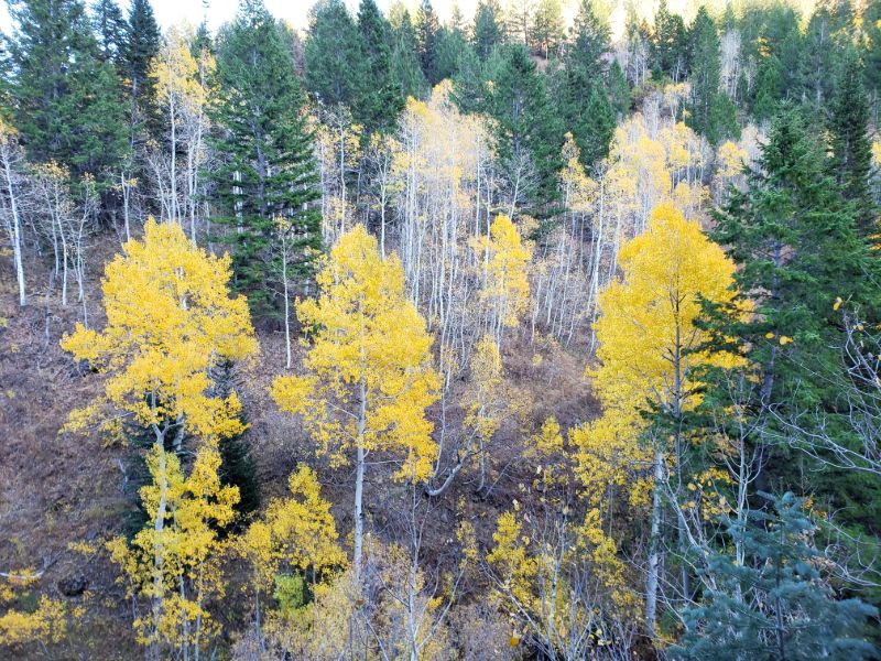
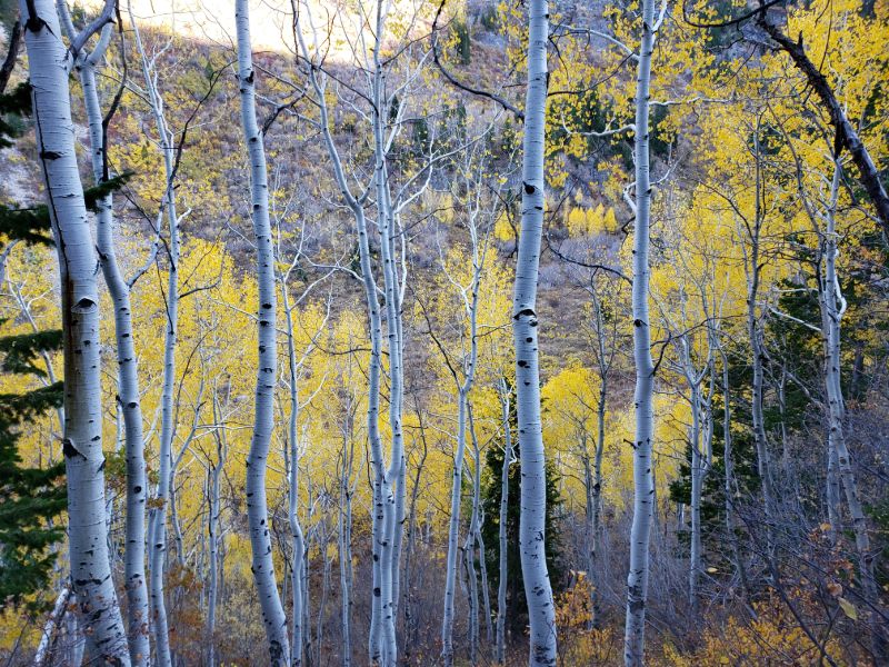
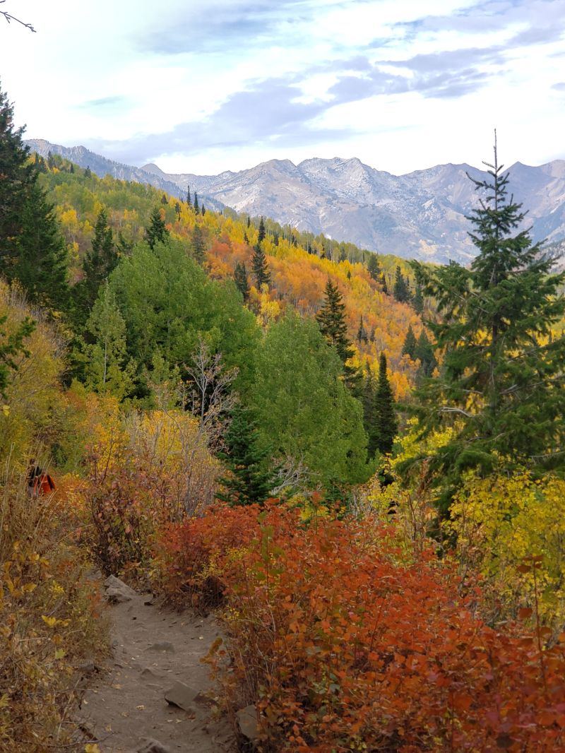
This is among my favorite hikes in the Salt Lake City in the fall; the leaves are absolutely spectacular. I have completed this trail three times: once in the summer and twice in the fall. In the summer it is a nice escape from the valley heat; in the fall, layering is required because it is almost always windy and cold at the peak.
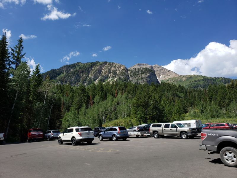
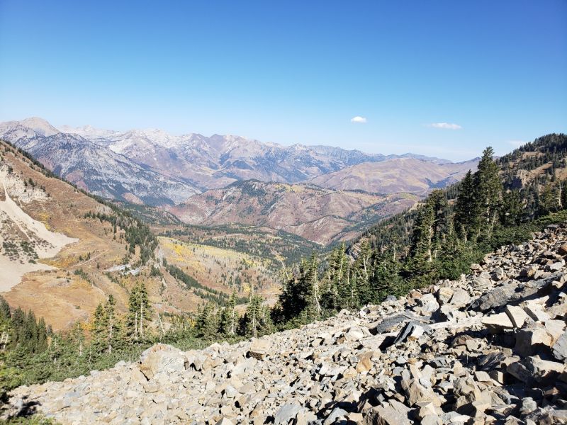
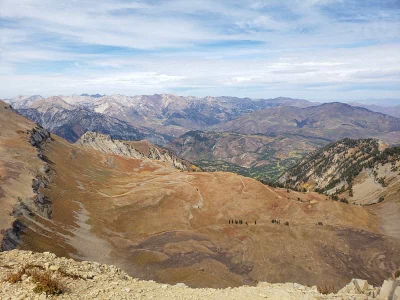
The Timpooneke route is approximately 15 miles round trip with 4500' of elevation gain. The trail is non-technical throughout, so anyone in decent shape can complete it within a day. The route begins in Timpooneke campground, which is tucked away in the forest along the Alpine Loop Scenic Byway. The first five miles of the trail are straightforward. There are a few small waterfalls along the way and two somewhat lengthy and steeper rocky sections, but overall it is consistently moderate throughout this sections, with a few expansive views toward the mountains around Little Cottonwood Canyon to the north.
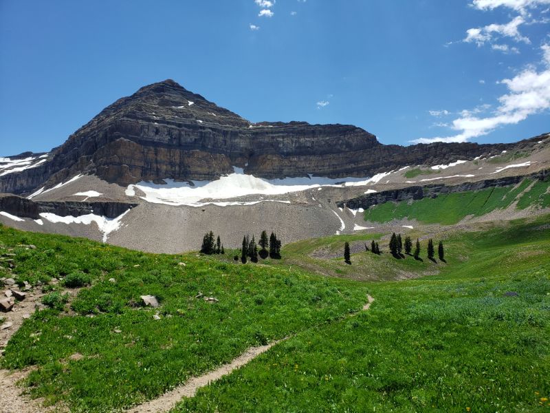
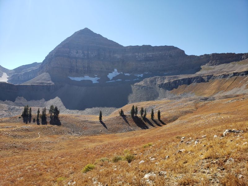
In the sixth mile, the trail arrives at the Timpanogos basin. This is also the first view of the actual mountain, which, on my first attempt was quite startling and a bit discouraging. The pyramid-like peak towers austerely above the basin; it is impossible to miss. The basin is also where some people choose to camp if summitting for sunrise (Timpanogos is a very popular sunrise hike in the summer).
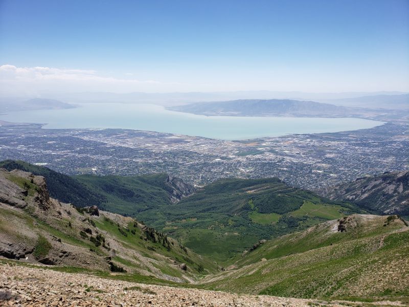
After crossing the basin, the trail begins switchbacking somewhat steeply toward the saddle between Mount Timpanogos and North Timp. This section can be a bit treacherous before all of the snow melts off since it is easy to feel like you are going to slide back down into the basin. Arriving at the saddle, I was amazed by the view into the Salt Lake Valley down below. After hiking for 6.5 miles, this is the first view of the valley on the trail.
From the saddle, the trail continues left toward the summit. After 0.3 miles, the trail veers sharply left and begins climbing up through a chimney, which in hiking terminology means a column of rock rising above its surroundings or isolated on the face of a slope. This is also where I saw mountain goats the first time I went.

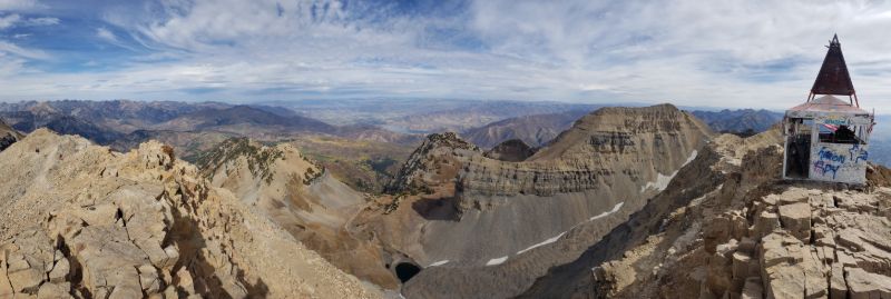
The last section to the summit is the hardest because it is steeper than the rest, and the altitude is non-trivial. The summit is marked by a small shack, which was used as an observation deck in the '60s. Here you will see some of the best 360° views of any mountain in the Salt Lake City area. Not only are there unobstructed views of the entire Salt Lake Valley, Utah Lake, and the Great Salt Lake in the west, but it is also possible to see as far as the Uintah range to the east. I would say that the average person can complete this hike in somewhere between 6-10 hours, while there are also some intense trail runners who have done the entire thing in 2 hours and 15 minutes. I am excited to climb this mountain again someday!
[ Home | Biography | Schedule | Videos | Mountains | Lessons | Contact ]