In the hydrologic cycle
which means that the water that falls to the ground in the form of rain, snow, etc will either soak into the groundwater, runoff into surface streams, or be evaporated from the surface or transpired through plant leaves.
In the U.S. the average precipitation is on the order of 30 inches per year; of which 8.9" runs off into streams, 0.1" infiltrates the ground, and 21" is returned to the atmosphere via evapotranspiration.
The water that infiltrates the ground will percolate (seep) downward through porous and permeable soil, sediment, and rock until it reaches an impermeable unit.
Porous means having void spaces between grains. Permeable means the voids are connected so water can pass through.
Porous and permeable materials include soil (if not too clay rich), sand, sandstone, limestone, fractured igneous and metamorphic rock, vesicular basalt and scoria.
Impermeable and/or non-porous materials include clay, shale, non-fractured igneous and metamorphic rocks.
Porous/permeable layers are called aquifers; impermeable layers called aquicludes.
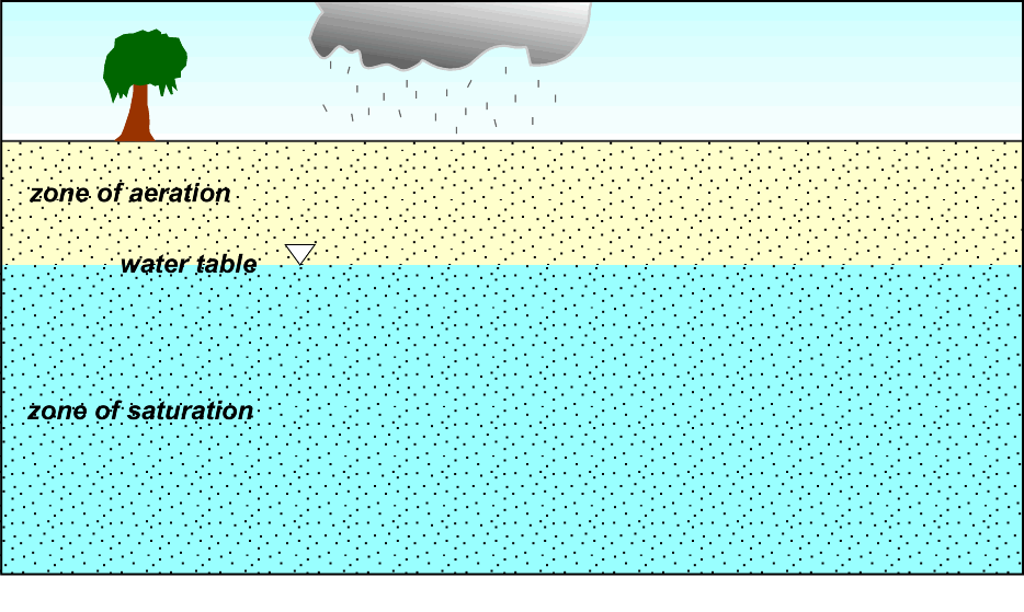
In an unconfined aquifer the zone of saturation (all voids filled with water) lies above an aquiclude; the top of the zone of saturation is the water table. Above this is the zone of aeration (voids filled with air, though grains may be wet - coated with water).
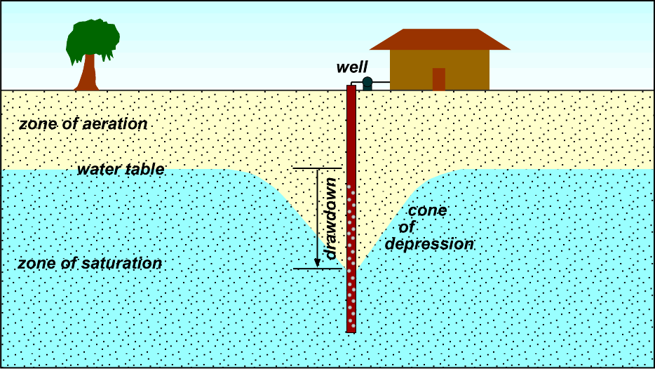
Pumping a well in an unconfined aquifer can lower the water table in a cone-shaped pattern around the well because it takes time for water to seep between grains; the total amount the water level drops in the well is called the drawdown; the area affected by the pumping is called the cone of depression.
Water table elevations generally follow the topography (lay of the land); water tables are high where the land is high and low where the land is low.
Water seeps into the ground in recharge areas, which are usually higher areas, and water is removed from the ground in low-lying discharge areas, such as lakes, streams, and springs.
In a confined aquifer aquicludes or confining units lie above and below the permeable aquifer units. The water to which level rises in a well tapping a confined aquifer is called the potentiometric surface (pressure surface). In most confined aquifers the water is under pressure (water rises above the top of the aquifer in a well). This condition is known as artesian. A flowing artesian aquifer (well) is one in which the water in a well flows to the surface (the potentiometric surface is above the land surface).
Groundwater flows from areas with a higher water table or potentiometric surface to areas with a lower water table or potentiometric surface.
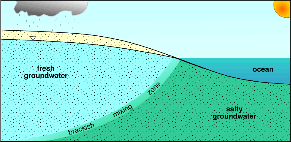
Near the coast a lens of fresh groundwater lies above denser saltwater.
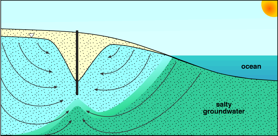
Saltwater intrusion occurs where too much freshwater is pumped out of the ground and is
replaced by brackish and eventually saltwater.
Groundwater pollution may occur
where toxic materials are dumped (eg. at a landfill). Rainwater
leaches toxic chemicals from the dumped materials and percolate down
to the water table. The toxic laden groundwater may contaminate local
wells. Proper landfills are now designed with impermeable liners and
caps.