|
|
by Joseph Brennan. Copyright 2001, 2002. |
Worth StPassenger service: 1904-1962.Existing abandoned portions: 2 platforms (on tracks in service). Touring: 6 trains, running between Brooklyn Bridge and Canal St. Look out the side windows, or the front door window if possible. The platforms are also visible from 4 5 trains, if no local train blocks the view. construction and operationWorth St was part of the first New York subway, opened in 1904. Like most local stations on the line, it is just below street level to reduce stair height, so there is no mezzanine, and it has separate fare controls on platform level on each side. The entrance area on the downtown side is out of the usual rounded rectangle shape because of the available space under the street above, but nothing else is unusual, and a tour of the next open stations, Canal St and Spring St, will give a good idea of what Worth St looked like. The station was lengthened twice. Like all the local stops, it was originally about 200 feet long to accommodate five car trains. The first door of the first car and last door of the last car were left past the platform ends and were not opened. Because of overcrowding, the Public Service Commission ordered the local platforms extended a few yards into the "manholes" at the ends, that is, the space left for access to equipment closets. Completed in 1910, this gave just enough room for six car local trains with only a door of the first and last cars at the platform. The manhole extensions can be best seen at ends of some open stations that have not been fully renovated, including Spring St, Bleecker St, 28 St, and 86 St. The second lengthening was done in 1948 by the Board of Transportation on the downtown side only. Again more easily seen at open stations like Spring St and Bleecker St, the 1948 work provided for the full length of a ten car train (510 feet). The work was done on one side only to save costs. The downtown side was the main unloading side in the business district so was the side chosen. The tile design does not try to match the original but was done to harmonize with it. The New York City Transit Authority decided around 1956 to extend all the old IRT platforms to a full ten cars for local and express trains. At Brooklyn Bridge, the island platforms were to be extended northward not only enough to reach full train length but for an additional distance to replace the curved extensions from 1910 at the south end. Stairs from the new north end rise to a new mezzanine level that connects to the immediately adjacent north mezzanine of the Chambers St station. That mezzanine extends all the way to a large street stairway in Foley Square at Pearl St, just one block south of Worth St. With a good entrance available almost at Worth St, the Brooklyn Bridge station in effect took over the function of Worth St station. When the Brooklyn Bridge station improvements were complete in 1962, it was renamed Brooklyn Bridge--Worth St, and Worth St station closed. |
diagram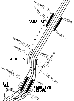
Worth St was always closer to Brooklyn Bridge station than to Canal St station. The extension of the former closed the gap to less than a trainlength. The location was probably influenced by the courthouse buildings around Foley Square. There was a streetcar route in Worth St, but it was just a downtown terminal branch off the Second Ave streetcar line at Chatham Square running to Broadway, and thus as part of a north-south route it would not be an important connection. The wall of the downtown platform continues in a straight line along the line of Lafayette St, to open up a space for the railroad clerk and entrance as the tracks curve into Foley Square. It can appear that the tunnel originally ran straight but it did not. Lafayette St itself was created by cutting through blocks from Worth St to Spring St when the subway was built. The downtown side extension north runs to about Leonard St, which is where special structure begins. The tunnel is below sea level from Leonard St to Howard St, and has a brick and asphalt lining. Possibly the planners wanted to avoid a second station in this section. The original 1904 subway is chained as route MM (mnemomic "Manhattan Mainline") from Brooklyn Bridge up to Times Square. The zero point is at the original and presentday south end of Brooklyn Bridge station. The numbers shown represent rounding to hundreds of feet. A ten-car train is 510 feet long. |
|
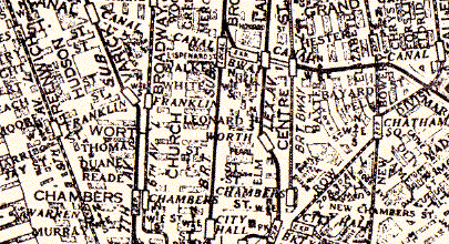
An enlarged detail from Travelgide's How to Find Your Way in New York, 1928, shows Worth St station correctly as extending from Pearl St to Worth St. Chambers St and Canal St were important crosstown streets with street railways. The elevated railway builders found the distance called for a station in between, sited at Franklin St for the Ninth and Sixth Ave Els, and of course at the important junction at Chatham Square for the combined Second and Third Ave Els. The subway thus followed the accepted idea in having a station. However, of the four later subways, only the Seventh Ave has a stop between Chambers St and Canal St. The two BMT lines, shown in Centre St and Broadway, and the IND, built after the map date, do not. |
A Hagstrom map of 1945 shows the vicinity cleanly and clearly as usual. The station circle is shown at Worth St itself instead of in the block south (see above). Combined with the offset of the Brooklyn Bridge station circle a little to the south of the station center, the result is that Worth St appears pleasingly halfway between Brooklyn Bridge and Canal St. Like many small details on Hagstrom maps, it is unclear whether this one is intentional. The crosstown bus (dashed line) in Worth St is a Second Ave bus branch succeeding the streetcar mentioned previously, not a true crosstown route. |
The Red Book guide of 1935 shows Worth St station and times it a little closer to Brooklyn Bridge. |
|
A generous contributor working in the station in 2002 contributed the following images. |
|
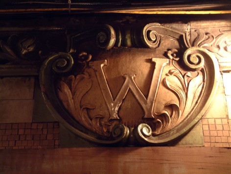
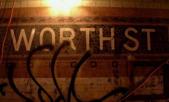
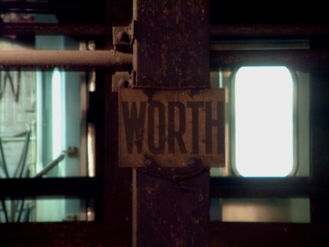
The shield and name tablet are similar to those at open stations nearby. Like many closed stations, Worth St is horribly defaced by graffiti. |

|
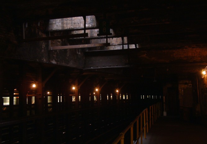
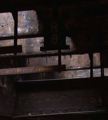
The views above and below show the ends of the uptown platform. The south end (above) has a modern enclosure at the end, with a plain modern door, but the north end (below) shows the extension into the manhole. Mounted over the track is a marker showing where an 8-car train can resume speed after passing over the switch just south of the station. The extended downtown platform continues farther north. |
|
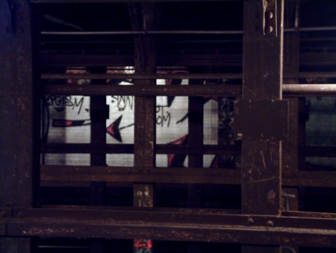
These signs were mounted on the columns between the local and express tracks. Many, below, are now too dirty to read. |
|
|
![]()