
For a feature with such an obvious demographic gravity, we know remarkably little about the Rio Grande’s position within indigenous systems of meaning. Of course, its economic significance to many late Pre-Columbian villages is undisputed. Critical routes upon which traders and others traveled followed the outlines of the river system; in other words, the Rio Grande transported not only water through the landscape but people and exchange goods as well. At the time of Spanish contact, floodwater farming and irrigation were also important agricultural techniques along sections of the river. Earlier anthropologists made much of this latter observation, arguing that the realities of irrigation management strongly structured traditional sociopolitical organization. Wittfogel and Goldfrank (1943) went so far as to suggest that we view the Rio Grande Pueblos as “a waterwork society in miniature”, implying that the Rio Grande was to the Pueblos what the Nile was to the ancient Egyptians (see also influential papers by Dozier 1960; 1961; 1970). Today, we may consider this suggestion considerably overstated (Bugé 1981; Ford 1977); nevertheless the Rio Grande remains an economic lifeline within our broader understanding of the region (Scurlock 1998).
Moving beyond economy and demography, however, we find ourselves on uncertain ground. How did the ancestral Pueblos conceptualize the Rio Grande? How did they experience the river, not merely as a conveyer of water but also as a feature within the larger sacred landscape, as a conveyer of cultural meaning, as a subject of cosmological discourse? Did its unbroken flow across ethnic boundaries lend it a symbolic import that transcended the particularities of ancestral Tiwa, Tewa, or Keresan[1] thought; was the river, in this sense, a shared emblem of sorts, one that threaded the Rio Grande Pueblos together like beads on a string? In short, how was the river narrated by indigenous peoples in the past, and how, by extension, should archaeologists narrate it in the present?
Statements by indigenous groups during the past century equip us with a means of initially approaching some of these questions. The Rio Grande figures prominently, for instance, in the oral histories of the Tewa who live beside the river just north of Santa Fe. The Tewa believe that after emerging from the underworld, their tribe split into two groups—the Summer People and the Winter People—who traveled on either side of the Rio Grande during their migrations southward (Ortiz 1969:15).[2] Once reunited in their present location, the geographic division introduced by the river during their migrations came to serve as the basis of a social division between Summer and Winter moieties within the village. (Note how the Rio Grande, in this sense, has become a structural element of Tewa society.)
Additional details might be drawn from local ethnography, but the potential of this information to shed light on (1) the Rio Grande’s varied uses (both economic and non-economic) and (2) its position within the larger cognized landscape of the Pueblos through time is limited. There are a number of reasons why this is so, ranging from the effects of colonization and the reservation system—which early on curtailed traditional use of much of the landscape—to a simple lack of attention by twentieth century ethnographers to Pueblo understandings of the river. Be that as it may, archaeological study of the Rio Grande and the sites that border it offer an important opportunity uncover the deep history of human engagement with this critical natural and cultural resource.
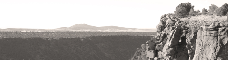
This document, therefore, proposes a five-year survey flanking one key segment of the river: the Rio Grande Gorge of Taos County (Figure 2). The Rio Grande Gorge is located at the northern extent of the traditional Pueblo region, and unlike other segments of the river to the south, the waters here run down the center of a 150 to 200-meter-deep rift valley where the Taos Plateau has been wrenched apart by tectonic activity. The sides of the gorge are a tumble of large basalt boulders, sheer cliffs and scree slopes. Access to the river, consequently, is very difficult, a fact that has largely precluded modern development but that has attracted a variety of recreational enthusiasts (river rafters, rock climbers, hikers, fishermen, and other thrill seekers), many of whom have returned with accounts of Pre-Columbian sites. Some of these sites—primarily petroglyphs—have been photographed and recorded through the committed work of the Taos Archaeological Society, a local organization of amateur, but very knowledgeable, enthusiasts. Systematic archaeological research in the gorge has not been undertaken, however, and the region’s significant potential to shed light on the position of the Rio Grande in the Pueblo imaginary remains a tantalizing potential. It is this potential on which the proposed study seeks to capitalize.
place-making in the rio grande gorge
The Rio Grande Gorge falls within the traditional use area of the two Northern Tiwa-speaking Pueblos, Taos and Picurís (Ellis 1974; Ellis and Brody 1964; Fowles 2004a; Parsons 1936), although other indigenous groups such as the Tewa, Apache, and Ute are known to have also moved through the region regularly. Hundreds of petroglyphs pecked into the basalt boulders and cliffs on either side of the river provide the most visually dramatic evidence of their presence. The majority of these petroglyphs were created in what Schaafsma (1980) refers to as the “Rio Grande Style” and appear to post-date AD 900. Large petroglyph sites in the gorge, however, frequently include a variety of more abstract, highly patinated glyphs that are indicative of earlier Archaic occupations. Considered alongside the many surface finds of Archaic projectile points along the rim of the gorge, such glyphs document a deep history of human place-making that extends back at least eight millennia (Fowles 2004b:129-140). Historic glyphs from various Hispanic and Athapaskan movement through the area as well as modern “graffiti” document the extension of such place-making into the present.
In light of the inaccessibility of the river and the rugged impassibility of much of the terrain, what drew Pre-Columbian peoples into the gorge? Current evidence suggests that one of the earliest uses involved the hunting of large game. At regular intervals, the rim of the gorge is cut away by small side canyons draining the water from the Taos Plateau. Deer and antelope traveling down these canyons in search of water would have been easily trapped when they reached the edge of the gorge. Limited survey in a few such areas has revealed small hunting blinds, chipping stations, Late Archaic points, and, in one dramatic case, an extensive sequence of Archaic petroglyphs (Fowles 2004b:135-140; see also Fowles 2002). Similar hunting techniques may have continued along the edge of the gorge during the subsequent Pueblo period (AD 900-present), although the relatively low occurrence of Pueblo-style projectile points along the rim suggests that this activity became less significant over time.
By the beginning of the twentieth century when the first ethnographic documentation of Taos and Picurís Pueblos was undertaken, no mention is made of the area as a hunting zone. We learn instead that the gorge was periodically visited, for example, by those suffering from rheumatism—natural hot springs bubble up in many places along the edge of the Rio Grande forming pools of steaming water that were considered to have curative powers (Ellis 1974). These visits may have had a spiritual component as well. Indeed, the springs of the Rio Grande Gorge, like those throughout the Pueblo world, were viewed as important sacred places.[3] The range of meanings attributed to these features is unclear; stories told at Taos Pueblo, however, relate the origin of one prominent spring allegedly formed when an aged man of the Summer People, weary from his travels, sat down beside the Rio Grande and disappeared (Stevenson n.d.:File 2.29).
Stories such as these undoubtedly only scratch the surface of the Pueblos’ cognitive engagement with the Rio Grande Gorge. We can safely assume that the striking physical reality of its landscape would have always drawn commentary and reflection, for here is a place where the earth suddenly drops away, opening up expansive vistas of a rocky lower world centered on the sinuous ribbon of water far below. Its materiality and the affordances of that materiality, in other words, are unique: here is where one may look down upon the flight of eagles, where one looks up at the ground surface of human occupation, and where spring-fed pools of steaming hot water form alongside the currents of cold water that race by in the Rio Grande just meters away. It is a place contrast and inversion.[4]
As a decidedly subterranean realm (vis-à-vis those who stand on its rim), it is reasonable to consider the potential associations of the Rio Grande Gorge with Pueblo conceptions of the sacred home of the ancestors. The Taos origin narrative, similar to that at other Pueblos in the Southwest, describes the gradual movement of ancestral humans through a series of lower worlds before emerging out of a lake into the present, upper world (Fowles 2004b; Stevenson n.d.). Most ritual attention related to this ancestral geography is focused on the well-known Blue Lake to which the Taos make a pilgrimage each year to commune with the katsina, the ancestral spirits. Nevertheless, I have also heard it said that the entire rim of the gorge was traditionally regarded as a charged and especially sacred location, raising the possibility that the rim marked the entrance to a place of the ancestors as one descended down towards the Rio Grande.
We must imagine, then, that particular locations within the landscape of the Rio Grande Gorge were cognitively marked as having special significance and spiritual power. The rim of the gorge and the springs located along Rio Grande itself were probably not the only distinguished places in this regard. We know, for instance, that the confluence of two waterways was also considered a sacred location for the many local Pueblos (Richard Ford, personal communication), and it is therefore not surprising that some of the most impressive petroglyph sites in the gorge have been found in such locations. Caves, too, have a profound spiritual resonance throughout the Pueblos—and, indeed, throughout the Americas—insofar as they provide another means of accessing the underworld (Ellis and Hammack 1968).[5] Only one cave site (the so-called "Houses of the Holy" near Pilar) has been recorded in the gorge, and that to a limited degree. Nevertheless, reputable reports and limited documentation by local residents confirm that additional such sites do indeed exist. (I have heard, in particular, of three dry caves of special interest: one said to be decorated with simple pictographs, another housing a scatter of artifacts including a Basketmaker yucca sandal, and a third exhibiting, so I was told, the partially exposed remains of a pre-Columbian human interment.)
To this list of potentially powerful locations, let us also add places of exceptionally high visibility, of which there are many along the rim of the gorge. Research elsewhere in the Taos region has demonstrated a general correlation between shrine features (bermed rock circles, in particular) and locations that command impressive views (Fowles 2004b:522). Whether or not such locations tapped into something more than the naturally contemplative aspects of being able to see for great distances, the correlation offers another means of exploring the logic of place-making in Pueblo landscape generally.
Taken together, the above observations begin to suggest a spatial grammar or set of geographic affordances that may serve as a broad guide as we seek to understand past patterns of conceptual engagement with the Rio Grande Gorge. Geographic spaces in the landscape typically became storied and/or sacred places by virtue of their specific physical characteristics that invited particular readings; meaning, in other words, was constructed in locations already suited to reflection upon boundaries, convergences, the relation between above and below, between inside and outside. As Mary Douglas (1996) would have it, the Pueblos relied upon “natural symbols”—anchored rather than floating signifiers. And herein lies an entrée for research aimed at undertaking a true cognitive archaeology of the Rio Grande landscape.
the survey
On one hand, then, we can describe the geography of the Rio Grande Gorge in such a way as to highlight locations whose characteristics would have naturally made them fertile ground for Pueblo systems of thought. Considering the “subterranean” quality of the region, the entire gorge might well be considered just such a potentially meaningful location. At a more intimate (and archaeologically manageable) level, however, we have already seen that our list of locations would include:
(1) confluences of rivers or major drainages,
(2) natural springs,
(3) caves and small overhangs,
(4) locations with remarkable visibility, and
(5) the entire rim or edge of the gorge.
To these we might also add certain other locations, such as:
(6) former places already marked by Archaic or pre-Pueblo peoples where the tangible signs of those who came before (e.g., petroglyphs, hunting blinds, etc.) would have lent themselves to reflection upon the past, the ancestors and, by extension, the sacred.
Of course, additional locations not predicted above may have figured prominently in past understandings of the Rio Grande Gorge. Nevertheless, this list serves as an effective set of initial expectations underwriting the proposed archaeological survey.
The survey itself has been designed to explore how Pueblo peoples[6] conceptualized the Rio Grande Gorge through a comparison of, on the one hand, the landscape’s natural affordances and, on the other, the actual archaeological traces of past activities. Based upon preliminary reconnaissance work in the region, these archaeological traces are expected to include the following:
(1) Extensive scatters of chipped stone debitage, projectile points and informal tools along the rim of the gorge and, in smaller quantities, within the gorge itself. The majority of these lithic scatters appear to date to the Late Archaic (roughly 1800 BC to AD 900[7]), but Pueblo period lithic scatters are also present. Special attention will be made to diagnostic projectile points from such scatters as well as isolated finds as one means of discussing the relative intensity of activity through time.
(2) Stone hunting blinds in side canyons near their contact with the gorge. Such features are very difficult to date, unless found in clear association with diagnostic projectile points or rock art.
(3) Petroglyphs. As noted above, a great number of petroglyph sites within the Rio Grande Gorge are anticipated. Insofar as appropriate rock faces for the creation of petroglyphs are present throughout the gorge, the distribution of such sites will provide the project with a critical means of exploring how specific cultural meanings were linked to geographic locations (see below).
(4) Rock shrines. After AD 1250 or so, Tewa groups to the south and the Northern Tiwa groups to the east are known to have regularly constructed a variety of rock shrines including cupule boulders, “axe-slick” or grinding boulders, simple upright stones, and both large and small bermed circles (Anscheutz 1998; Fowles 2004b). Research by BLM archaeologists and volunteers engaged in non-systematic survey have documented the presence of few cupule boulders and grinding features in the Orilla Verde Recreation area at the southern end of the gorge. Such features, however, are subtle and easily missed; consequently, many other such features are present.
(5) Dry caves sites. Local residents have repeatedly commented upon the existence of pre-Columbian material in association with cave sites within the gorge. Preliminary exploration by the author in the central portion of the gorge has already located one small cave with dry, largely intact deposits and an associated scatter of chipped stone debitage. BLM archaeologists have located a much more substantial cave complex with multiple entrances, dozens of petroglyphs and a possible human interment. This site—colloquially referred to as “Houses of the Holy”—is on private land in the southern portion of the gorge and may not, therefore, be accessible. Nevertheless, the site underscores the expectation that cave sites, some of impressive complexity, exist within the vast unsurveyed areas of the gorge.
(6) Trails. While extremely difficult to date and complicated by their continued use into the present, trails providing access to particular areas within the gorge are important features that establish the possibilities of regular movement through the otherwise broken landscape. The possibilities for movement that such trails afford today (and potentially afforded in the past) will greatly assist our understanding of how various marked locations may have articulated with one another as past peoples moved throughout the gorge.
Of the site types mentioned above, petroglyphs will clearly present the richest dataset with which to address issues of cultural meaning. For example, one site in the gorge reported by Schaafsma (1992:137) includes awanyu (water serpent) imagery that has a strong association with water and, in this case, the Rio Grande. But the same site also exhibits a number of glyphs of birthing women. Additional female figures, some in apparent birthing positions, have also been located in the Orilla Verde Recreation area at the southern end of the gorge. Why, we must ask, were such images of female reproduction created in these particular points on the landscape? Are comparable glyphs found elsewhere in the gorge, and if so, is there an identifiable association between such glyphs and particular geological features, particular sides of the river, particular zones of the gorge? Are there grounds for positing that the gorge, the river, or various locations within were gendered in specific ways? At a broader level, how do such glyphs relate to the larger corpus of iconography found in throughout northern Rio Grande, and are there grounds for linking particular icons with particular ethnic groups? Unquestionably, the recording and spatial analysis of rock art within the gorge will command a great deal of the project’s energy.sampling strategy
While the archaeological resources within the Rio Grande Gorge promise to be rich, the challenges of pedestrian survey in a landscape characterized by rugged cliffs, canyons and scree slopes are such that the pace of movement and, consequently, the rate of archaeological discovery will be slow indeed, necessitating a careful sampling strategy. The initial study area for the proposed survey is a roughly fifty-five kilometer long segment of the gorge extending from its southern edge at the confluence of the Rio Grande and Embudo Creek to the Rio Grande’s confluence with the Red River in the north (Figure 2). So defined, the study area includes all portions of the gorge that were within the recorded ethnogeographies of both the Tewa and the Northern Tiwa (Ellis 1974; Harrington 1916).
The Bureau of Land Management is the primary landowner within the study area and has lent their support to the project. Access to most portions of the gorge are therefore possible, the most significant exception being the Track A portion of the Martinez Grant owned by Taos Pueblo which includes a roughly fifteen kilometer extent of the eastern side of gorge immediately west of the town of Taos. While both Taos and Picurís Pueblos will be consulted during the survey (particularly in the event that highly sensitive sites are encountered), we will not seek to gain access to Pueblo land and will instead limit our investigations to the extensive holdings of the BLM.
(to be continued...)
[1] Tiwa, Tewa, Towa, Keresan, Piro, and Tompiro were the major languages spoken along the Rio Grande at the time of Spanish contact. These languages more-or-less corresponded to broad ethnic divisions which themselves resulted from a complicated immigration sequence during the late pre-Columbian period (Ford et al. 1972).
[2] The Tewa today view the entire Rio Grande as a sacred “road”, comparable to the cornmeal “roads” that are sprinkled on the ground during rituals to symbolically provide a path for the spirits (Richard Ford, personal communication).
[3] For the Northern Tiwa, all natural bodies of water had an obvious sacred import due to the belief that the katsinas and other supernaturals such as Big Water Man (Pâköalanna) dwelt within them (Parsons 1936:109-110).
[4] Anglo-Americans, of course, are also prone to viewing this landscape as “otherworldly”. Consider, for instance, that the Rio Grande Gorge was chosen as a training site for astronauts in advance of the Apollo 15 mission to the moon, its jagged exposures of rock being viewed as an appropriate simulation of a lunar landscape.
[5] For the few references to sacred caves used by Taos Pueblos, see (Grant 1976:15, Jeançon 1929:7).
[6] While significant numbers of Archaic, Apache, Ute and Hispanic archaeological sites are also anticipated and will, of necessity, be carefully documented, a consideration of these remains is not part of the intellectual core of the project. The research is being undertaken in consultation with Dr. Sunday Eiselt (Southern Methodist University) and Dr. Richard Ford (University of Michigan), specialists in Apache and early Hispanic archaeology, who will incorporate the relevant findings of the proposed project into their own research.
[7] My extension of the Late Archaic to AD 900 is unorthodox, but reflects the likelihood of a continued hunter-gather presence in the Taos District until at least this time (Fowles 2004b). In this sense, it includes what Steve Post has recently referred to as the “Latest Archaic”.
references
Anschuetz, Kurt F. 1998. Not Waiting for the Rain: Integration Systems of Water Management by Pre-Columbian Pueblo Farmers in North-Central New Mexico. Unpublished Ph.D. Dissertation, University of Michigan, Ann Arbor.
Douglas, Mary. 1996. Natural Symbols: Explorations in Cosmology. Routledge.
Ellis, Florence Hawley. 1974 [1962]. Anthropological data pertaining to the Taos land claim. In Pueblo Indians I, pp. 29-150. Garland Publishing Inc., New York.
Ellis, Florence Hawley and J. J. Brody. 1964. Ceramic stratigraphy and tribal history at Taos Pueblo. American Antiquity 29(3):316-327.
Ellis, Florence Hawley and Laurens Hammack. 1968. The inner sanctum of Feather Cave, a Mogollon sun and earth shrine linking Mexico and the Southwest. American Antiquity 33:25-44.
Fowles, Severin M. 2004a. Tiwa versus Tewa: settlement patterns and social history in the northern Rio Grande during the Pueblo IV period. In The Archaeology of the Pueblo IV Period, edited by E. Charles Adams and Andrew Duff. University of Arizona Press, Tucson.
–––––––. 2004b. The Making of Made People: The Prehistoric Evolution of Northern Tiwa Hierocracy. Unpublished Ph.D. Dissertation, University of Michigan, Ann Arbor.
–––––––. 2005. Historical contingency and the origin of Eastern Pueblo moiety organization. Journal of Anthropological Research. 61(1):25-52.
Harrington, John P. 1916. The Ethnogeography of the Tewa Indians. In 29th Annual Report of the Bureau of American Ethnology for the Years 1907-1908, pp. 29-636. Government Printing Office, Washington D.C.
Parsons, Elsie Clews. 1936. Taos Pueblo. General Series in Anthropology No. 2. George Banta Publishing Company Agent, Menasha, Wisconsin.
Schaafsma, Polly. 1980. Indian Rock Art of the Southwest. School of American Research, Santa Fe.
–––––––. 1992. Rock Art in New Mexico. Museum of New Mexico Press, Santa Fe.
Scurlock, Dan. 1998. From the Rio to the Sierra: An Environmental History of the Middle Rio Grande Basin. General Technical Report RMRS-GTR-5. U.S. Department of Agriculture, Forest Service, Rocky Mountain Research Station, Fort Collins, CO.