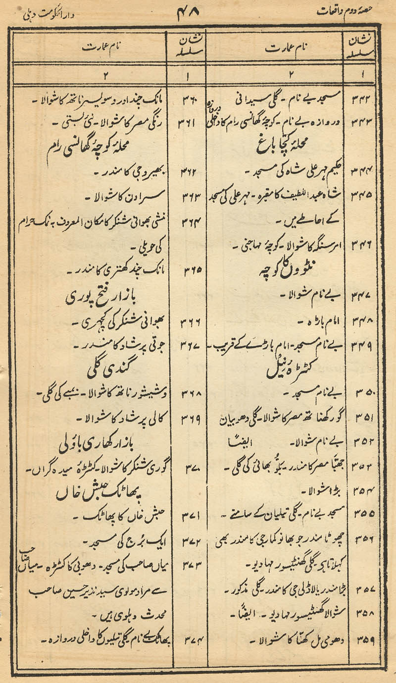
|
|
|
|
|
|
| 1 |
 |
 |
 |
 |
| 2 |
 |
 |
 |
 |
| 3 |
 |
 |
 |
 |
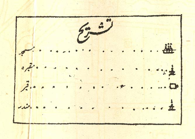
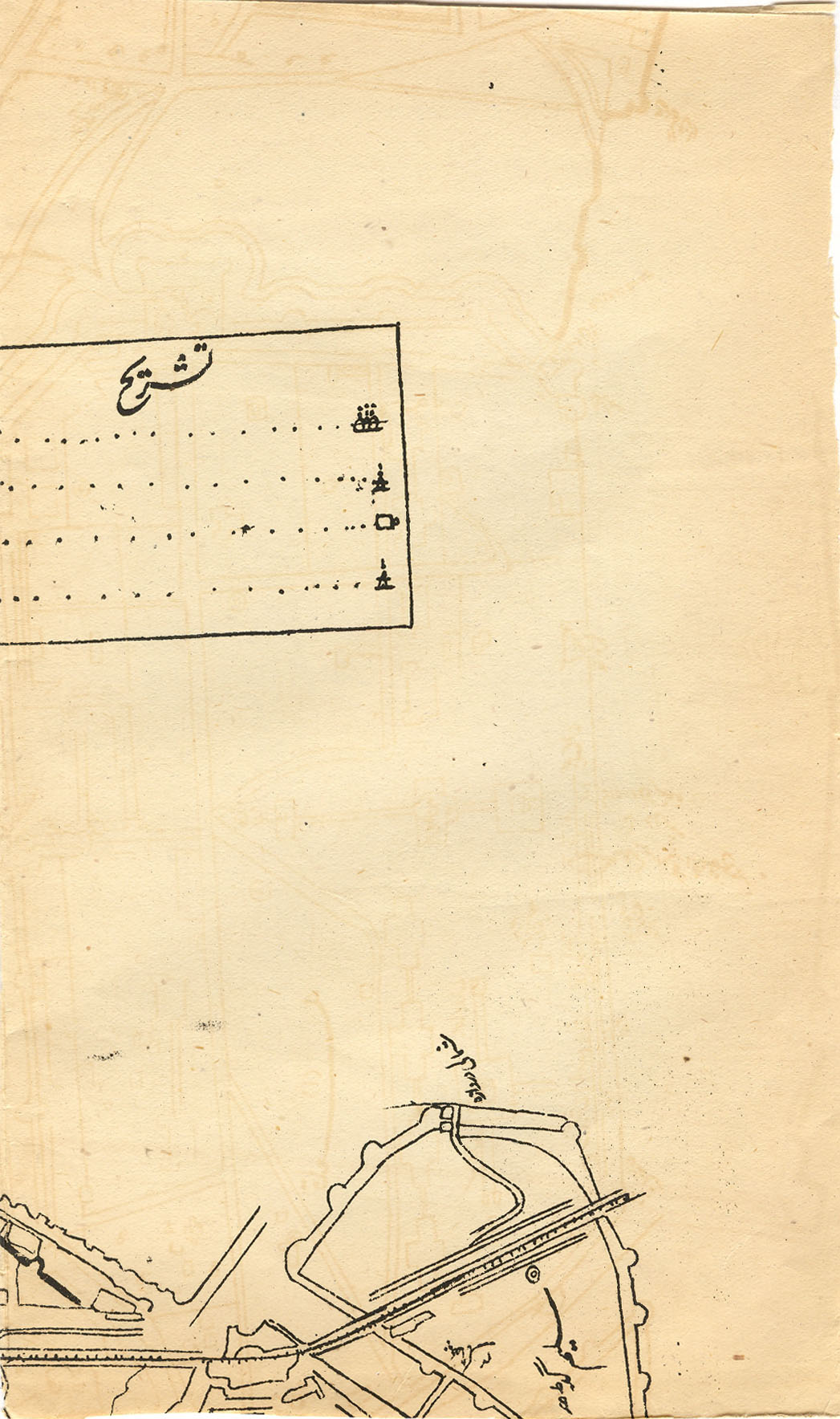
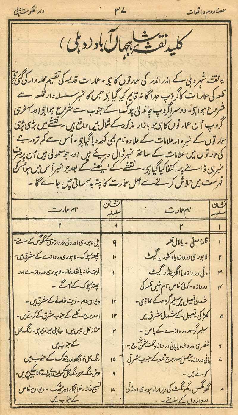
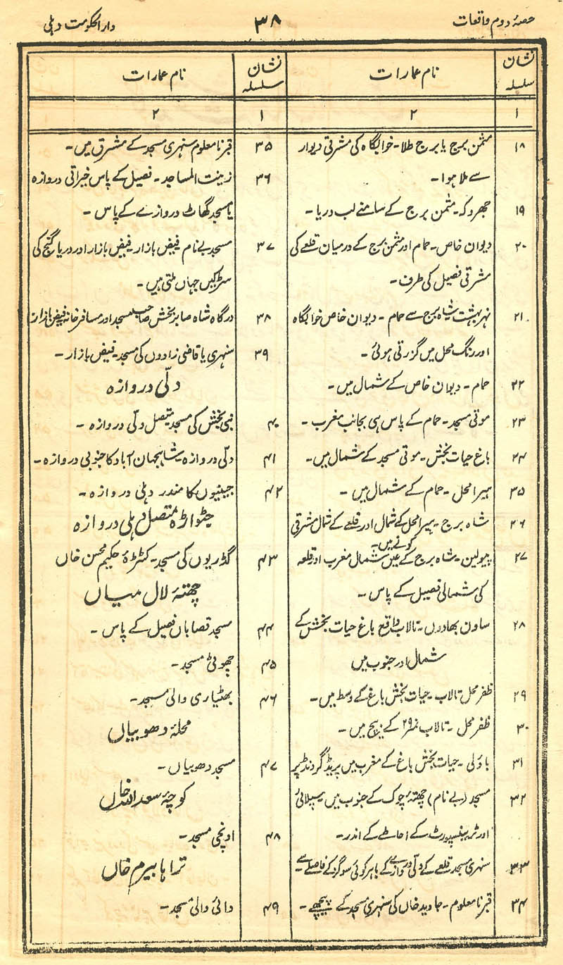
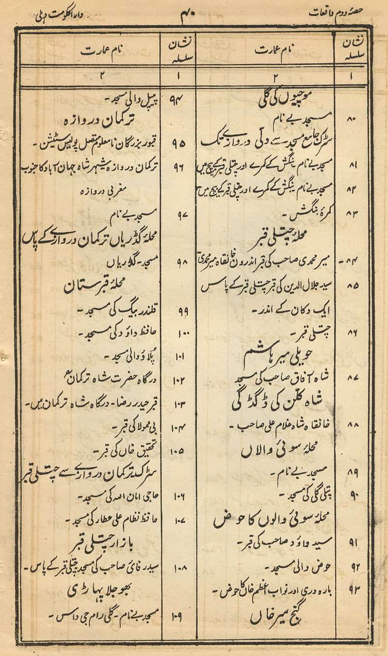
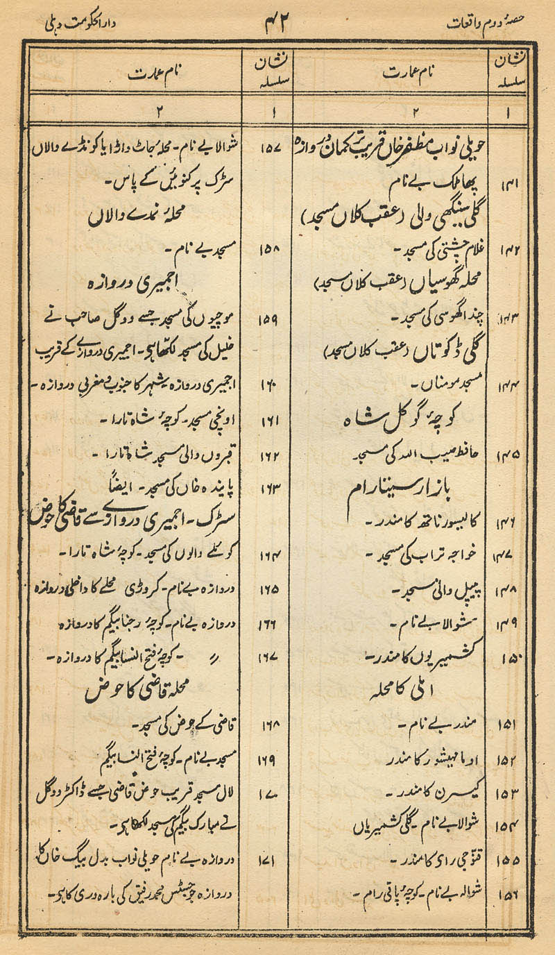
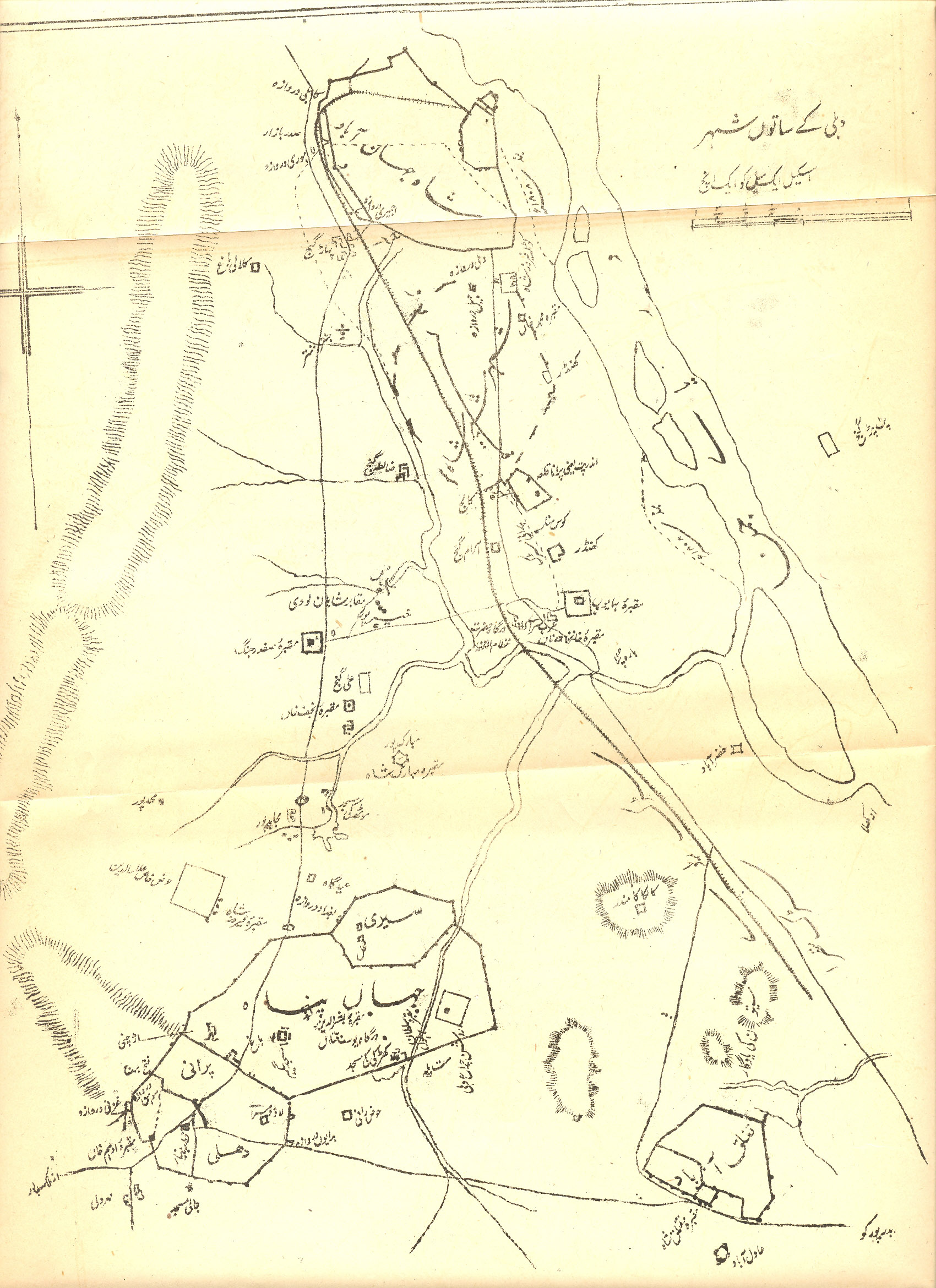
*map title*; *key to symbols*
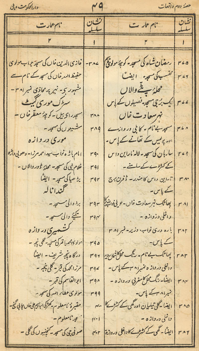
|
|
|
|
|
|
| 1 |
|
|
|
|
| 2 |
|
|
|
|
| 3 |
|
|
|
|
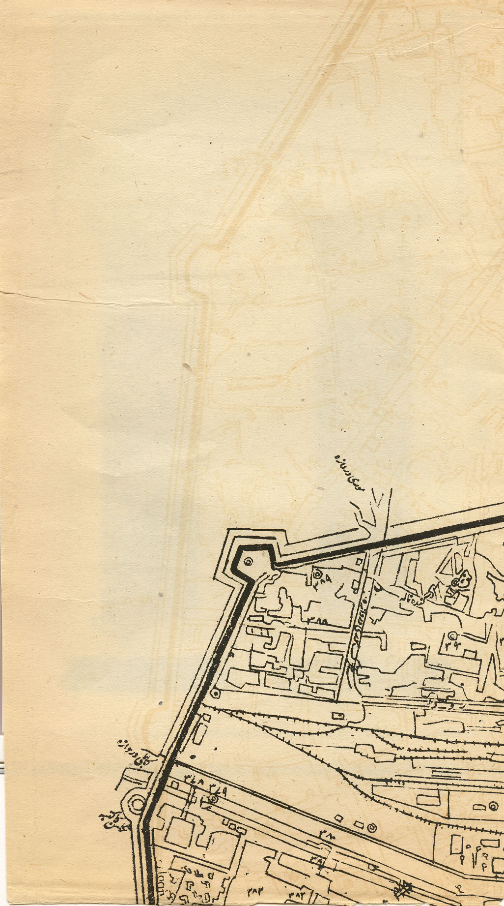
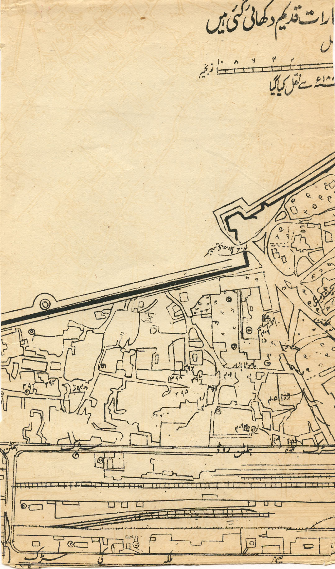
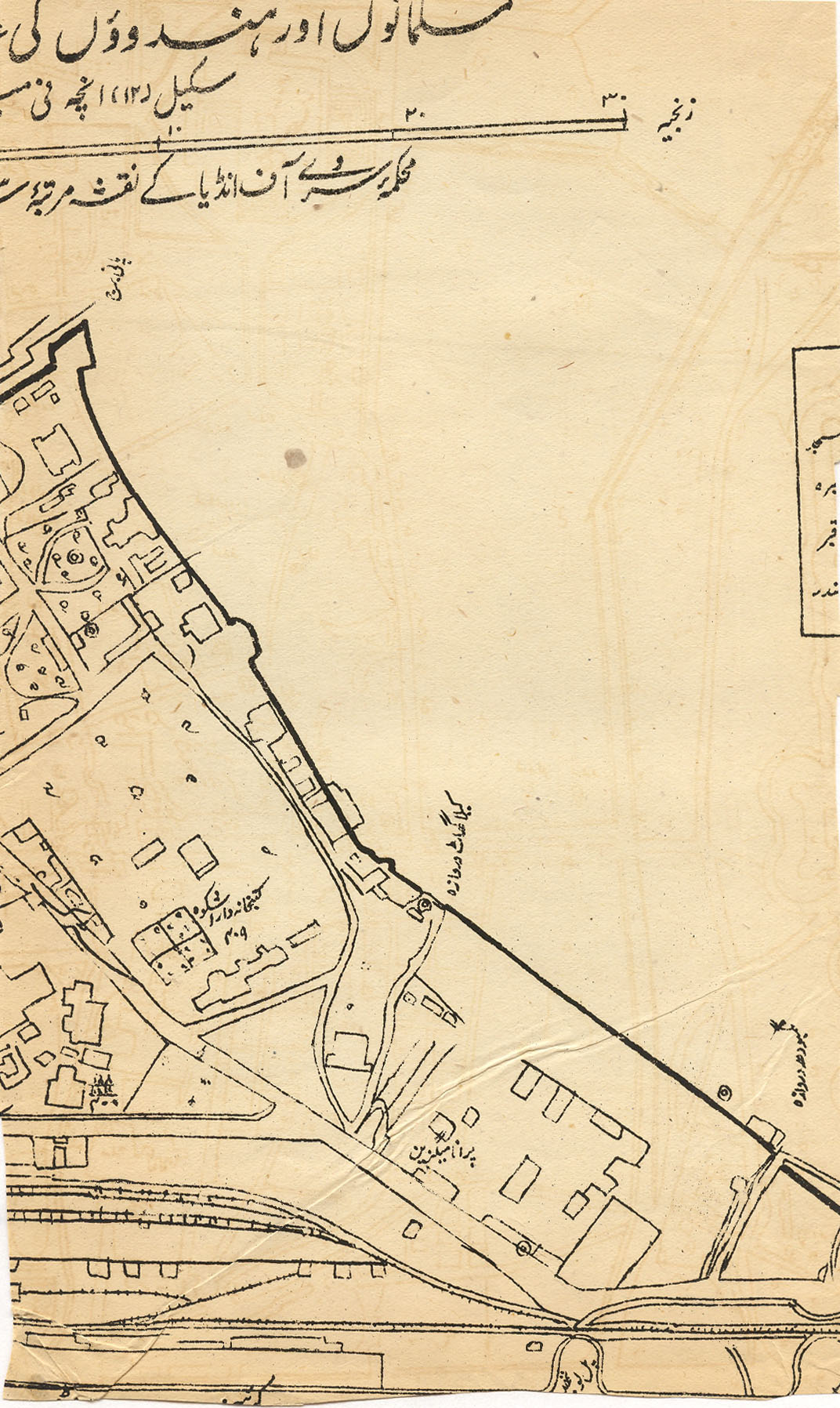
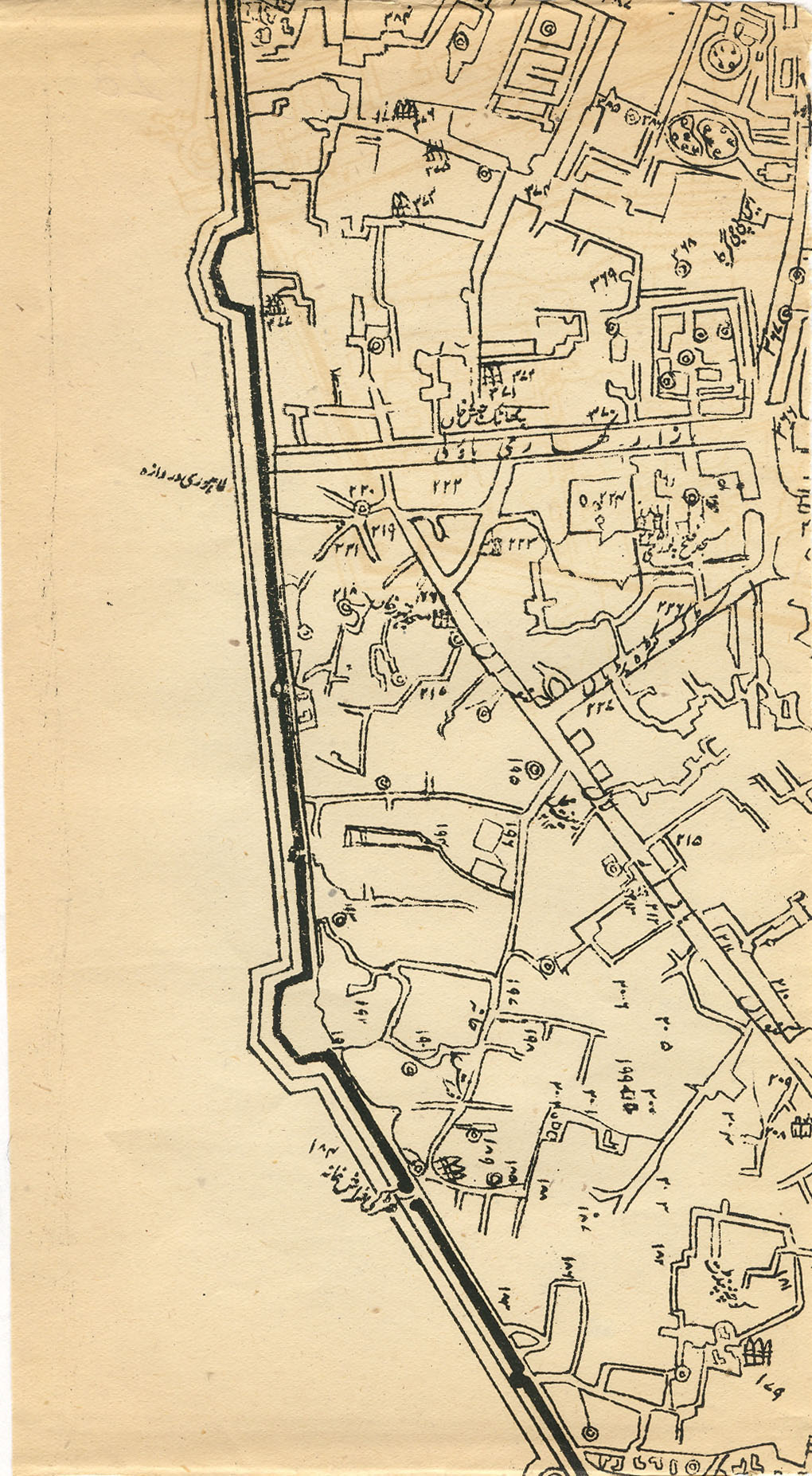
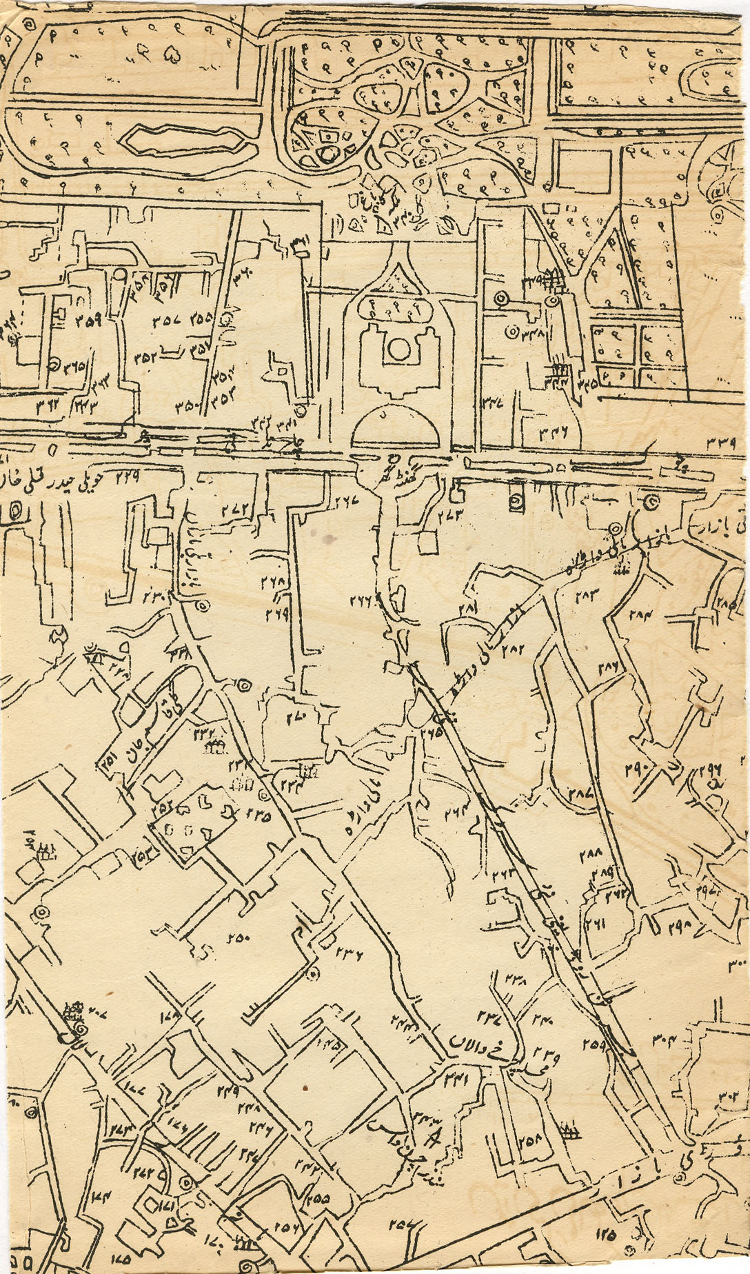
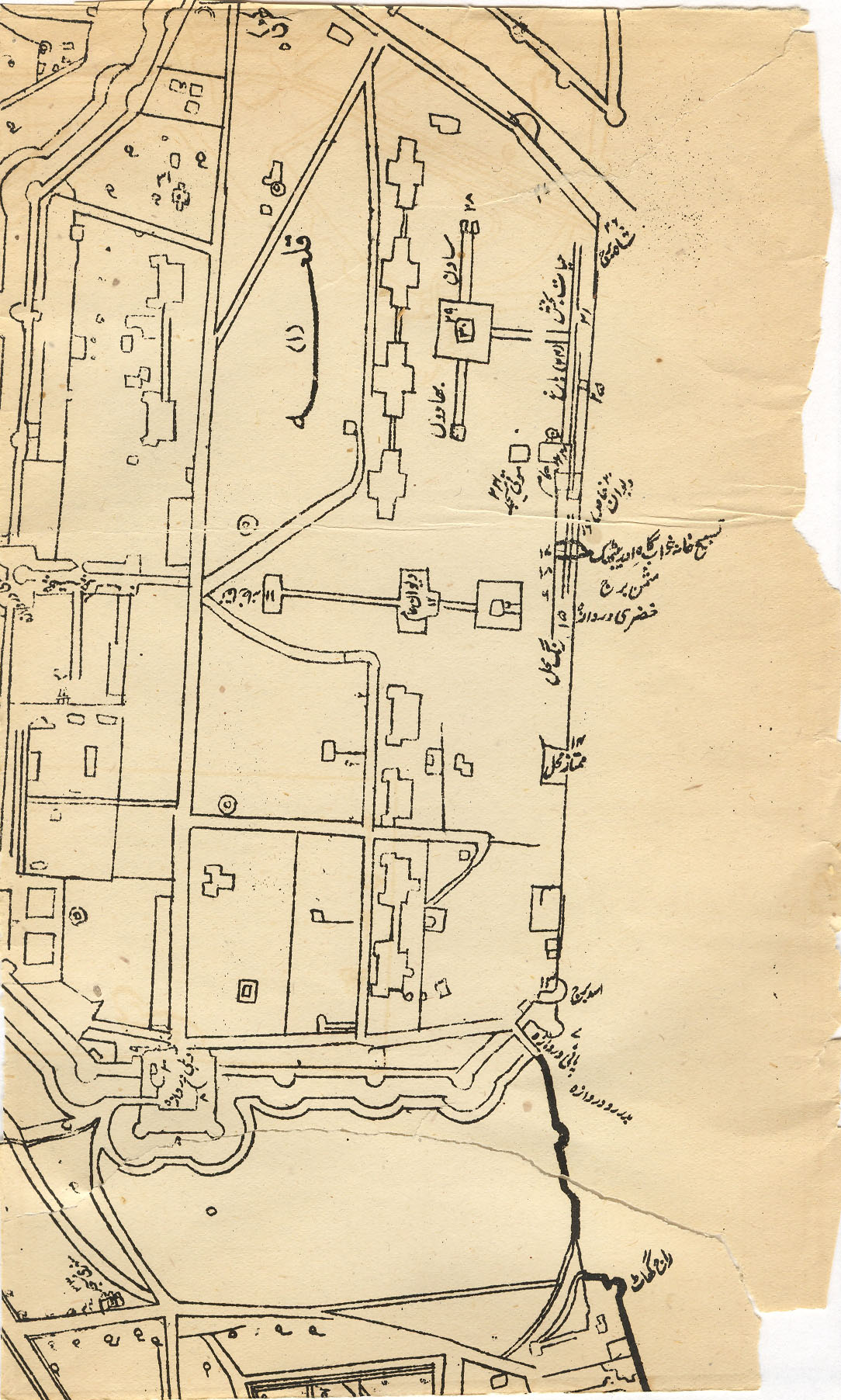
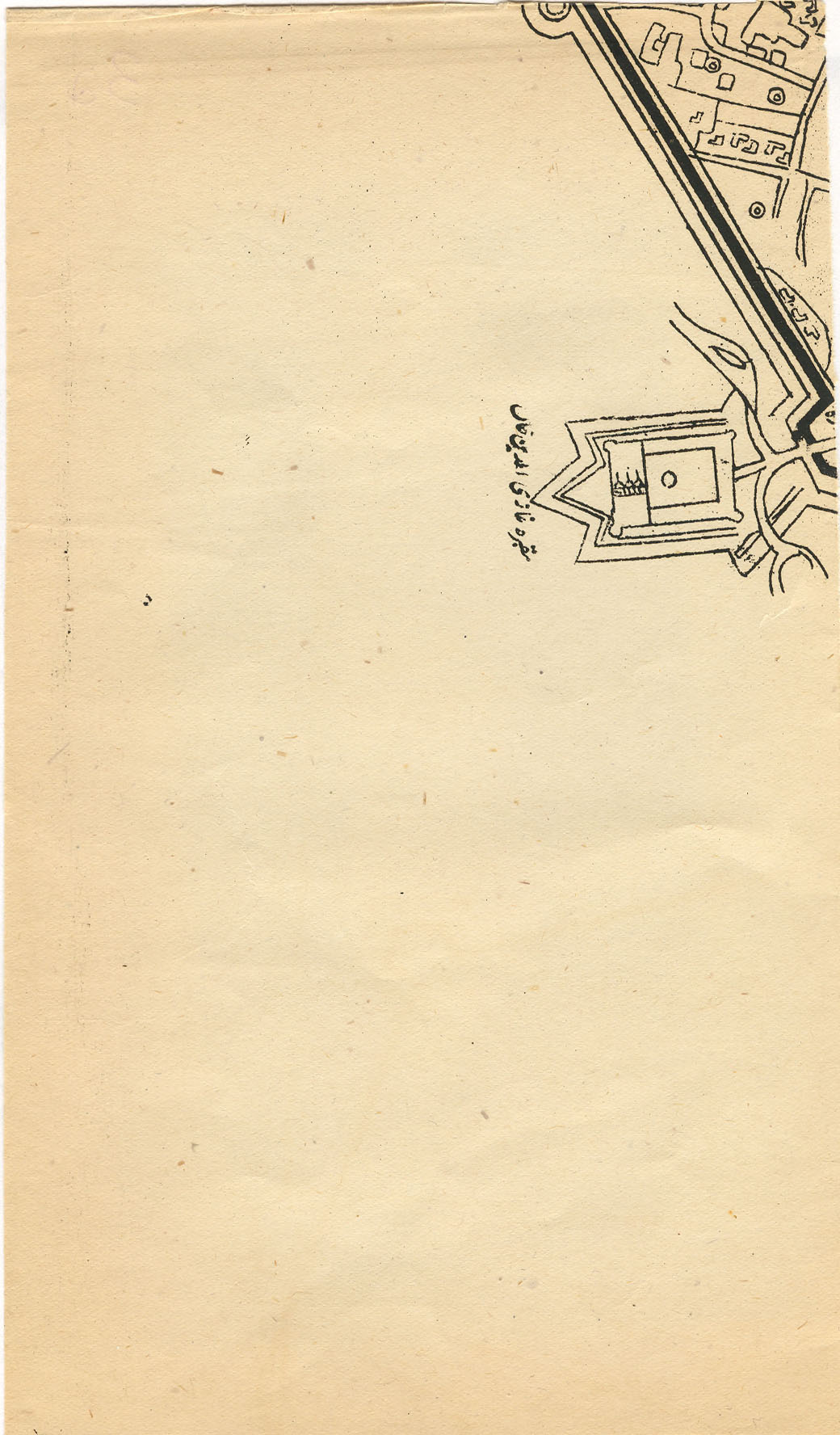
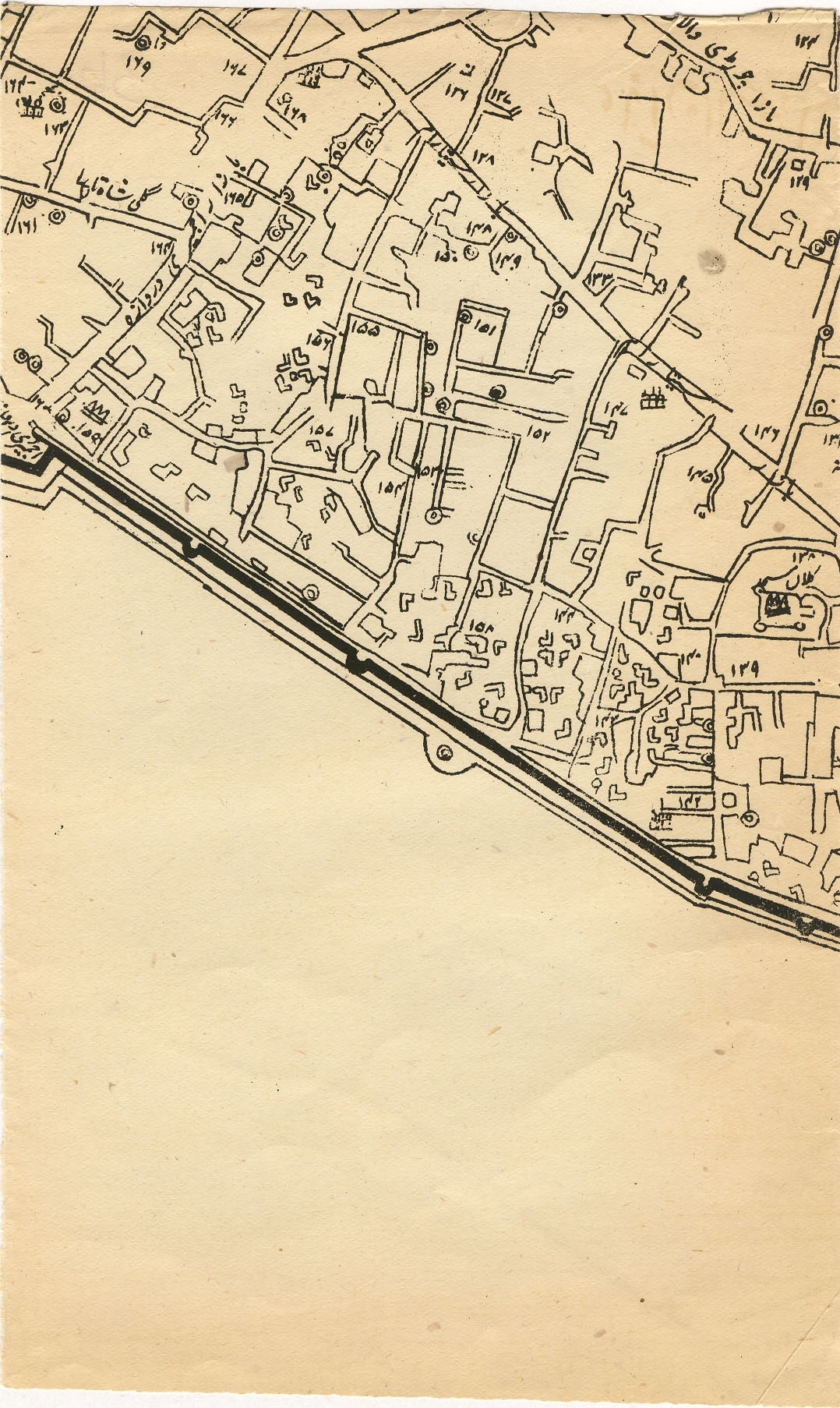
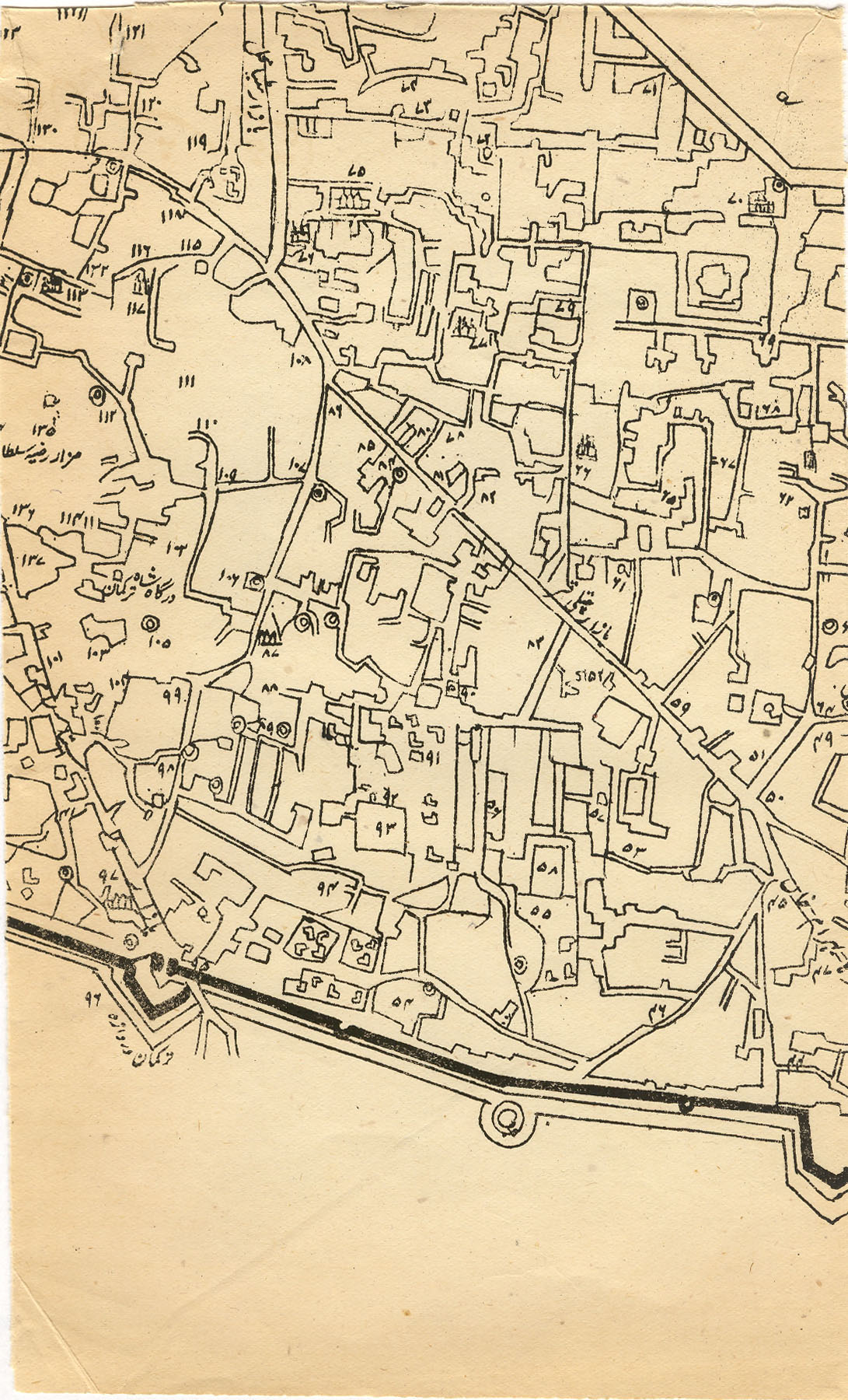
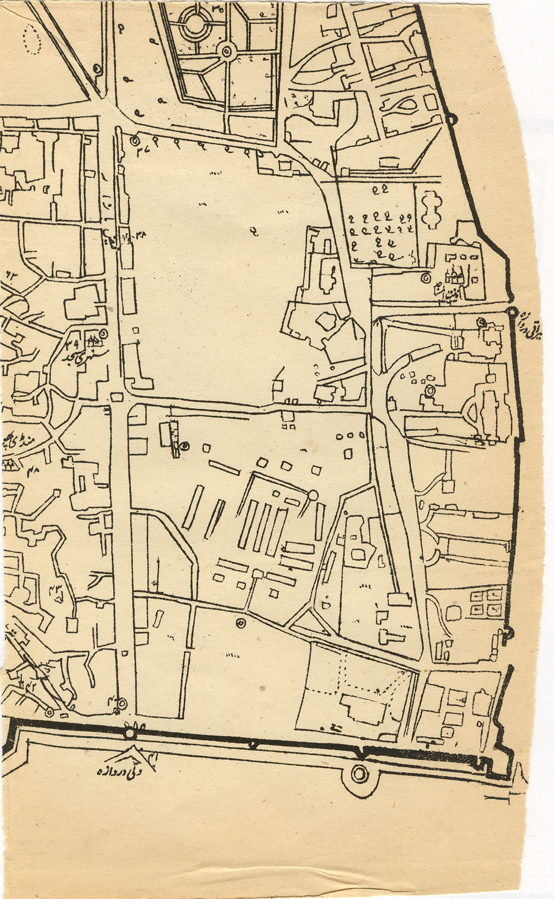
"Map of the City of Delhi (Shahjahanabad), in which the Mussulmans' and the Hindus' ancient buildings have been shown; scale 12 inches per mile; copied from the map published by the Survey of India in 1873," from Bashir ud-Din Ahmad Dihlavi, Vaqi'at ul-hukumat-e Dehli (Agra: Shams Machine Press, 1919 [A.H.1338]), vol. 2 [of 3]), inset between pp. 36-37 of the introduction. CLICK ON ANY SECTION OF THE MAP FOR A VERY LARGE SCAN.
Source: scanned by FWP from the three-volume set kindly given to me by Phil Oldenburg many years ago. This much-folded map was disintegrating even while I was scanning it; so alas, I couldn't do a better job.
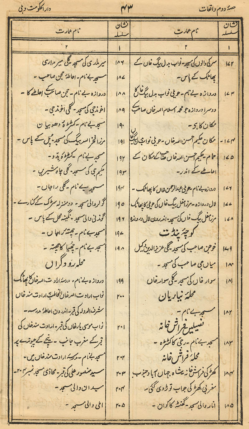
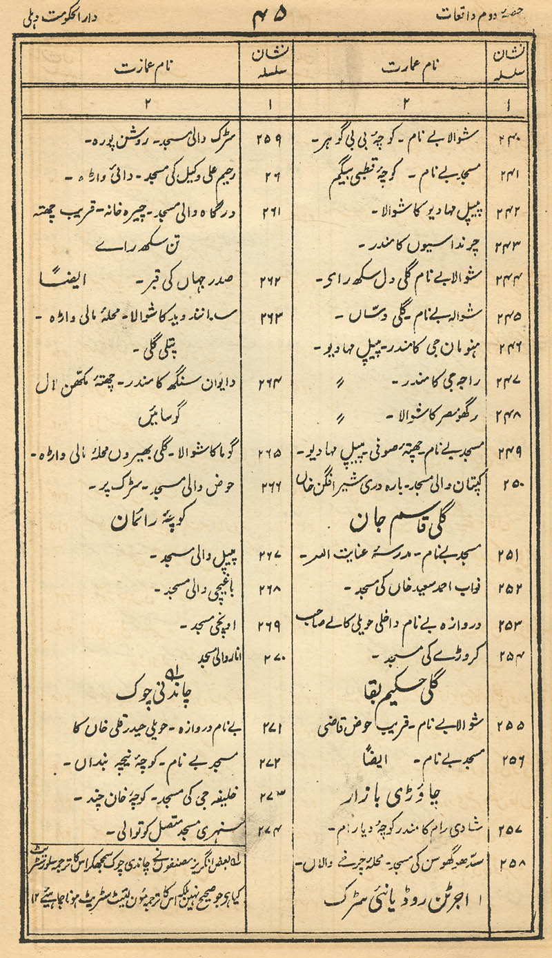
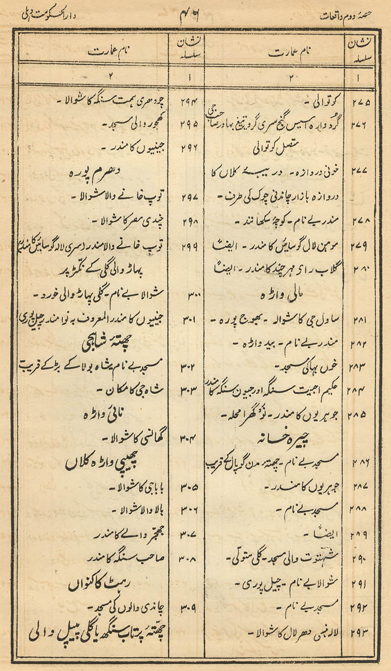
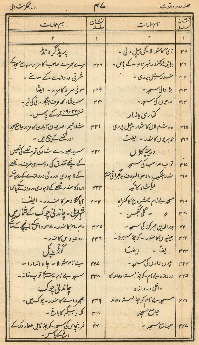
KEY TO THE MAP NUMBERS:
*#1-#17* = *#18-#49* = *#50-#79* = *#80-#109* = *#110-#140* = *#141-#171* = *#172-#205* = *#206-#239* = *#240-#274* = *#275-#309* = *#310-#341* = *#342-#374* = *#375-#402* = *#403-#410*
*"The Auspicious Fort before 1857," between pp. 40 and 41, vol. 2*
*"The Seven Cities of Delhi," between pp. 10 and 11, vol. 2*
== Colonial index == Main map index == Glossary == FWP's main page