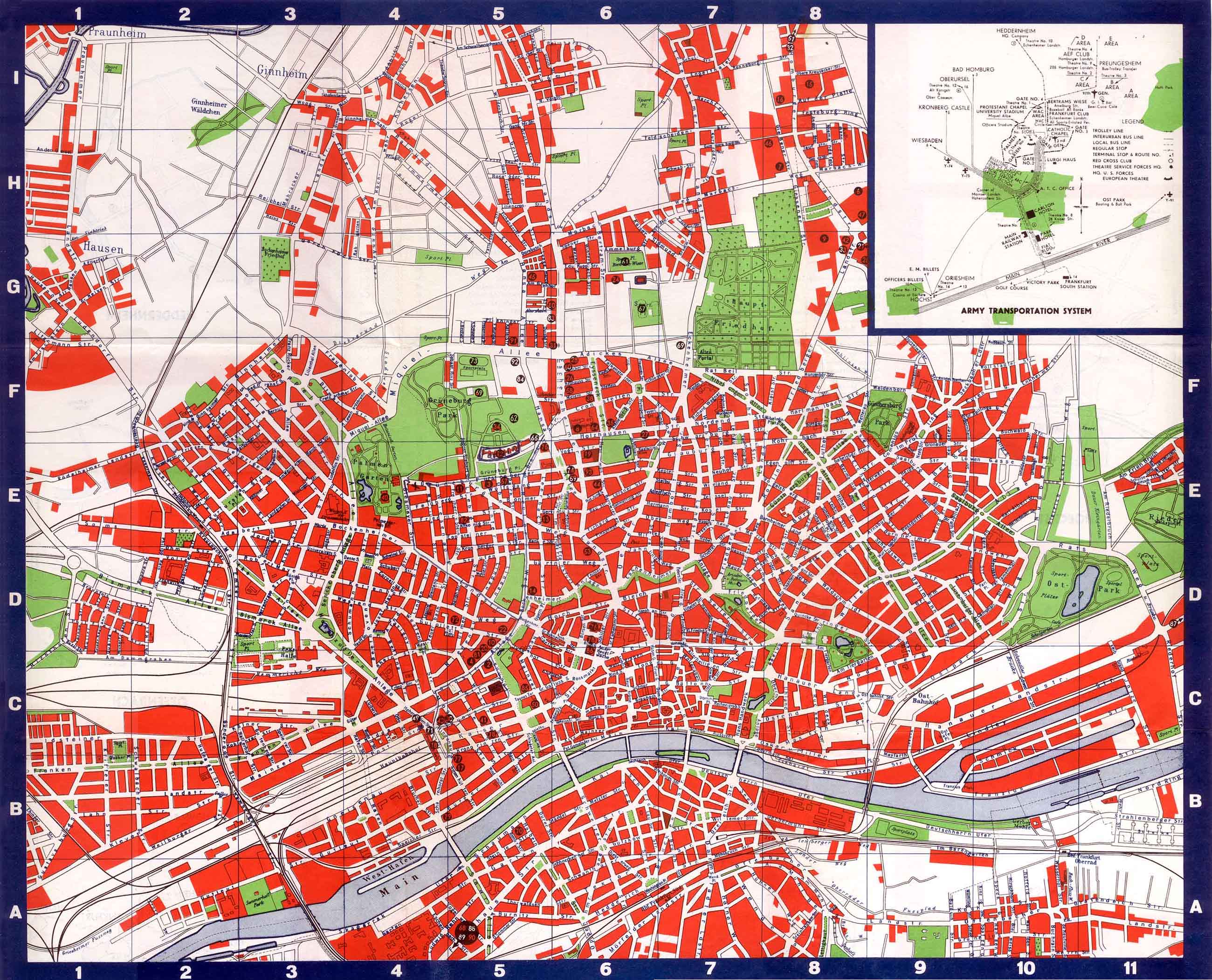
Frankfurt Army post map in 1946 by the 655th Engr TOPO Bn under the
direction of the Chief of Engineers, HQ USFET. The I.G. Farben building is
at upper E5. This is 8 years before Frankfurt High School would be built in
upper F5, but you can see the athletic field is already there, labeled
Sportplaz. Map found at Walter Elkin's
US Army in
Germany site (scroll down), along with
the key to the numbers in the black
circles. The area north of the Farben building is not developed yet:
the High School, Ambassador Arms Hotel, HiCoG and Platenstraße and Hugel
housing, WAC Circle buildings have yet to be built. The main PX was over by
the 97th General Hospital.