[ Home | Biography | Schedule | Videos | Mountains | Lessons | Contact ]
I have been enthralled with Lone Peak since I visited Utah for the first time in 2013. This granite monolith rises 7000' above the Salt Lake Valley and borders Little Cottonwood Canyon on the south side. It is the final peak in a succession of nearly thirty on the WURL (Wasatch Ultimate Ridge Linkup) - an incredibly challenging 36 mile, 18000' elevation gain traverse of the ridge all the way around Little Cottonwood Canyon.
There are two popular routes up to Lone Peak. One is the Jacob's Ladder Trail and the other is the Cherry Canyon Logging Trail. Jacob's Ladder is shorter than Cherry Canyon, but what it lacks in length it makes up for in steepness. The Cherry Canyon Logging Trail (henceforth CLT) is longer and has more overall elevation gain. I decided to attempt the CLT route - a 16.7 mile round trip with approximately 6600' of elevation gain (however, thanks to some poor planning on my end, this was closer to an 18 mile round trip with around 7500' of elevation gain). Unlike other hikes in the area, which start far up Little Cottonwood Canyon (thus reducing elevation gain), the CLT starts in the valley and climbs all the way up to the 11,253' peak.
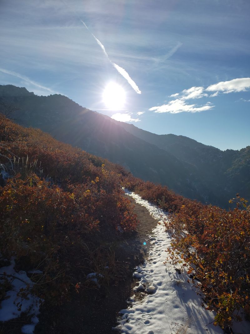
The first time I attempted Lone Peak, I started at sunrise (around 8am) in order to avoid being caught on the mountain after dark, something I learned the hard way from other hikes. This gave me approximately 10.5 hours to finish. To begin, the trail ascends up the foothills rising straight up from the valley. This section of the hike averages 15-30% grade, climbing over 1000' per mile, and the dusting of snow that had fallen the previous day made for slow going.
I knew there was not a single other person on the trail because no other human footprints had been made; however, there was an abundance of fresh mountain lion prints, so I picked up a few rocks and carried them with me just in case (a trail runner had been followed by a mountain lion for several frightening minutes earlier that week on a trail nearby).

After gaining the foothills, the trail opens up into a beautiful meadowy area, and the incline becomes a bit more forgiving before entering a forest. Here, I was particularly wary because the animal prints looked to be no more than a few hours old (and there were some bigger ones, too - perhaps bear or moose).
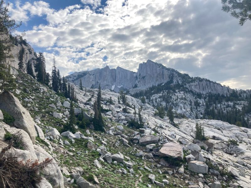
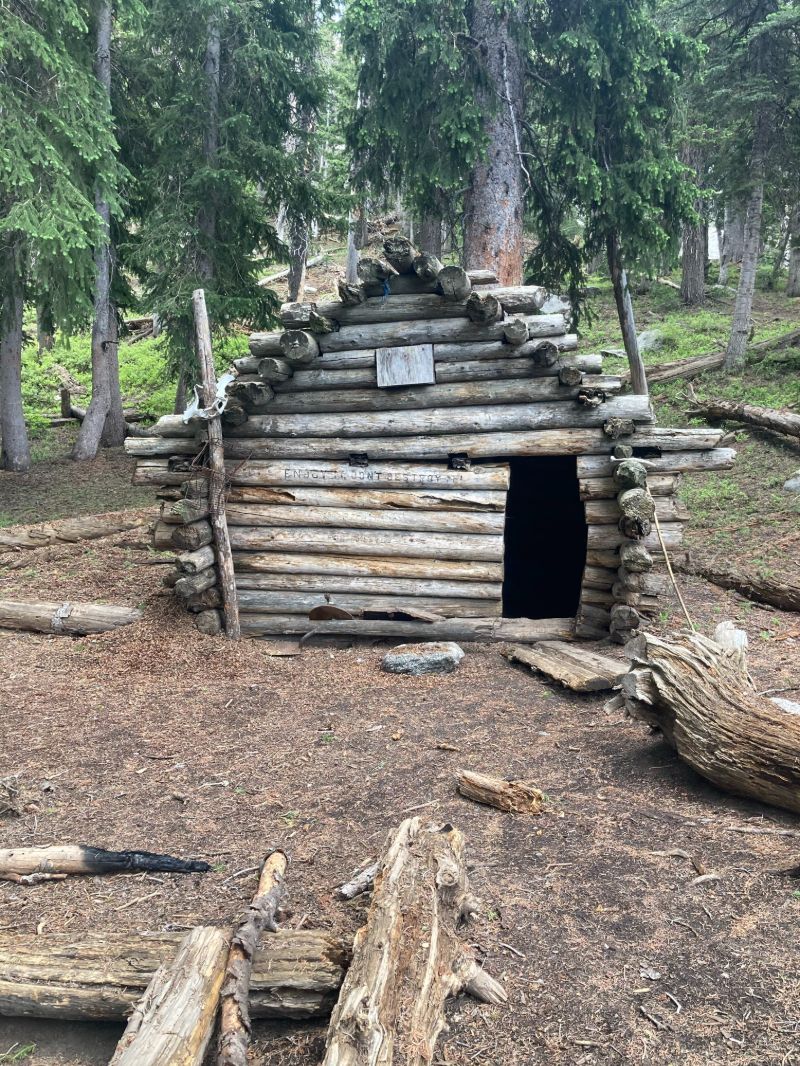
Upon exiting the forest, the trail arrives at the Outlaw Cabin, a small structure built in the 1960s which saved the life of a family caught in an early season blizzard in 1997. At this point, the trail begins a steep climb through a gully, at the top of which I finally had my first peek of the peak.
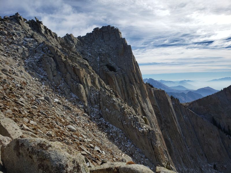
The trail then descends a few hundred feet before climbing back up to the ridgeline. This is where things became tricky. Had there been any more snow, it would have been too dangerous for me to attempt. After a half hour of maneuvering thin ledges, backtracking, and trying not to look down, I finally made it to the peak.
I ate a quick lunch and realized, much to my dismay, that my phone had died at 37% because it was sticking out of my pocket and was exposed to the high winds and cold. Since most of the trail was covered in snow, and the only human footprints were mine, I thought I could simply retrace my steps. I was wrong.

On my way down, the first in a succession of poor decisions came when I attempted to avoid climbing back up the hill near the cirque by going around the other (north) side. As I tried to find a "shortcut" route, the path narrowed until, in a harrowing moment, I very nearly became stuck on a cliff. I retraced my steps and went back the original way.
Unfortunately, upon exiting the forest, there was a short stretch where the snow had melted, and right at that moment there was a fork in the trail. I did not remember which path to take and took the wrong turn. By the time I realized this, however, I had descended over 500' and was too exhausted to walk back up, so, in my stubbornness, I kept going. Eventually, when I ended up in a canyon with no semblance of trail, I realized that I was hopelessly off route, so I decided that the best thing to do was to bushwhack straight up the hill to get a better vantage point. I had no idea where this would lead to, so after a half hour of wrestling trees and shrubs, I was overjoyed to reach the top of the hill and find a trail. I continued down on this trail, hoping that it would lead to the right place. I did not recognize my surroundings, but the trail was well marked and seemed to be going in the right direction.

I was absolutely elated when, after an hour of running down an unknown path, I finally stumbled across a hiker. They asked how far the trail went up, which I answered with a bewildered "Where am I?" As it turns out, this was the Trail of the Eagle, which ran adjacent to the CLT, and I was approximately a mile and a half from the bottom. I finally made it back to the trailhead just before 5pm, grateful to be alive and uninjured.
There was a lot of luck involved on this adventure. It is crucial to minimize the "luck" factor and maximize safety, so here are a few takeaways from this experience and mistakes I will never make again. 1) Research does not substitute for experience - if attempting a hike with any unknowns whatsoever, on the first try it is best to go with someone who has done it before. 2) Always bring a portable phone charger or satellite phone, especially if this is where your map is stored. 3) If unsure of the consistency of cell service throughout the hike, download the map beforehand. 4) Never take "shortcuts." Routes exist for a reason - shortcuts can lead to death or an hours-long SAR (search and rescue) operation. Luckily, I had brought plenty of water and food (a lesson learned from previous experiences), so I was neither dehydrated nor hungry. This is by far the most difficult hike I have completed with the exception of Mount Shasta. The combination of steepness, length, and a somewhat technical last few hundred yards of ridge to the peak are a test of both physical and mental endurance. I have since hiked Lone Peak once more this past summer minus the mishaps of my first climb.
[ Home | Biography | Schedule | Videos | Mountains | Lessons | Contact ]