[ Home | Biography | Schedule | Videos | Mountains | Lessons | Contact ]
The only hike on this page that I have broken into two days, Mount Shasta is a 14,179' volcano in the Cascade range of northern California. This is the only 14er in California that is not located in the Sierra Nevada range (with the exception of White Mountain) and thus has a nearly 10,000' prominence over its surrounding landscape. There are three main routes up this giant: the most popular is the Avalanche Gulch Route, which can only be taken early in the summer before the snow melts; otherwise the rockfall threat makes it too dangerous to ascend. The second route is the Hotlum Bolam Ridge Route, which requires some ice climbing and is much too technical for me. The last of the three main routes is the Clear Creek Route, which, after extensive research, I learned was the only possible route that could be safely taken late in the season and matched my experience level.
This trip took quite a bit of planning. As I mentioned above, not all of the routes were safe in August, and the mountain practically has its own climate, so a storm could roll in at the drop of a dime. Most days there are sustained 60+ mph winds at the top, and the temperature rarely tops freezing. The terrain is also treacherous: since Shasta is a volcano, much of the mountain is loose rock and scree, which is extremely difficult to hike on, especially at altitude and when it is steep. Hiking poles and a helmet are absolutely essential (and, depending on the season, microspikes/crampons and an ice axe may be necessary as well). Finally, acclimatization is key: I had been training on the 11000'+ mountains in Salt Lake City all summer, but even so, the altitude was difficult to manage. The three friends with whom I went did not have the opportunity to acclimate beforehand and did not end up summitting because of this.
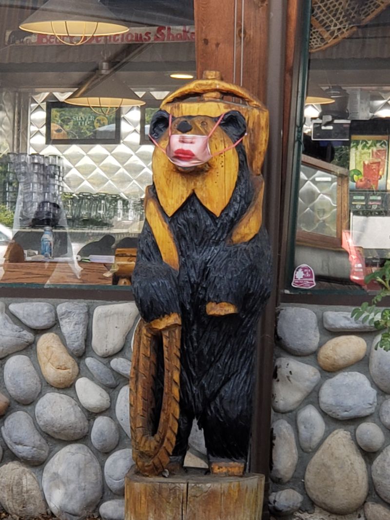
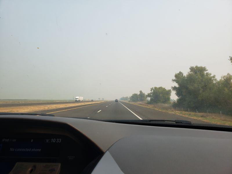
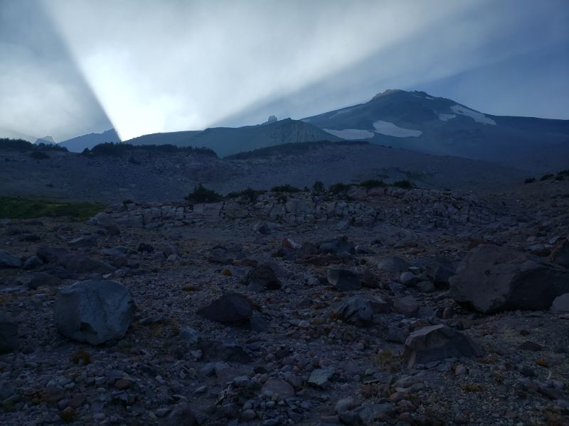
PSAs out of the way, here's what unfolded on August 22 and 23. We were packed and ready to go from the Bay Area on Saturday morning and drove up to the town of Mount Shasta, where we had lunch at the Black Bear Diner (outdoors, since this took place at the height of Covid - the owners thought it would be humorous to don the ornamental bear at the entrance with a mask). After, we rented gear at Fifth Season, Inc, a fantastic local outdoor recreation store, and drove out to the trailhead, outside of nearby McCloud. The summer of 2020 was a particularly bad one for wildfires in California, so we set out in a thick blanket of smoke. Normally, Mount Shasta is visible for many miles around, certainly from town, but because of the smoke, we were not even aware of its existence until a friend spotted what, at first glance, appeared to be clouds, but actually turned out to be patches of snow high up on the mountain. This happened only as we were arriving at the trailhead.
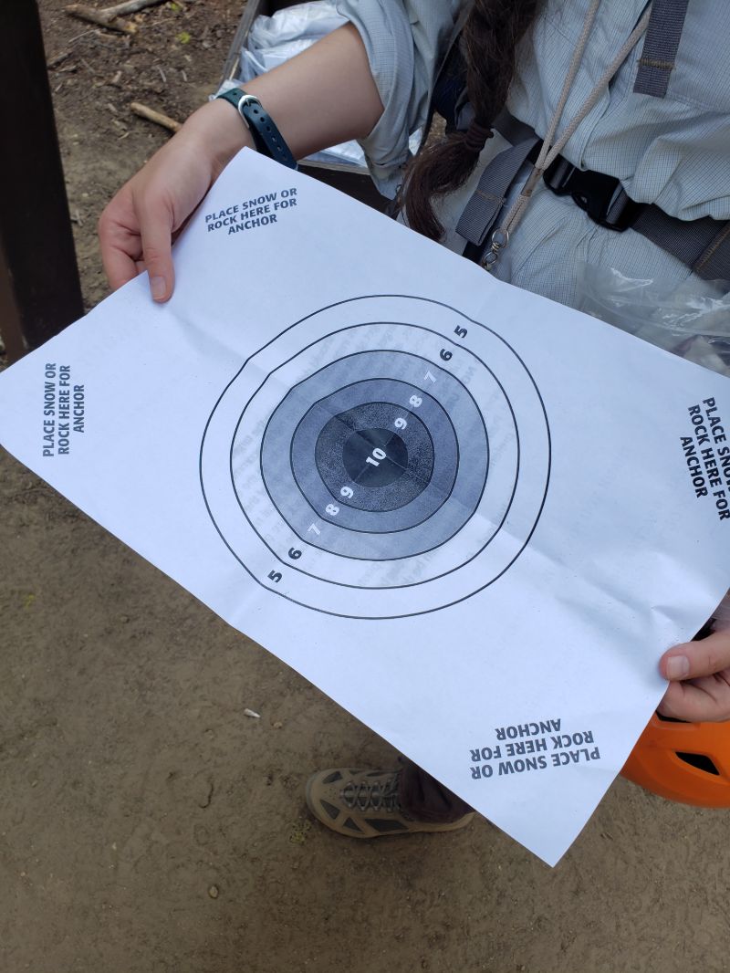
We parked at what we thought was the trailhead, but actually was a mile and a half from the true start. Regardless, the car would not have made it through the sandbars, so we gathered our overnight packs and began walking. A little ways in, a ranger drove by and offered to give us a lift to the trailhead, which we gladly accepted. At the trailhead, it is required to fill out a wilderness permit and a summit pass ($25), which everyone must carry above 10000', and take a poop kit, which includes a paper with a conveniently drawn target and instructions, a heavy duty Ziploc bag, and a paper bag filled with kitty litter to eliminate the smell.
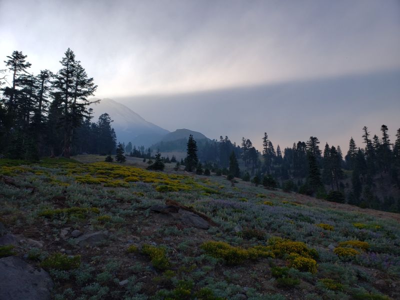
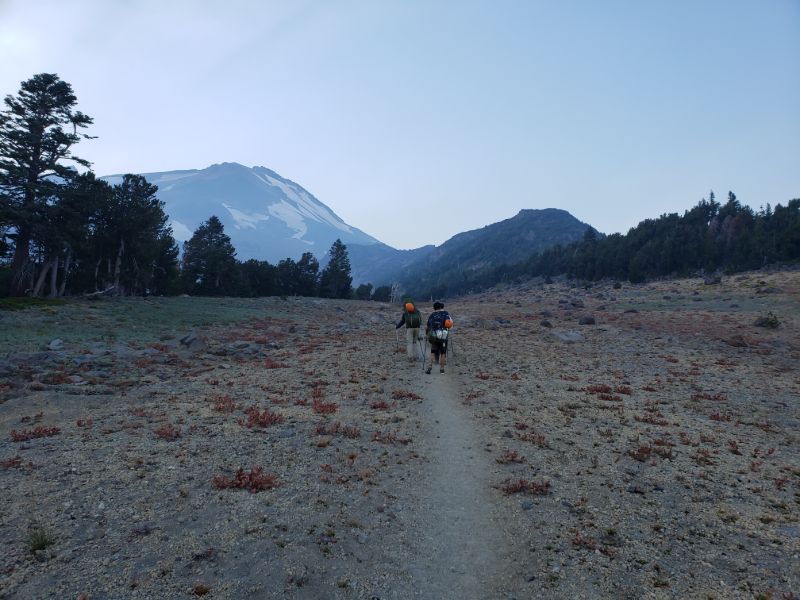
The first section of the trail (the part we planned to complete on the first evening) has a base elevation of around 6,473' and gradually climbs for three miles to Clear Creek Springs at 8500', which is the final water source on the mountain and the area where most hikers camp. It is recommended to bring a water filter in order to avoid contracting giardiasis, but I did not use a filter and was fine. Right before reaching the campsite, the trail exits the forest and opens up into a meadow with a breathtaking view of the peak. At this point, we were finally starting to ascend above the smoke.
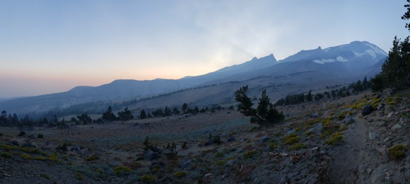
After a restless night at the campsite, we were up at 3:30am to begin the second leg of the trail: the ascent to the peak. This is where things became interesting. From Clear Creek Springs to the top of Mount Shasta it is only 3.5 miles, but with close to 5700' of elevation gain on loose terrain, and factoring in the altitude, the going was at a snail's pace. The sunrise was absolutely incredible, which reminded me of why I repeatedly engage in such torturous pursuits. Eventually, my group decided that they were finished, so I continued on alone. We carried walkie-talkies in case something happened, and I set a turnaround time for 11:30am in order to avoid possible afternoon storms.
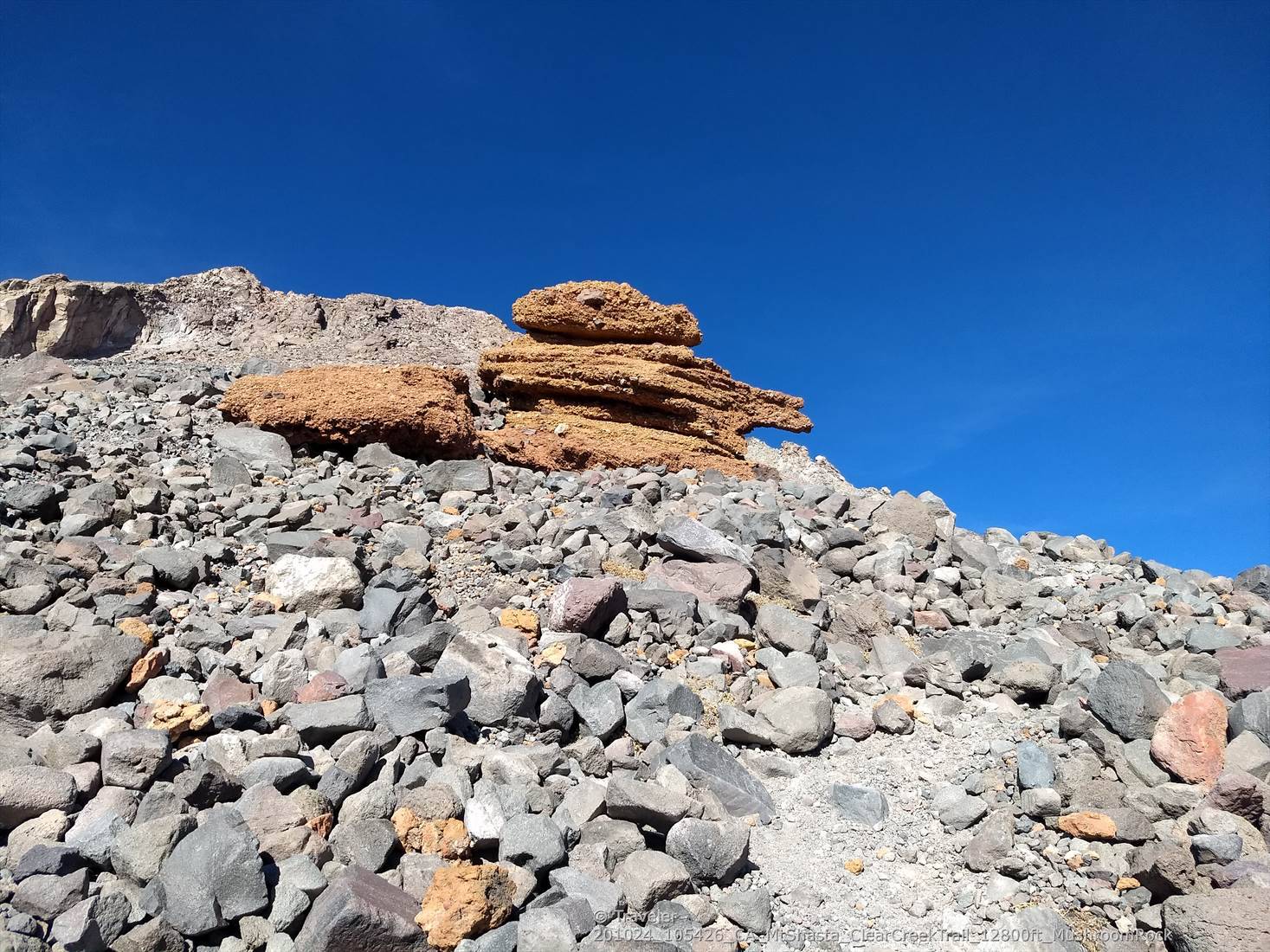
The difficult part of being above tree line is that there are no outstanding features on the mountain to gage the distance from the summit. After hours of two steps forward, one step back, it seemed that I had made little to no progress, until finally, around 9:30am, Mushroom rock (or UFO rock, depending on who you ask) came into view. This rock, sitting at 13000', is the only abnormal feature on the moon-like landscape from Clear Creek Springs to the summit, and, consequently, is also the only place to relieve oneself without being seen by other hikers. Finally I could use my turd kit! (Disclaimer: I was too preocuppied with my bowel movement to take any photos of Mushroom rock, so the photo here I found on the internet).
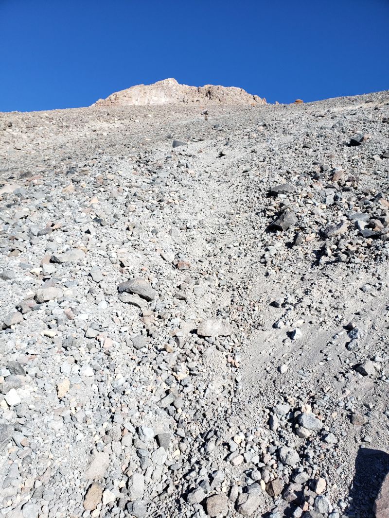
After Mushroom rock, there are three options: go to the right and die (not recommended), go to the left and die (also not recommended), and go the slight left and probably live (recommended). The right-leading route ends up on Wintun Glacier on a steep scree slope. This requires technical experience, and inexperienced parties (like me) have often found themselves in a pickle. The left-bearing route leads to a class 4 climb, which also may require some experience and equipment that I did not have. The route that goes slightly left (the one I chose) leads to a class 2-3 scramble (for what I mean by "class," check out this). It was at this point that I hit the metaphorical "wall" (fitting, as I was approaching a wall), likely because of the altitude. It was difficult to take more than one step without resting, and I had trouble envisioning myself making it to the summit by the time I set to turn around. The scramble, although not particularly technical, turned out to be quite a bit more treacherous than I normally encountered in class 3, largely because the rock was incredibly loose, so I had to be extremely careful about which rocks I chose to grab, and even then, I disloged quite a few. This section is only approximately 0.3 miles, but it felt endless.
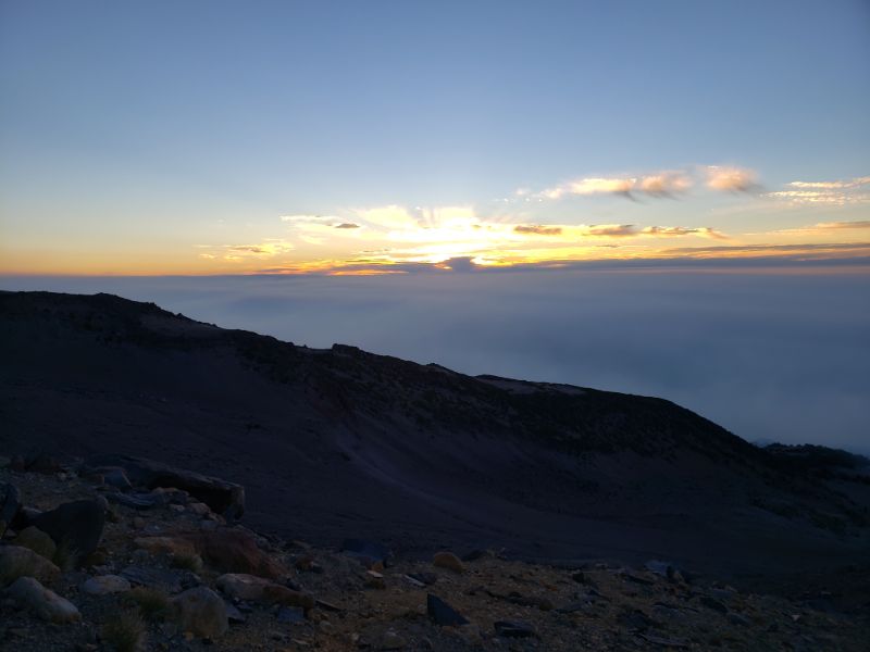
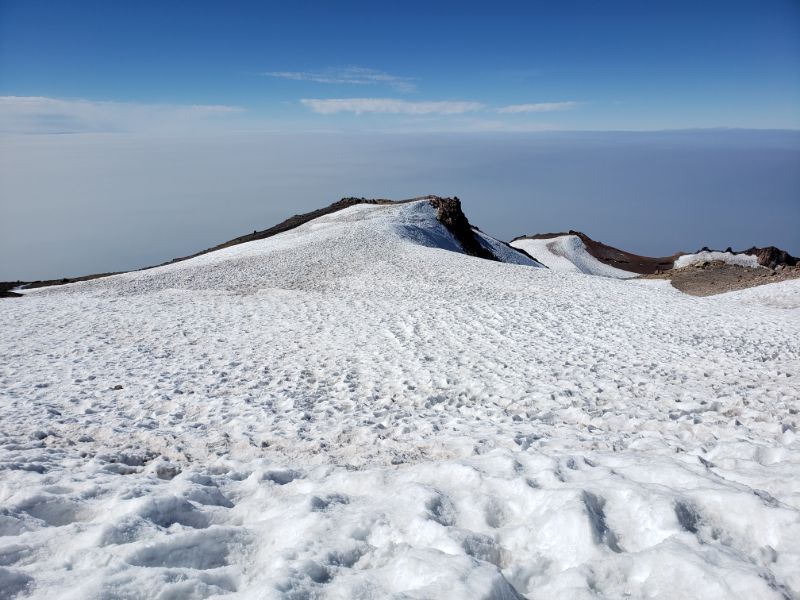
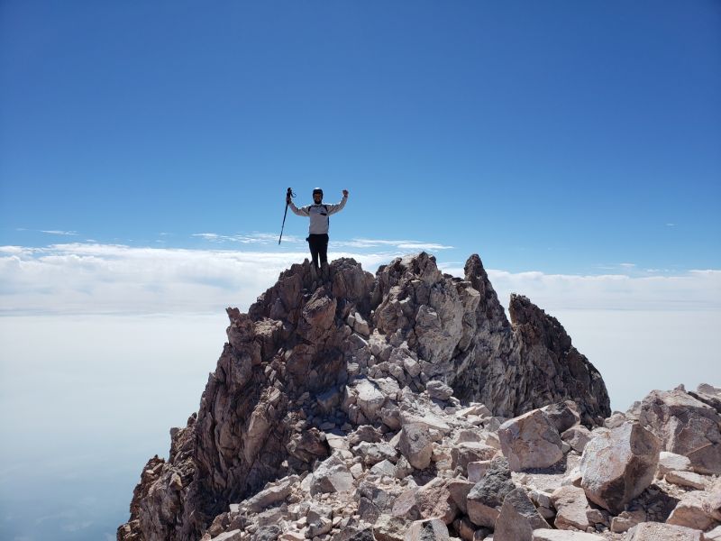
Finally, at 11am, I crested the headwall and found myself by a snow field. The trail flattened out for a moment, which was just as well because I was slipping and sliding even without the incline. After the snow field, there was one brief steep climb, and, voila, I was standing on top of the summit, precisely at 11:30am. Unfortunately, everything far below me was covered in smoke, but it still felt surreal being so high up. Also, unluckily, both my phone and radio died briefly after summitting, so I could no longer communicate with my friends, who decided to stop after reaching 11,500'.
One pro (and con) of this mountain is that the terrain is so loose that I was able to scree-ski down in my boots. This was also a con because I periodically had to stop to pour out the plethora or rocks that inevitably infiltrated my foot space. Thankfully, I caught up to my friends approximately 1.5 miles from the campsite, and, once we returned, I took a two hour nap. We were back at the car around 8:30pm and had well-deserved, giant pizzas upon our return to Mount Shasta town. I would love to climb this mountain again someday when it is not smoky, perhaps on the Avalanche Gulch Route instead.
[ Home | Biography | Schedule | Videos | Mountains | Lessons | Contact ]