DELHI MAPS

DELHI MAPS
A modern city map of Delhi, emphasizing train stations
Source:
http://www.indiamike.com/photopost/showphoto.php/photo/2992/cat/505/page/1
(downloaded May 2005)
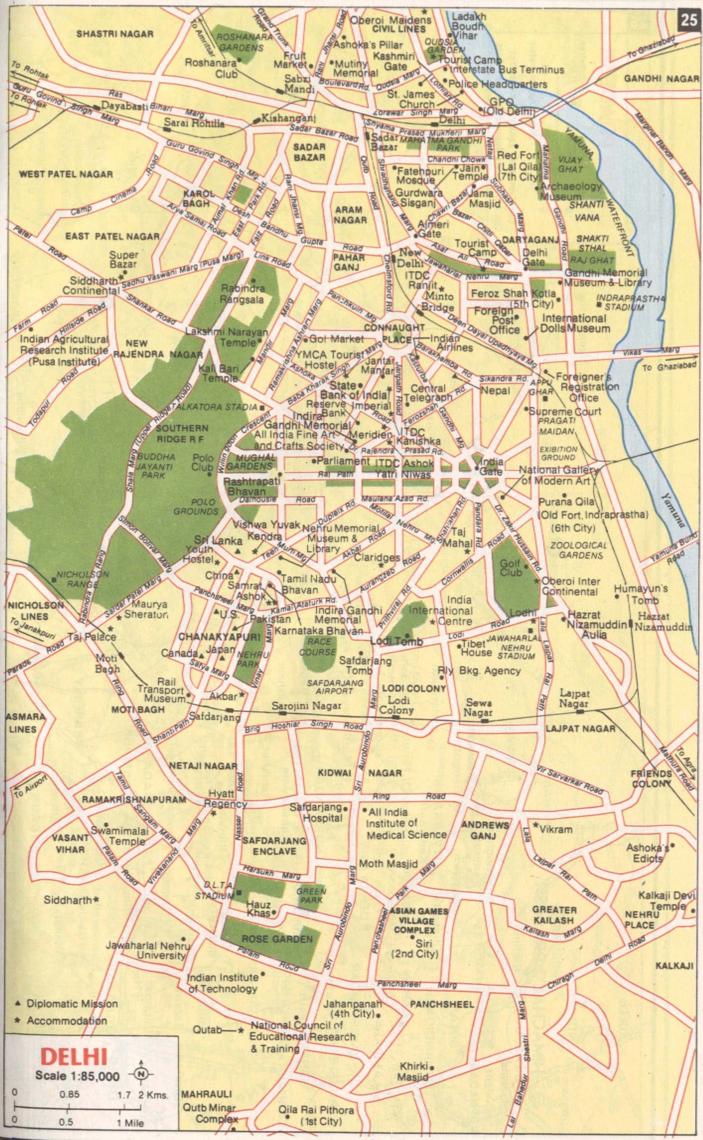
*A map that locates (within a tourist map) the "seven cities" of Delhi*
Source: http://www.india.ru/india/delhi_map.jpg
(downloaded Oct. 2005)
**MAPS OF THE DELHI REGION, c.1700-1850**
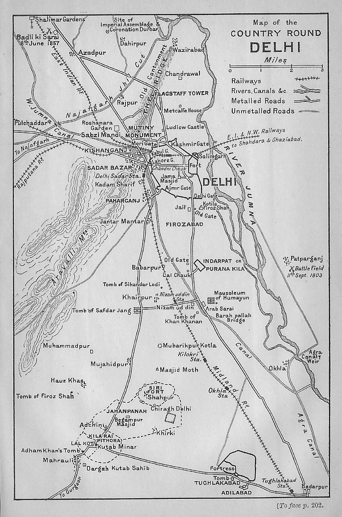
*Delhi and its immediate environs, 1901, from Murray's Handbook for Travelers* (showing historical sites)
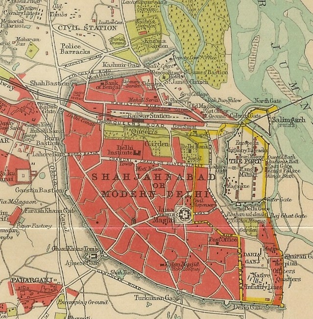
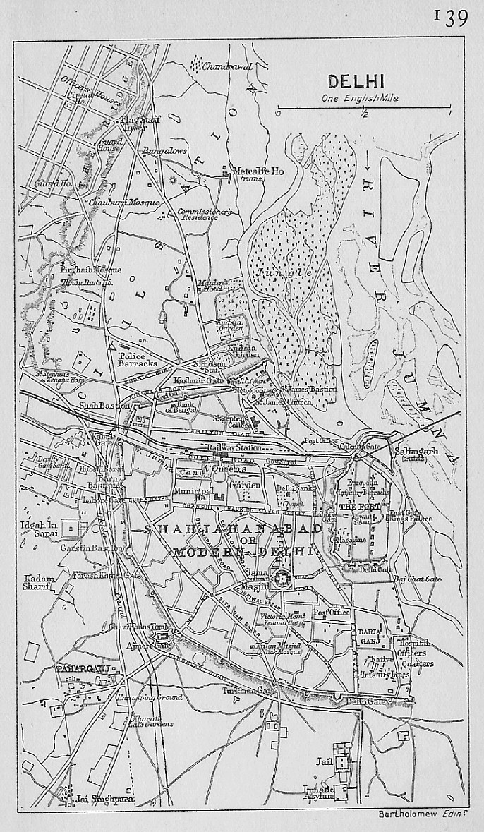
*Shahjahanabad, 1906, from Murray's Handbook*
*Delhi and its immediate environs, 1909, from Murray's Handbook* (showing historical sites)
*Delhi in 1912, from A Literary and Historical Atlas of Asia, by J. G. Bartholomew*
*Delhi and its surroundings, 1924, from Murray's Handbook (showing historical sites)*
Source:
http://homepages.rootsweb.com/~poyntz/India/maps.html#regional
(downloaded Apr. 2006)
*A truly GIGANTIC topographical map of the Delhi region, U.S. Army, 1955*
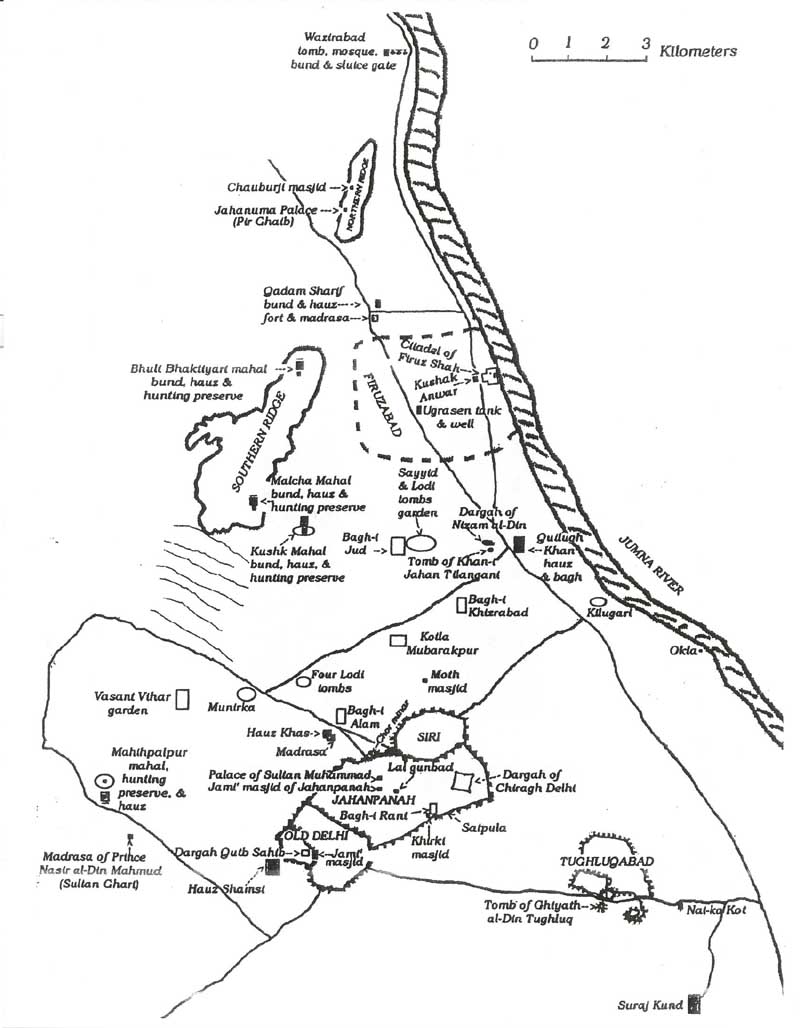
*The Cities of Delhi, by Jennifer Lort, 1995-- a historical map of the Sultanate period*-- A map that emphasizes Sultanate tanks, wells, and gardens. From her unpublished M.A. dissertation, "Curiously Seen: Baolis of the Delhi Sultanate," Department of the History of Art, University of Victoria. Reproduced in Nilanjan Sarkar, "The Political Identity of the Delhi Sultanate, 1200-1400: a study of Zia al-din Barani's Fatawa-i Jahandari"(Ph.D. dissertation, SOAS, 2005). Scanned by FWP, Feb. 2006
== Modern index == Main map index == Glossary == FWP's main page