 |
MODERN
MAPS
from
c.1900 onward |
SELECTIONS
FROM THE *SCHWARTZBERG
HISTORICAL
ATLAS* (DSAL, highly ZOOMABLE)--
PRE-1947
|
=*imperialism
in Asia, 1800-1947**
=*South
Asia
in
world
affairs, c.1900-1947**
=*the
status,
age,
and
nature of South Asian boundaries**
=*the
fixing
of
modern
South Asian frontiers**
=*the
Bengal
partition
etc.,
1905-1947**
=*evolution
of
the
central
legislature**
=*evolution
of provincial legislatures**
=*modern
religious
revival
and
reform movements**
=*religious
composition
of
South
Asia, 1931**
=*political
events
of
the
nationalist period, 1879-1947**
=*Indian
National
Congress
presidents
and sessions**
=*All-India
Muslim
League
presidents
and sessions**
=*major
elections, 1920-1945**
=*the
Indian
Empire
in
1947**
=*social
disturbances
and
insurrectionary
movements**
=*population
growth, 1901-1961**
=*South
Asian
population,
urban
density, and literacy, 1971**
|
SELECTIONS FROM THE *SCHWARTZBERG
HISTORICAL
ATLAS* (DSAL,
highly ZOOMABLE)--
POST-1947
|
=*territorial
changes, 1947-1955**
=*territorial
changes, 1955-1975**
=*the
status,
age,
and
nature of South Asian boundaries**
=*South
Asia
in
world
affairs, 1947-1971**
|
|
WORLD MAPS
|
=*Library of Congress world maps**,
some from this period |
|
NORTHWEST,
CENTRAL ASIA, c.1900
|
=*the Northwest, c.1900; and Central
Asia*; two large detailed maps
|
|
INDIA,
1902
|
=*India,
1902*-- Century Atlas, Buffalo, NY |
|
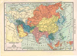
ASIA, 1902
|
=*Asia,
1902*-- a Cram atlas map |
|
INDIA, 1904
|
=*India,
1904*-- a Hammond atlas map |
|
INDIA, 1911
|
=*India,
1911*-- a Cram atlas map |
|
BRITISH EMPIRE,
1912
|
=*The
British Empire: South Asia, Indian Ocean, 1912*;
some overviews
|
|
WARRIORS, 1918
|
=*"The Fighting Clans of our Indian
Empire," 1918* |
INDIA, ASIA,
1922
|
=*Bartholomew
maps* from the classic "Times Atlas" of 1922
|
|
"RACES," c.1925
|
=*Asia analyzed
in the racial categories of the day, c.1925* |
Imperial
Gazetteer
maps,
1908-1931,
*available
through DSAL**
|
=Imperial Gazetteer of
India (Oxford, Clarendon Press, 1908-1931): -- *Afghanistan** -- *Balochistan** -- *Baroda** -- *Bombay, City of** -- *Bombay, Island of** -- *Bombay, Northern, and Sind** -- *Bombay, Southern** -- *Burma, Central** -- *Burma, Northern** -- *Burma, Southern** -- *Calcutta** -- *Calcutta, environs** -- *Central India** -- *Central Provinces and Berar** -- *Eastern Bengal and Assam** -- *Hyderabad** -- *Madras** -- *Madras, Northern** -- *Madras, Southern** -- *Nepal** -- *NWFP and Kashmir** -- *Punjab** -- *Rajputana** -- *United Provinces** -- *South Asia** |
|
INDIA, BURMA,
1946
|
=*On
the eve of Partition, 1946*, a National
Geographic map, with finding tools
=*the
Indian
Empire
in
1947**
|
|
PARTITION, 1947
|
=*Maps
showing the Partition process, 1947* |
|
TOPOGRAPHIC, 1955
|
=*Topographic maps of India, 1955**,
a U.S. Army set; HUGE |
|
BANGLADESH, 1971
|
=*The birth of
Bangladesh, 1971-72*
|
|
SRI LANKA,
1974...
|
=*Sri Lanka, shaded relief map, 1974**,
from the P-C *Sri Lanka set** |
|
INDIA, 1979...
|
=*India, shaded relief map, 1979**,
from the P-C *modern India set** |
|
KASHMIR, 1990...
|
=*Kashmir
and
its region, 1990* from the P-C *Kashmir set**; also a good *2002 map** and a *2004 map** from P-C |
|
NEPAL, 1990...
|
=*Nepal, 1990**, from the P-C *Nepal** set |
|
PAKISTAN, 1991...
|
=*Pakistan, a political map, 1991**,
from the P-C *Pakistan set** |
|
BANGLADESH,
1996...
|
=*Bangladesh, a political map, 1996**,
from the P-C *Bangladesh set** |
|
AFGHANISTAN,
1993...
|
=*Afghanistan, a political map, 1993**,
from the P-C *Afghanistan set** |
|
INDIAN OCEAN...
|
=*Indian Ocean map, 1993**,
from the P-C *Indian Ocean set** |
|
DELHI
|
=*Delhi,
some modern and historical city maps* |
|
INDIAN MAP CENTER
|
=*A
one-stop website for modern Indian maps** (with
ads) |
|
PAKISTAN
POLITICAL
|
=*The
administrative divisions of Pakistan*, with
detailed maps for *Sindh*, *Balochistan*,
the *Punjab*,
the *NWFP*,
and
*Azad
Kashmir* |
|
NWFP MAPS
|
=*Pakistani city and regional maps, for
the NWFP area** |
MODERN AND
HISTORICAL
|
=*MANY EXCELLENT MAPS**
-- check out the Perry-Castaneda Map Collection,
University of Texas |
|
INFINITE MAPS
|
=*National Geographic MAP MACHINE**
-- try it during off-peak hours. Also, try the
astonishing *GoogleEarth** |