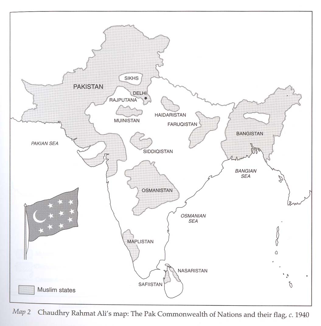
The earliest proposed map of the "Pak Commonwealth of Nations," c. 1940; CLICK ON THE MAP FOR A VERY LARGE SCAN
Source: Akbar S. Ahmed, "Jinnah, Pakistan, and Islamic Identity" (London: Routledge, 1997), p. xxvii; scan by FWP, Oct. 2007
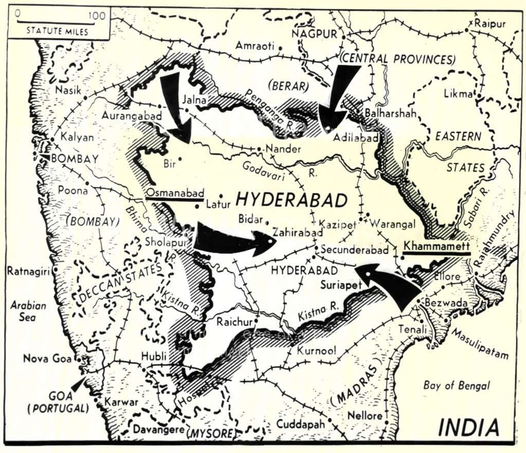
*INDIA IN 1946, SHOWING PRINCELY STATES AND OTHER POLITICAL BOUNDARIES*


 |
 |
Rand McNally's late 1947 view of Partition; CLICK ON EITHER HALF OF THE MAP FOR A VERY LARGE SCAN
Source: Bought from Phyllis Newman Antique Prints, Greenflea market, and scanned by FWP, July 2006
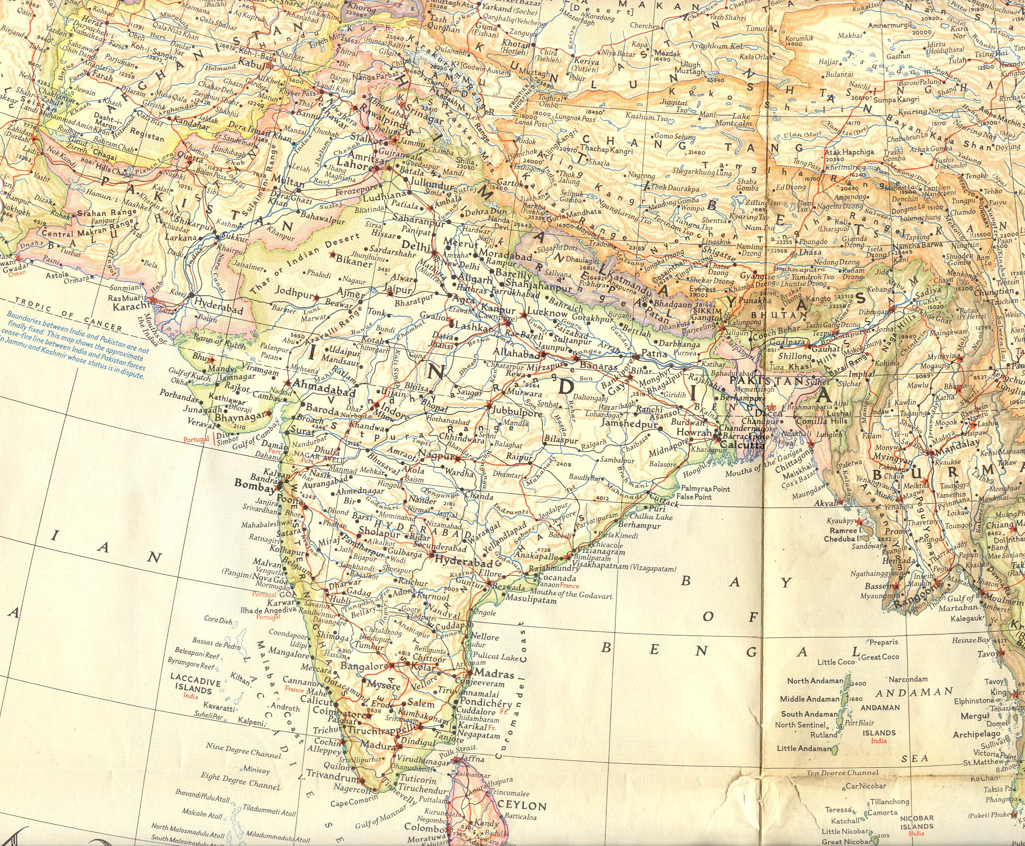
In March 1951, the editors of this National Geographic map are still warning their readers about possible boundary changes, especially in Kashmir; CLICK ON THE MAP FOR A VERY LARGE SCAN
Source: Bought on ebay and scanned by FWP, Apr. 2008
 |
 |
Before and after; CLICK ON EITHER MAP FOR A LARGE SCAN
Source: http://www.answers.com/topic/india-partition-gif
(downloaded Nov. 2006)
![]()
An attempt to show the population transfers in August 1947; the pie chart applies to post-1947 India
Source: http://cla.calpoly.edu/~lcall/partition_india.jpg
(downloaded Nov. 2006)
== Modern index == Main map index == Glossary == FWP's main page