From a Portuguese atlas, 1630
Source: ebay, Mar. 2007
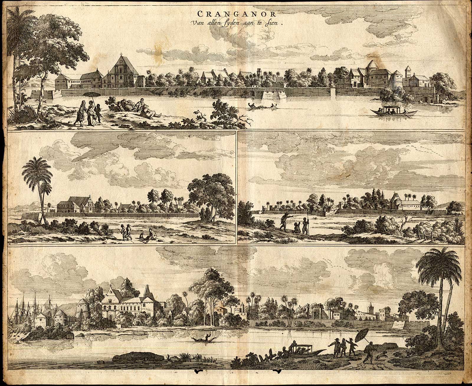
"Cranganor" by Philip Baldaeus, from 'Nauwkeurige
beschrijving Malabar en Choromandel, derz. aangrenzend rijken, en
het machtige eiland Ceylon', Amsterdam, 1672
Source: ebay, Aug. 2014
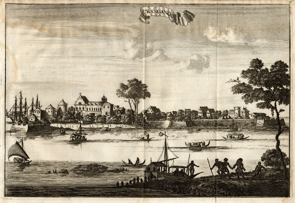
"Cranganoor," with Dutch East India
Company ships in the harbor; from "Wouter Schouten's travels into
the East Indies," 2nd ed., Amsterdam, 1708
Source: ebay, Aug. 2010
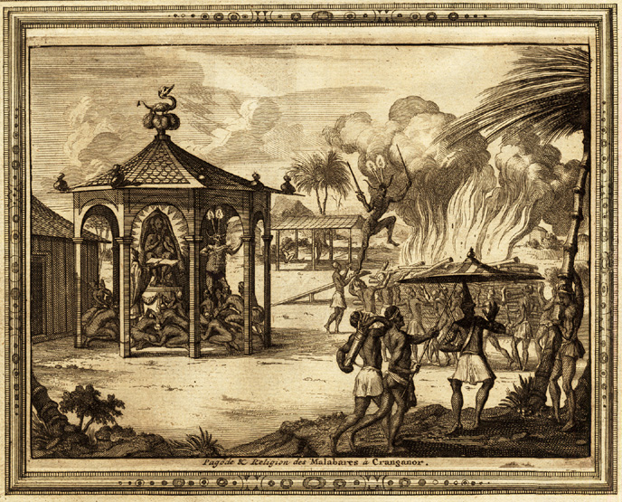
"A pagoda of the religion of the
Malabares at Cranganore," from 'La galerie agreable du monde
(...). Tome premier des Indes Orientales.', published by P. van
der Aa, Leyden, c. 1725
Source: ebay, Jan. 2012
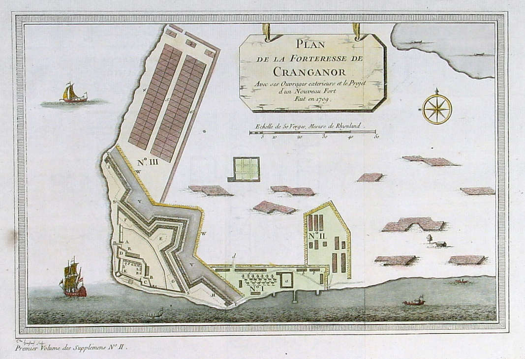
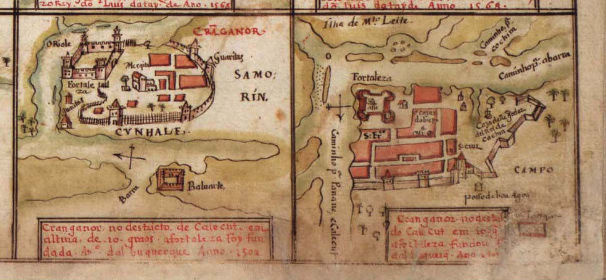
A plan of Cranganore fort by Bellin, from *PREVOST*,
1747,
with later hand coloring
Source: ebay, Sept. 2005
== Indian
Routes index == Indian Routes
sitemap == Glossary ==
FWP's main page
==