|
|
by Joseph Brennan. Copyright 2001, 2002. |
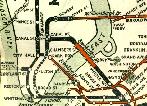
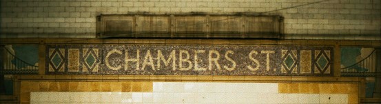
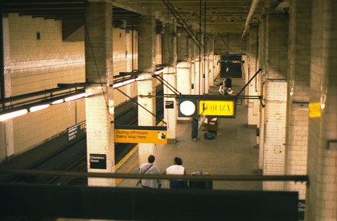
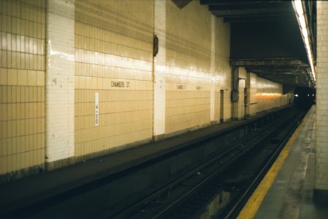
Chambers St closed platformsPassenger service: August 1913 - May 1931.Existing abandoned portions: 2 platforms and trace of another (on tracks in service). Touring: J M Z trains to Chambers St. Two island platforms are in service on the sides facing the outermost of four tracks. The center island platform is closed, and so is the eastern side platform. On the west side are traces of another side platform. construction and operationChambers St station was opened in August 1913 as the terminal of the Centre St subway coming down from the Williamsburg Bridge. The subway was originally known as the "Brooklyn loop line" and similar names because it connected the bridges to Brooklyn. The subway had been built mainly 1907-1910, but work stopped south of Worth St from May 1908 to February 1911 while the Municipal Building was constructed over the line. The portion including Chambers St station was built 1911-1913. Only the western two tracks were used until September 1914. The transfer passage at the south end to the IRT subway was opened in 1914, and of course it required payment of another fare.Trains off the new subway tracks on the Manhattan Bridge came into the station in June 1915. The tracks at south end of Canal St station were realigned in 1914, so that in the four track subway leading north from Chambers St, the west pair were for the Williamsburg Bridge service and the east pair for the new Manhattan Bridge service. The main service off the Manhattan Bridge was diverted to the new Broadway subway in September 1917, but a part-time service continued to run to Chambers St. The side platforms and center island platform were exits, and the other two islands, the two still open today, were entrances. Each summer from 1913 to 1917, a joint service to Rockaway Beach was run from Chambers St station by Brooklyn Rapid Transit and Long Island Railroad trains. Although it crossed the Williamsburg Bridge, it used the east platforms at Chambers St, sharing them with the Sea Beach subway trains. There are two provisions for things unbuilt. During the hiatus in work on the station, the Public Service Commission added two more tracks to the plan in 1909, and then in 1910 went back to four tracks but with some provision for adding two more on the east side if ever wanted. More significantly to the station, the 1909-1910 revisions called for only the west pair of tracks to rise south of the station and curve east to reach the Brooklyn Bridge railway. The Public Service Commission admitted the curvature and grade would have required "heavy motive power", and in the end it was not attempted, but the western two tracks still rise in the station to begin the climb. The high ceiling was a provision for starting the incline farther north, within the station. Transit staff today report that some parts of the ramp still exist. Most of it was destroyed in 1928-1931, and nothing can be seen from the station or trains. The Nassau St subway, running south from Chambers St, was opened in May 1931. The outer tracks at Chambers St were connected to the new route while the inner tracks merged into a new tail track that ended a trainlength away. There were now two train services: some Williamsburg Bridge trains now ran down the new route to terminate in the stub tracks south of Broad St station; and two part-time Manhattan Bridge services ran in opposite directions on what was called the Nassau Loop running through between the Manhattan Bridge and the tunnel south of Broad St. The only trains terminating at Chambers St were some Williamsburg Bridge runs. Under the 1931 plans, the exit platforms were closed, leaving open just the two island platforms that are still open today. The center and side platforms have been abandoned ever since. The more northern of the original station mezzanines was closed in 1938 so that it could be used as part of the Municipal Building basement, and a new mezzanine further north was provided in its place. The disused stair openings can still be seen in the ceiling. The western side platform was destroyed in 1960-1962 when the adjacent Brooklyn Bridge station was enlarged. A new wall was built blocking it off, just inside the line of columns, so the track side of the columns is still visible, and a strip of platform. The Manhattan Bridge service became less and less important after 1960, and the re-routings of November 1967 cut off the last remnant when the track connection near Canal St was severed. Current plans (2001) call for some revision of the tracks south of the station, but possibly the same two platforms will continue in use. |
diagram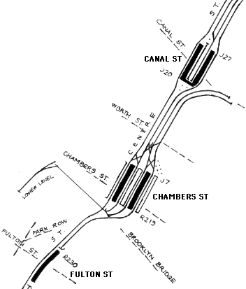
The odd history of the Centre St subway can be guessed from the track plan north of Chambers St. The station itself is under the Municipal Building, not a street. |
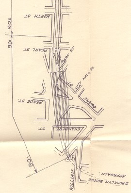
A detail of a Public Service Commission map shows the station as it relates to the old street plan before the Municipal Building was built. The original subway is not shown but was located in the street immediately left of the tracks from Reade St to Chambers St. The Brooklyn Bridge connection, never completed, is shown here as coming off all four tracks, but was partially built as coming off the two western tracks. Public Service Commission for the First District, from their Report. . . for the year ending December 31, 1908, Albany: the Commission, 1909. |
A slightly later plan shows the 1910 revised plan with the two west tracks connecting to the Brooklyn Bridge. On the curve, on the grade, is a double crossover. The two tracks appear to run under the elevated lines' bridge terminal and come up on each side to join the bridge line at about the point where the bridge railway itself starts rising. Undated engineering drawing, circa 1910-1913. Paul Matus collection. |
|
|
|
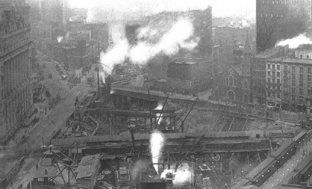
The Municipal Building is seen here under construction in 1909. Centre St runs from lower left straight to the cloud of steam at left center. The original subway, just five years open, is under it at lower left, but curves away at left center running toward Lafayette St. At lower right is the City Hall station of the Second and Third Ave Els, in Park Row. Nothing is visible yet of the future Chambers St station, except that the work site continues under and beyond Duane St, center, toward that cloud of steam in Centre St, for the benefit of the subway. The church at right center still exists, originally at the corner of Duane St and the now-gone City Hall Place. Public Service Commission for the First District, from their Report. . . for the year ending December 31, 1909, Albany: the Commission, 1910. |
|
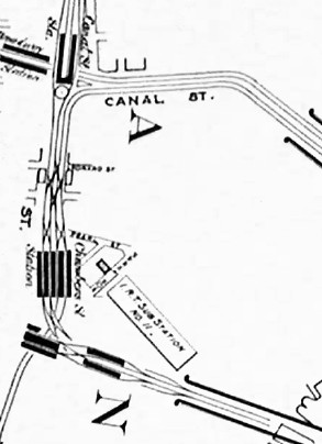
The 1924 BMT official map shows the relationship of Chambers St station to the bridges. Underground lines are in black, aboveground in red, and the line thickness indicates how many tracks. The Nassau St line is shown dashed since it was still only proposed at this date. Scan by Joe Korman. For the full map see http://www.nycsubway.org/maps/historical at the New York Subway Resources site. |
|
|
|
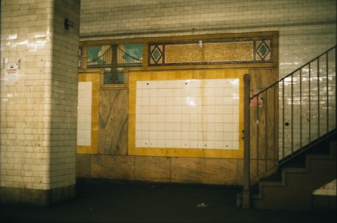
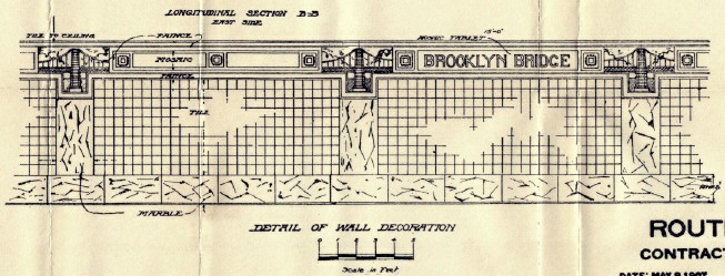
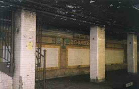
The east side platform is intact. The wall decoration includes a ceramic of the Brooklyn Bridge, incorrectly shown with only vertical suspension ropes. However, the ceramic artist can't be faulted for the Brooklyn Bridge cables. They were wrong in the contract drawings, as seen below the earliest drawings of the station from 1907, when it was still to be named Brooklyn Bridge. The mosaic strip was changed, and even the image is different (note the clouds), but the cables remained the same. Below: Board of Rapid Transit Railroad Commissioners. From the Report of the Public Service Commission for the First District, for the six months ending December 31, 1907, Albany: the Commission, 1908. |
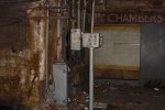
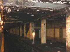 The deterioration of the station had reached amazing levels by 2000. This is in plain view from an open platform (just visible on the left)... Photo copyright by Harry Beck. From the Chambers Street page at http://www.nycrail.com. |
 ...and so is this. Photo copyright by Kevin Walsh. From Plaque with a Flaw at http://www.forgotten-ny.com. |
|
|
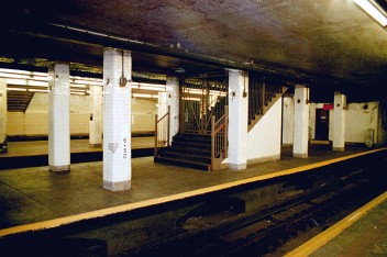 Like the east side platform, the center platform has no lights of its own, but it's well lit from the open platforms on each side. In 2001, the center was partly boarded up by contractors as work began on station renovations. Photo copyright by David Pirmann. From the Chambers Street page at nycsubway.org. |
|
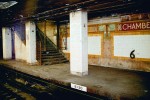
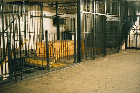
This closed stairway runs from the center platform all the way up past the mezzanine level. It was a long climb. |
|
|
|
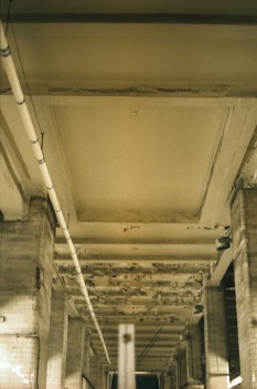
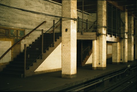
A view from the stairs at the south end of the downtown platform shows the high ceiling over the south end of the station, and at left the wall built about 1960 when the west side platform was destroyed (of which more below). Ahead, the ceiling drops where the original north mezzanine was located, and a stairway to the newer north mezzanine is visible farther down the platform.
|
|
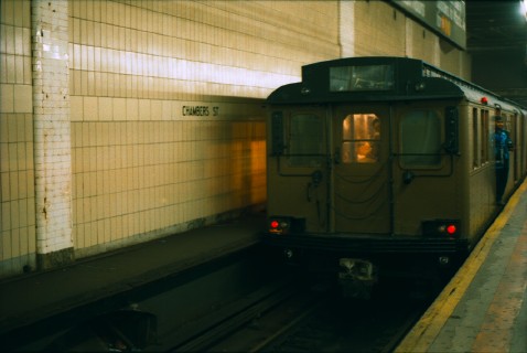
Top, a train of BMT "triplex" cars ran to Chambers St in 2001 on a fan trip, standing against the west side platform wall. The west side platform is walled up, and much of it was destroyed to make room for the expansion of Brooklyn Bridge station. The tiled columns project a little bit from the new wall, except the last one which is flush with the wall. You can see the other side of that last column... |
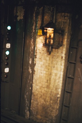
...from Brooklyn Bridge station! Go to the uptown end of the uptown platform, and look into the tunnel where the 6 train goes. Just outside the station, on the side away from the platform, is the column shown here. It's dirty, but it has a light on it for the route request buttons. |
 Photos of Chambers St station can be found at The Other Side of the Tracks, www.nycrail.com. |

|
|
|
|
|
![]()