|
|
←(Use Google Translate to see an approximate
translation into another relevant language)
|
[General index]
[Index to chapters]
[Index to galleries]
[Full family history]
Arlington, Virginia, 1956-61:
Hall's Hill
Frank da Cruz
Bronx NY
January 2021
This is not a chapter of my family history but a
section of the Arlington chapter
extracted for reference as a special topic.
Also see the accompanying gallery of highly
detailed 1943 plat maps of the area.
Most recent update: 1 September 2023 14:11:54
The Hall's Hill Segregation Wall
As on outsider, I am absolutely not qualified to write about Hall's Hill;
the following is a brief sketch of the schizophrenia of North Arlington
when I lived there 1956-59 and 1961-62, and the unease I experienced with a
WALL between human beings just across the street from our house, especially
in 1961-62 after returning from 2.5 years on
an Army base in Germany among people of all
races, religions, nationalities, cultures, and economic status and attending
an integrated, diverse high school there. Information on Hall's Hill has been
hard to find until recently but now we have some excellent sources; see
the References section below.

|
| Hall's Hill on Lee Highway near Glebe Road 1950s
|

|
| Houses on N. Columbus Street 1956
|
Behind the houses along the other side of Columbus street was a high
wall (not visible in the photo from my bedroom window but just behind the
houses on the right). It separated the white neighborhood from Hall's Hill,
an area settled by former slaves after the Civil War. Virginia was
segregated from the first arrival of African slaves in 1619 until the
mid-1960s. Black and white people had separate neighborhoods and separate
schools and many other impediments to normal life. During and after World
War II, the increase in government jobs in Washington resulted in new white
suburban tracts throughout formerly rural North Arlington. New Black
arrivals moved into enclaves like Hall's Hill, which was walled in to
prevent any contact between white and black residents. It is the only Black
enclave I know of that was
completely surrounded by a wall.

|
| Hall's Hill 2020 (Google) - Click to enlarge
|

|
| Wooden Hall's Hill wall segment
|

|
| Hall's Hill Masonry wall segment
|
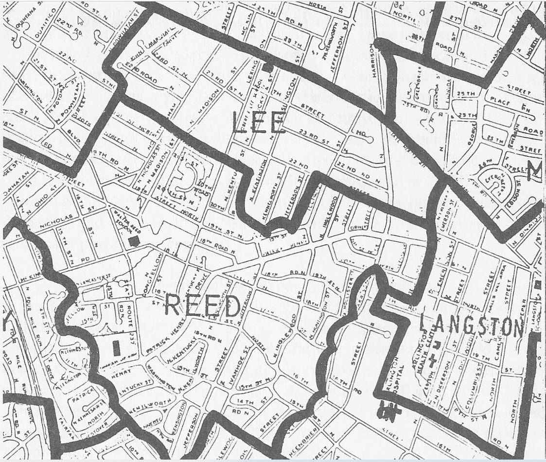
On the modern Google map at left, I traced the outline of Hall's
Hill as best I can, given that I've never seen a proper map of it. Towards
the upper center of the map, the circled A marks
my
grandmother Gus's house on the corner of
N.23rd Street and Glebe Road, where I lived 1945-46, and the circled B marks
the house on N.23rd Street and Columbus Street where we lived 1956-59 and
1961-62, which just is 200 feet from the Hall's Hill wall.

|
| Hall's Hill Segregation Wall historical exhibit
|

|
| Crenellated top of Hall's Hill wall
|
I know the wall went along the backyards of the houses on Columbus Street
from Lee Highway all the way to N.26th Street because I saw it. Other
sources [
4,5,6,12] confirm that it
enclosed all of Hall's Hill. The wall was constructed between 1930 and
1940 by the white occupants of each house on the dividing
line[
4,5,12]. There were only two openings
between Hall's Hill and the outside world: N. Edison Street and
N. Dinwiddie Street, which both opened onto (Robert E.) Lee
Highway, one of Arlington's main thoroughfares and shopping streets. In the
heydey of segregation, the roads within Hall's Hill were all dead ends.
Some of them still are, but since gentrification set in starting about 1979,
some of the roads have been connected to the surrounding streets, as can be
seen on the Google map.

|
| Peoples Drug sit-in 9 June 1960
|

|
| Cherrydale Drug Fair sit-in with Nazis
|
Hall's Hill residents had access to the shopping area at the intersection of
Lee Highway and Glebe Road, and were welcome at the Safeway supermarket on
the corner of Lee Highway and Columbus Street and (as I recall) also the
High's Ice cream store next door to it as well as the nearby hardware store.
They could shop at Robertson's 5&10 but if black children or teenagers
showed up unaccompanied by an adult, the proprietor (Libby) would follow
them around to make sure they didn't steal
anything[
1]. They could also shop at Peoples
Drug Store but could not eat at the lunch counter; this sparked some sit-ins
in 1960, plus "pushback" from the American Nazi Party and its Führer, George
Lincoln Rockwell, who lived nearby[
11]. I was
in Germany during this period.

|
| Evans Coffee Shop about 1960
|

|
| Glebe theater 1945
|
Hall's Hill residents were
not welcome at the barber shop, nor
Glebe theater (1945-72), nor Evans Coffee
Shop[
14,15] (1939-1980, "plantation-style
menu") a snooty place decorated with animal heads and historical memorabilia
and frequented by DAR and Daughters of the Confederacy families.
Nevertheless, Arlington (which until the mid-1930s was home to a thriving
KKK chapter[
1,5,7,8]) fancied itself more
genteel and "tolerant" than the deep south (including non-northern Virginia,
e.g. Charlottesville), so we did not have "White" and "Colored" signs all
over the place, people could sit anywhere they wanted on the WV&M buses
(at least in the early 60s when I was riding them), and Blacks did not have
to step off the sidewalk to make way for whites. There were, however, cross
burnings over the years including at least one when I was living there in
1958[
9].

|
| John M. Langston School 1942
|

|
| Hoffman-Boston High School
|
Hall's Hill residents were hardworking Arlington county taxpayers. Their
local taxes were supposed to go towards the same things white people's taxes
did: water and sewer service, paved streets and sidewalks, gutters, street
lights, trash collection, police and fire department protection, and so on,
plus (from 1954) Supreme-Court mandated separate-but-equal schools. But for
decades water came from wells, bathrooms were outhouses, roads were dark and
not paved until well after WWII, there were no sidewalks and no drainage,
the police never came unless they were looking for somebody and the fire
department would not come at all (so Hall's Hill formed its own volunteer
fire department). As to education, Hall's Hill had its own Langston
Elementary School[
13] (at the center of
the
map where it says Langston-Brown
Community Center). It was extremely convenient but, at least until
1953[
2], had only four rooms. The closest high
school for black teens was Hoffman-Boston: five miles away with no school
bus or public transportation. Getting the Arlington County government to
meet its responsibilities in all of these areas was a struggle over many
decades of which I, who lived practically next door, was completely unaware.
And all this is not even to speak of the decades-long struggle for school
integration, in which, even after Brown-vs-Board-of-Education, Virginia was
a notorious foot-dragger[
1,2,5]. When I
graduated from nearby Yorktown High School in 1962, it was still all white.

|
| Present-day Wall tourists
|

|
| Marker (click to read)
|
By the time Hall's Hill finally had paved roads, running water, and all the
other services it had fought so long and hard for, white people started to
move in and today they are in the large majority. Many of the streets are
reconnected and the wall is mostly gone except for some sections that serve as
tourist attractions. And now, as a New Yorker since 1966, I watch in stunned
disbelief as the same thing happens here to Harlem....
Harlem!!!
Acknowledgments...
...to Cathy Hix, Annette Benbow, and Jessica Kaplan of
the Arlington Historical
Society (AHS) and to Frank O'Leary, former Arlington County Treasurer
and even more former high-school buddy at the Army high school in Frankfurt,
Germany, for connecting me with the folks at AHS. And to Wilma Jones for
writing the book that so badly needed writing!
References:
- Book: Wilma Jones, My
Halls Hill Family: More Than a Neighborhood, self-published (2018).
- Article: Sophie
B. Vogel, The
Integration of Reed Elementary School, Arlington Historical
Magazine, Vol.11 No.1, October 1997, pp. 32-41, accessed at the
Arlington Historical Society website 15 January 2021. This is a PDF file
that starts with a 1963-64 map that, on the mid-to-lower extreme right,
shows bits of Hall's Hill where the dead-ending
of the streets is clearly visible. It notes that in 1925 the John
Langston School at 4864 Lee Highway was established to provide separate but
equal education for the children living on either side of Lee Highway. It
also says that additions were added in 1953, 59, and 64. It also notes that
the process of integration of Arlington schools began on February 2, 1959,
when four Afro-American students were enrolled at Stratford Junior High by
Court order. Four years later, in 1963-64 [the year after I graduated from
nearby all-white Yorktown High School], all secondary schools in the county
were integrated. No action was taken to desegregate at the elementary level
until 1966 — twelve years after Brown-vs-Board-of-Ed; I came back to
Yorktown that year, after the Army, to pick up a transcript and found an
integrated school.
- PhD Dissertation: Nancy Perry,
The
Influence of Geography on the Lives of African American Residents of
Arlington County, Virginia, During Segregation (PDF), George Mason
University (2013).
- PhD Dissertation: Lindsey
Bestebreurtje, Built
by the People Themselves – African American Community Developments in
Arlington, Virginia, from the Civil War through Civil Rights (PDF), George
Mason University (2017): pp.63-75 (history); 208-209 (about the Wall);
213-214 (street lights); 223-224 (KKK); 289-29 (overcrowding); 319-349,
373-377 (schools and integration); 351-353 (infrastructure improvements);
377-393 (gentrification).
- Book: Plat Book of Arlington County,
Virginia, Franklin Survey Company, 2006 Chestnut Street, Philadelphia PA
(1943).
- Article: Hall's Hill Area Due for Renewal,
Northern Virginia Sun, 23 February 1965: "...Negro community of 1650
persons, 322 houses, three churches, and a school... The community is cut
off from Glebe Road by dead-end streets and from any entry on the south side
by four blocks of solid fences and walls running along North 17th Street."
(Thanks to Cassandra Ellison of the VCU Center on Society and Health for
sending me the article as a PDF.)
- Article: Janet Wamsley, The
K.K.K. in Arlington in the 1920s, Arlington Historical Society,
Arlington Historical
Magazine, Vol.10 No.1, October 1993, pp.55-59.
- Masters Thesis: James Lamb, The
Ku Klux Klan in early twentieth Century Virginia, James Madison
University, Summer 2018.
- Article: "Fiery Cross Set Up in
Arlington",
The Washington Post and Times Herald, 23 June 1958, p.B2: "A burning
cross was found yesterday in a cemetery adjoining a Negro church in the 5000
block of Lee Highway, Arlington County Police reported ... made with 7- and
5-foot building timbers ... Reported by the Rev. John F. Monroe of the
Calloway Methodist Church." Thanks to Jessica Kaplan of AHS for this, who
also said "Saundra Green, a long time resident and historian of the area,
had one burned on her front lawn during this period as well."
- Report: A Guide to
the African American Heritage of Arlington County Virginia,
Department of Community Planning, Housing and Development Historic
Preservation Program, Second Edition (2016). Covers Hall's Hill on
pages 12-22 and the Peoples Drug Store lunch counter sit-in on p.57.
- Article: Mark Jones,
Sit-ins Come to Arlington, Boundary Stones (WETA history site),
22 June 2014. The first photo shows Gwendolyn Greene at the counter of
the Peoples Drug at Lee Highway and Old Dominion Drive, which is about
500 feet from Hall's Hill. The Cherrydale Drug Fair was about a mile
to the east on Lee Highway.
- Article: Lindsey Bestebreurtje, A View from Hall's Hill: African
American Community Development in Arlington, Virginia from the Civil
War to the Turn of the Century
Arlington Historical Magazine, Vol.15 No.3 (2015), pp.19-34:
"(the) wall construction was executed on an individual home-owner level,
however, it was planned out enough that by the early 1940s the entirety of
Hall's Hill was quartered off ... the wall meant that the community could
not expand..."
- Article: Nellie C. Stewart, History of
Langston School (origin unknown, written some time after 1960;
Wilma Jones found it among her mother's papers)
[audio]
- A
Guide to the Bayard D. Evans Collection, Fairfax County Public Library.
- Obituary: Bayard
Evans, Restaurateur, Washington Post, September 8, 1980:
"Its furnishings included a much-admired array of historical memorabilia,
including weapons, portraits and tools that predated the Revolution, as
well as a collection of items that related to Robert E. Lee."
- There are examples of segregation walls that do not totally enclose the
Black enclave; for example, the wall erected in Detroit when a new white
subdivision was constructed on empty land next to an existing Black
community, the The
Detroit Eight Mile Wall (Wikipedia, accessed 26 January 2021).
Another example is
the Liberty
City wall in Miami.
- Book: Arlington Historical Society, Arlington,
Images of America series, Arcadia Publishing (2000). Has a few photographs
of and words about Hall's Hill.