West Hill Lift, Hastings
East Hill Lift, Hastings
TODAY'S ITINERARY
Exploration: Saturday, 29 June, 2019
lv London Bridge 0914 Southeastern
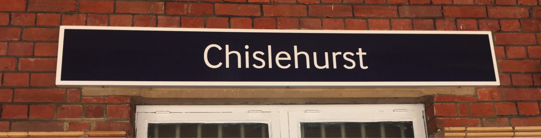
ar Chislehurst 0933
lv Chislehurst 1149 Southeastern
ar Orpington 1155
lv Orpington 1210 Southeastern
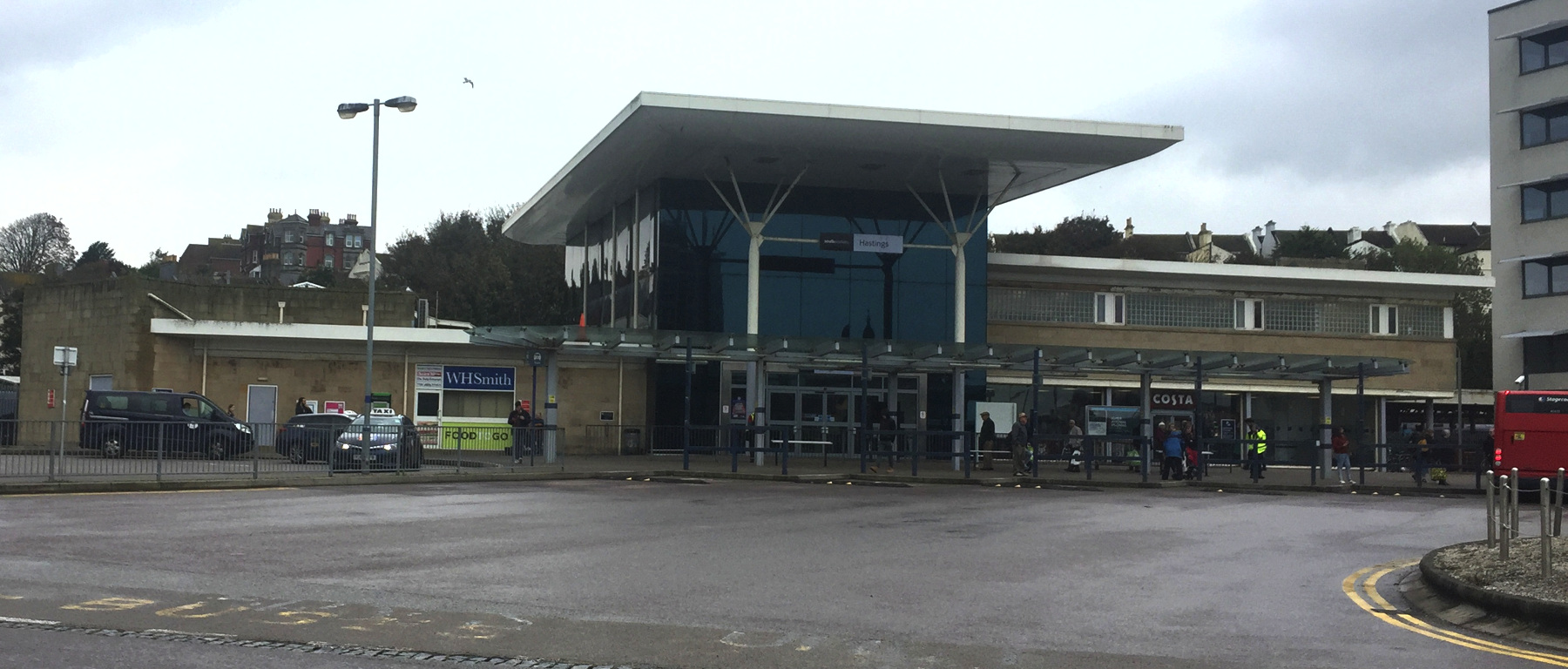
ar Hastings 1319
lv Hastings 1631 Southeastern
ar London Bridge 1800
Exploration: Monday, 14 October, 2019
lv London Bridge 1124 Southeastern
ar Hastings 1300
lv Hastings 1603 Southern
ar Victoria 1829
JUNE
In London it was hotter than Hell.[note 1] The record-breaking weather that had been roasting the Continent for a week now pushed a tongue of fire into Britain for one miserable day.
I had already been considering whether to go to Hastings at all, because I had been there in 2017 and might have all the photos I needed. For that reason I held Hastings for last in case some disruption would require all the days I had to visit the other funiculars. But everything went well. The only problem that happened was the South Western Railway five-day strike, and it occurred so early in my stay that I could just rearrange my schedule. Nevertheless my secret Pokémon-like goal was to "collect them all" in the same year, and now I did have a day available for Hastings. I was always ready to go out in a little rain, but this heat was something else.
To put off the final decision, I decided to start by going somewhere cool. Literally cool. Many years ago I had come across an old guidebook that mentioned two unusual places just outside London that appealed to me. Bekonscot Model Village, I finally visited in 2018, and it was even better than I expected. You need to see it. The other one was the Chislehurst Caves. Chislehurst is on one of the railway lines that go to Hastings, so I could realize the dream from long ago and still continue if I wanted to do so.
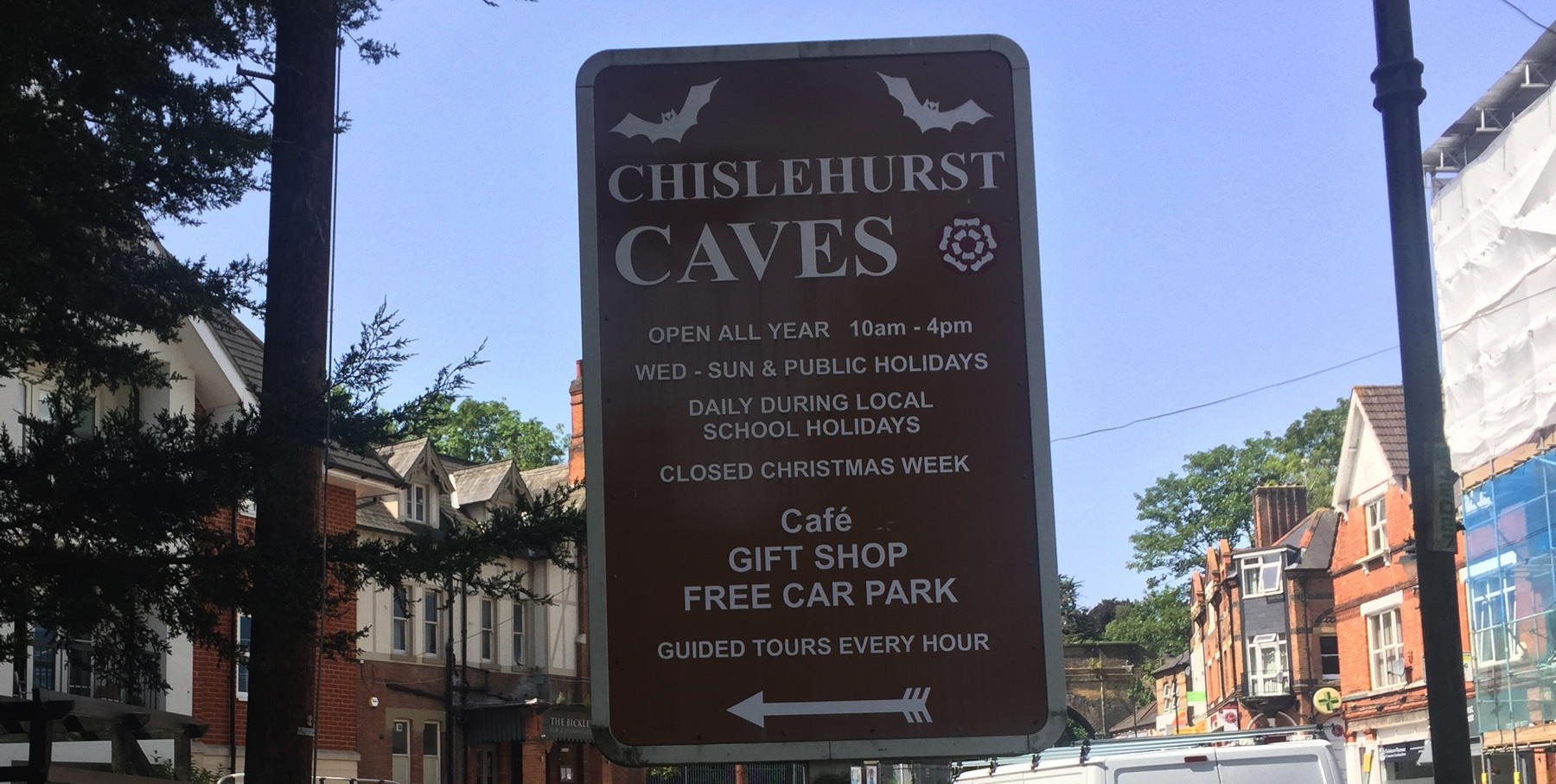
It's just a few blocks from the station. They are not really caves, but a system of intersecting man-made tunnels forming a mine for chalk and flint that dates back to the thirteenth century or earlier. The guided tour covers no more than one mile of the estimated twenty-two miles of passages. I arrived shortly before the first tour of the day. As we entered oil lanterns were distributed to the adult visitors, because most of the path we would walk has no electric light installed. The tour emphasizes the mine's role as a shelter in the second world war when many civilians stayed there during German bombing. I was happy with the 50°F temperature and our cheerful guide's patter. "If you have been entertained or learned something please do not blame me," he concluded.
Since I had not worked this day out ahead of time I asked the station agent at Chislehurst about the best place to change for Hastings, and after consulting her screen she advised Orpington. It worked out.
OCTOBER
My heat-addled brain was not able in June to recall which views I had already photographed, and so I missed some obvious things like the upper stations of both funiculars. Really. So on a second visit to Britain in October I went back to cover what I missed. The lifts were still running but with shorter hours, said the web page. The lift is closed for necessary maintenance, said the paper sign on the entrance to each of them. But it was now cooler than Hell, so at both sites I walked up to get pictures.JUNE AND OCTOBER
In October I took the same railway line past Chislehurst and Orpington, so the rest of this page is about the same type of journey to Hastings.
After I was home I read that the railway south from Tunbridge Wells was built quickly through difficult terrain, with excessive curvature, grades as great as 2 per cent, and eight tunnels. Substandard construction of the tunnels required installing thicker lining at various times after opening day, and the result was the need for special narrower rolling stock for over a century. The last of the restrictions was cleared by relaying four of the tunnels with single track.
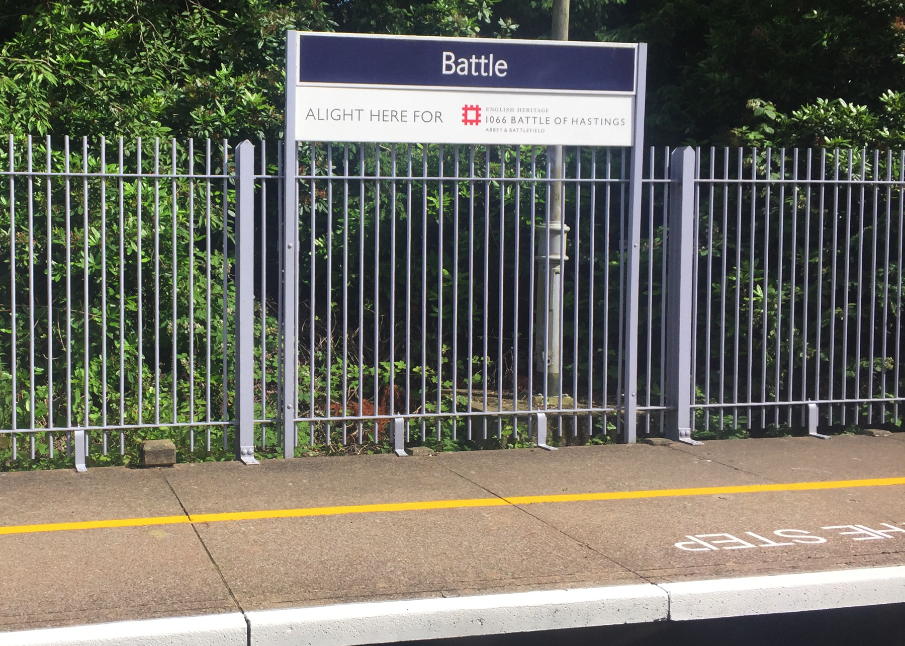
The sign at the station for the village of Battle reads "Alight here for 1066 Battle of Hastings" and some say that it was a Saxon sign of this nature that led William of Normandy and Harold Godwineson to choose the site for the all-day event that changed the course of English history. Those who say that are being silly of course, but it is disappointing that the battle was fought six miles from its titular town. The Battle of Battle I suppose does not sound right.
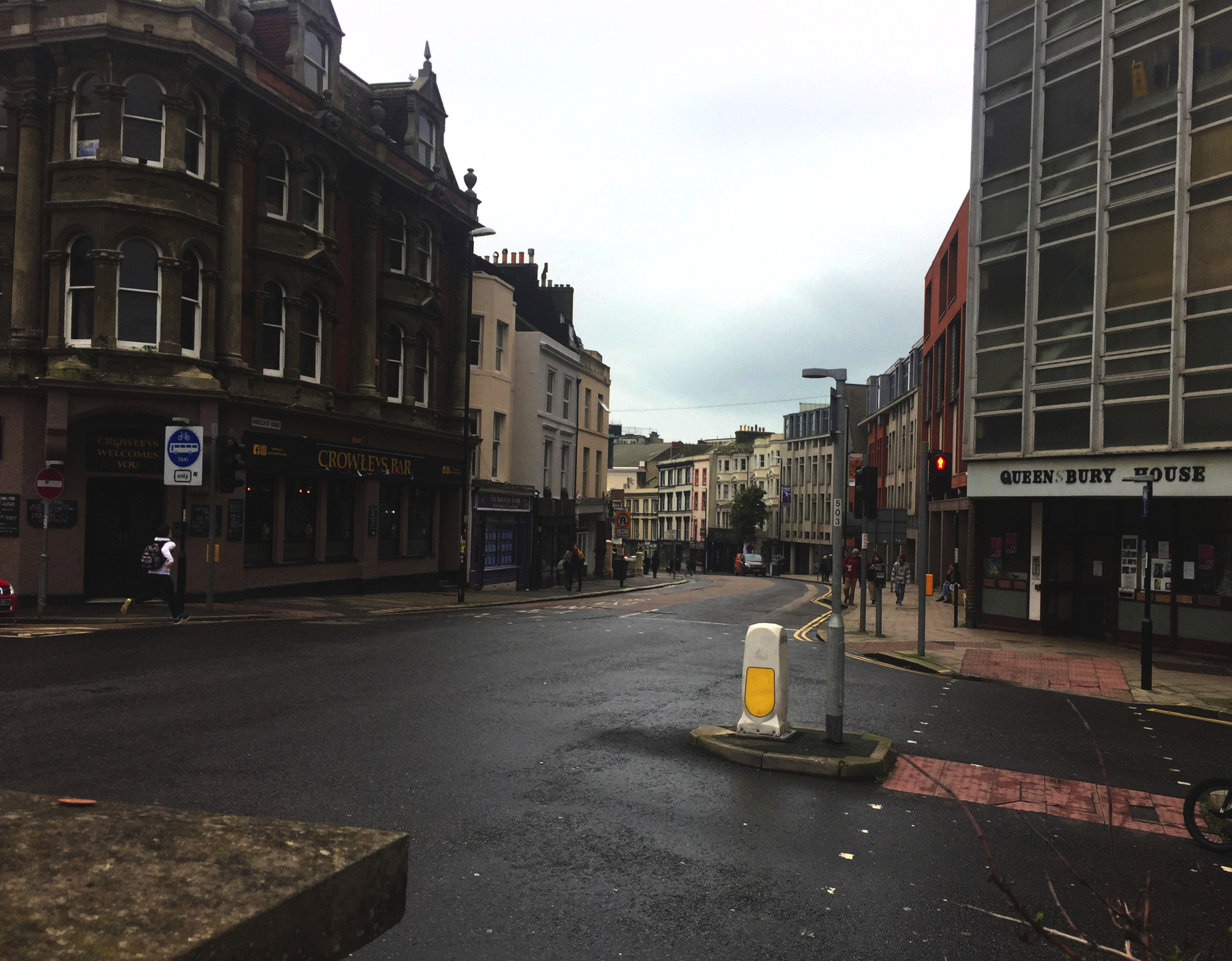
The two "lifts" in Hastings are named for West Hill and East Hill, large open grounds separated by the valley of Old Town, all of this situated to the east of Hastings station and the modern business district. From the railway station a good plan is to cross the bus station and follow the gentle curve of Havelock Road and its continuations to the wide "parade" street that follows the coast. The west lift is about half a mile from the station and the east lift about a third of a mile from there.
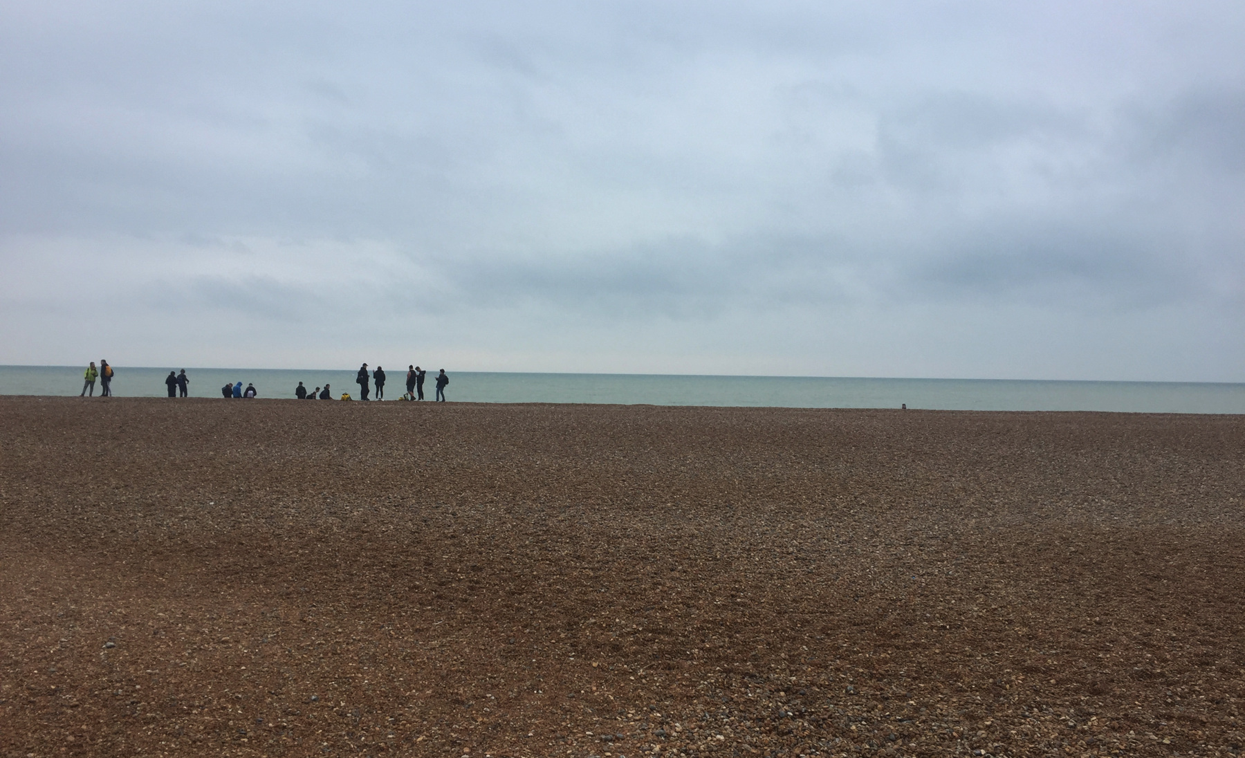
Go down to the beach, even if it's cold or rainy.
West Hill Lift
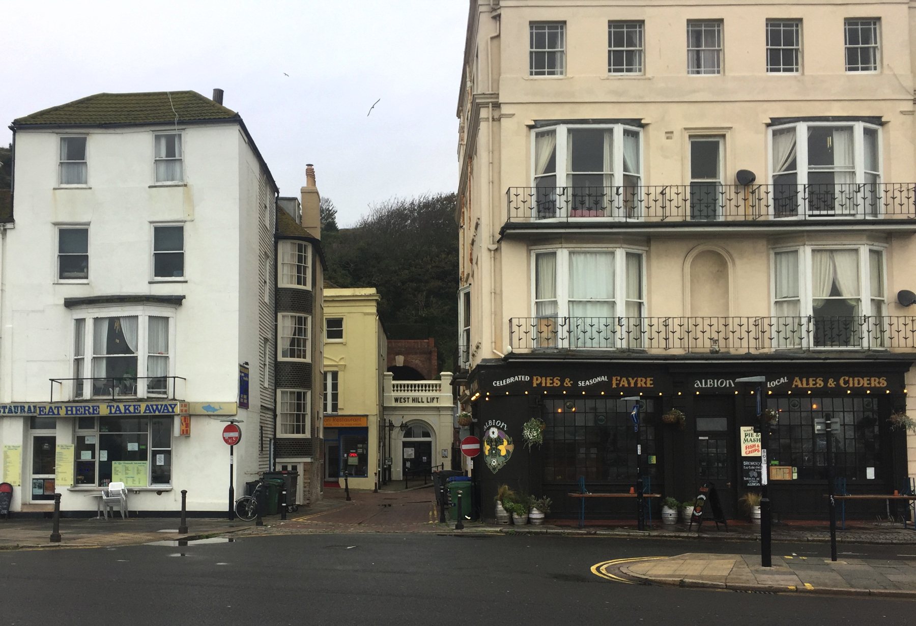
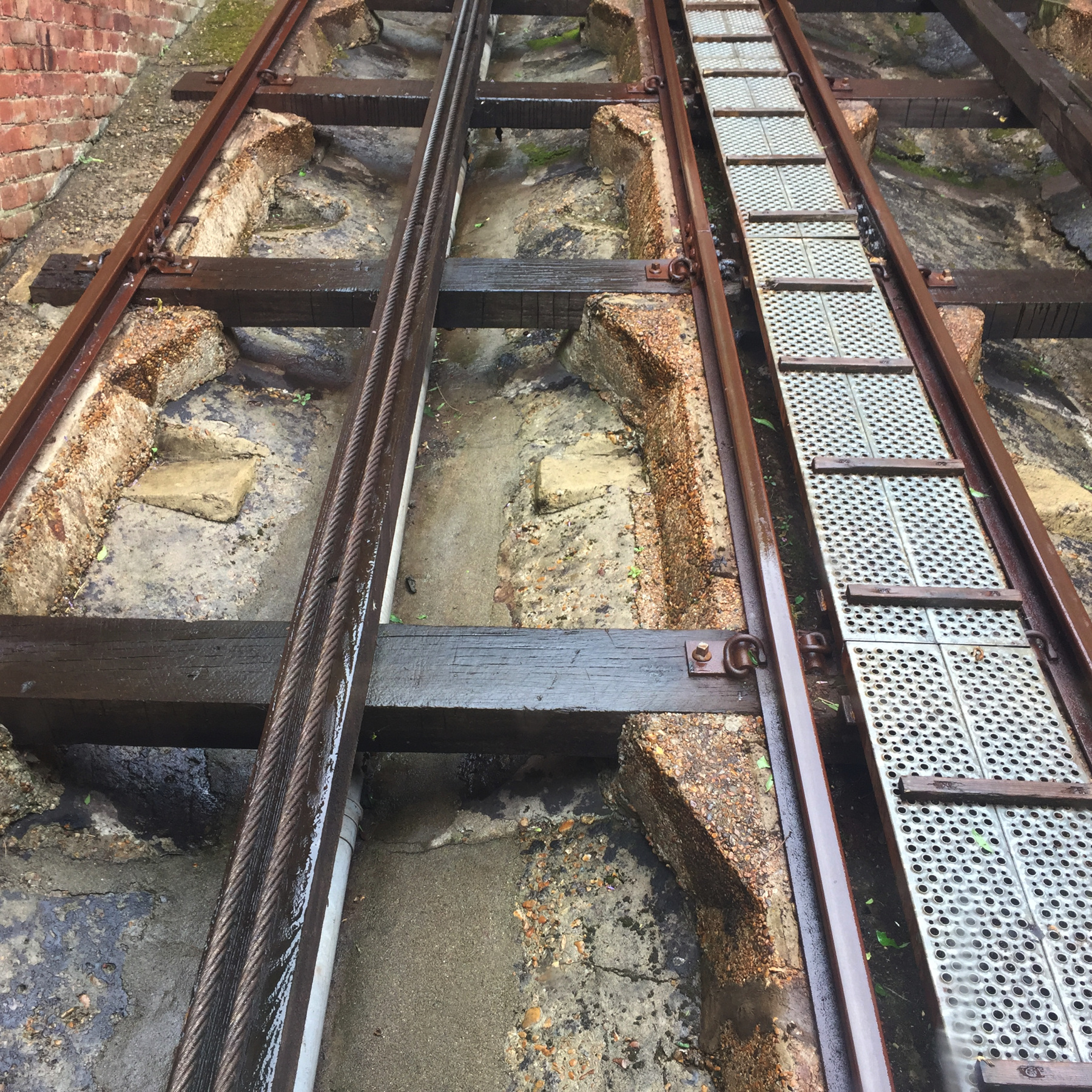
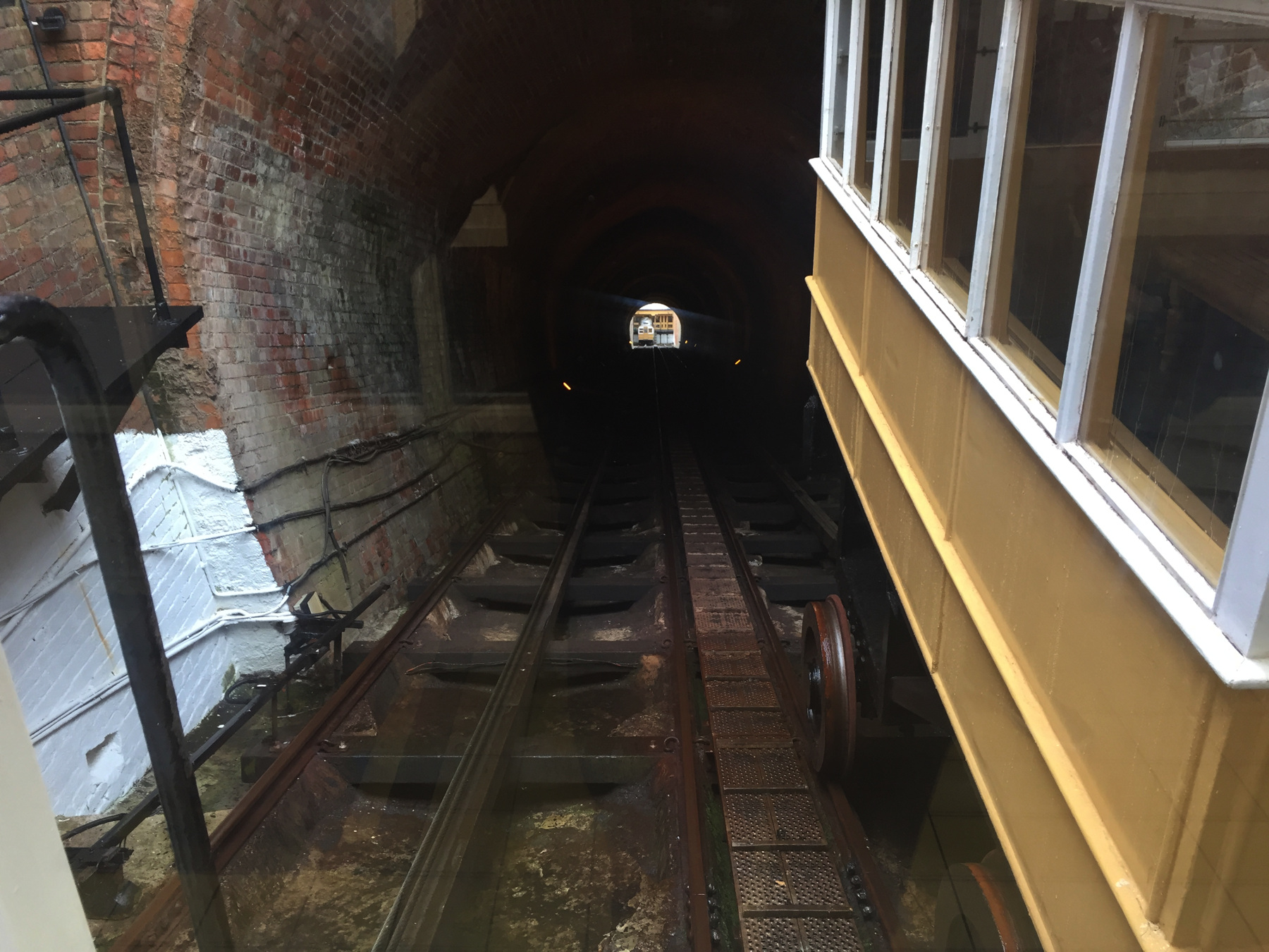
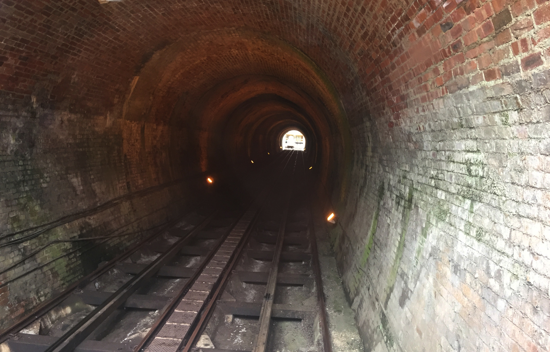
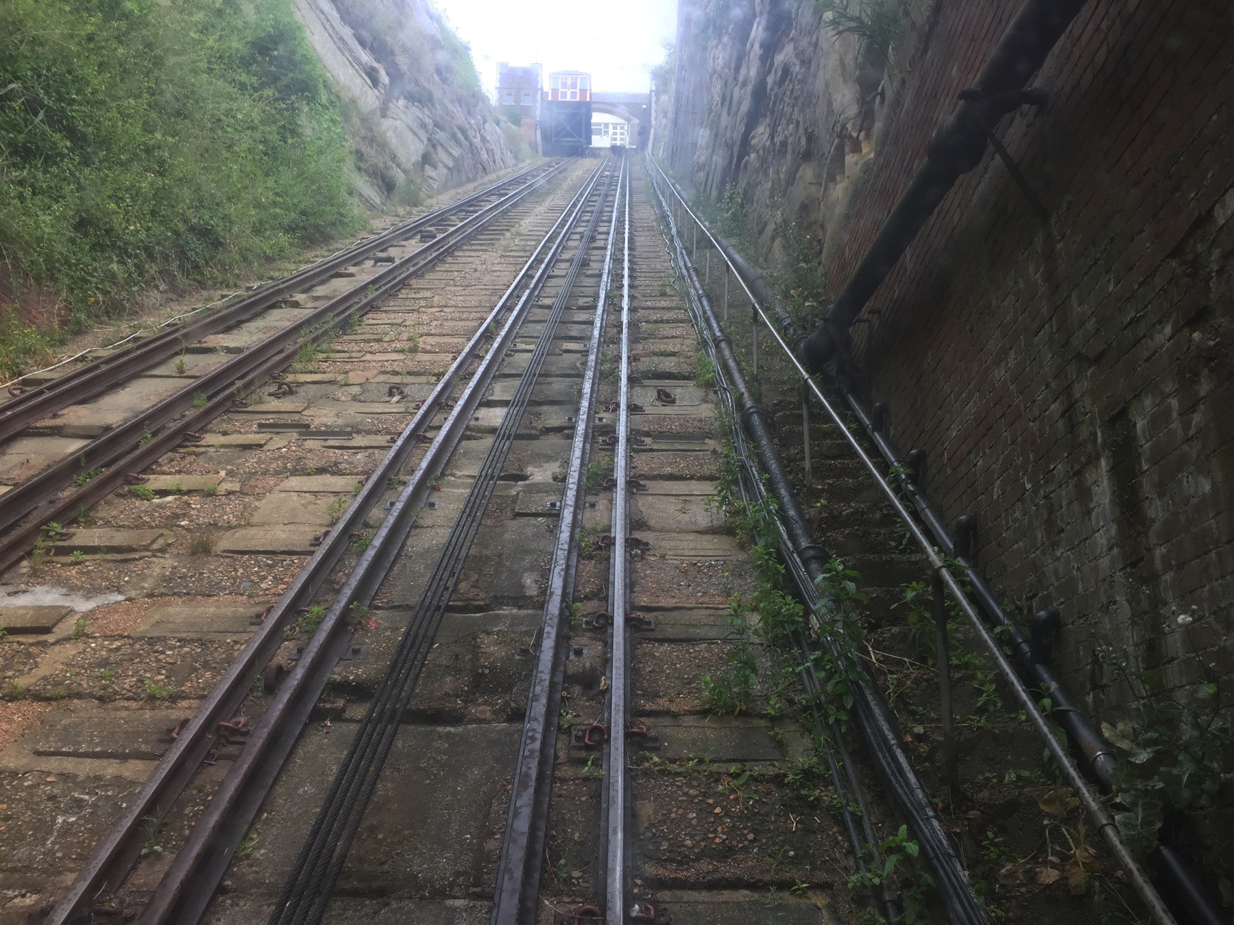
The lower station of the West Hill Lift is set back at the end of a lane off George Street, from which you could miss it if you keep your eyes straight ahead. The lane does continue out to the parade, so it can be seen from there too, if you are looking for it, by sighting along the left side of the Albion pub (with its deservedly celebrated pies). In addition to this limited visibility almost the entire railway is in a tunnel, and the short open sections at each end are in cuts.
Let's go up.
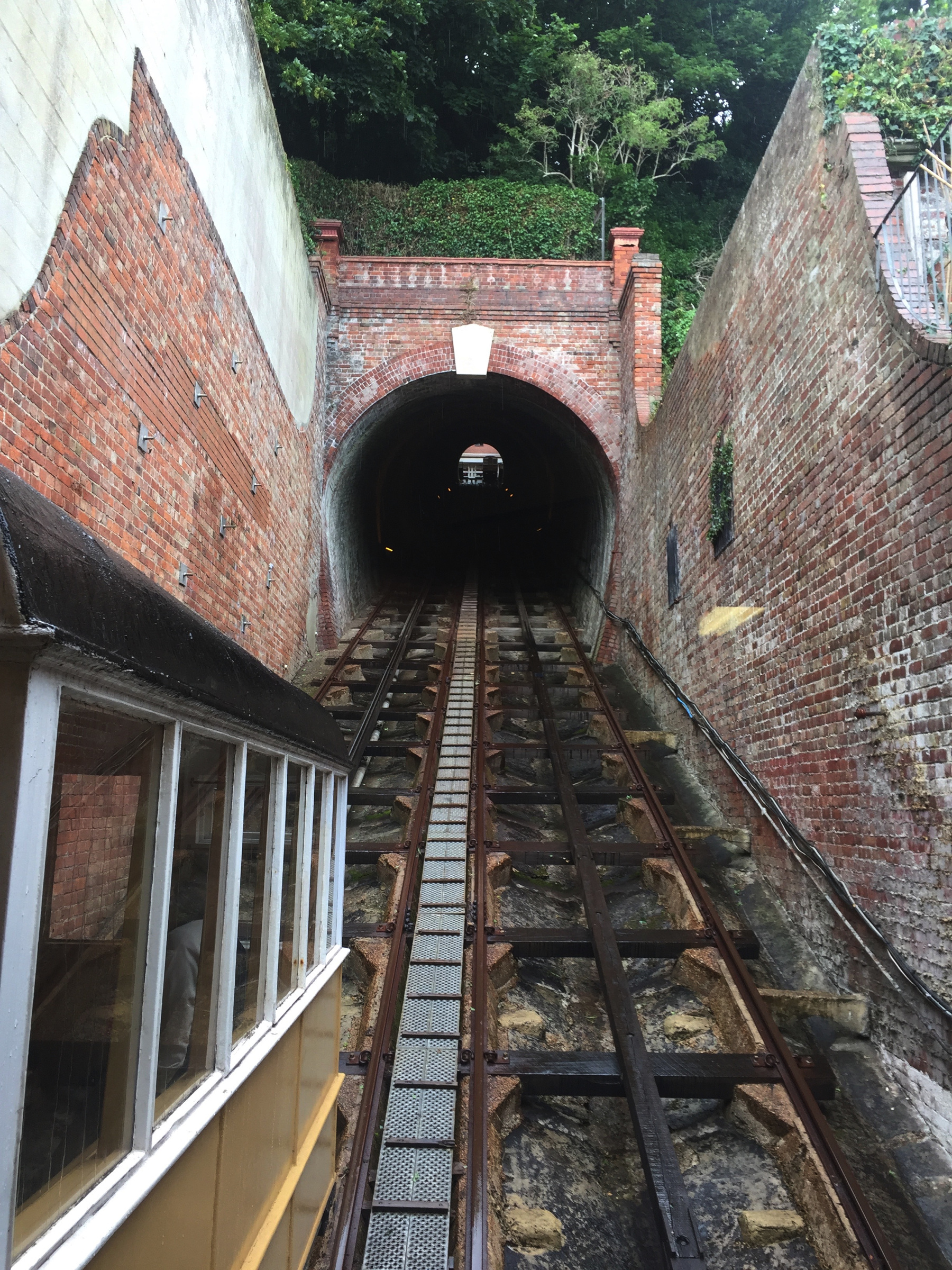
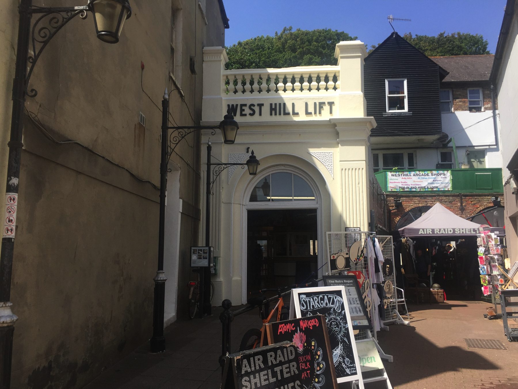
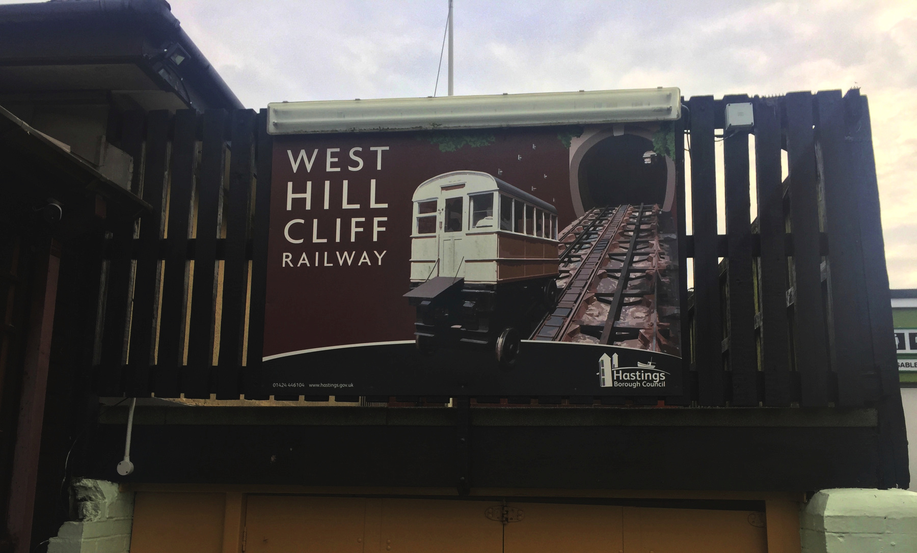
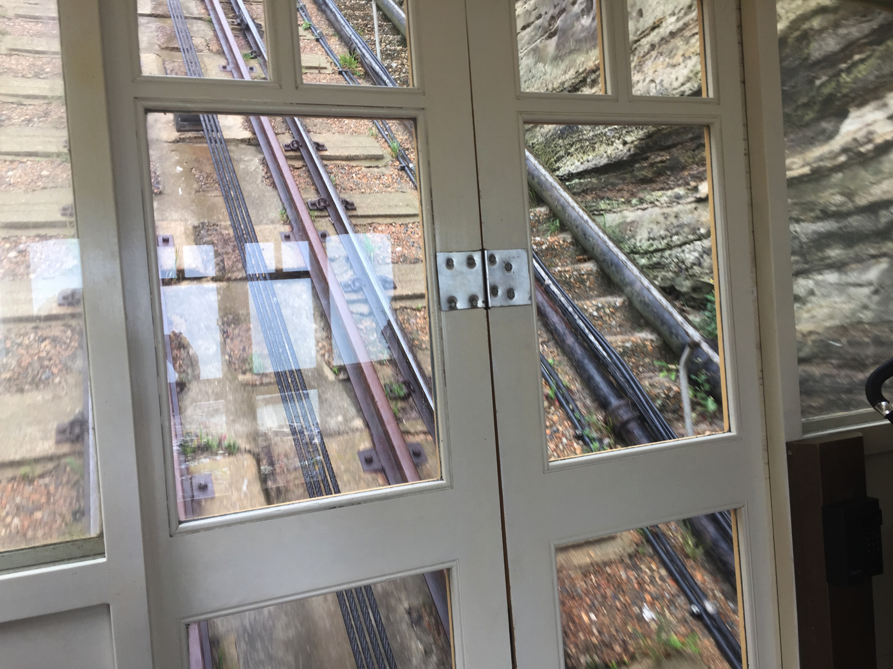
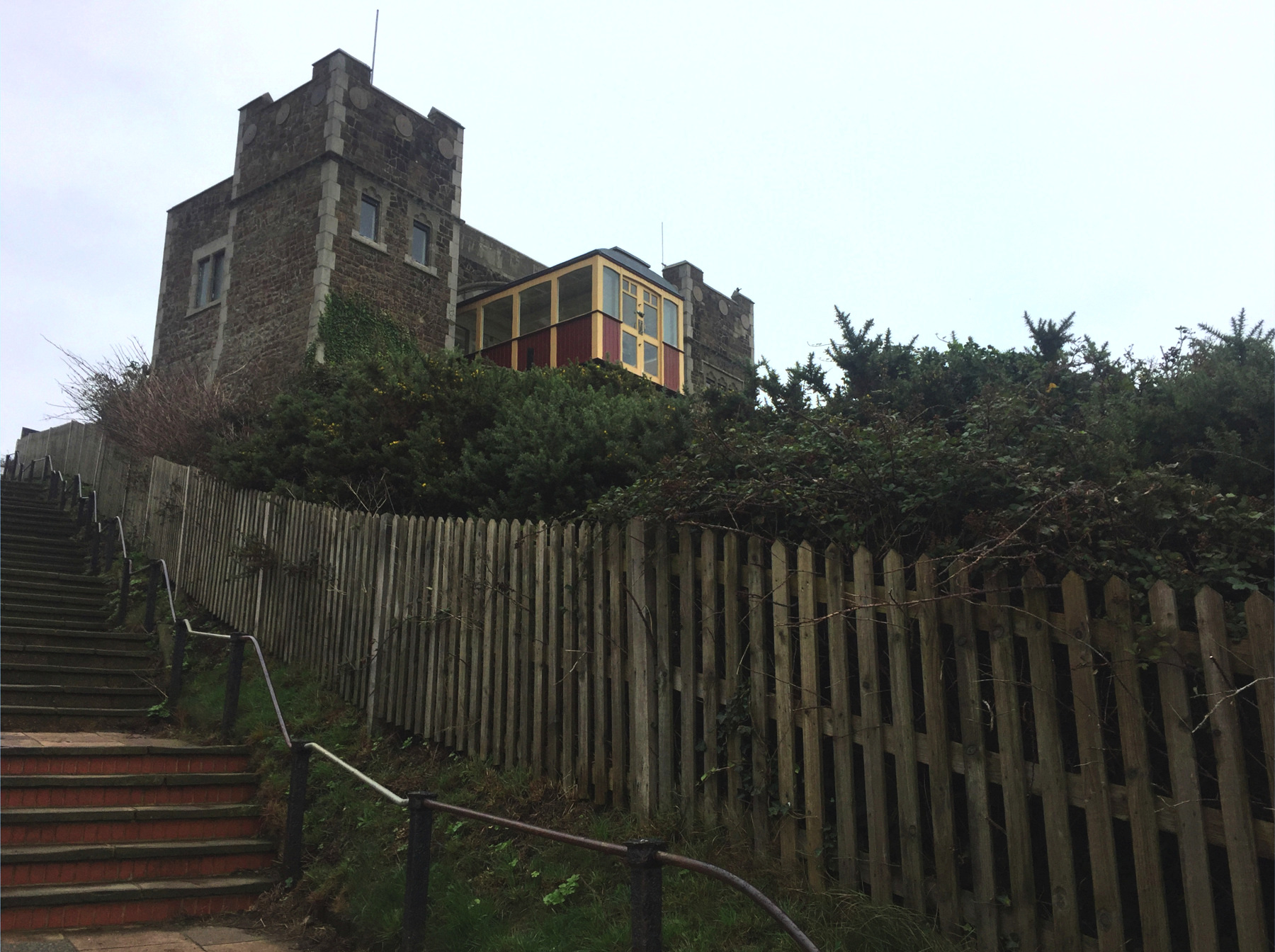
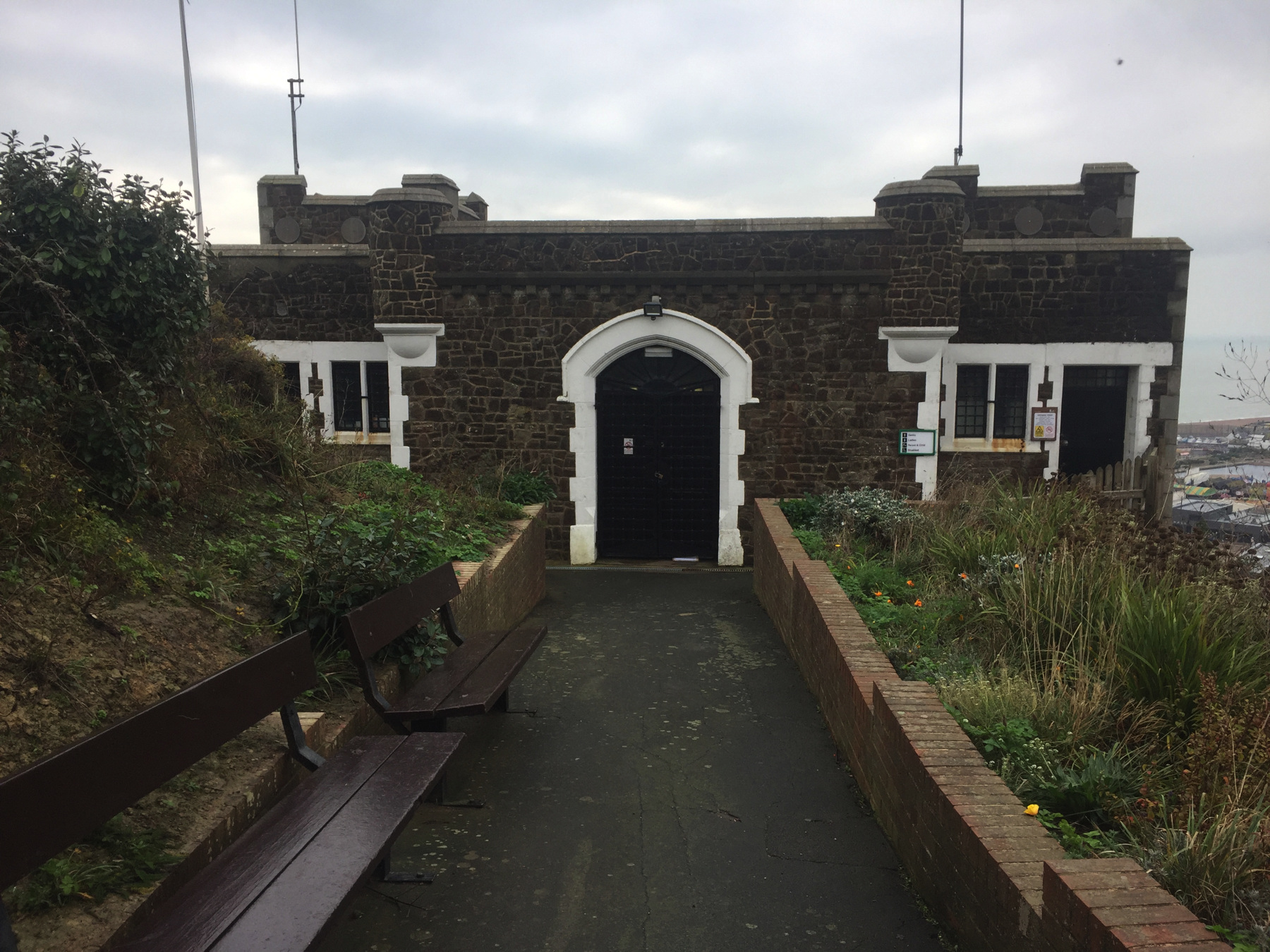
The upper station is also a little hidden, around the back of the West Hill Cafe. The entrance is over there on the right. Once you approach there is a nice graphic for the West Hill Cliff Railway (sic) with a better view of the car than you can get from anywhere in real life.
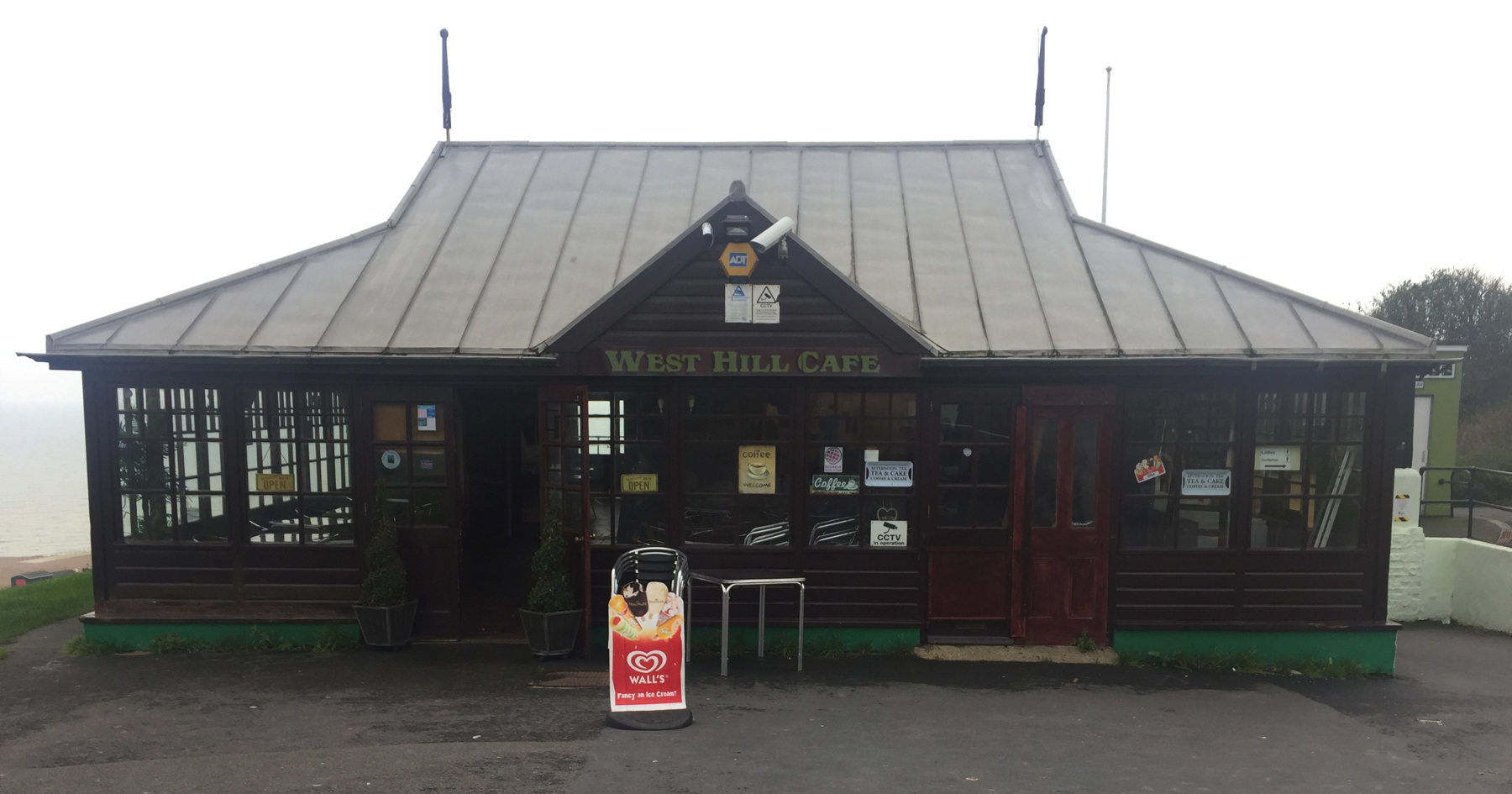
There is an open cut at the top, like there is at the bottom. It is right behind the cafe building, but a tall brick wall prevents cafe customers on the terrace from getting a look at the funicular. I think it would be great if they could watch it.
If you climb up the hill south of the station you can see where the secret open cut is. You can also see, on the right-hand slope of East Hill, the top of the other cliff lift.
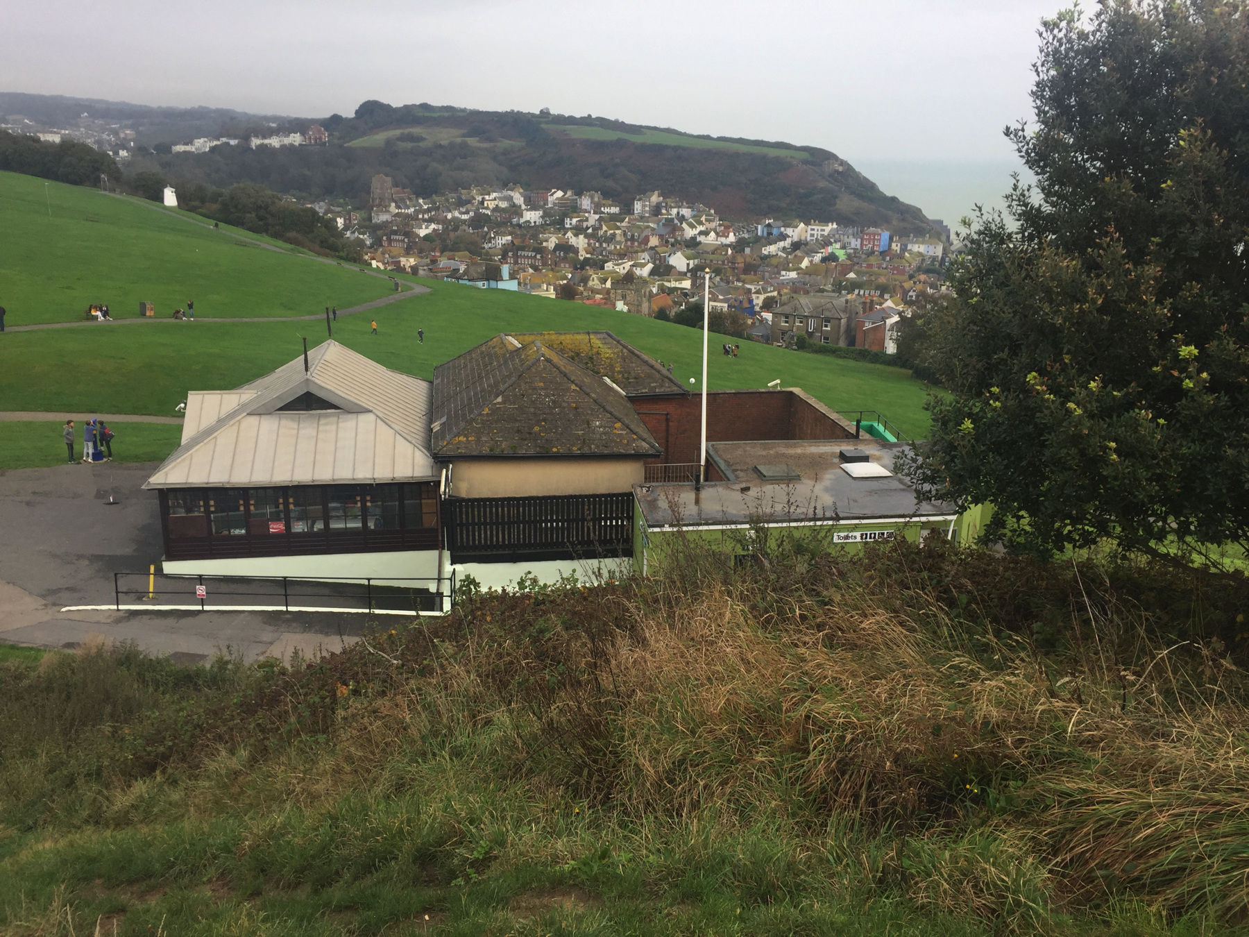
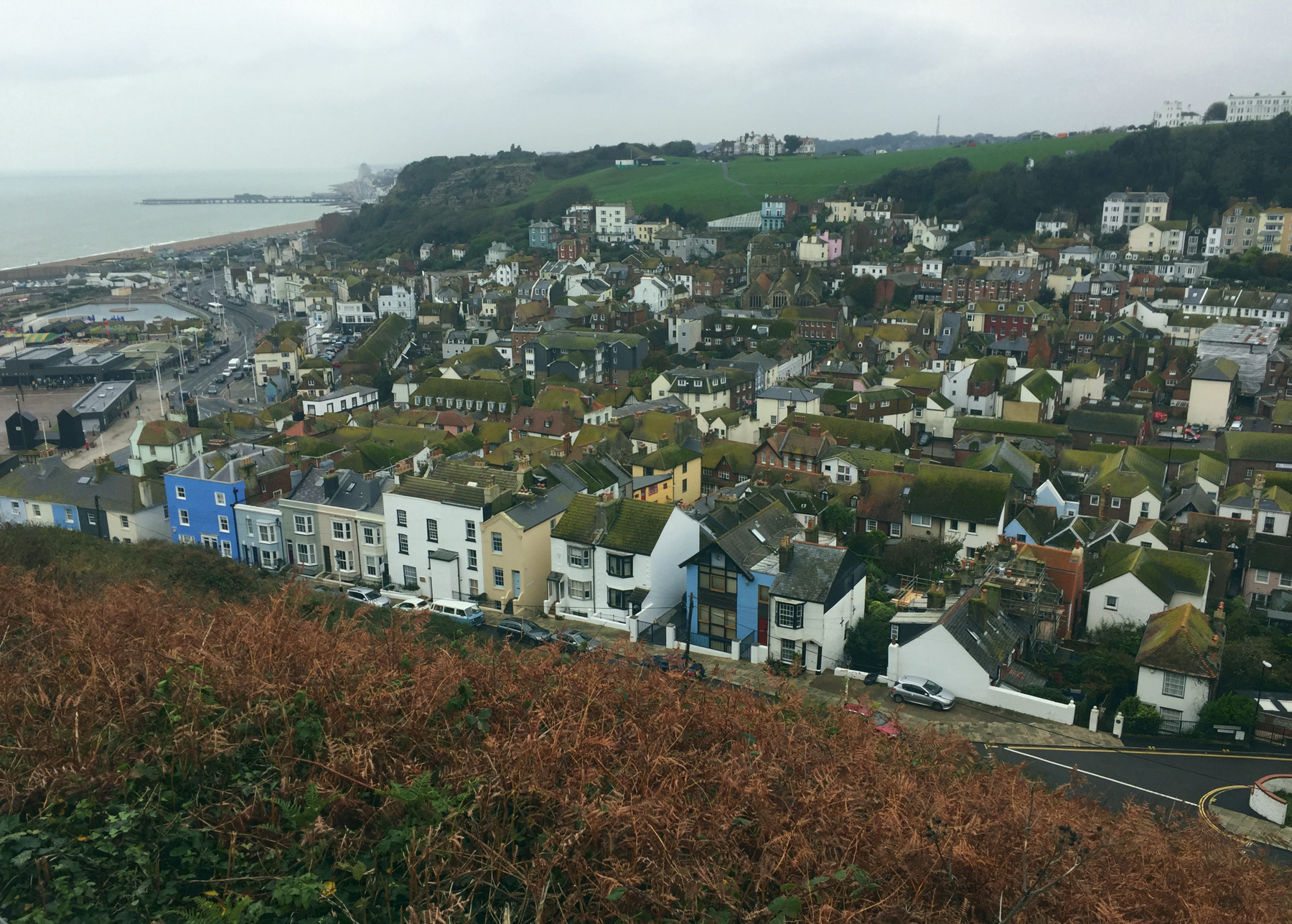
A short walk from the previous vantage point almost gives a view of the lower station too. The tall cream white building in the center is the Albion pub. Right below it, there is a space between buildings: the one with the black top floor and windows on the left, and the small building with the dark peaked roof on the right. A little bit of white shows in that space. That's the lower station.
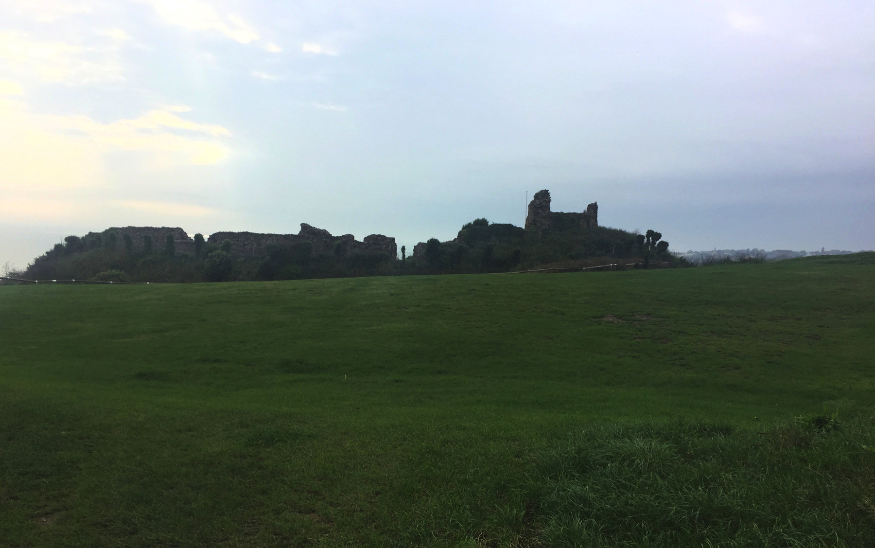
The other thing that will catch your eye, if you can forget about funiculars for a moment and turn south, is the remains of Hastings Castle. It's very hard to get an image of it that shows more than a silhouette. This is the best one of maybe two dozen tries! It's an English Heritage site, and you can find your way over there and go in for a modest admission. The castle dates to about 1080, but as early as 1287 parts of the walls were lost to cliff erosion. More of the same damage continued and it was a ruin by 1600, topped off by bombing in the second world war.
And so we go down.
Now if you happen to arrive when the West Hill Lift is not running, you can always walk up. Just use the 99 Steps. They're just down the street, the street with a solid row of buildings, each touching the next. The steps are on the official Sussex County map of public footpaths. They are shown on Google Maps and Open Street Map, and on an Ordnance Survey map of a hundred years ago.
But where are the steps? The only thing I could find was a narrow arched opening near one side of a building that leads straight back, with no doors along it, to a hint of daylight shining on steps. It has no "private" sign but it has no other sign either. After hesitating a few minutes I decided to go into the semi-darkness of the antique shop next to it and ask the old curmudgeon sitting at the desk. I said something like, Hello, that passage (here I pointed in its direction), does that go to the 99 Steps? He chuckled and said yes, paused for breath, and added, it's really 120 steps. I wondered aloud why there was no sign. He blamed it on the Liberal Party who don't care about anything. I thanked him for his help.
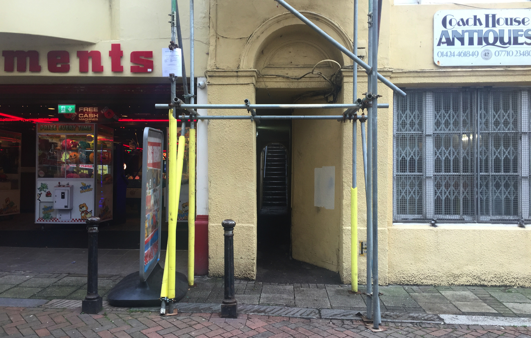
He was right, the passage went to the 99 steps, or the 120 steps; I didn't count. It takes a few turns going up, and somewhere it crosses over the hidden tunnel of the West Hill Lift to end up east of it. About halfway I met an Italian couple (judging by the man's speech) who asked whether the steps really went all the way down. I told them yes, and right at the end you go through a building, and that last bit did not seem to surprise them.
East Hill Lift
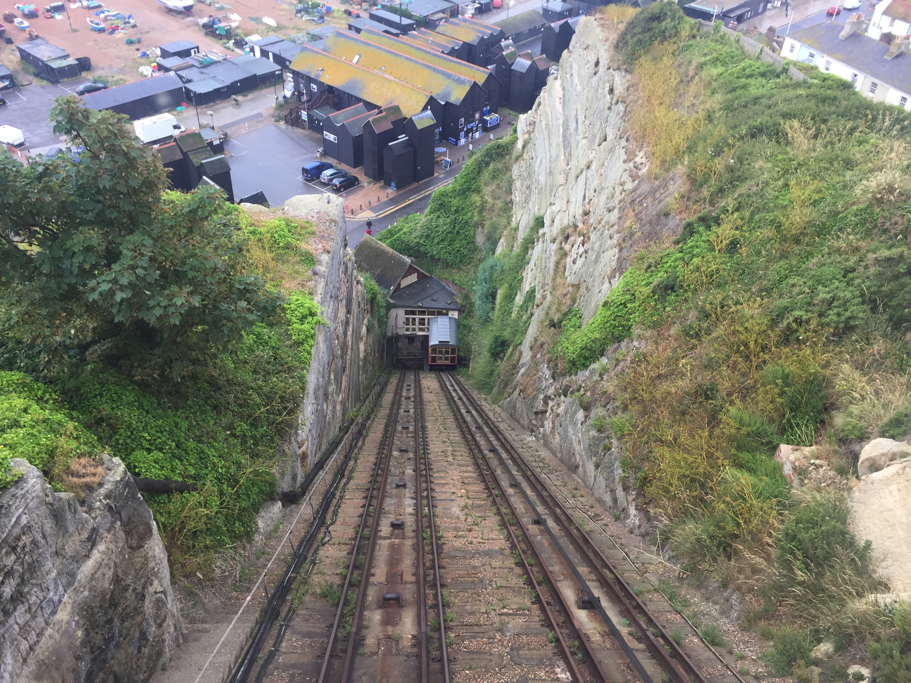
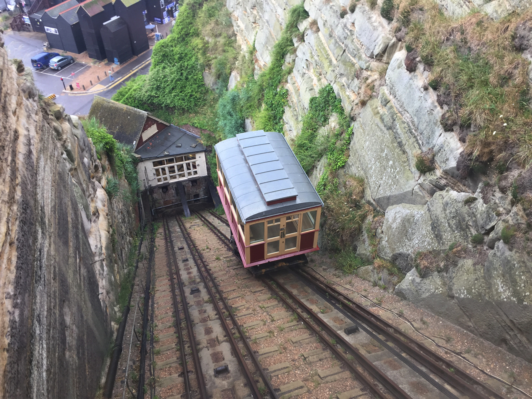
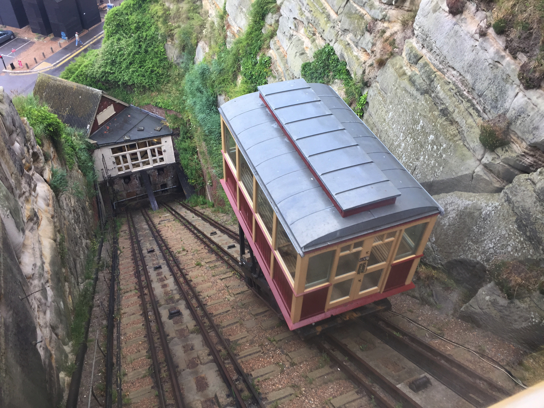
The East Hill Lift presents quite a contrast. The lower station is in plain view and the railway is too, out on the cliff face. The overall height is more than the West Hill Lift and the grade is much more steep.
The style of the two stations could hardly be more different but both are original. The towers of the upper station contained water tanks: unlike the West Hill Lift this one was water balanced.
Going up...
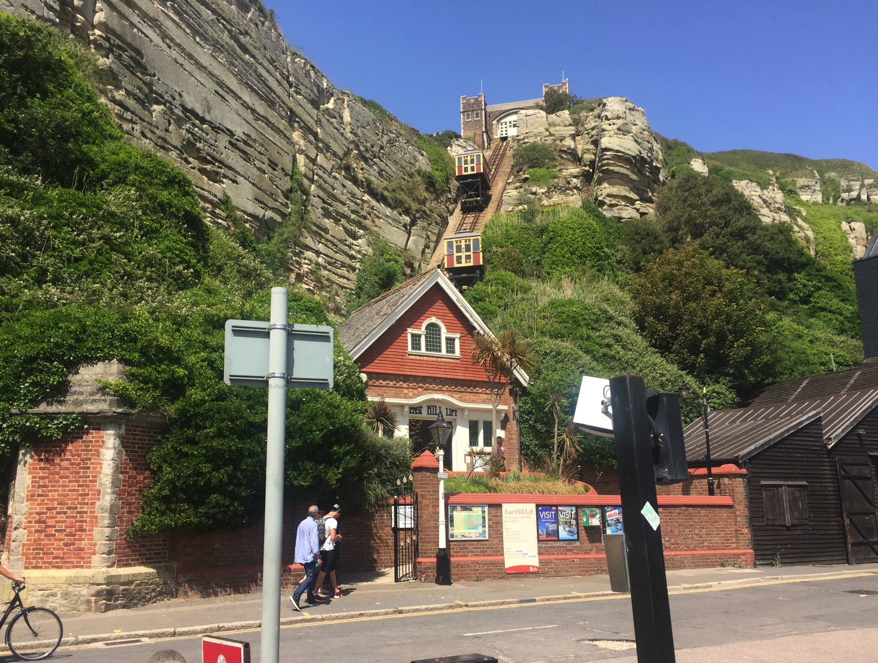
The East Hill Lift has four cables, while the West Hill has only two. In both cases the cables connect only the upper ends of the car.
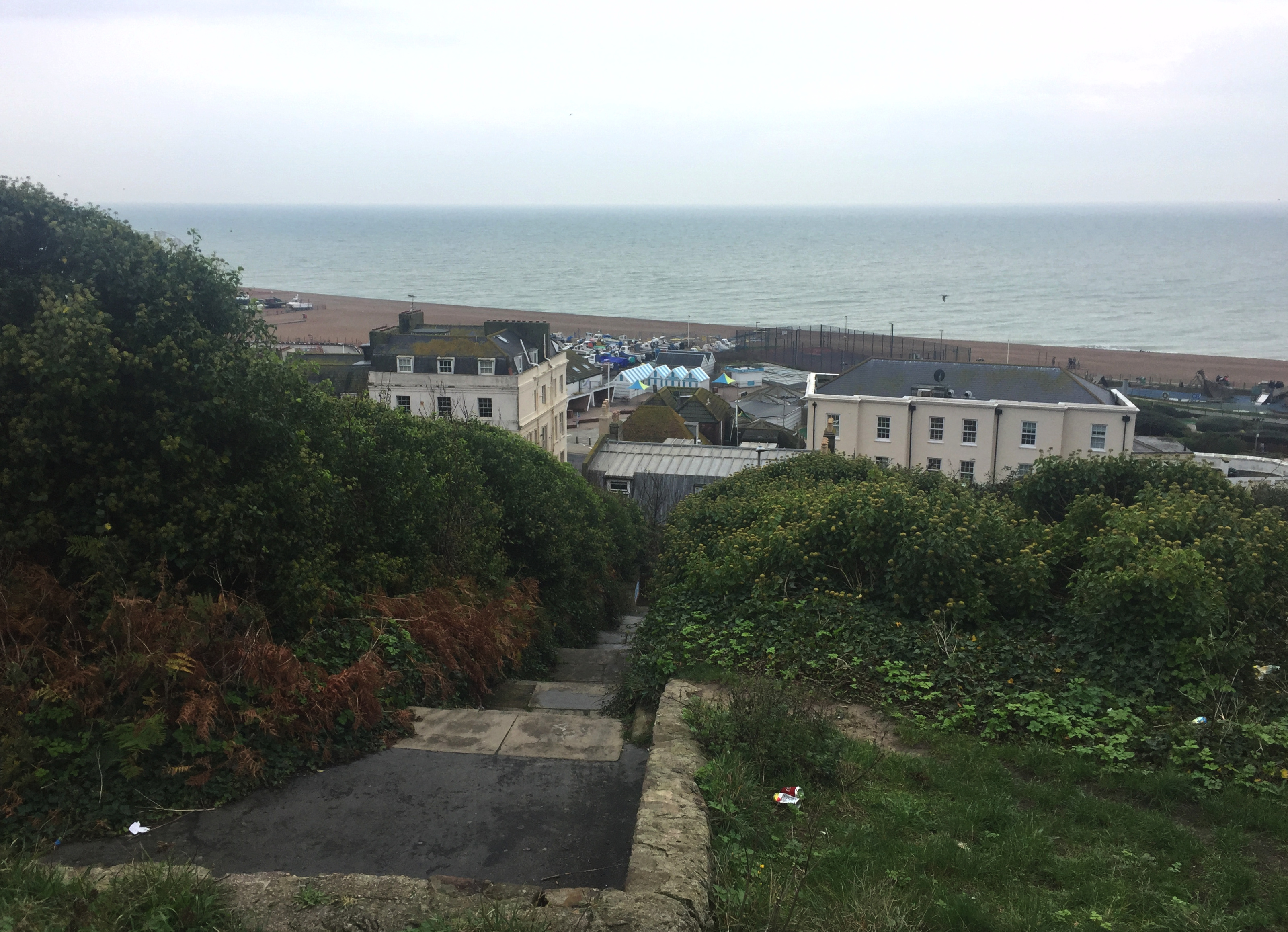
Below is a view of the upper station from the footpath you can use if the lift is not running. I did not count the steps. It surprised me that the cars are stored at the ends, where they are out of balance.
The view below looks the opposite way from the earlier one, across the Old Town. The low white building in the on the hill in the distance is the upper station of the West Hill Lift. This view is from the steps just below the top.
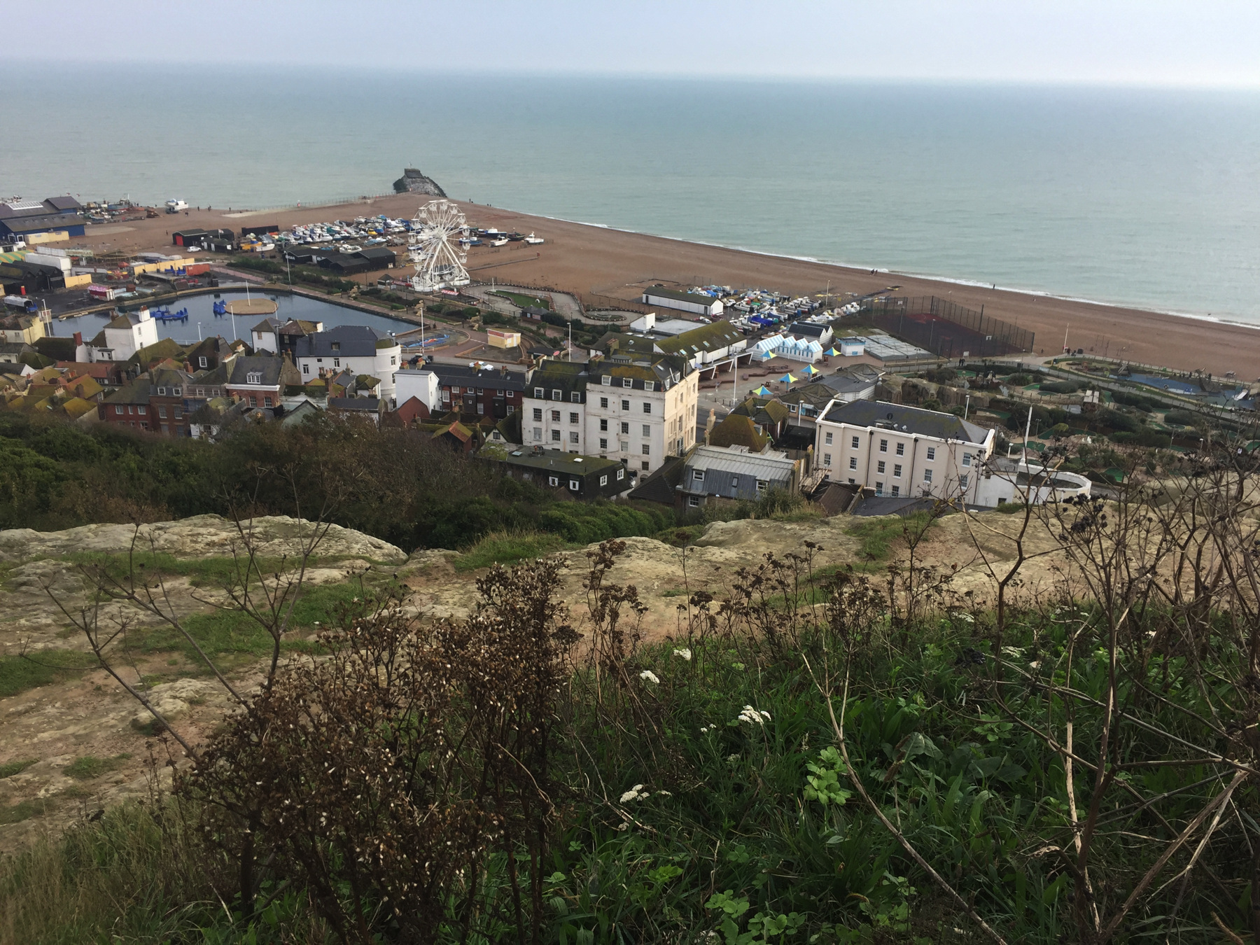
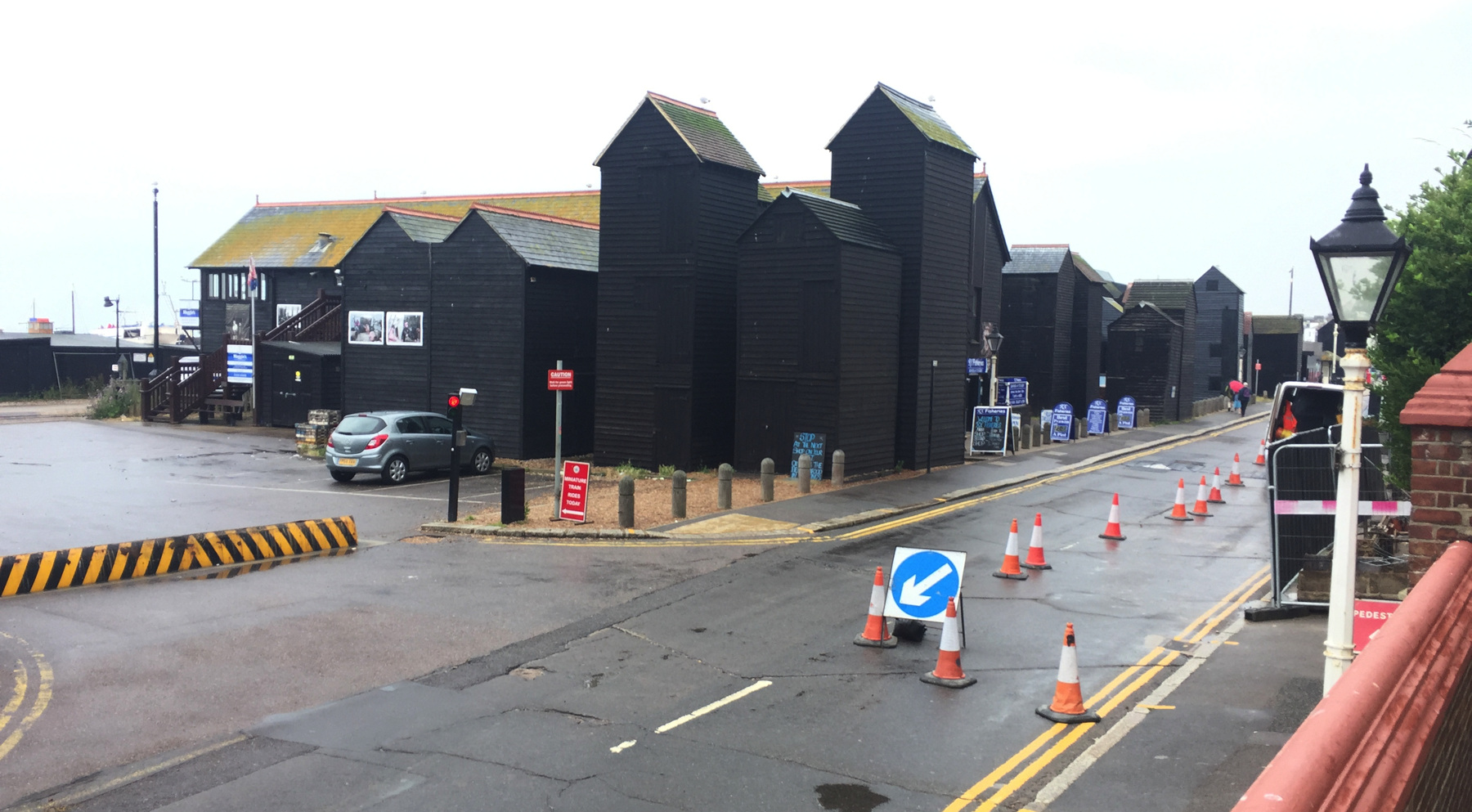
A nice sequence looking down. Across the street is The Stade, from a Saxon word for landing place, the home of a large fleet of fishing boats launched from the beach rather than piers. The tall black buildings are "net shops" for the storage of fishing gear, built tall to fit as many as possible in the limited space.
Here's a better look at the net shops, from outside the lower station. They are a famous sight of Hastings.
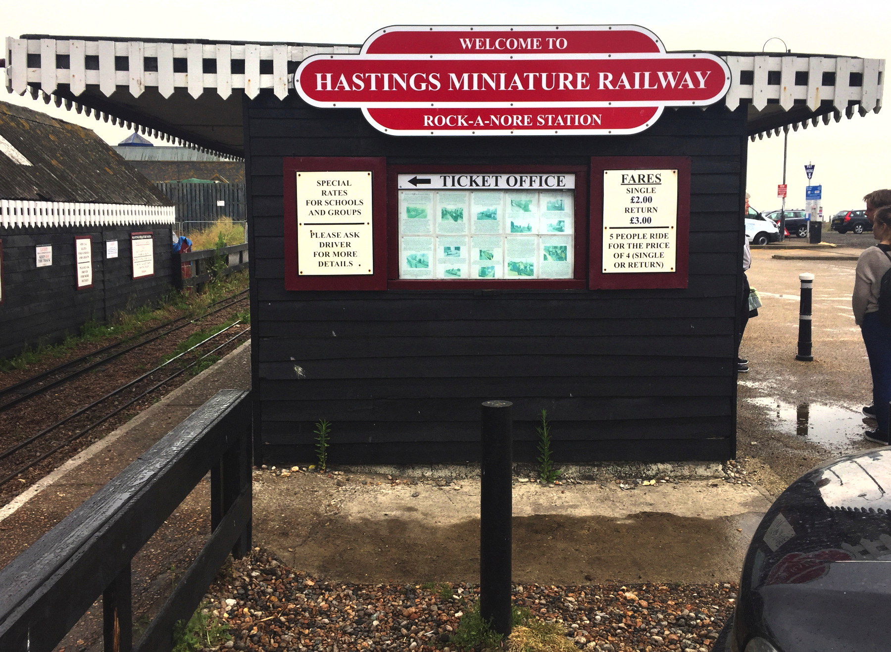
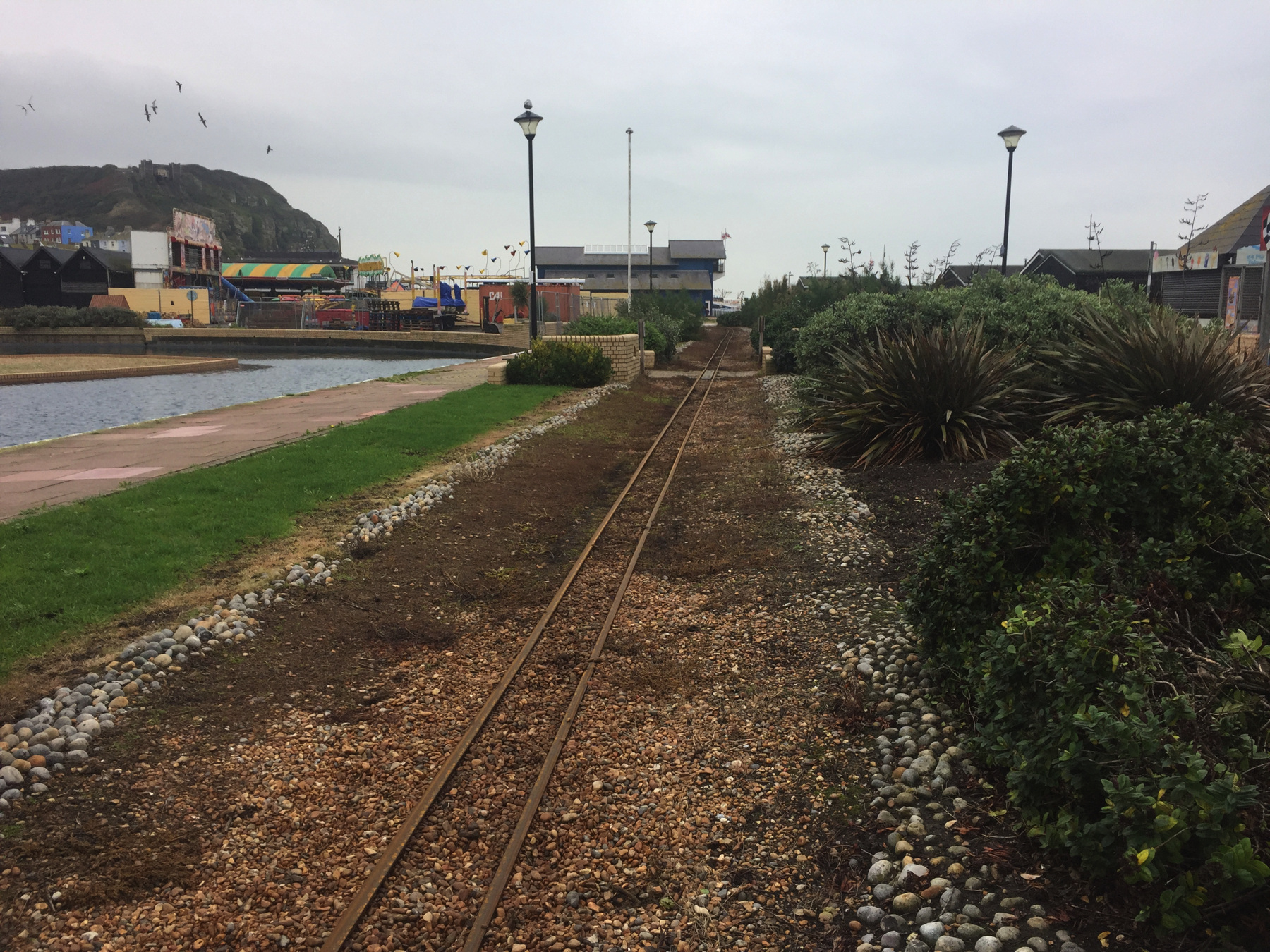
It is not necessary to walk between the lifts. The Hastings Miniature Railway connects them. Rock-a-Nore station is across the street from the East Hill Lift, and Marine Parade station is across from Albion Lane, leading to the West Hill Lift. The gauge of ten and a quarter inches is beyond narrow gauge, so "miniature" is well deserved. The intermediate station at East Beach was closed thirty years ago but its platform can be seen at the passing place where the railway has two tracks.
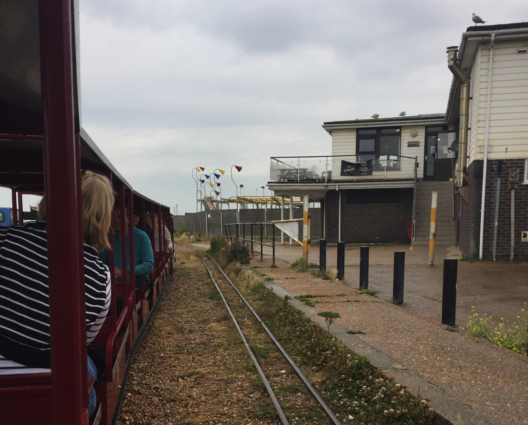
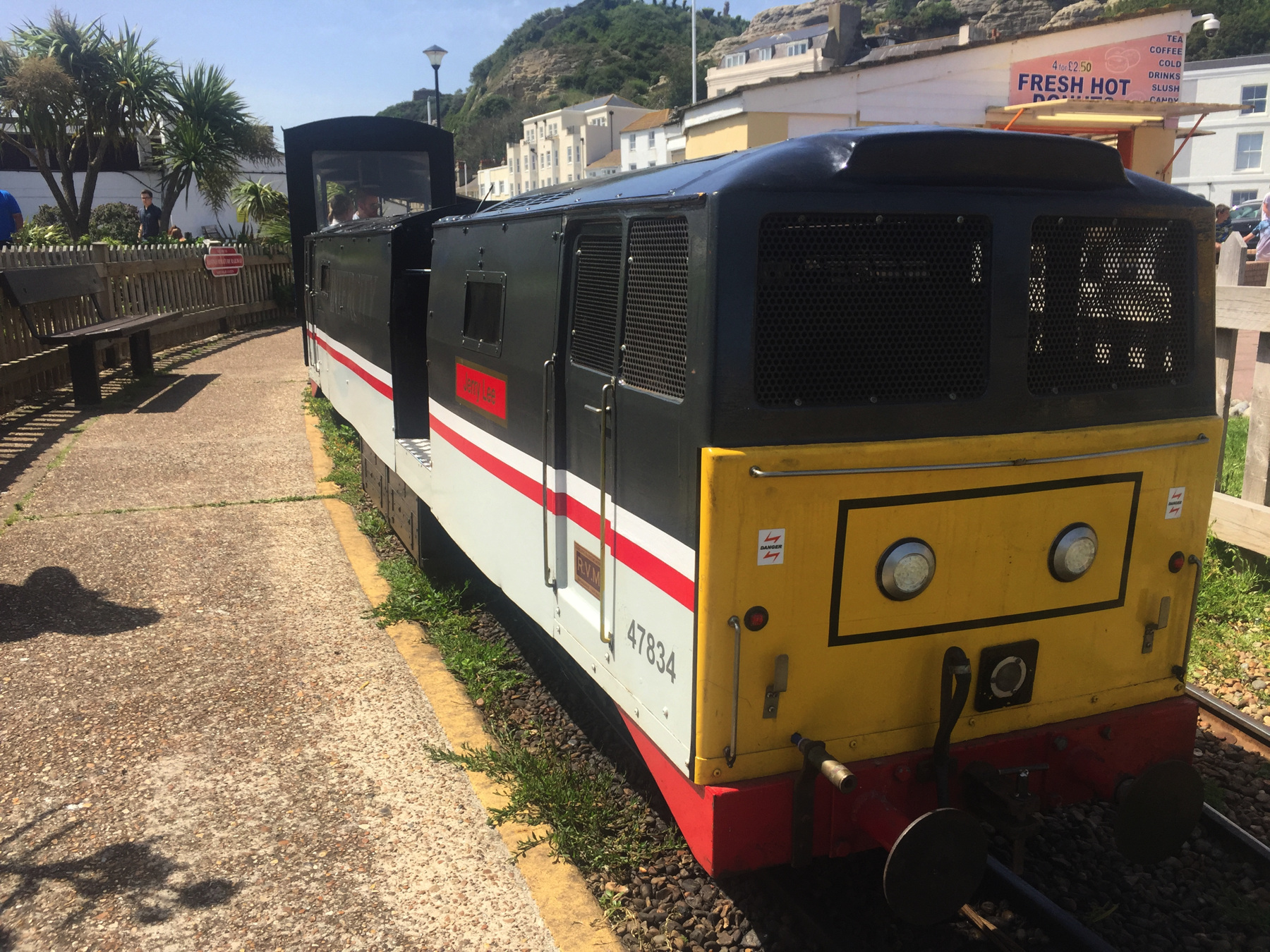
The teen girl who was about to drive the mock 47 class diesel electric engine kindly agreed to get out for a moment at Marine Parade station so I could take a picture that would fool people into thinking it was larger than it is. The height of the first passenger car there gives it away.
And with this I concluded my visit to All the Funiculars* in June. I wanted to go back to London by the other, longer, route along the coast and then up the Brighton line to Victoria, but that train was cancelled, and I was desperate to get into air conditioning, so I just went back the way I came (in reverse).
In October a train to Victoria was not cancelled, so I got my wish. The station list included one called PEVENSEY & WHAM, and I loved the idea of a place called Wham. There are stranger names in Britain. Sadly it turned out to be Westham.
Eastbourne is the main source of ridership between Hastings and Lewes, and since Hastings can be reached faster from London by the more direct route, I think the train I was on is mainly intended for stations between London and Eastbourne, with the continuation to Hastings just thrown in to provide service to the stations in between. The east-west railway is about three miles inland as it nears Eastbourne, so we go down a branch to reach it, and reverse, and come back out. The third side of the old triangle, to bypass Eastbourne, is long gone.
There is one station along the branch, Hampden Park, and this is what you see in the train's list of stations:
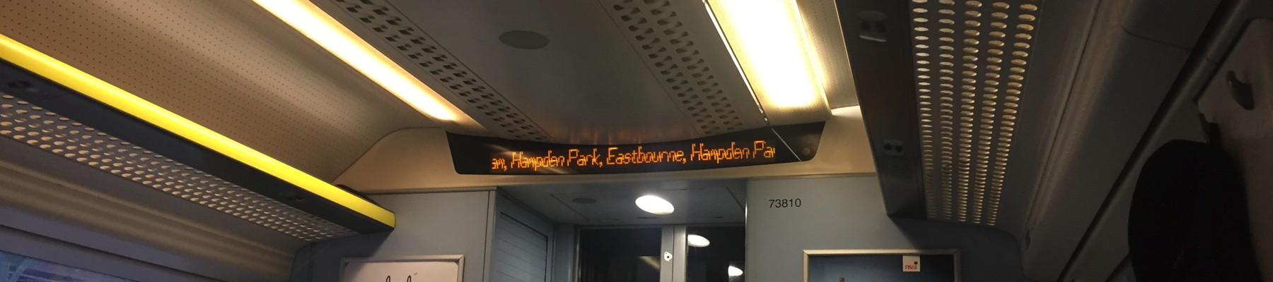
That is just how it went. We stopped twice at Hampden Park. Resuming our westward direction, we turned gradually north to Lewes (pronounced in two syllables), a modest town with a large nineteenth century junction station that has an overall roof and classic iron work. I could not get a good picture. On to Victoria, and more familiar scenery as we joined the main line from Brighton.
And with this, for the second time, I concluded my visit to All the Funiculars*. But also for the second time, it was not quite the conclusion.
[note 1] In June, was London really hotter than Hell?
We need to get some data. The King James Version of the New Testament mentions Hell thirteen times, but notoriously (in certain learned circles) as a translation of three different words in the Greek original. In Acts 2:27 the word is `Αδην (Hades, in accusative case) and this matches the use of Hades in the Septuagint as the translation of the Hebrew Sheol, the place of the dead. In Peter 2:4 the word is Ταρταρος (Tartarus), which I write off as an intrusion of Greek mythology.The other eleven mentions of Hell consistently translate the Greek Γεεννα. Ge'enna is not a Greek word but a transliteration of the Aramaic place name Gehenna, which is in Hebrew Ge Hinnom. The Valley of Hinnom is in Jerusalem, outside the old walls. It is mentioned twice in 2 Chronicles as a place to burn incense and child sacrifices, and again in Jeremiah where the LORD threatens the people for those practices. It became known as a cursed place.
Gehenna appears in a different context in early Christian and rabbinical Jewish works written after the destruction of the temple in 70. In those documents Gehenna's cursed reputation makes it a metaphor for a place of fire for the purification of souls to prepare them to go to back their Maker in their original perfection. Archaeologists have not found evidence of it being literally a place of fire, but the association with death is real enough because Gehenna was an area of tombs and for the Roman army after 70 a place for cremations. It seems a bit anachronistic to put the metaphorical usage into the mouth of Jesus (gospels) and the pen of James (epistle). Letters of Paul that are considered authentic are the oldest Christian documents but they never mention Gehenna, despite the emphasis given it by later writers. But we cannot compare metaphors to anything in this life. After all what is London in metaphor? For a long time London was the foggy, rainy, cool place. There is a London Fog line of raincoats. I did not want one on this date.
If Gehenna and Hell are synonymous in the KJV then that should be enough for anyone. Let's compare London and Gehenna. The date was Saturday, June 29, 2019. The web site timeanddate.com archives its past weather reports. That's what we need. On that date, Jerusalem had a high of 88°F with humidity of 55% and a calculated "feels like" of 93°F. Now that is miserably hot, no doubt about it. But London had a real high of 93°F with humidity of 66%, for a "feels like" of 112°F. A hundred and twelve! In flipping London! Who expects that?
London was literally hotter than Hell. Q E D.
Since I first wrote this, I was told that it is not remarkable when London is hotter than Hell, Norway. But when someone is "swearing" by saying "Hell" they don't mean a village on the Norwegian coast, or a village in Michigan either. And those who stick to more polite language are aware that London is generally warmer than Heck in North Yorkshire.
TODAY'S FUNICULAR : 1
West Hill Lift, Hastings
Date: since 1891
Power: Electric motor
Rise: [about 150 feet]
Run: [about 460 feet]
Length: [about 482 feet]
Slope: about 33%
Gauge: 6 feet
Track: 2 tracks, straight
Car: level floor, doors at ends
The railway was run with a gas engine until 1924 (not gasoline, but coal gas or similar), and then an oil engine until 1971. Most of it is in a brick lined rock tunnel.
CLAIMS: No claims I know of, but it is the only operating funicular that is mostly in a tunnel.
HEIGHT: I call the rise 150 feet, from about 25 feet (bench mark 24 a block away) to about 175 feet (below a contour of 200 at the upper station). The run, measured off an Ordnance Survey map, is 457 feet. This gets a track length of 482 feet. My figures are all estimates but they come near the 500 feet of track in a source, which I assumed was rounded off.
TODAY'S FUNICULAR : 2
East Hill Lift, Hastings
Date: since 1903
Power: Electric motor
Rise: [about 175 feet]
Run: [about 210 feet]
Length: 267 feet
Slope: 78%
Gauge: 5 feet
Track: 2 tracks, straight
Car: level floor, doors at ends
The railway was water balanced until 1976. The towers of the upper station contained water tanks. The lower tanks were under the lower station building.
CLAIMS: The steepest funicular railway in Great Britain. No. The Westcliff Lift at Bournemouth is steeper, at 100% (45 degrees).
HEIGHT: In An Illustrated Guide to the Funicular Railways of Great Britain from the Heritage Railway Association, the length of track is given as 267 feet and the grade as 1 in 1.28, which is 78%. From Ordnance Survey maps I get the run as about 210 feet, and if the rise is 175 feet that matches those figures. OS Sheet TQ81 (1961) has a 175 foot contour line at the upper station, but the lines in that area are dashed, meaning they are interpolated estimates. I think the upper station is at 200 feet, and that allows a rise of 175 since the lower station is at about 25 feet. Having walked around at the top, I can say that the steep cliff ends at the elevation of the top station, not a little farther as the dashed contours suggest. Because of the claim about being the steepest in Britain I want to take care with this one. But 78%, which is very steep, still does not come close to the Westcliff Lift. Whether the other two at Bournemouth really are 81% as I estimated is more open to argument.
TODAY'S ALE
The Albion, Hastings: Harvey's Brewery, Sussex Best Bitter (cask ale)