Lift, Broadstairs
Cliff Lift, Margate
TODAY'S ITINERARY
Exploration: Wednesday, 9 October, 2019
lv London St Pancras 0722 Southeastern
ar Broadstairs 0904
lv Broadstairs Baptist Church, Stagecoach (bus)
ar Cliftonville (Margate) Athelstan Road
lv Cliftonville (Margate) Athelstan Road, Stagecoach (bus)
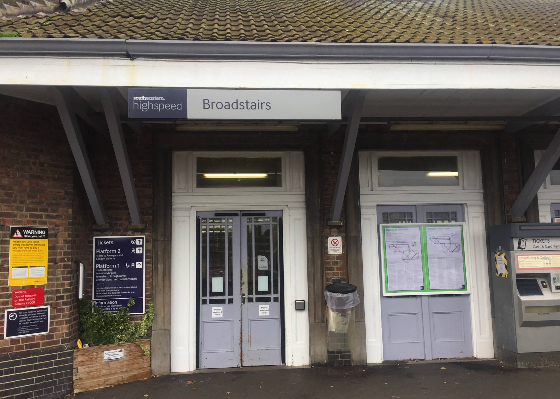
ar Broadstairs, Railway Station
lv Broadstairs 1425 Southeastern
ar London St Pancras 1610
To complete the category of cliff lifts that are not funiculars, I wanted to visit two more little-documented ones that were closed within my lifetime and have visible remains. It's easy to see both in one day. They are in Thanet,[note 1] the northeast corner of Kent, the most southeast part of England. Like the famous White Cliffs of Dover, these too are made of chalk, a soft mineral that invites digging tunnels for shelter and especially for the agricultural market for chalk itself. One of the lifts is in a tunnel and the other is next to an old resort that was mined into the cliff.
Neither of them had more than a generic name. A photograph of the upper station at Broadstairs shows a sign for just "Lift" (Martin Easdown's book Cliff Railways, Lifts and Funiculars), and a movie clip of the upper station at Margate shows the longer name "Cliff Lift" (Youtube).
Each of them is quite short, and the small single car was balanced by a concrete weight in a vertical shaft. If I had slightly mixed feelings about the Southend inclined elevator, because of the weight going down on another inclined track, there is no doubt that the lifts at Broadstairs and Margate were elevators, not funiculars. Still I found their ruins fascinating to see.
Trains on the high speed route from St Pancras make a big loop around Thanet and come back to St Pancras. There the electronic departure boards do not list all the stations, in an effort to avoid sending passengers the long way round. The down side is that I found no trains listed as going to Broadstairs by either route! It's one of the farthest points and could reasonably be reached by going either way. I checked online and found that the next train out, which seemed to end at Margate, was really continuing to Broadstairs and beyond. On board, as the display gradually removed stops already made, it also added more to the end of the list, revealing Broadstairs before long. I could have stayed in my seat so I could tell you where the train is when it finally shows St Pancras, but I was on assignment.
Lift, Broadstairs
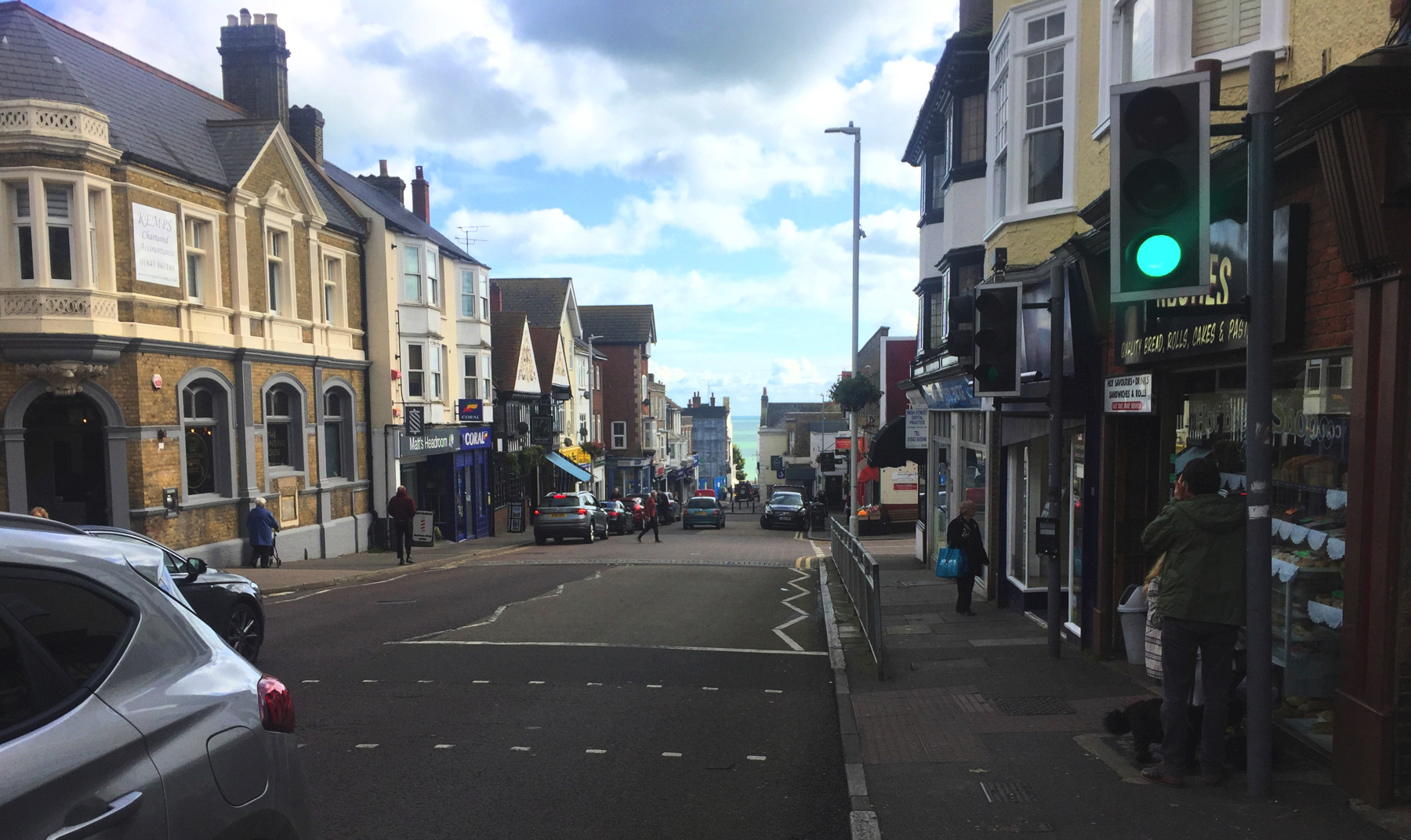
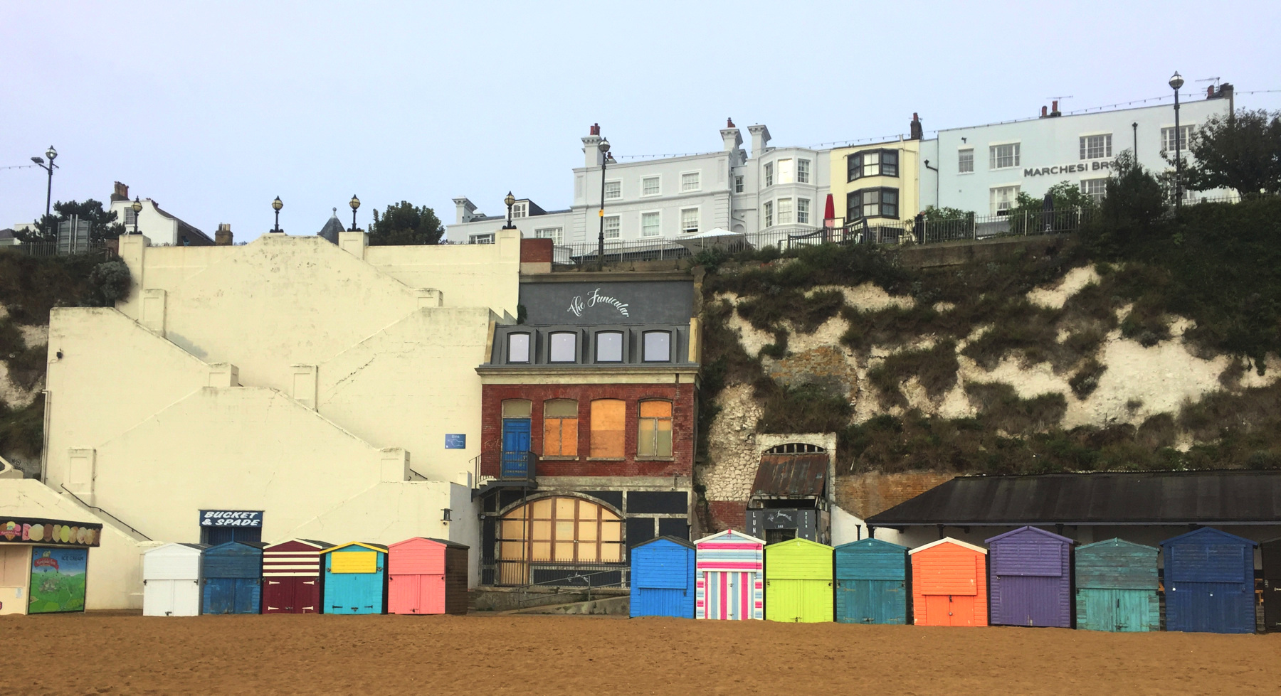
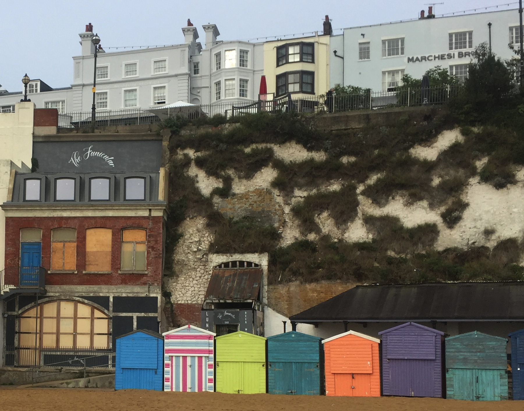
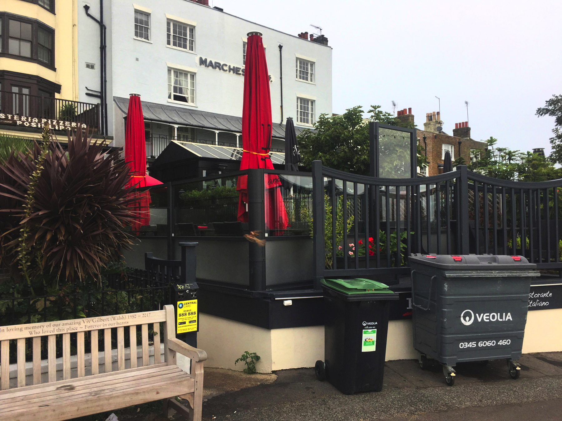
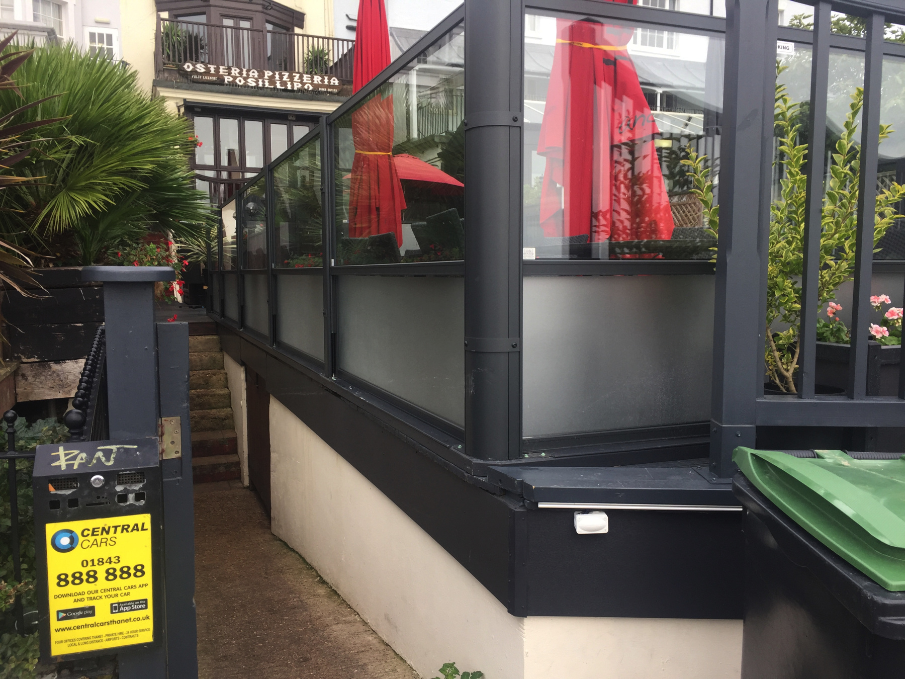
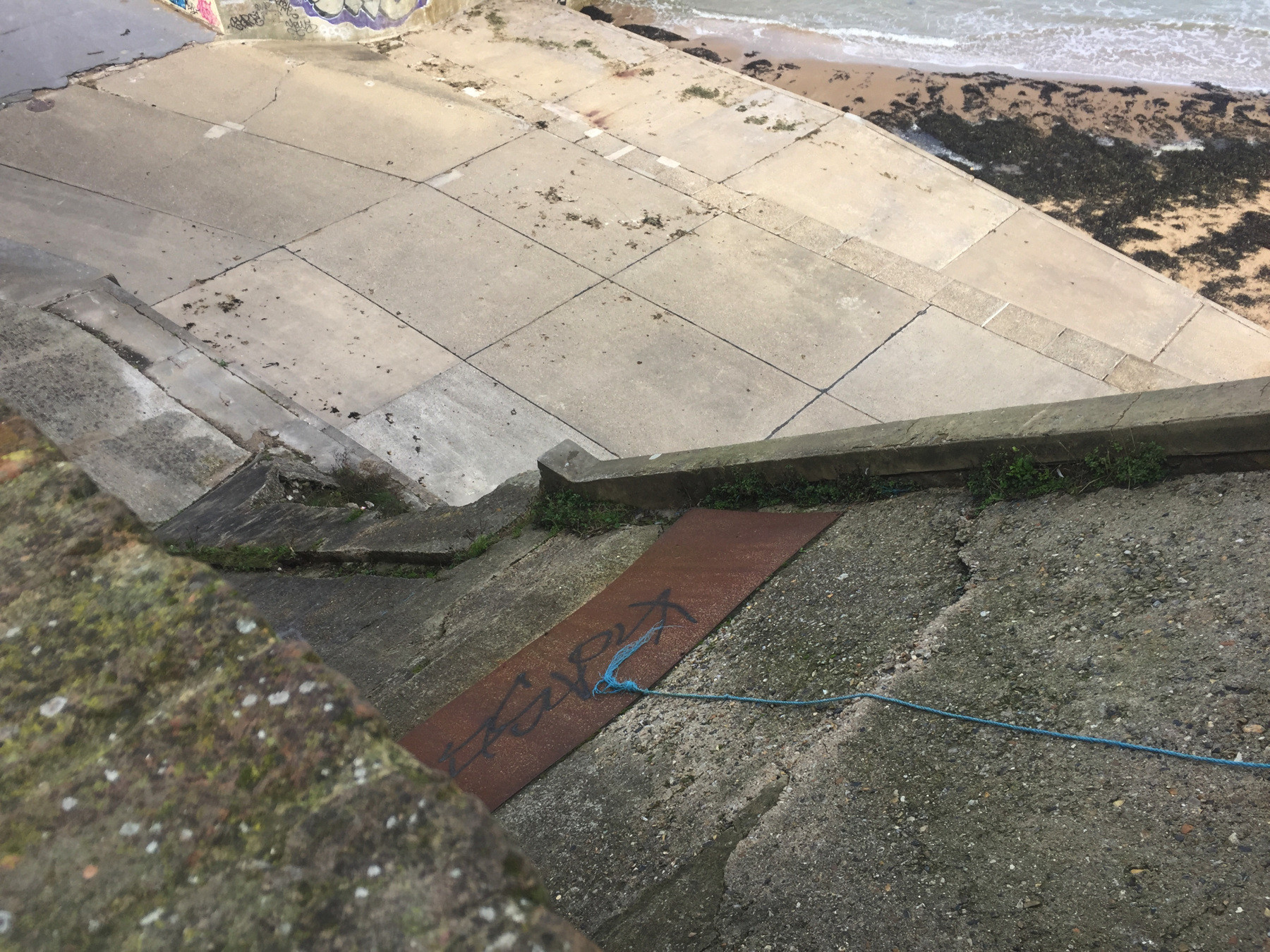
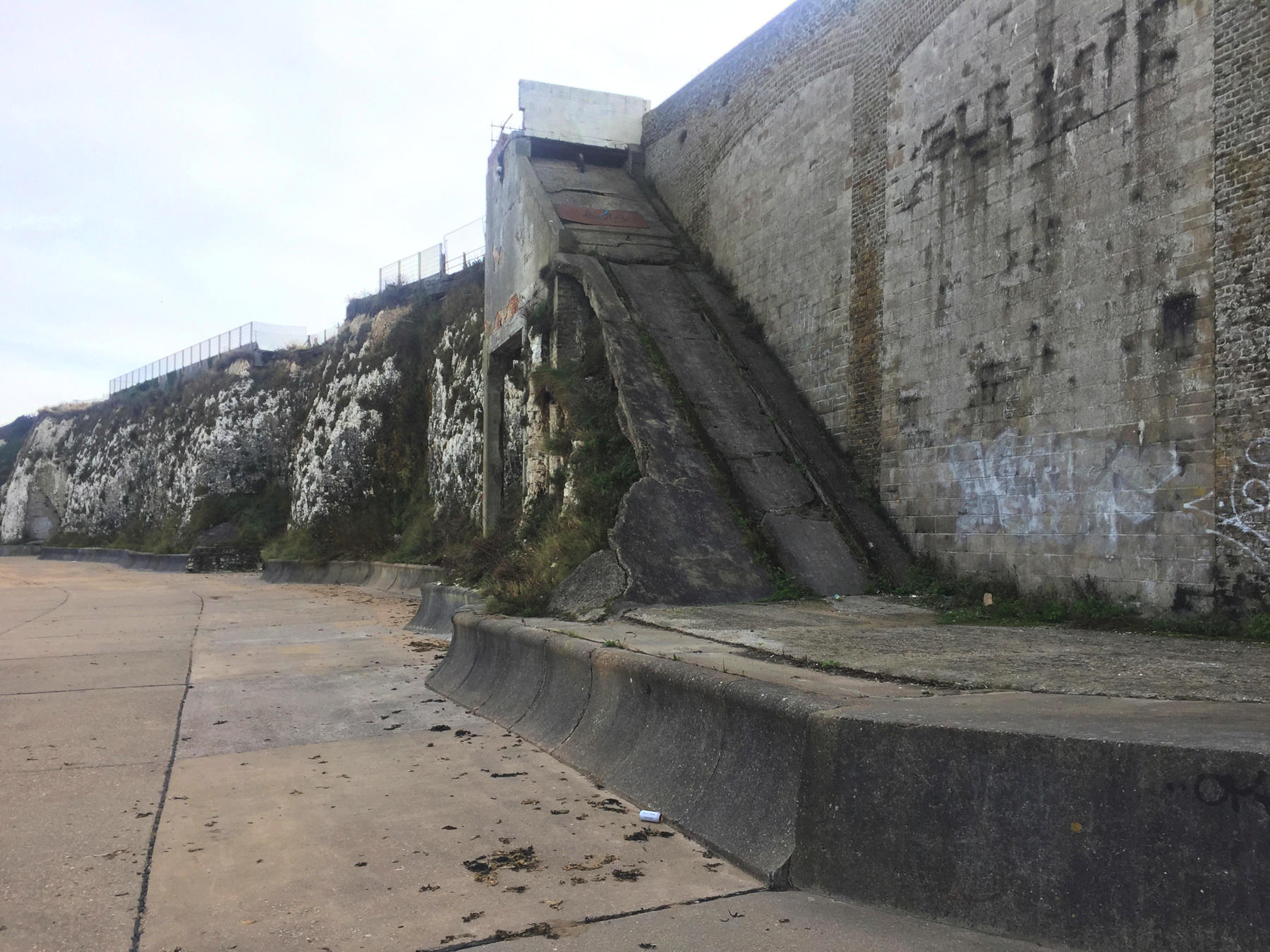
From Broadstairs station, all you need to do is walk down the High Street toward the sea, or rather to the top of the cliff at The Parade. You will find a broad stairway to the beach— not the medieval one for which the town is named— and as you go down it is hard to miss the raggedy lower station of the lift.
There it is. The first view is from the stairs, and the second is straight on from beach level.
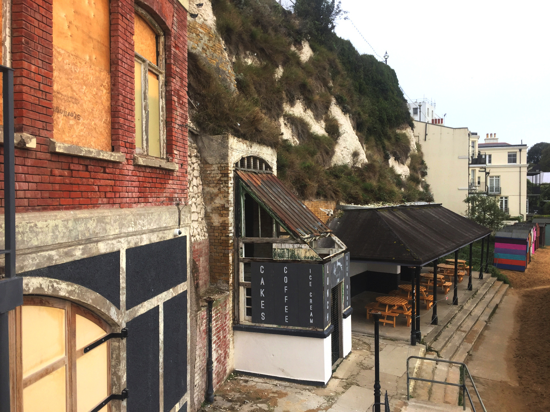
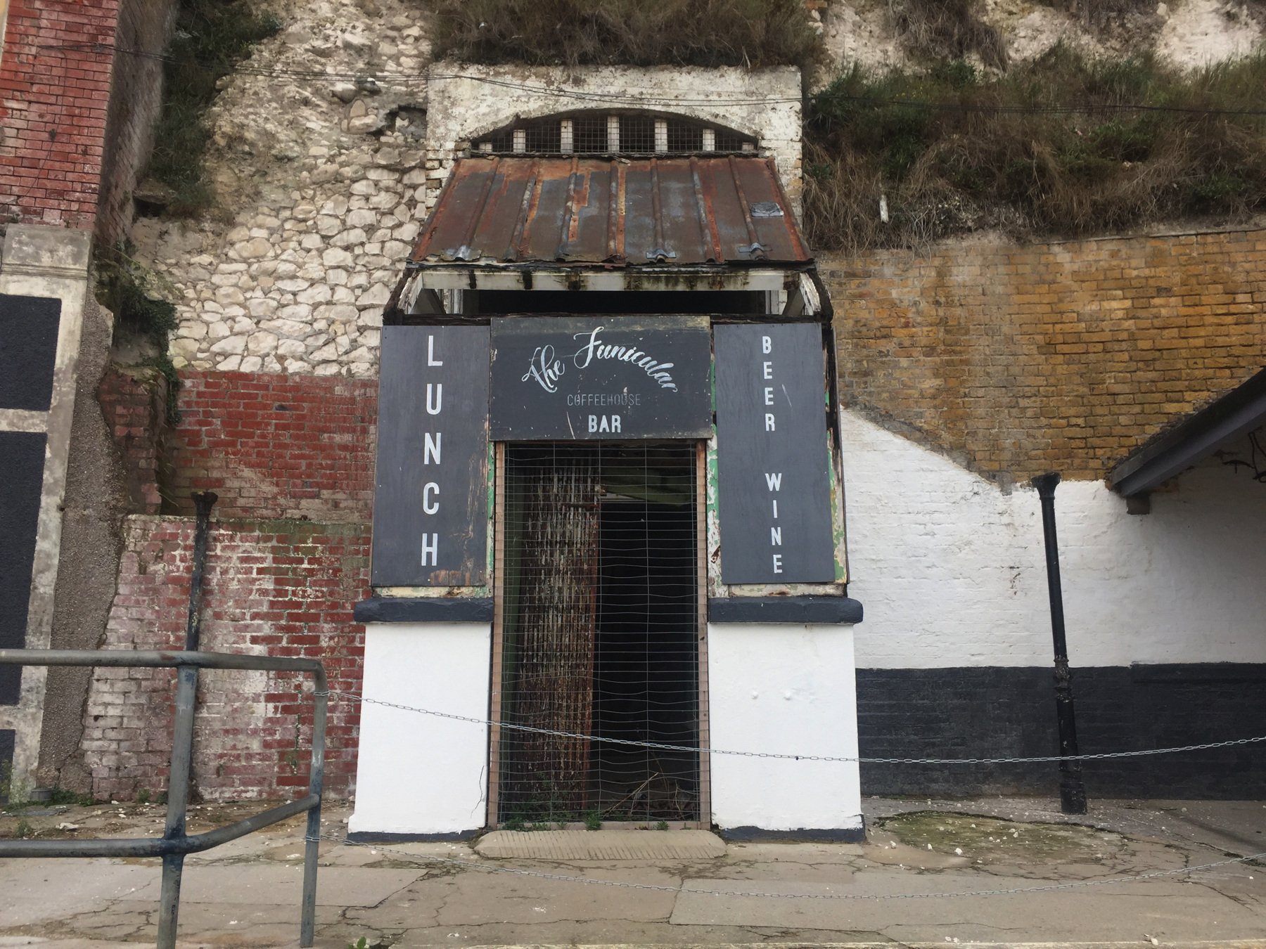
A coffee house called The Funicular opened on the site in June 2018. The main part of the cafe is in the former toilet building (yum!) to the left of the cliff lift. I was thinking of getting a cup there, but it happened to be closed for one week while some work was done. You can find pictures on the web showing the arched ceiling inside that corresponds to the arched window, and the white tile walls. The property includes the lower station, which has not yet been improved, and a renovated shelter with picnic tables. The owners seem to have good funding, and what they do with the lower station bears watching, since showing it off is built into the name of the business.
Unfortunately, in mid 2019 the enterprise was in peril because the local council did not come through on an agreement to move the beach huts away from in front of the property. I stepped back onto the beach to get the obstructed view below. There you can see the steps I came down and the coffee house building, and the small gap in the line of beach huts that was opened. The owners say the space behind the huts promotes public urination and drug abuse. The shelter that they renovated should have a view of the beach, but it is hidden behind the huts on the right.
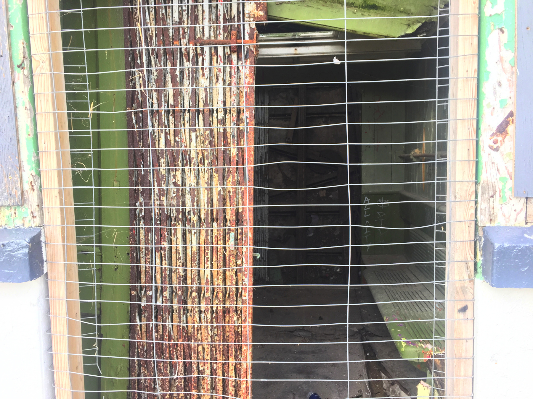
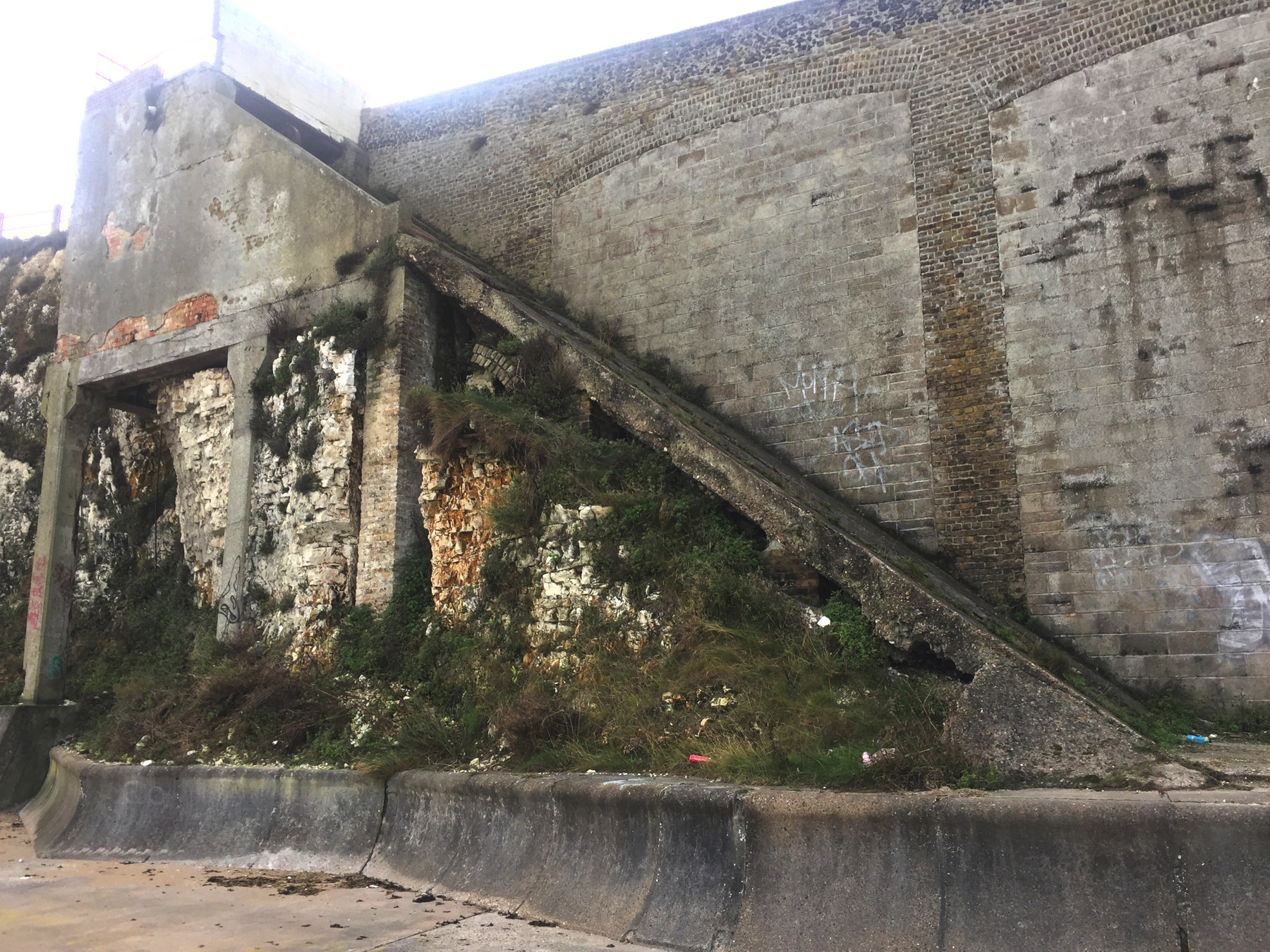
Below, here is what's inside the lower station. I pushed the exposure to get a view into the darkness. There's a bench on the right, and a second sliding gate that would close the far doorway. This is not a tiny waiting room: it is the lift car or what's left of it. The lift was known for the peculiarity of having teddy bears and other toys placed along the wall of the tunnel, because they could be seen from the gates at the ends of the car. I wonder how it carried twelve people as reported. I guess six people could squeeze together on that bench.
Beyond the far doorway is the track, with the center brake rail visible and a little of the rail on the right. I know it looks like a vertical wall in the picture. In real life I could see that it sloped back. The lift was claimed to be a very steep 45 degrees (100% slope).
By the 1970s the lift was a substantial drain on the local council's budget, and with a threat of closing, local hotels and businesses took over running the lift and made up the losses. The last operator of the lift gave up in 1991. By that date very substantial work was needed to update the equipment to keep it running. The Otis Elevator Company stepped in and financed all the repairs including total replacement of the electrical equipment in the upper station. And then shortly after it was done a storm ripped the roof off the upper station, and rains destroyed the new electrical equipment and began the rot of other parts of the lift. That was the end. So we're looking at about twenty years of decay.
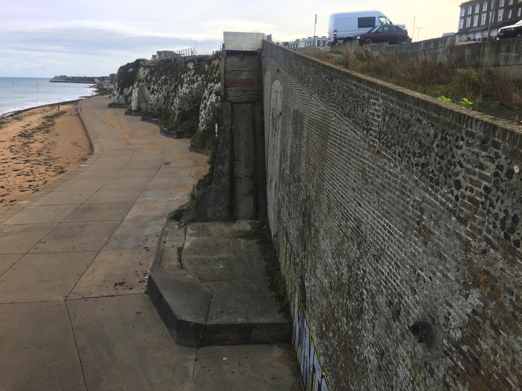
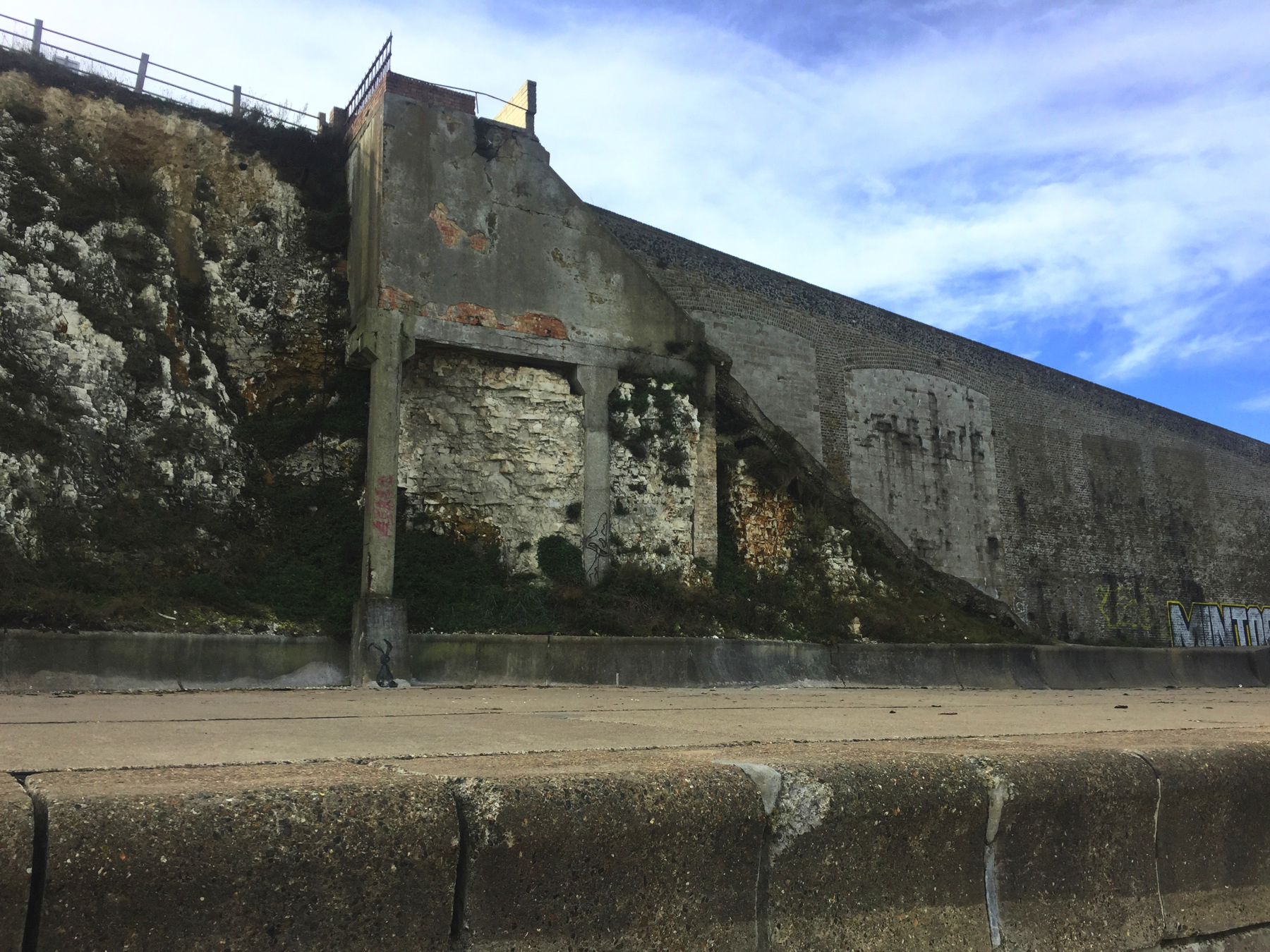
Now... where was the upper station? An enlargement of my picture from the beach makes it clear that it must be this side of that cream-colored building with the black-framed bay windows. We're looking at the back of the row of buildings that front on Albion Street. Here on this side is a paved footpath along the top of the cliff.
The first picture below shows the upper station, probably in 1991 with the roof missing. Certainly the signs that had directed attention to it, seen in older pictures, are missing here, and instead is the name of D.J. Ellis, a management company in Broadstairs. The sloping path along the left side is still there.
Compare the buildings to my own photograph below it: from the right, the three chimneys, the building with an upper story veranda (now painted white), and the the building with black-framed bay windows. That building on the left (extreme left in the old photograph) is now the Osteria Pizzeria Posillipo.
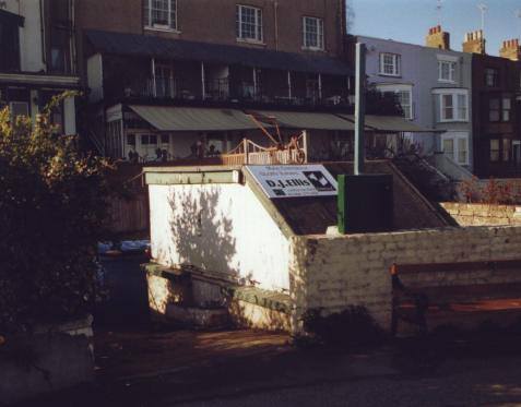
(above) Photo © Mark Hows, used by permission. See hows.org.uk.
The raised deck behind the Osteria is right over the gaping hole of the cliff lift. Along the left side (see below) is a door that, it is said, gives access to the tunnel. I wonder what the restaurant manager would have said if I had asked to see what's in there.
Cliff Lift, Margate
I could have taken the train one stop to Margate, but the station is not very near the old lift. I found that a bus called The Loop would drop me off much closer, and since it runs every eight minutes the average travel time would be shorter than the train. At the stop at Queens Road I nodded hello to an old man waiting on the bench. He wondered which bus I wanted, and I told him, and he said it could be a long time before it comes. I countered that it was supposed to be every eight minutes, but he told me that was not his experience with it. More than ten minutes later two of them came along. I boarded the first one, and the two The Loops played tag all the way to Margate— if one made the next stop, the other would pass, unless someone on board requested the stop. Which bus would win? I don't even remember. At length the bus robot announced the Athelstan Road stop, in the Cliftonville neighborhood, and that was my cue.
Margate looks a little shabby compared to Broadstairs. To be sure, there are people shopping in the main streets, and many small hotels in the rows of houses. It's not dead gone. It has potential. It needs some love. The abandoned sea front around The Lido is particularly sad. A place that once hosted thousands with the beach, a pool, restaurants, and entertainment, now sees not much more than a few people walking dogs and the occasional fool like me. Nearly a hundred years ago T.S. Eliot, writing part of "The Waste Land" in a shelter on the upper promenade, put to pen the words, "On Margate sands. ⋮ I can connect ⋮ Nothing with nothing. ⋮ The broken fingernails of dirty hands." It beats me what he meant, and yet I feel it.
The Cliftonville Lido was built in 1926, but behind the Art Deco front buildings was a resort a hundred years older called Clifton Baths, much of it dug out of the chalk. Inside were sea water pools, one of which was set aside for women and children, and storage for bathing machines, the closed carts that brought women out into the water to swim so that they would not have to walk on the sands improperly dressed. The Baths were altered over the years to meet new requirements, and the Lido was the last and most extensive improvement. Its developers added a large semi-circular outdoor swimming pool, a theater, a zoo and aquarium, and bars and restaurants. While the Lido had stairs inside, and maybe a vertical elevator, the crowds it drew also kept the cliff lift busy. Fifty years later the crowds had drifted away to more distant resorts. The lift was abandoned, the big outdoor pool was closed in 1977, and everything was closed by 1980 except one pub located near street level.
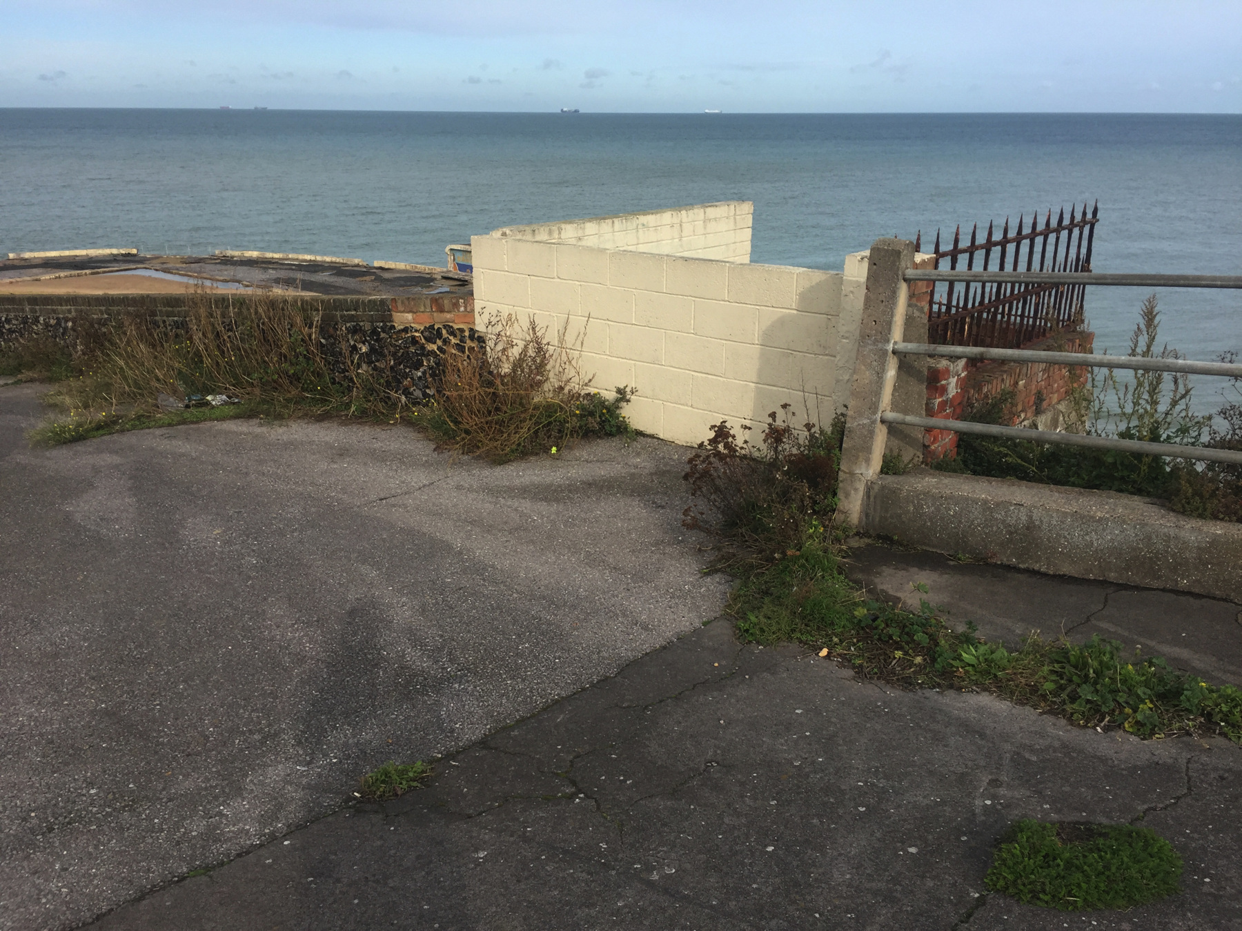
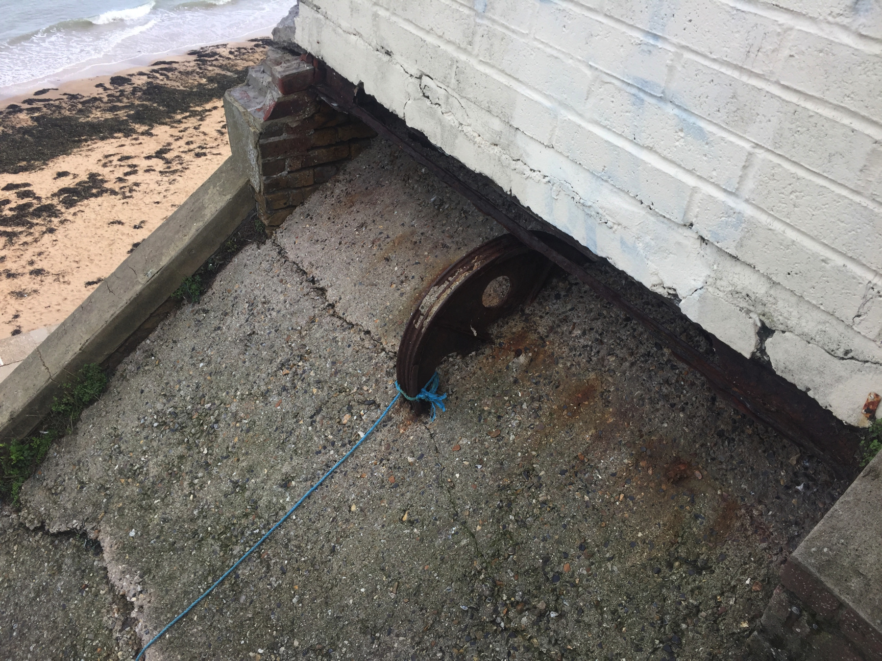
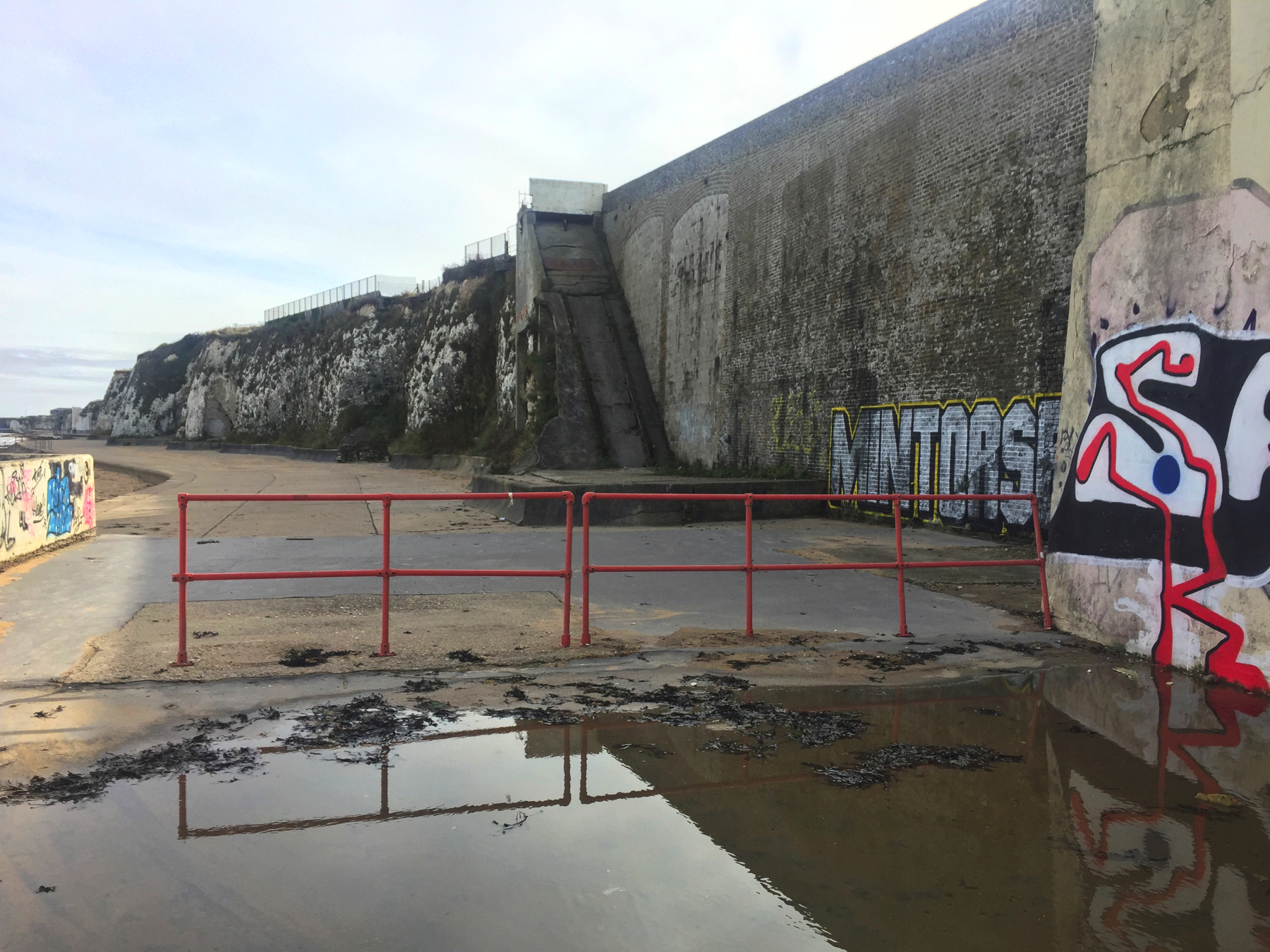
The upper station of the lift is marked by low cinderblock walls to which someone has taken the trouble to apply white paint. I cannot give as much credit to the work order to pour concrete over the track without even removing the wheel that connected the cable to the vertical weight. A broken blue rope indicates that the local youths have tried their hands at a sport other than scrawling on the walls with spray paint. And then one day... something happened, where that red board lies.
Addendum: A reader provided some information after this page was first published. The block walls were added not too long ago, because the original metal fence began falling apart. The red metal board covers a hole in the floor that would drop trespassers into the space where the engines had been.
Below is an image from a short amateur film with faded color, showing the car and the upper station. A photograph in Mr Easdown's book shows that the car was a brighter blue and that the lower station was an area surrounded by railings like the ones at the top. I'm surprised the car is so closed in. It could have been much more open on the sea side.
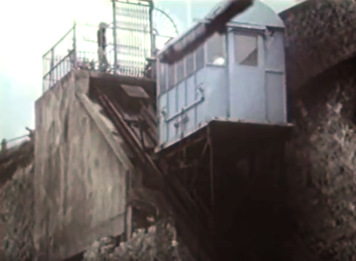
(above) Image from a film of unknown origin.
The film was found on Youtube
here with an
attribution to cinematograper Wilf Watters, although it is so far
below professional standards that I cannot believe the credit.
You have to go see the remains from below to appreciate the horrible condition the lift is in. Resolving to leave no tern unstoned (though I saw no terns), I found a way down to the lower promenade along the beach.
The red fence prevents motor vehicles from driving over a section of pavement that is just a roof over part of the Lido.
This might be another one with a 45 degree slope.
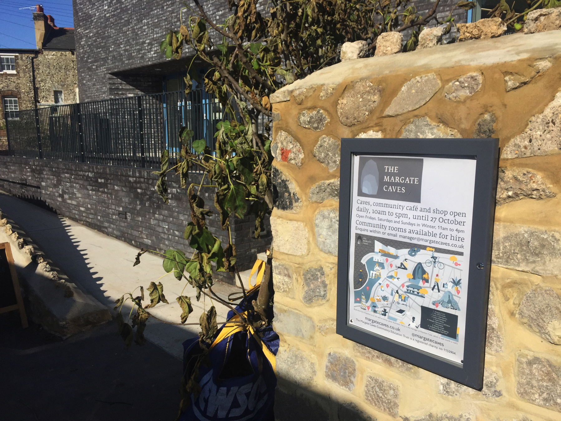
Before we leave Margate I want to put in a word for an overlooked attraction, the Margate Caves. Like the Chislehurst Caves, they are really a chalk mine, but these are at multiple levels and have high ceilings. I didn't realize that the caves had reopened to the public after fifteen years just two months before I went there. With support from a range of charities there is a new visitor center and cafe around the entrance. I was told that parts of it are not fully explored and that the caves might extend as far as the Clifton Baths a few blocks away. By the way my guide, old enough to remember The Lido, pronounced it "lie doe", not "lee doe".
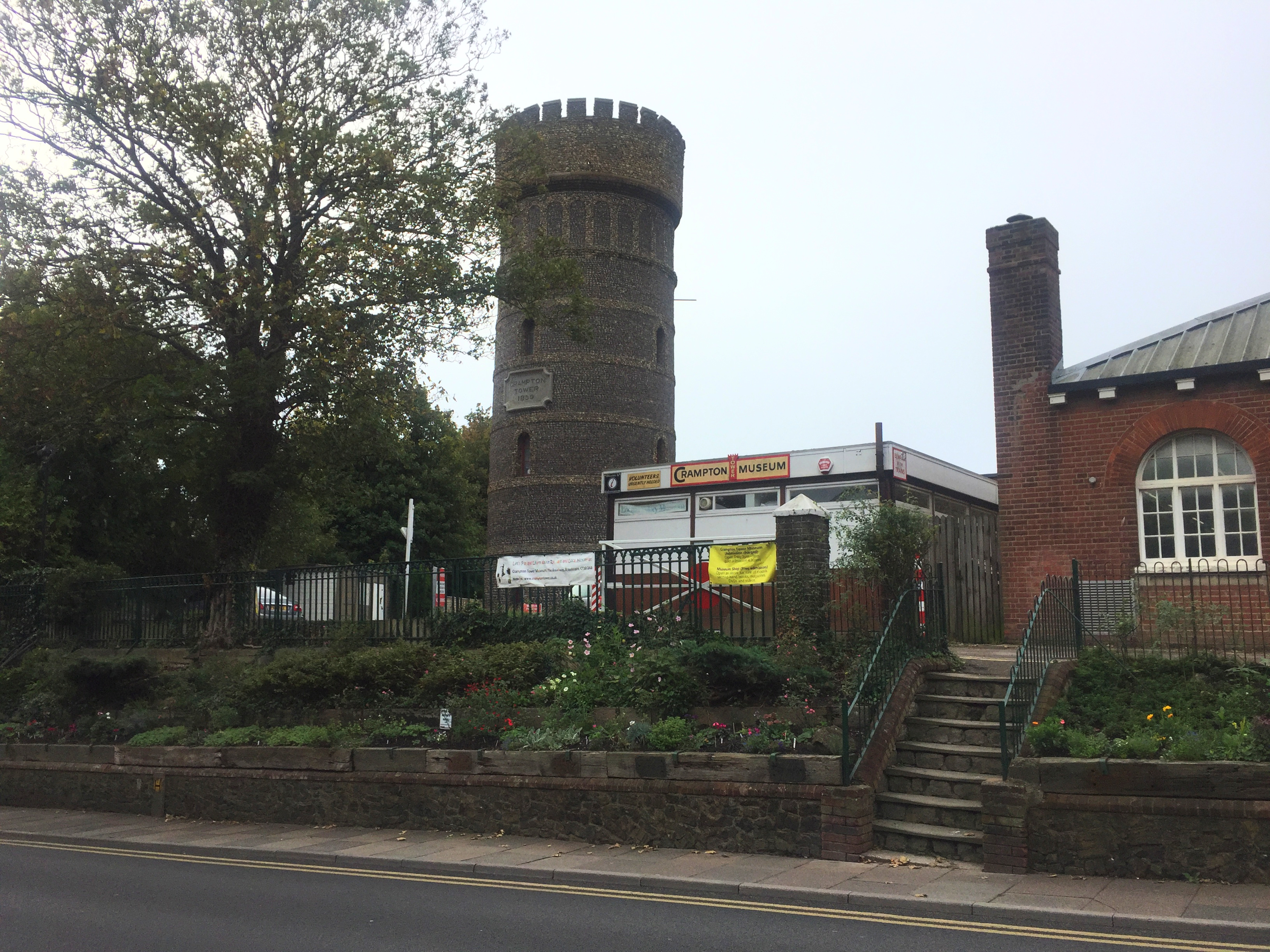
I took a The Loop bus back to Margate, and had lunch. All this in one morning! I had noticed near Broadstairs station a museum dedicated to local genius Thomas Crampton, which had a sign outside about opening at two o'clock. Since it was twenty of two when I got back to the station I decided to take a short walk. Unfortunately the sign was for summer months, so it was still closed when I got back. Among his works was a design for steam locomotives with a low-slung boiler and firebox over non-powered wheels and a pair of very large drive wheels mounted far back. My interest was parochial. I have seen in histories of New Jersey railroads pictures of a very odd looking "Crampton" engine on the Camden and Amboy Railroad. It may have been the only one in America. A less extreme version was popular for a time on French railways.
[note 1] Thanet is also called the Isle of Thanet. It was an island once, but some of the channel separating it from mainland Kent silted up in the sixteenth century. The importance of the waterway in earlier times is indicated by the Romans building forts at both ends. The train to Margate passes through marshy ground between Herne Bay and Birchington-on-Sea, and a drainage ditch in those marshes still offers a slight connection by water to a place with the wonderful name of Plucks Gutter, whence the River Stour still flows to the sea in the course of the old channel.
But what of the name Thanet? Some have said that it comes from British (Celtic) roots, either the tan that means "fire" or the other tan that means "oak", but this has been dismissed by most scholars. Medieval sources suggest an Germanic origin, specifically pirates from Jutland, a place that is today in the border region of Germany and Denmark. The Anglo-Saxon Chronicle records that the British king Vortigern invited two Jutish brothers, Hengist and Horsa, and their forces to help him fight the Picts in about the year 450. The Historia Brittonum, compiled about 820 from many written and oral sources, records that the brothers helped Vortigern to such an extent that the king granted them land. We want the exact words:
Guorthigurnus suscepit eos benigne, et tradidit eis insulam, quæ in lingua eorum vocatur Tanet, Brittanico sermone Ruoihin.That's the name Vortigern, evidently pronouncing V as W (as the Romans did). I will translate as literally as I can: "Vortigern admired them generously, and granted them the island, which in their language was named Tanet, by British speech Ruoihin." The last phrase is interesting because it is in the somewhat ambiguous ablative case. If the meaning is "from British speech" it implies that Tanet translates the British Ruoihin, but I think the point here is to tell us another name that the British called it. It has been suggested that the name is from the Roman fort Reculbium at the north end of the channel that separated the Isle of Thanet, a place possibly still then fortified by Vortigern. Recall that the Historia's sources included oral tradition that may have garbled unfamiliar proper names. It's not unusual to give military leaders border or shoreline lands, because they would be the first line of defense. But in this case Hengist eventually turned on the Britons, and inviting more of his people to settle in Thanet, he became the first Germanic king of Kent.
But why did the Jutish brothers call it Tanet? Was it because the Greeks called Britain Θανατος, Thanatos, Death, and therefore the brothers called all of Britain Tanet? The Venerable Bede, in his Ecclesiastical History, even calls the isle Tanatos. According to Greek legend [citation needed] Britain was the solemn place to which "bodies were rowed across the sea in un-manned boats in the middle of the night and returned empty before dawn." I don't recall this in the Greek texts we read in school, and I think I would remember that, but we couldn't read everything. It is said [citation needed] that Thanet has more Bronze Age burial mounds per area than anywhere else in Britain, as a proof. Isadore of Seville reported that there were no snakes in Thanet and that soil from Thanet taken anywhere else kills snakes, and that explains the name Thanatos. This gets more silly as it goes.
Well then, would you believe this: Recent work ties the name to the Phoenician goddess Tanit of Carthage. Phoenicians? Believe it or not Carthaginian coins have been found in places all over England, particularly around the south coast port of Poole and most of all in... Thanet. The Punic name would be, written without vowels, Y TNT, Isle of Tanet. A very convincing paper by Dr Caitlin Green is here. We have only to believe that the sea-faring people of Jutland had knowledge of the ancient name. Sailors swapped stories, I guess.
TODAY'S FUNICULAR CLIFF RAILWAY : 1
Lift, Broadstairs
Date: from 1910 to 1991
Power: Electric motor
Rise: [about 52 feet]
Run: [about 52 feet]
Length: [about 74 feet]
Slope: 100%
Gauge: 5 feet 2 inches
Track: 1 track
Car: level floor, doors at ends
CLAIMS: That it is a funicular. Sorry. Also that, with a slope of 45 degrees and 37 meters of track, it is the "second steepest and shortest cliff railway in Britain, the first being the exposed system installed at the Clifton Baths in Margate." The wording is ambiguous. I think second shortest is correct based on my calculation for Margate (see below). At 45 degrees it is certainly steeper than the East Hill Lift at Hastings, but there are other contenders.
HEIGHT: The slope is reportedly 45 degrees, 100%, which I can believe just from the limited view of the track at the lower station. The reported track length of 37 meters is absolutely impossible. That's 121 feet. Given the equal rise and run (because the slope is 45 degrees), if the track is 120 feet, the rise and run would be 85 feet, which is ridiculous. The Ordnance Survey map has a benchmark 73.5 feet at the corner of the High Street and Albion Street. The location of the upper station is somewhat lower than that, and the lower station is certainly above sea level, so a rise of 85 feet is impossible. Equally so, a run of 85 feet would make it come up far inland from the known location. Something is very wrong.
Assume the 100% grade is correct. The Ordnance Survey map does not show the lift itself, but the run starts parallel to the toilets building, which is shown, and from there the location of the upper station is about 52 feet back. Can that also be the rise? I think so. The bottom is roughly 6 feet above mean high water, and 52 feet more brings it to 58 feet, an elevation that seems possible given that the upper station is somewhat lower the 73.5 benchmark. That gives a track length of 74 feet, which happens to be twice the number 37, given as the length in meters. I think my estimates are close to correct.
TODAY'S FUNICULAR CLIFF RAILWAY : 2
Cliff Lift, Margate
Date: from 1912 to 1972
Power: Electric motor
Rise: [about 48 feet]
Run: [about 48 feet]
Length: 68 feet
Slope: 100%
Gauge: 5 feet
Track: 1 track
Car: level floor, doors at ends
CLAIMS: That it is a funicular. Sorry. It was also called the shortest and steepest. I go along with shortest, but for steepest we would need careful measurements of the Broadstairs Lift and the Westcliff Lift at Bournemouth.
HEIGHT: I don't have much on this one. One source says the length is 21 meters, 68 feet. If the grade is 100%, which looks possible, then the rise and run are 48 feet. The Ordnance Survey map has a benchmark of 56 nearby, so allowing for the lower station to be at least 6 feet above high water, 48 feet of rise seems about right.
TODAY'S ALE
The Charles Dickens, Broadstairs: Ramsgate Brewery, Gadds' Seasider Amber Ale (cask ale)