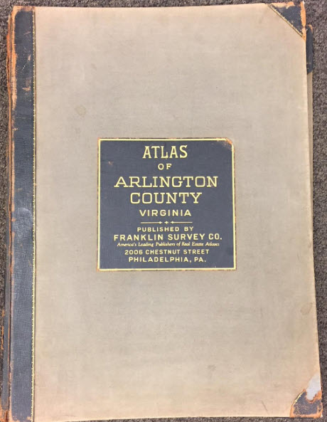
Franklin Survey maps of Arlington VA 1943
Selected images from the Plat Book of Arlington County,
Virginia, Franklin Survey Company, 2006 Chestnut Street, Philadelphia PA,
1943, available at the US Library
of Congress, showing Hall's Hill and nearby areas. Note: Most of these
images are somewhat rotated from north.
(What is a plat?)
▲
(Click on any photo to enter)


| Created by Photogallery 3.07 January 19, 2021 |