| From the Gulf of Cambay on down the Malabar Coast, c.1700's-1850's: ports (with forts) | |
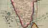 |
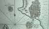
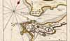
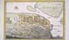
MAPS of the
Malabar
Coast during this period; *maps
of the Gulf of Cambay region* |
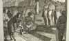 |
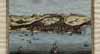
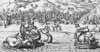
Nieuhoff's early depictions of Malabarians, 1703 |
 |
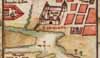
On a promontory in southern Gujarat was the Portuguese fort of DIU |
 |
SURAT had been the Mughals' chief port, but it was gradually supplanted by colonial-period ports to the south of it (including, over time, Bombay) |
 |
South of Surat was the Portuguese fort of DAMAN |
|
BAY* |
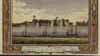
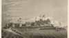
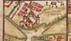
Bombay, on the "good bay" that the British had acquired from the Portuguese, was growing rapidly, protected by its Bassein Fort |
 |
Just a bit south of Bombay was the
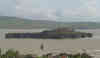
Siddis' island fort of JANJIRA, which lived on
piracy and was never conquered by any Indian or colonial power |
 |
Then, as we move further southward, came DABUL |
 |
Next the small fort that Bellin calls "Andarajapour," that seems to be RAJAPUR |
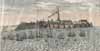 |
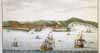
Then came GERIAH, at the heart of what was sometimes called the "Pirate Coast"; for a vivid account see *The Pirates of Malabar* |
 |
The small port of VENGURLA was an early Dutch settlement (1638) |
|
|
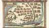
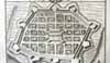
Next came the Portuguese stronghold of Goa |
 |
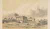
Just to the south of it was ONORE (modern Honavar), an English fort besieged by Tipu Sultan in 1784 |
 |
BARCELORE was one of the smaller port towns |
 |
MANGALORE came next |
 |
A bit further to the south was CANANORE |
 |
TELLICHERRY was an early English spice trading center, from 1638 until 1794 |
 |
Next came the small French fort of MAHÉ |
 |
Then there was CALICUT (modern Kozhikode), a longstanding and important trading center, though by this time on the decline |
 |
Then came CRANGANORE [Kodungallor]; near it once lay *Muziris*, an important Roman trading port |
 |
COCHIN was, like Goa, Daman, and Diu, an early Portuguese trading center |
 |
QUILON was one of the last links in the chain, before Cape Comorin |
 |
Finally came ANJENGO, another early English trading center like Tellicherry (1684) |