Dublin and Kingstown Railway
The Metals
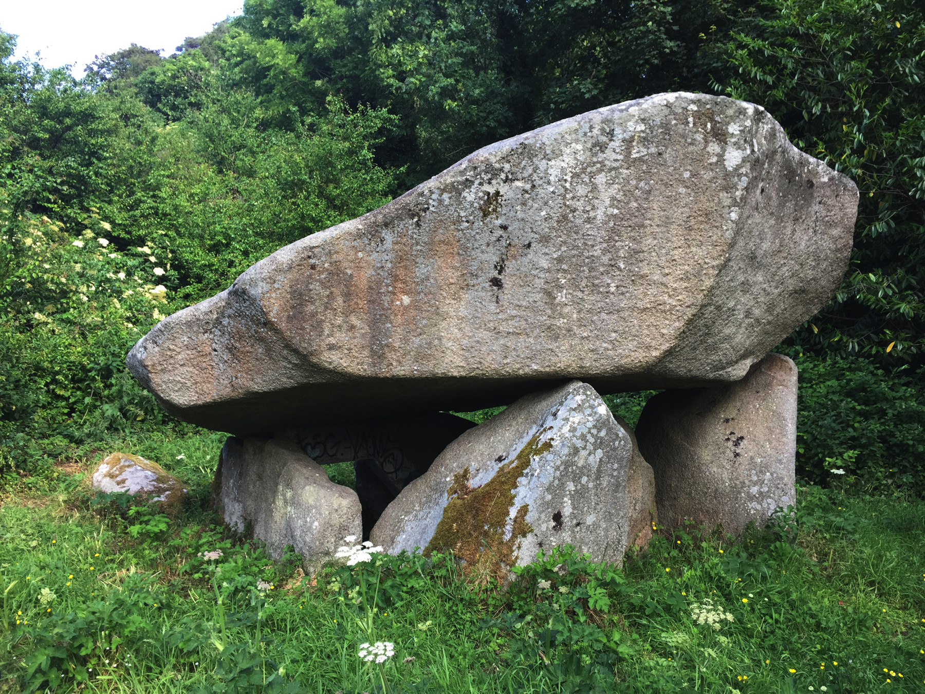
In which Joe goes off on a tangent about the upper part of the Dalkey quarry railway, with the most detailed explanation on the web of the chain inclines, quoting from a German eyewitness account, and takes an illustrated walk from Killiney Hill Park, and then digresses from the digression to allude to a dolmen and an uninhabited island.
Explorations: Thursday, 21 June 2018, and Tuesday, 15 October 2019
Journey: Dún Laoghaire Marine Road stop (near the railway
station) or Dalkey Ulverton Road stop (near Castle Street) to Killiney
Victoria Road stop, bus 59.
-
OFTEN CITED REFERENCES
- Rob Goodbody, The Metals : from Dalkey to Dún Laoghaire, Dún Laoghaire Rathdown County Council, 2010.
As I explained on the previous two pages the truckway that became known as The Metals was not replaced by the Dalkey atmospheric railway, but rather continued alongside it from Barnhill Road in Dalkey down to the Kingstown station.
The Dublin and Kingstown Railway never attempted to build farther along the truckway, so strictly speaking it is outside the scope of atmospheric railway history. However because of the close relationship between the two railways, and my own interest in cliff railways, I thought I'd give a description of the lesser known part of the truckway.
There is a whole book on the The Metals by Rob Goodbody. It is out of print but it is full of historical detail and many illustrations, and well worth seeking out if you are interested in the subject. I will not repeat too much of what is there, but I do hope to add a little to the body of knowledge.
Some sources say the truckway above Barnhill Road was a funicular railway and some even imply that all of the truckway was. I know I was misled. It is not true. The upper portion was operated with chains, and it did use the weight of the trucks going down to pull those going up, but the trucks were only briefly attached as they went on their journey.
There are neither technical or popular illustrations of the upper truckway in use. The only contemporary documentation we have are two things: a map sheet from the first Ordnance Survey of Ireland, and a book by two Prussian engineers, C. von Oeynhausen and H. von Dechen, Ueber Schienenwege in England ⋮ Bemerkungen ⋮ geſammelt ⋮ auf einer Reiſe in den Jahren 1826 und 1827 (Berlin: G. Reimer, 1829), which despite the title includes all of Great Britain and Ireland.
Rob Goodbody explains that although the Ordnance Survey was carried out in 1837, the maps were not published until 1843, and they were revised in the meantime. Compared to the manuscript, which he saw and of which he includes excerpts, the quarry on Dalkey Hill is shown in 1843 with much more rock removed, and of course the revision includes the atmospheric railway. The three inclined planes are shown with "Friction Wheel" or just "F.W." at each end, except for incomplete coverage of the uppermost plane, which I call number 1. In the 1837 manuscript only its upper friction wheel is shown and in the published map neither is shown. This may mean that the upper part of the quarry was no longer in use.
An excerpt of the 1843 map is below, with my annotations pointing out the inclines and wheels.
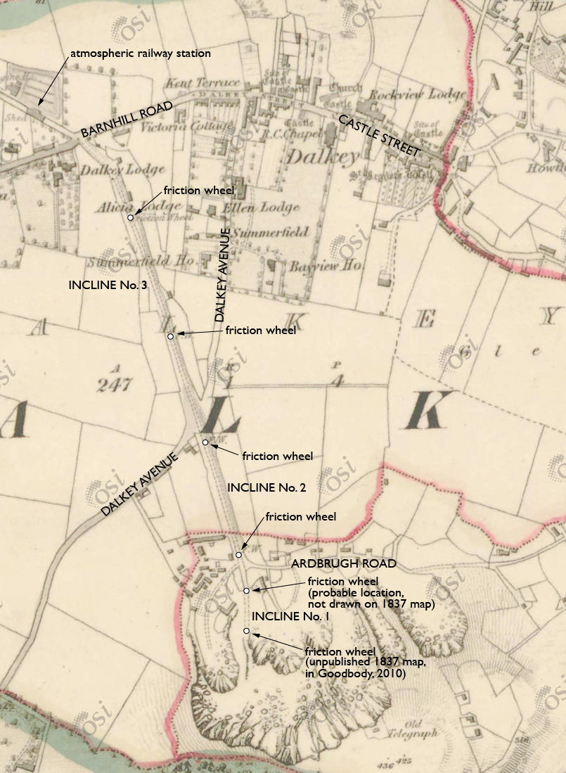
The space between inclines no.1 and 2 is at Ardbrugh Road, which appears to end at that point although there are small buildings on the other side of the inclines. The space between no.2 and 3 at Dalkey Avenue is definitely a public road that could not be blocked.
The Prussian engineers describe the truckway using the mining term Bremsberg,"brake mountain", which is an inclined plane on which loaded trucks run down by gravity, controlled not only by brakes but with some amount of counterbalance, either from empty trucks going up on another track or from counterweights. I will interpret their words as best as I can.
Es liegen auf den Bremsbergen zwei Schienenbahnen jede vom 4 fuß Spurweite, in 3 Fuß Entfernung von einander. ... Jede Schiene iſt 3 Fuß lang, einſchließlich der Spurrippe, 4 Zoll hoch, und 1 Zoll breit. ... Die Befeſtigung iſt auf Granitblocken...
On the brake mountains there lie two railway tracks, each of 4 foot gauge, spaced 3 feet apart. ... Each rail is 3 feet long, 4 inches high including the track rib, and 1 inch wide. ... The support is granite blocks...Of course the rails were laid on granite blocks! It was a common type of track on early railways, and here there was granite to spare.
By the way I considered the possibility of this being a plateway for ordinary trucks, but a rail only one inch wide rules that out. In contrast, for example, the same book describes the Surrey Iron Railway (plateway) track as having a running surface 4 inches wide and 1 inch thick, with a flange 3 inches high.
I was especially interested in how the inclines worked, and the Prussians do not disappoint. I will give a gloss in "English as she is spoke".
Die Bremsvorrichtung iſt auf den 3 geneigten Ebenen ſich gleich. Eine Kette ohne Ende geht an dem oberen Ende des Bremsberges über eine gußelserne in der Ebene des Weges liegende Schiebe, an der zugleich ein Bremsrad anegebracht iſt ; an dem unteren über zwei kleinere Leitungsſcheiben. Vor jeder dieſer Schieben liegt eine ſenkrecht hängende Rolle, wodurch die Kette mit Sicherheit darauf geleitet wird. Die obere Scheibe iſt mit dem remsrade aus einem Stück gegoſſen, 7 Fuß Durchmeſſer und 15 Zoll hoch, mit einer Rinne zur Aufnahme der Kette und mit Kränzen verſehen. ... Die Achſe dieſer Scheibe iſt von Gußeiſen, 8 Fuß lang und oben bedeutend ſtärker als unten. Die Bremſe beſteht aus einer eiſernen Schiene von 5 Zoll Breite und umgiebt das Rad nur zur Hälfte, kann aber durch eine doppelte Hebelverblndung ſehr ſtark dagegen gedrückt werden. Die unteren Leitungsſcheiben liegen ebenfalls den Ebenen des Weges parallel, und beſinden sich an eiſernen Achsen.
The braking device is the same on the 3 inclined planes. At the upper end an endless chain passes over a cast iron disk lying in the plane of the railway, to which a brake wheel is mounted ; and at the lower end over two smaller disks. In front of each of these disks is a vertically hanging roller, which guides the chain properly. The upper disk is cast in one piece with the brake wheel, 7 feet in diameter and 15 inches high, with a channel to accommodate the chain. ... The axle of this disk is cast iron, 8 feet long and much stronger at the top than at the bottom. The brake is an iron rail 5 inches thick. Though it surrounds only half the wheel, it can be pressed very hard against it by a double lever facing. The lower cable disks also lie parallel to the plane of the railway, and are mounted on iron axles.
Die herunter zu bremſenden vollen, und herauf zu ziehenden leeren Wagen, werden mittelſt ziemlich langen Ketten mit einem ſtarken Haken, an der Kette ohne Ende befeſtigt, und zwar iſt dieſe Kette an dem unteren Ende der Wagen angehängt, ſo daß ſie oben über dem dem Wagen hinweg geht, welches beſonders bei dem Anhängen von Vortheil iſt, und ſonſt wenigſtens keine Nachtheile hat. Auf dieſe Weise werden 2 bis 3 volle Wagen in Entfernungen angehängt, und eben ſo viel leere auf der anderen Seite, ſo daß das Heraufziehen und Hinunterlaſſen beſtän, dig fortdauert. Die Wagen beſtehen aus einer starken Plattform, welche, für den Transport großer Steine, ohne allen Kaſten, sind, für kleinere Steine mit einem Kaſten, der an beiden Enden Thüren hat, die unten in Gewerben hängen, und oben mit Oeſen und Vorſtecklingen befeſtigt werden. An jedem Ende ſind an beiden Geſtellbäumen 2 Haken, woran die Ketten angehakt werden können ; Wagen ſind 4 Fuß breit, 6 Fuß lang ; die Achſenmittel ſtehen 3 Fuß auseinander.
The full trucks to be let down with brakes and the empty trucks to be pulled up are attached to the endless chain by a chain with a strong hook that is attached to the lower end of the truck, so that it goes over the truck going down, which is especially useful when there are loose parts, and at least has no down side. In this way up to 3 full trucks can be attached with a space between them, and just as many empty ones on the other side, so that the pulling up and letting down of the truck is continuous. The trucks consist of a strong platform, which for the transport of large stones have no box, and for smaller stones have a box with doors at both ends that hang from hinges and are fastened at the top by hook and eye. At each end the trucks have 2 hooks from which they can be fastened to the chain ; trucks are 4 feet wide, 6 feet long ; the axle centers are 3 feet apart.If that's not clear, the loaded trucks going down were attached by a chain running from their lower end, which had to pass over the top of the truck and then to a hook on the endless chain up behind the truck. If it helps when there are loose rocks then maybe it helped hold down a canvas over the truck. That doing this has "no down side" appears to be an engineer's joke.
The Ordnance Survey map uses the phrase "friction wheel", which is used today for a means of transmitting power from a continuously running engine to an intermittently running device, but in 1837, it probably meant simply that chain went around wheels at each end that turned as the chain moved.
I wonder whether workmen rode the trucks to use the handbrakes on them in coordination with the braking power given to the chain. Any slips could block the entire line. When the harbor was being built there was a truck every few minutes, so everything had to go right.
The truck's journey from the upper floor of the quarry therefore went
like this:
drawn by horse to the top of incline no.1Empty trucks going back did the same thing in reverse. The lower floor of the quarry did not require use of incline no.1.
hooked to the chain (one or more cars) of no.1
down no.1 by chain
unhooked at the bottom of no.1
drawn by horse across the road to the top of no.2
hooked to the chain (one or more cars) of no.2
down no.2 by chain
unhooked at the bottom of no.2
drawn by horse across the road and a level section to no.3
hooked to the chain (one or more cars) of no.3
down no.3 by chain
unhooked at the bottom of no.3
drawn by horse to Kingstown.
It sounds pretty labor intensive, and it was. For the quarries and truckway combined, the Board of Works employed as many as 800 people at once, and there were 300 trucks and at least as many horses.
Back to the maps— Rob Goodbody mentions the puzzling depiction of the inclines on the 1837 and 1843 maps. I wish I had a better close-up but this blurry enlargement below will do. Each friction wheel is shown as a black spot between two dashed lines, and there is another pair of lighter dashed lines to the right. He suggests that the heavier dashed lines represent the chain, and the finer lines one of the tracks. He does wonder why only one track is indicated. Though the D&KR's James Pim told a member of Parliament in 1841 that "one line of the tram road in the possession of the Commissioners has been long since disused" I wonder whether that could have been only on the lower part (which is what mattered to the atmospheric railway proposal), since the inclines depended on counterbalance.
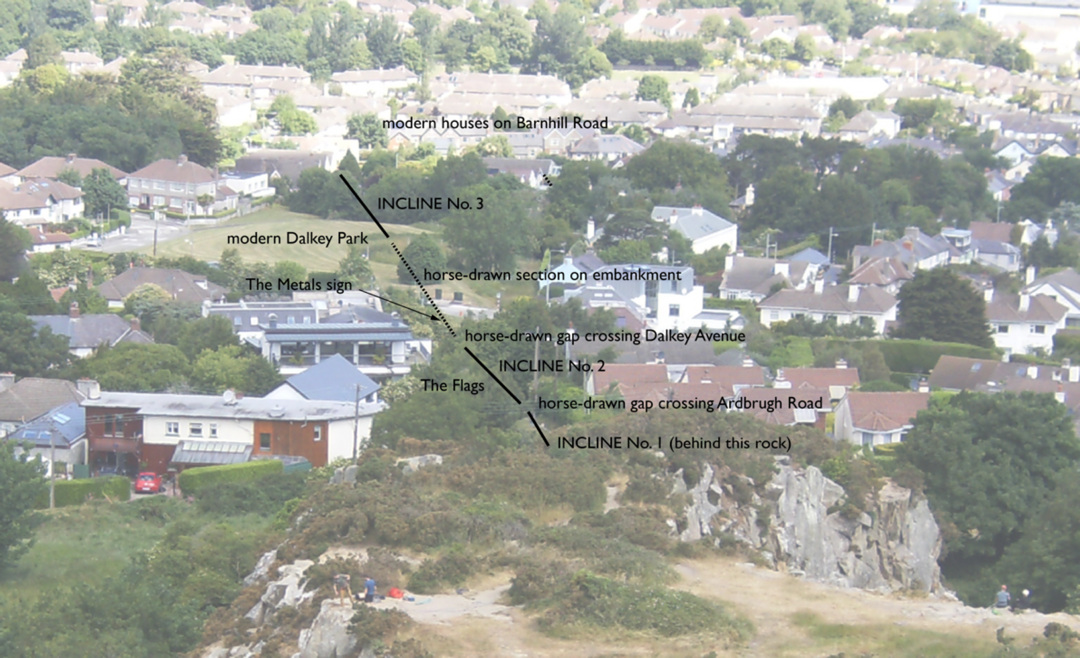
The main problem with the interpretation of the heavy dashed lines is that they continue between the bottom of incline no.2 (just below the big L) and the top of no.3 (below the smaller L). There could not have been a chain crossing Dalkey Avenue. Horses pulled the trucks across the road and in this case also some distance farther, onto a nearly level earth embankment to the top of no.3. May I suggest that the heavy dashed lines are the narrow gauge tracks, which would have run on each side of the friction wheels as shown, and that the light dashed lines represent a footpath. Near the wheels the light lines even run out of parallel to the heavy ones.
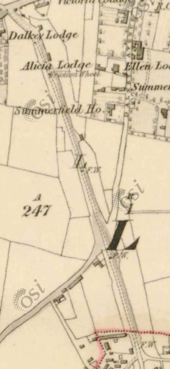
Goodbody reproduces 1867 maps of this area that have only the light dashed lines in the same position along the east side of the property. I am further influenced by the modern conditions on The Flags, the former incline no.2, which we will see.
I wonder what is being shown north of Alicia Lodge, beyond the bottom of no.3. The heavy lines end at the label for Dalkey Lodge, and then two pairs of light lines go up to Barnhill Road and stop. Maybe it shows the end of track no longer in use, its bed now in effect a second footpath.
Almost all of the upper course of The Metals can be walked, and where it cannot, slight detours are provided. Assuming you'd rather walk down than up, I suggest bus 59. That's what we did in 2018. The bus leaves you at the edge of Killiney Hill Park, and if you walk back a little bit from the Victoria Road stop you will find an entrance to the park and the Tower Tea Rooms just inside, where you can fortify yourself before a fine walk. Let's go, find the quarry, and then go down The Metals from there.
Take the path to the right, which is closer to the sea, and you will pass by a place called the Killiney Hill Viewpoint. Every visitor has taken the same photograph, and why should I be different?
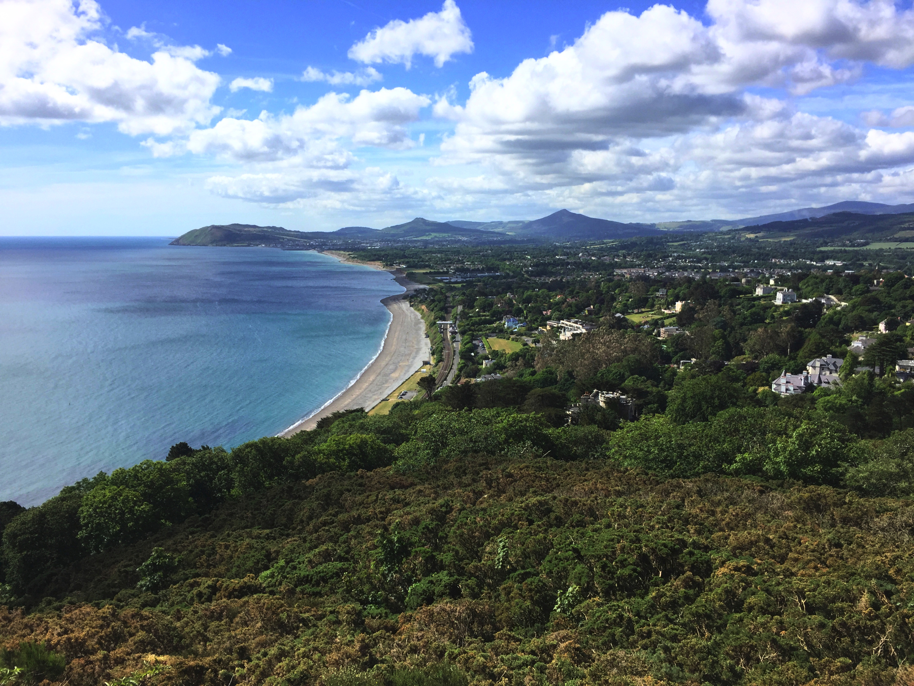
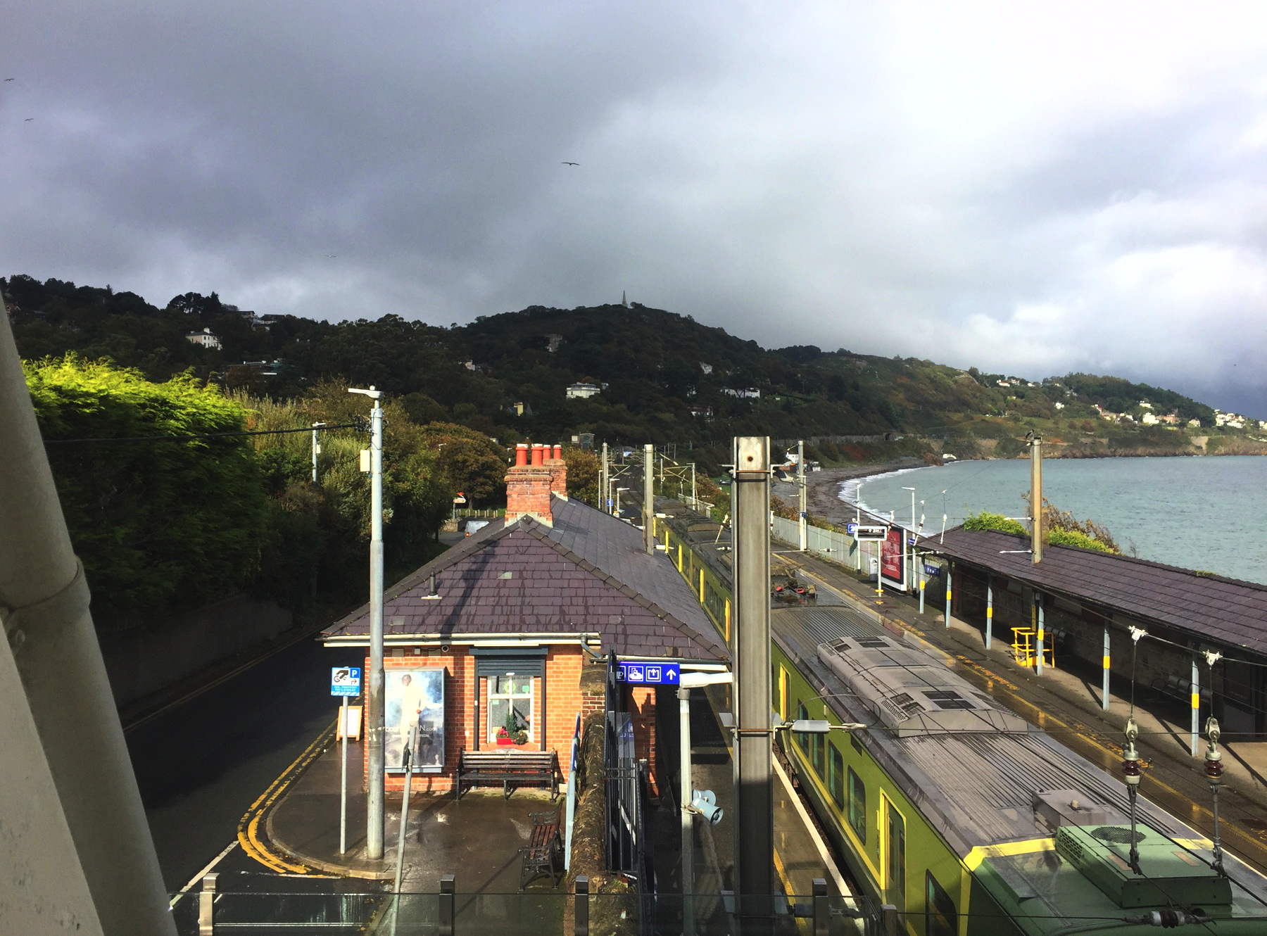
See that railway station down there? The white bridge over the tracks? That's Killiney. The other way to visit Killiney Hill is take DART there and walk. It's less than a mile, and just 500 feet up.
Here's the opposite view, from that footbridge. Please notice the pointed structure at the top of the hill.
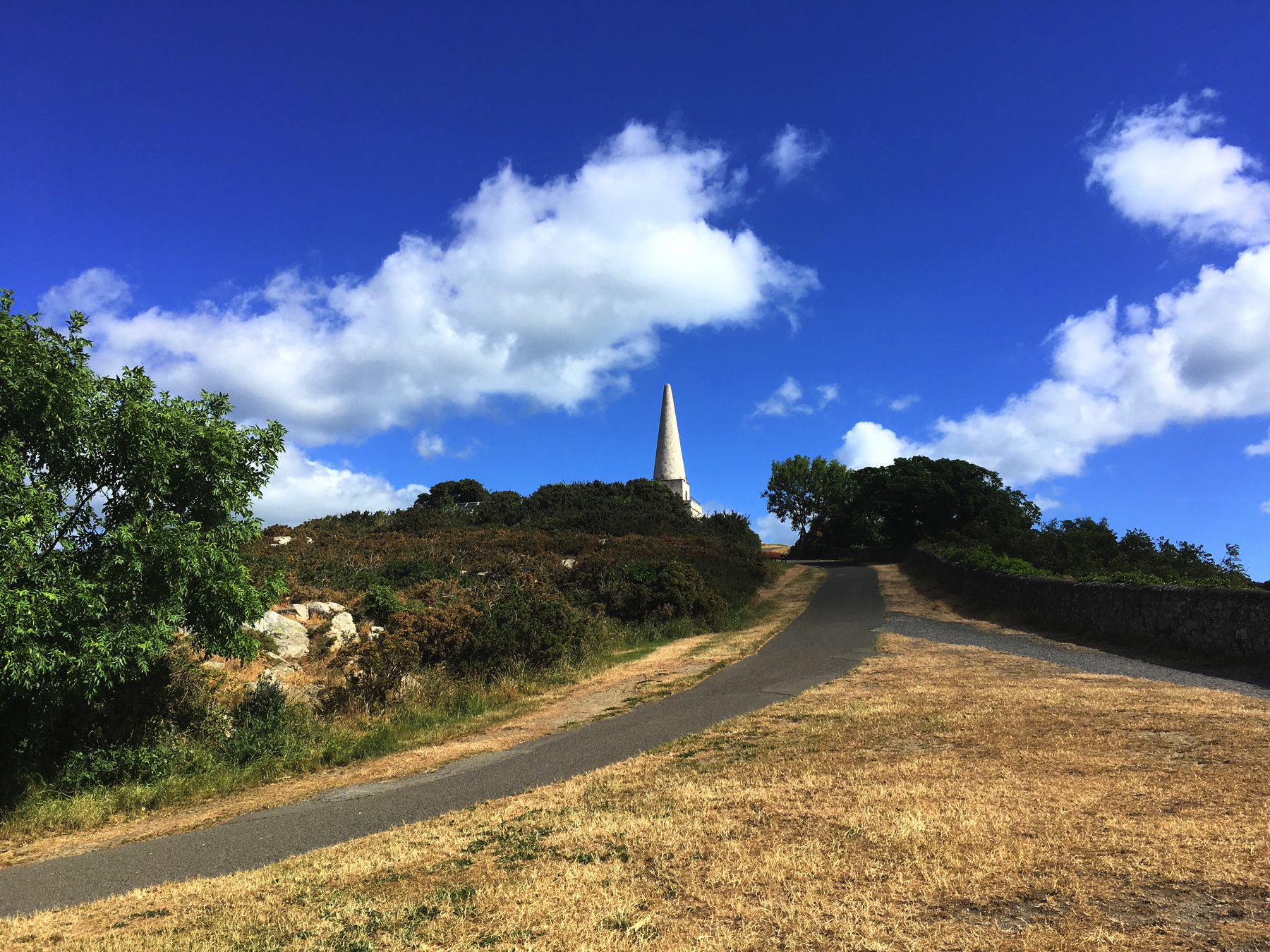
It's The Obelisk! It was commissioned in 1742 by a monied landowner, John Mapas, to provide work for starving families after what was called the Year of the Slaughter, an extremely cold winter followed by an extremely wet summer, which led to the deaths of at least a quarter million people from sickness, crop failures, and loss of livestock. Having no other purpose, the Obelisk could be called a folly, but it was not built for fun. I have read that once it was there, it became one of the landmarks sailors sighted on, so it was useful after all. The Obelisk was restored in 1840 by a later landowner, Robert Warren, who got into the spirit and in 1852 added another peculiar structure nearby, the Pyramid of Dublin.
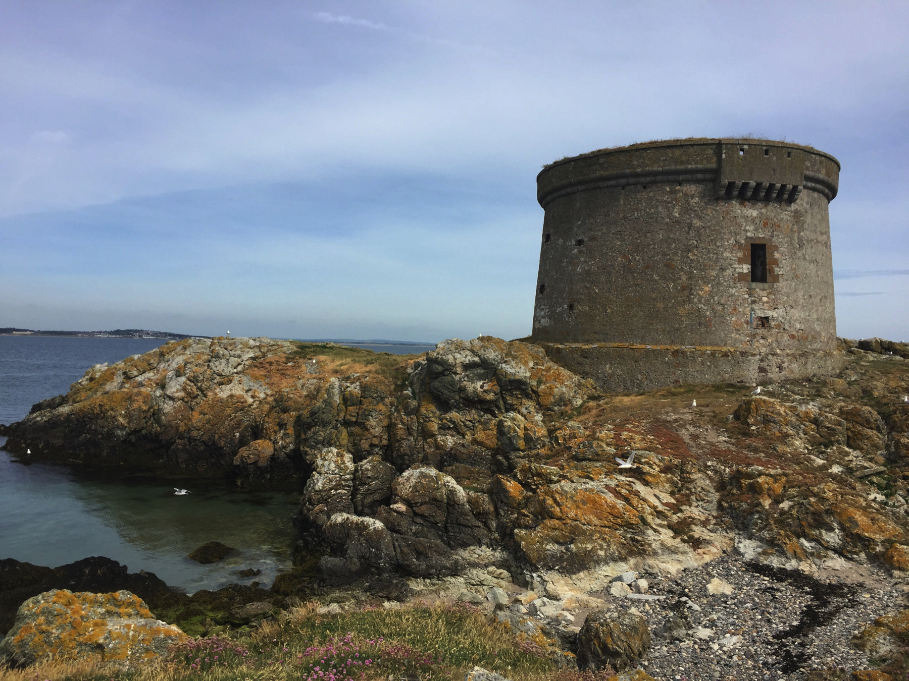
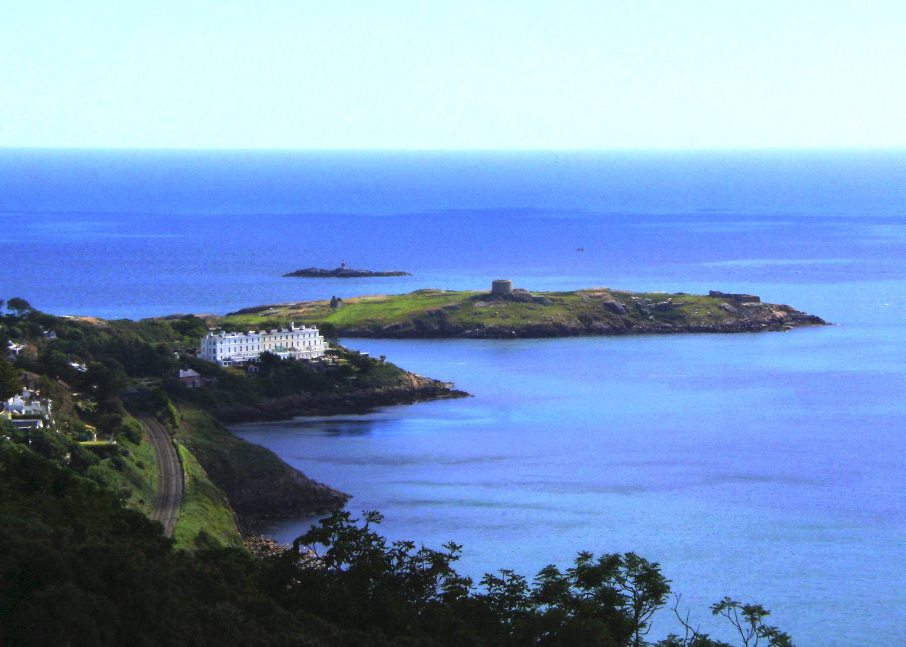
Below, from a place near the Pyramid we can look up the coast. That's Dalkey Island. In the middle is a Martello Tower and on the far right is the ruins of the other church of Saint Begnet. Beyond on a rock is Muglin's Lighthouse. The railway has gained elevation since it left Killiney, but it still needs to enter a tunnel, its portal almost visible in shadow, to make its way up to Dalkey station.
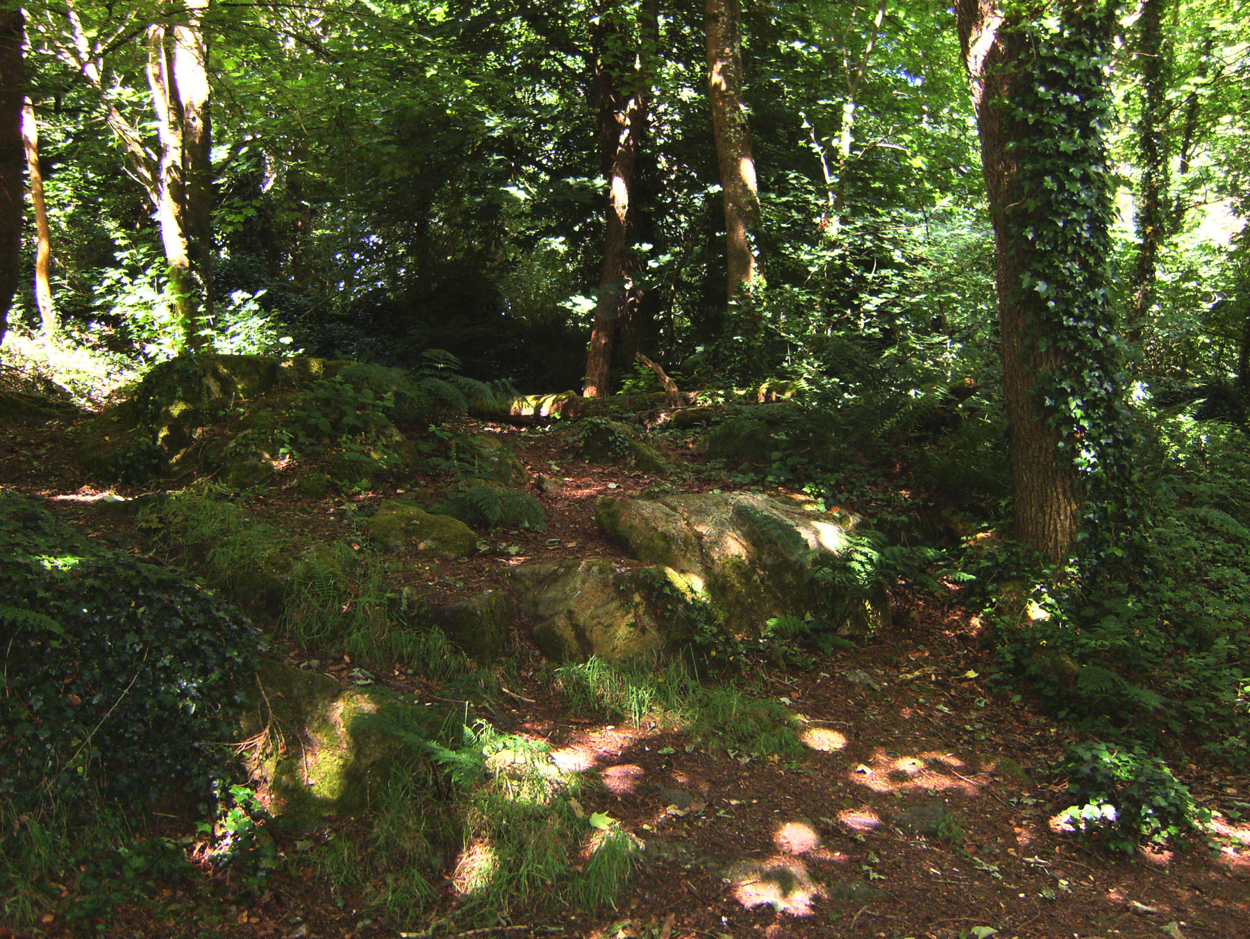
I like a nice walk in the woods. Below, this is in the less travelled section of the park between Killiney Hill and Dalkey Hill. Ireland is about green.
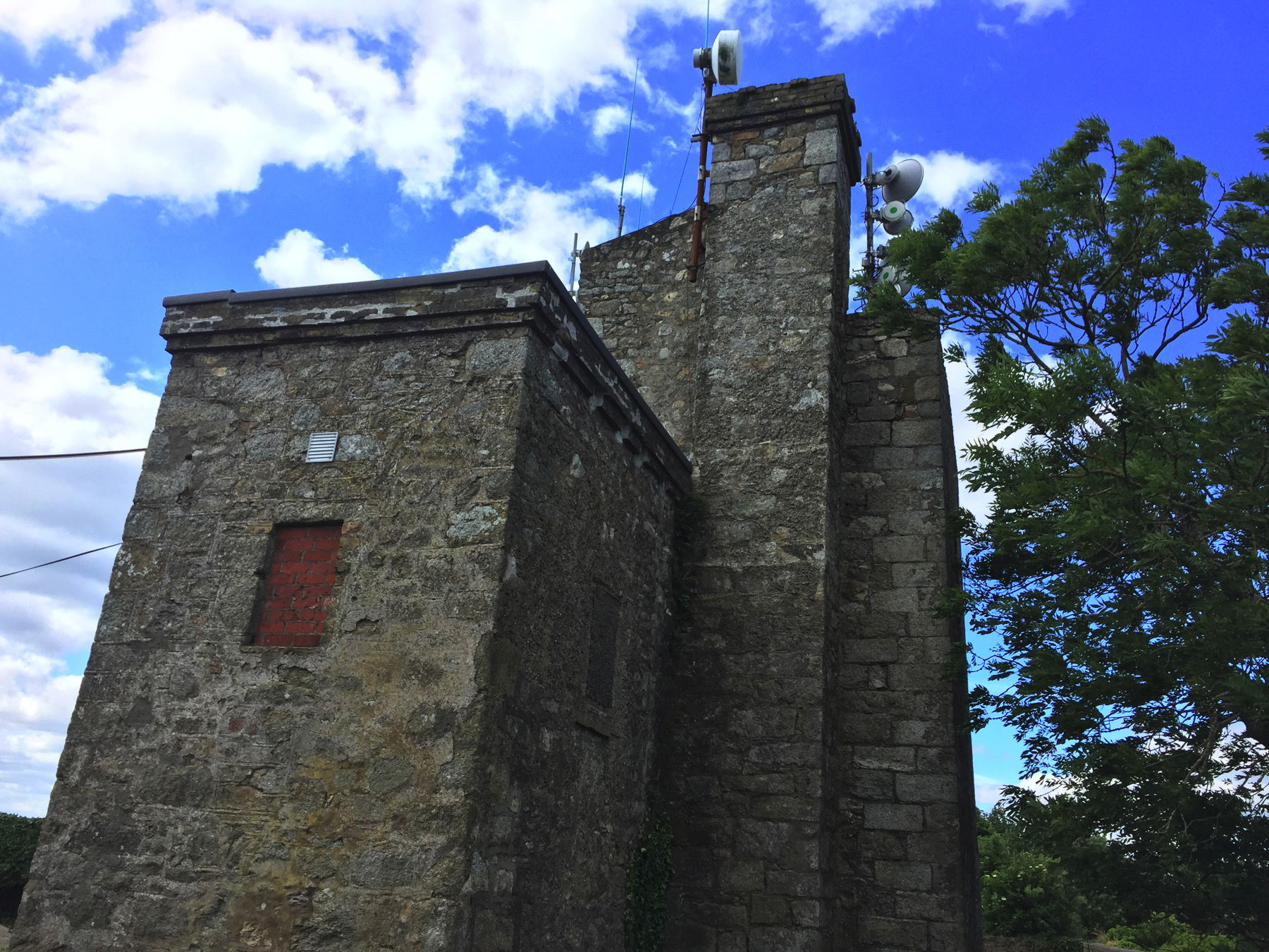
At the bottom of the 1843 Ordnance Survey map is a building just above the quarry marked "Old Telegraph" as if it was already obsolete then. It was. It was built in 1804 as part of a system that would alert everyone if French ships approached during the Napoleonic wars, which never happened, and its purpose was made obsolete with the defeat of France in 1815. The Martello Towers in England and France, like the one on Dalkey Island, were also made obsolete by the end of the war. (The British had difficulty taking a round tower at Mortello Point in Corsica, and if it was difficult for the British then it would be impossible for the French. That was the logic.) As to the Old Telegraph, it was reused for some years by the contractor for the Dalkey Quarry, for storage and even as a residence, simply because it was there. A stone laid into it records that Robert Warren repaired it in 1851, the year before he built the Pyramid. But it became derelict for many years and now appropriately it seems to be in use for radio signals. The word telegraph does not refer to electric telegraph (not yet invented) but to an optical telegraph using shutters or semaphore arms.
Below, the way down from the path near the Old Telegraph, into the quarry.
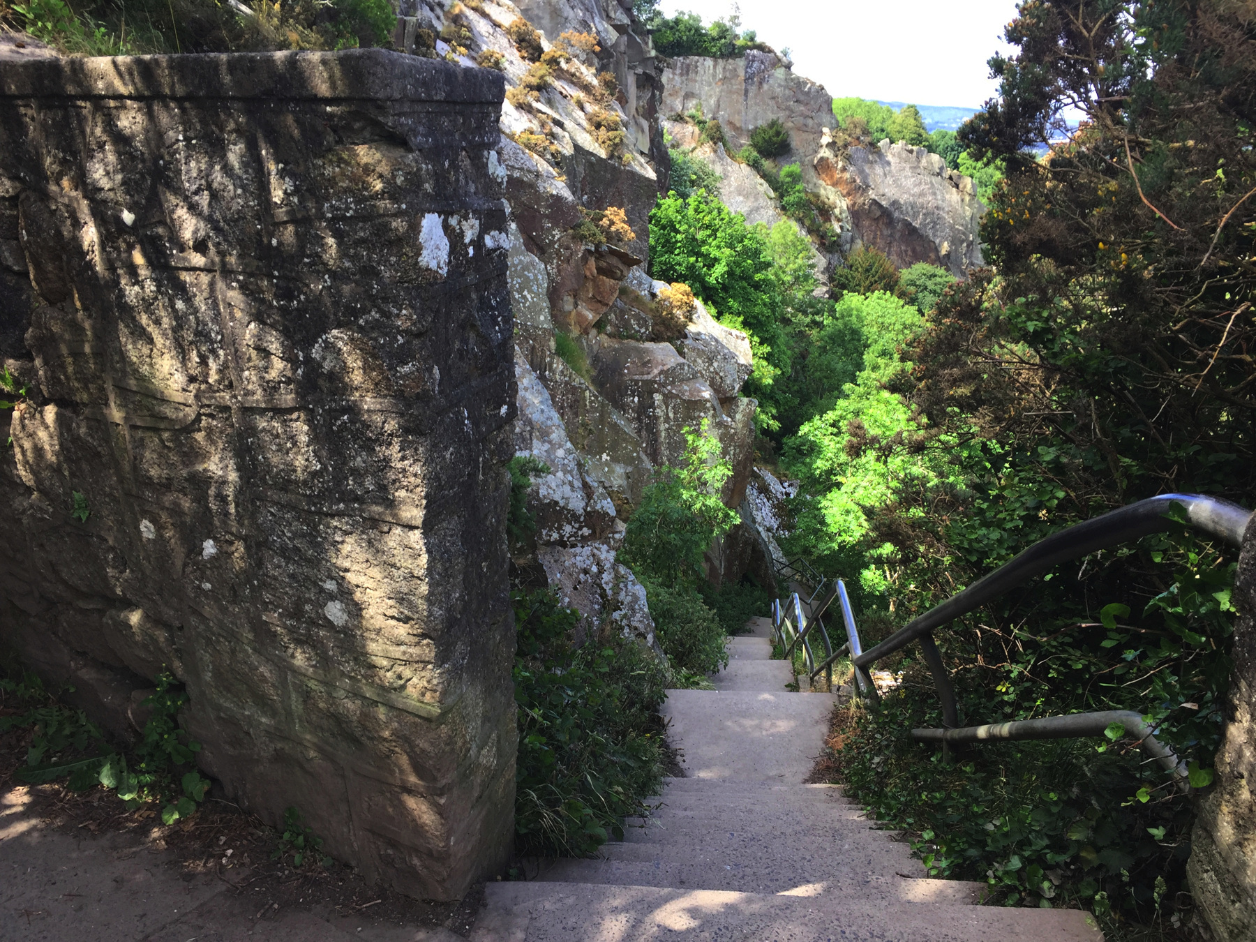
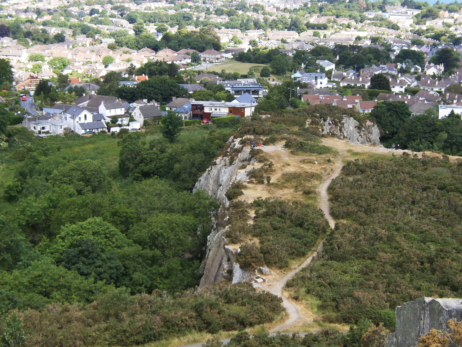
Above, the quarry seen from up on the hill. After I went down the stairs, I missed the turn that would lead to the site of incline no.1. You want to go into that unpaved but well worn path and bear left into the farthest rocky outcrop. That will get you to the top of no.1. As shown in the Ron Goodbody book, not far below the top there are holes in the rock and a groove that seems to be left from the incline chain. The 1843 map, way up above, shows that this portion was left between deeper cuts, in order to maintain the incline from the upper part of the quarry.
Notice The first group of houses on the left, arranged haphazardly between very narrow lanes. Goodbody suggests that the properties are a remnant of workers' houses built willynilly although their buildings have long since been replaced.
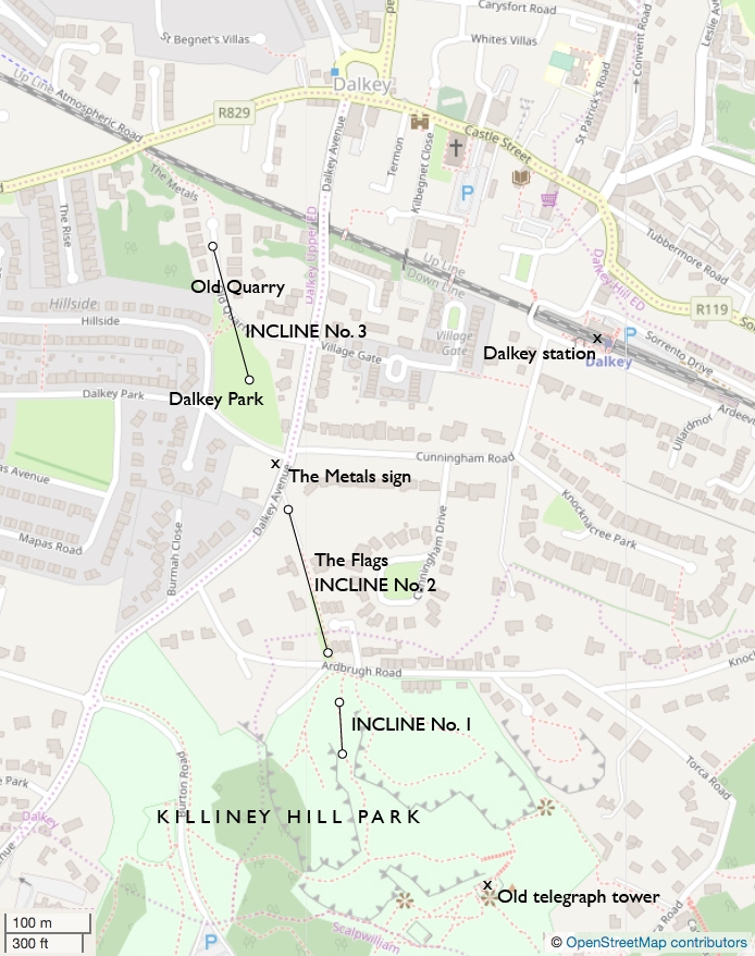
Below is a map showing where the inclines were against the modern street system. You can see the stairs near the Old Telegraph and the path to incline no.1.
I am repeating a detail of the photograph, with notations, because it happens to show the paths of all three inclines. The lines may be a little off the correct locations.
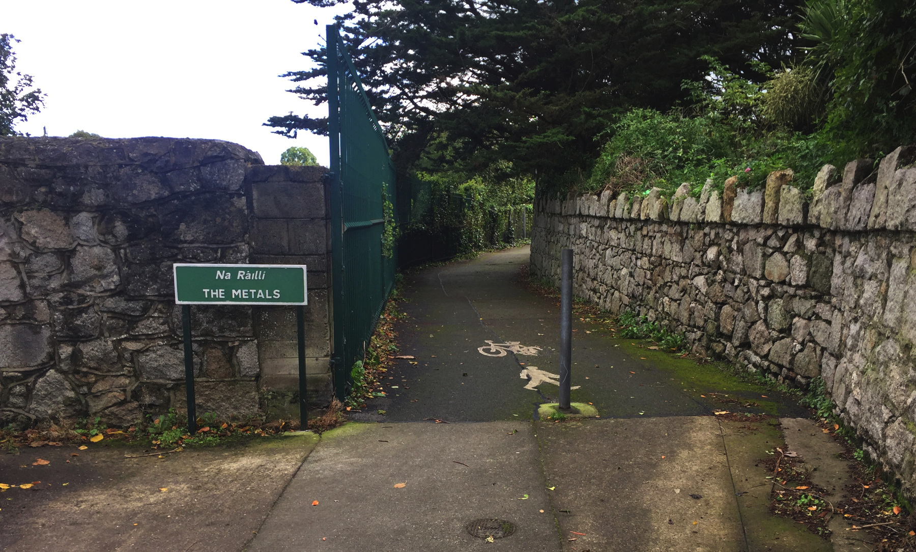
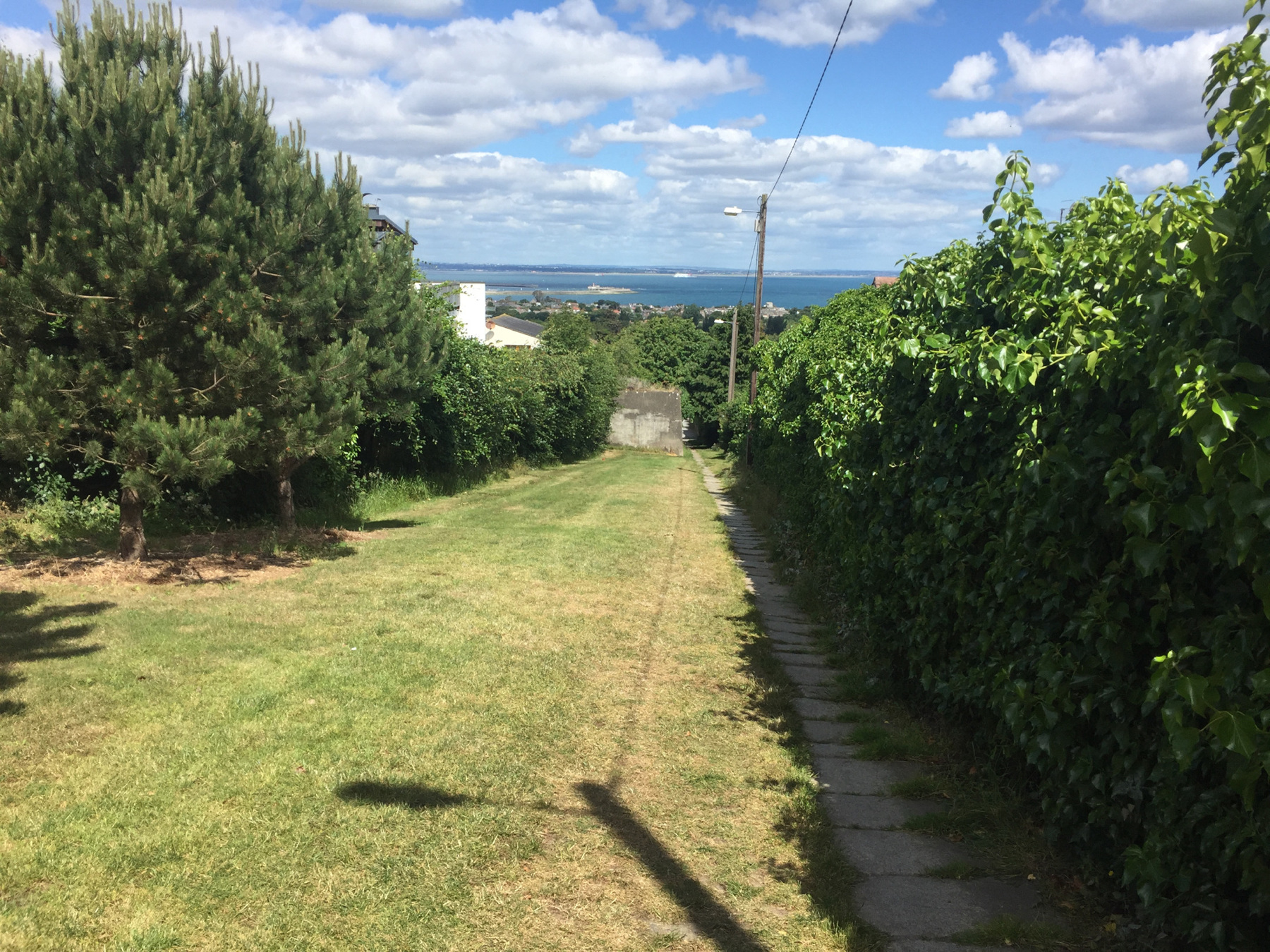
Below is The Flags, so called because of the flagstones along most of its extent, which corresponds to incline no.2. Older photographs (see the Goodbody book) show that the incline was in the grassy area to the left that is now interrupted by two concrete structures. The stone path is where the 1843 map showed a pair of lighter dashed lines. Toward the bottom, near Dalkey Avenue, the flagstones end and there is instead a one-lane road for motor vehicles to reach a few residential properties. The road is called The Metals, the uppermost place where the name is used.
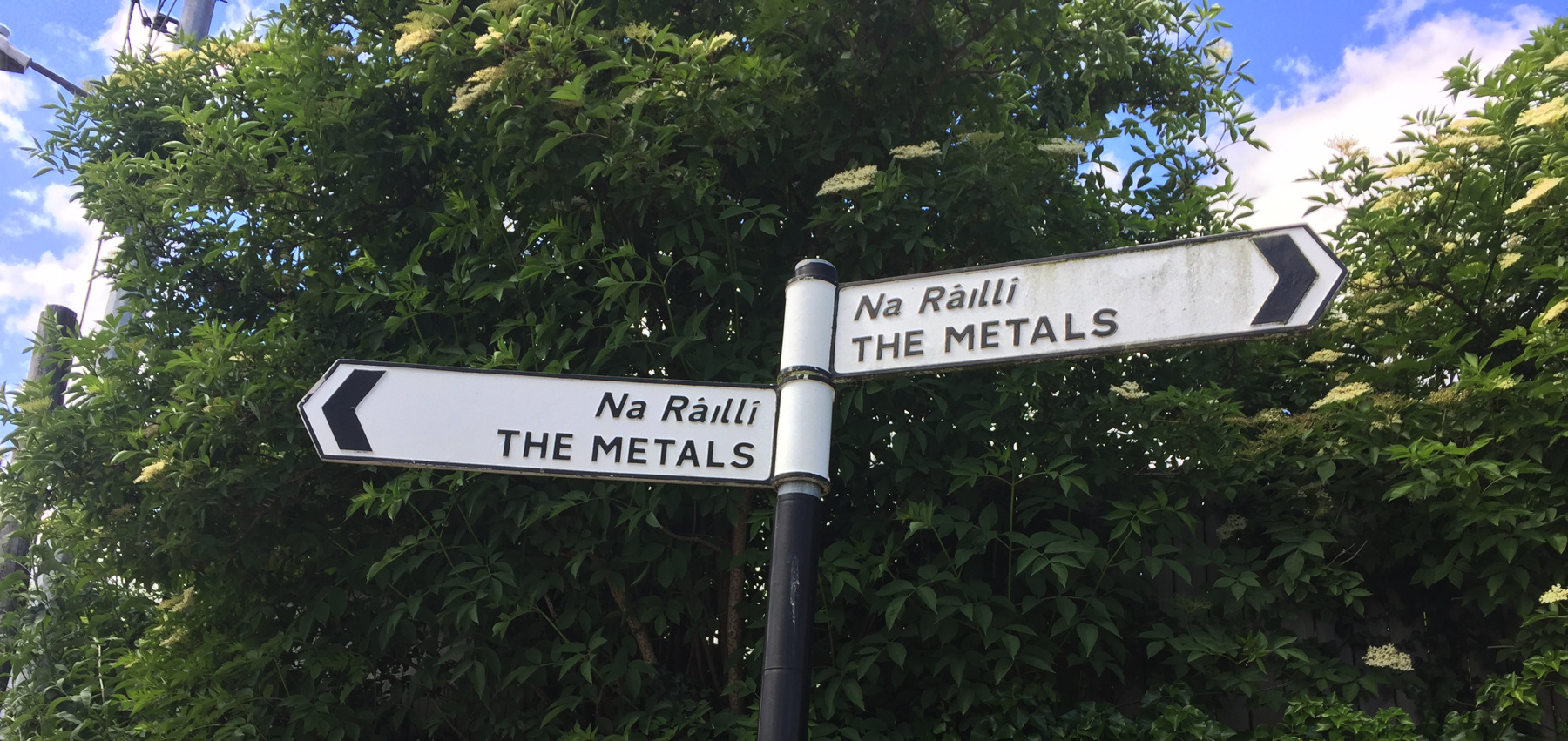
At Dalkey Avenue the line of the truckway crosses into a small triangular space marked on the modern map as "The Metals sign" which is in the picture above. The line of the truckway then crosses a modern street called Dalkey Park, and into a grassy space of the same name. The best image I have is the view from the quarry seen above. The truckway ran onto an embankment here, reaching the top of incline no.3 within the grounds of the park. There is still a raised area of earth there.
Below that point was the newer quarry that destroyed the truckway grade down to Barnhill Road. Fortunately you can take a footpath across the park and into the residential street called Old Quarry, where there is a sign for "The Metals" at the street end. If you walk down the street, which is only roughly in line of the truckway, where it ends for cars is another footpath that curves around to run next to the railway and comes out at Barnhill Road, as seen below. To continue from here see the Dalkey page.